Gordo, Alabama

Last updated

Gordo, Alabama
Flag of Gordo, Alabama.png
Logo of Gordo, Alabama.png
Pickens County Alabama Incorporated and Unincorporated areas Gordo Highlighted 0130736.svg
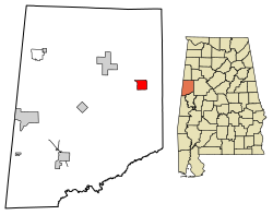
Location of Gordo in Pickens County, Alabama
Coordinates: 33°19′17″N87°54′13″W / 33.32139°N 87.90361°W / 33.32139; -87.90361
CountryUnited States
State Alabama
County Pickens
Government
  MayorCraig Patterson
Area
[1]
  Total3.26 sq mi (8.44 km2)
  Land3.25 sq mi (8.42 km2)
  Water0.00 sq mi (0.01 km2)
Elevation
282 ft (86 m)
Population
 (2020)
  Total1,628
  Density496.16/sq mi (191.58/km2)
Time zone UTC−6 (Central (CST))
  Summer (DST) UTC−5 (CDT)
ZIP code
35466
Area code 205, 659
FIPS code 01-30736
GNIS feature ID0119169
Website www.townofgordo.org

Gordo is a town in Pickens County, Alabama, United States. At the 2020 census, its population was 1,628, down from 1,750 in 2010. It was the second-largest municipality in Pickens County as of 2020, after Aliceville. The town incorporated in 1900. [2]

Contents

History

A post office called Gordo has been in operation since 1847. [3] The name of the town likely commemorates the 1847 Battle of Cerro Gordo in the Mexican–American War. [4]

Geography

Gordo is located at 33°19′17″N87°54′13″W / 33.32139°N 87.90361°W / 33.32139; -87.90361 (33.321461, -87.903729). [5]

The city is located in west central Alabama along U.S. Route 82, which runs northwest to southeast through the town. It leads southeast 22 mi (35 km) to Northport and 23 mi (37 km) to Tuscaloosa. It runs northwest 8 mi (13 km) to Reform and 37 mi (60 km) to Columbus, Mississippi. Alabama State Route 86 runs west 14 mi (23 km) to Carrollton, the Pickens county seat. Alabama State Route 159 runs north 31 mi (50 km) to Fayette.

According to the U.S. Census Bureau, the town has a total area of 3.2 square miles (8.3 km2), of which 3.2 square miles (8.3 km2) is land and 0.31% is water.

Demographics

Historical population
CensusPop.Note
1910 707
1920 642−9.2%
1930 81126.3%
1940 93415.2%
1950 9521.9%
1960 1,71480.0%
1970 1,99116.2%
1980 2,1126.1%
1990 1,918−9.2%
2000 1,677−12.6%
2010 1,7504.4%
2020 1,628−7.0%
U.S. Decennial Census [6]

As of the 2010 United States Census, there were 1,750 people living in the town. 58.9% were White, 37.8% African American, 0.2% Native American, 0.2% Asian, 0.9% from some other race and 2.0% of two or more races, or were aliens. 1.5% were Hispanic or Latino of any race.

As of the census [7] of 2000, there were 1,677 people, 728 households, and 474 families living in the town. The population density was 527.1 inhabitants per square mile (203.5/km2). There were 810 housing units at an average density of 254.6 per square mile (98.3/km2). The racial makeup of the town was 58.91% White, 40.31% Black or African American, 0.18% Native American, 0.30% from other races, and 0.30% from two or more races. 1.25% of the population were Hispanic or Latino of any race.

There were 728 households, out of which 27.9% had children under the age of 18 living with them, 45.3% were married couples living together, 17.6% had a female householder with no husband present, and 34.8% were non-families. 33.0% of all households were made up of individuals, and 17.7% had someone living alone who was 65 years of age or older. The average household size was 2.30 and the average family size was 2.92.

In the town, the age distribution of the population showed 24.2% under the age of 18, 8.8% from 18 to 24, 24.3% from 25 to 44, 23.9% from 45 to 64, and 18.8% who were 65 years of age or older. The median age was 41 years. For every 100 females, there were 82.5 males. For every 100 females age 18 and over, there were 77.0 males.

The median income for a household in the town was $23,813, and the median income for a family was $35,714. Males had a median income of $27,500 versus $21,029 for females. The per capita income for the town was $13,937. About 17.5% of families and 23.1% of the population were below the poverty line, including 32.4% of those under age 18 and 19.3% of those age 65 or over.

Education

Education in Gordo is overseen and governed by the Pickens County Board of Education. Students of Gordo and its surrounding areas are served by Gordo Elementary School and Gordo High School.

Notable people

Crime (Notable Events)

Related Research Articles

<span class="mw-page-title-main">Pickens County, Alabama</span> County in Alabama, United States

Pickens County is a county located on the west central border of the U.S. state of Alabama. As of the 2020 census, the population was 19,123. Its county seat is Carrollton, located in the center of the county. It is a prohibition, or dry county, although the communities of Carrollton and Aliceville voted to become wet in 2011 and 2012, respectively.

<span class="mw-page-title-main">Ashland, Alabama</span> City in and county seat of Clay County, Alabama

Ashland is a city in Clay County, Alabama, United States. The population was 2,037 at the 2010 census. The city is the county seat of Clay County.

<span class="mw-page-title-main">Pollard, Alabama</span> Town in Alabama, United States

Pollard is a town in Escambia County, Alabama, United States. It was the first established county seat of Escambia County, from its creation in 1868 until 1883, when it lost that distinction to Brewton. At the 2020 census, the population was 128.

<span class="mw-page-title-main">Glen Allen, Alabama</span> Town in Alabama, United States

Glen Allen is a town located in Fayette and Marion counties in the U.S. state of Alabama. The town incorporated in May 1959. At the 2020 census, the population was 433, down from 510 at the 2010 census. Glen Allen is positioned along the BNSF railway and is near Interstate 22, providing access to multiple expanding industries.

<span class="mw-page-title-main">Linden, Alabama</span> City in Alabama, United States

Linden is a city in and the county seat of Marengo County, Alabama, United States. The population was 1,930 at the 2020 census, down from 2,123 at the 2010 census.

<span class="mw-page-title-main">Carrollton, Alabama</span> City in and county seat of Pickens County, Alabama

Carrollton is a city in and the county seat of Pickens County, Alabama, United States. At the 2010 census the population was 1,019, up from 987 in 2000.
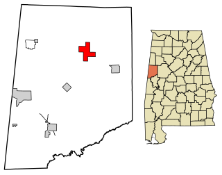
<span class="mw-page-title-main">Reform, Alabama</span> City in Alabama, United States

Reform is a city in Pickens County, Alabama, United States. At the 2010 census the population was 1,702, down from 1,978 in 2000. It is located approximately halfway between Columbus, Mississippi and Tuscaloosa on U.S. Route 82.

<span class="mw-page-title-main">Vincent, Alabama</span> City in Alabama, United States

Vincent, originally known as Propel, is a city in Shelby, St. Clair, and Talladega counties in the U.S. state of Alabama. At the 2020 census, the population was 1,982. The community was first known as Propel, but later named Vincent in honor of the Vincent family, who were early settlers of the area. It was incorporated in 1897.

<span class="mw-page-title-main">Camp Hill, Alabama</span> Town in Alabama, United States

Camp Hill is a town in Tallapoosa County, Alabama, United States. It was incorporated in 1895. At the 2010 census the population was 1,014, down from 1,273 in 2000. Camp Hill is the home to Southern Preparatory Academy.

<span class="mw-page-title-main">Buena Vista, San Jose</span> Neighborhood of San Jose in Santa Clara, California, United States

Buena Vista is a former census-designated place (CDP) in Santa Clara County, California, United States. The population was 1,704 at the 2000 census. The area is now part of the city of San Jose.

<span class="mw-page-title-main">Stanley, Louisiana</span> Village in Louisiana, United States

Stanley is a village in DeSoto Parish, Louisiana, United States. The population was 107 at the 2010 census, down from 145 in 2000. It is part of the Shreveport–Bossier City Metropolitan Statistical Area.
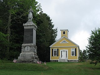
<span class="mw-page-title-main">Dennysville, Maine</span> Town in the state of Maine, United States

Dennysville is a town in Washington County, Maine, United States. The population was 300 at the 2020 census.

<span class="mw-page-title-main">Pickens, Mississippi</span> Town in Mississippi, United States

Pickens is a town in Holmes County, Mississippi, United States. Per the 2020 census, the population was 920.
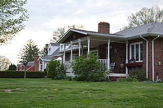
<span class="mw-page-title-main">Shanor-Northvue, Pennsylvania</span> Census-designated place in Pennsylvania, United States

Shanor-Northvue is a census-designated place (CDP) in Butler County, Pennsylvania, United States. The population was 5,051 at the 2010 census.

<span class="mw-page-title-main">Girard, Pennsylvania</span> Borough in Pennsylvania, United States

Girard is a borough in Erie County, Pennsylvania, United States. The population was 2,994 at the 2020 census. It is part of the Erie Metropolitan Statistical Area.

<span class="mw-page-title-main">Masontown, Pennsylvania</span> Borough in Pennsylvania, United States

Masontown is a borough in Fayette County, Pennsylvania, United States. It is part of the Pittsburgh Metro Area. The population of the borough was 3,274 at the 2020 census. It is served by the Albert Gallatin Area School District. Masontown is a small crossroads for the rural portions of western Fayette County, and it contains a small shopping center and a grocery store within its business district.

<span class="mw-page-title-main">Fredonia, Pennsylvania</span> Borough in Pennsylvania, United States

Fredonia is a borough in central Mercer County, Pennsylvania, United States. The population was 435 at the 2020 census. It is part of the Hermitage micropolitan area.

<span class="mw-page-title-main">Pea Ridge, West Virginia</span> Census-designated place in West Virginia, United States

Pea Ridge is a census-designated place in Cabell County, West Virginia, United States. As of the 2020 census, the population was 6,602. It is part of the Huntington–Ashland metropolitan area.
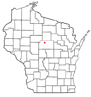
<span class="mw-page-title-main">Rib Falls, Wisconsin</span> Town in Wisconsin, United States

Rib Falls is a town in Marathon County, Wisconsin, United States. It is part of the Wausau, WI Metropolitan Statistical Area. The population was 993 at the 2010 census. The unincorporated community of Rib Falls is located in the town.

<span class="mw-page-title-main">Vernon, Wisconsin</span> Village in Wisconsin, United States

Vernon is a village in Waukesha County, Wisconsin, United States. The population was 7,474 at the 2020 census.
References

  1. "2019 U.S. Gazetteer Files". United States Census Bureau. Retrieved June 29, 2020.
  2. "Gordo".
  3. "Pickens County". Jim Forte Postal History. Retrieved April 28, 2015.
  4. "Towns have unusual beginning". Cherokee County Herald. February 22, 1989. pp. 7B. Retrieved April 28, 2015.
  5. "US Gazetteer files: 2010, 2000, and 1990". United States Census Bureau. February 12, 2011. Retrieved April 23, 2011.
  6. "U.S. Decennial Census". Census.gov. Retrieved June 6, 2013.
  7. "U.S. Census website". United States Census Bureau . Retrieved January 31, 2008.
  8. "Disabled veteran imprisoned in Alabama for medical marijuana possession released". Advance Local Media LLC. November 9, 2020.

33°19′17″N87°54′13″W / 33.321461°N 87.903729°W / 33.321461; -87.903729