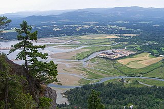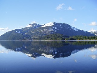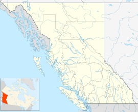
North Cowichan is a district municipality established in 1873 on Vancouver Island, in British Columbia, Canada. The municipality is part of the Cowichan Valley Regional District. North Cowichan is noted for a landscape including forests, beaches, rivers, and lakes. The municipality encompasses the communities of Chemainus; Westholme; Crofton; Maple Bay; and "the South End". The latter is an informal name for a built-up area which is essentially a suburb of the City of Duncan, a separate municipality.

The Cowichan Valley is a region around the Cowichan River, Cowichan Bay and Cowichan Lake on Vancouver Island, in British Columbia, Canada. There is some debate as to the origin of the name Cowichan, which many believe to be an anglicized form of the First Nations tribal name Quw'utsun.

Cowichan Lake is a large freshwater lake located on southern Vancouver Island, British Columbia, Canada. It is located along the Cowichan Valley in the Cowichan Valley Regional District, with its eastern shore about 28 km (17 mi) west of Duncan, British Columbia. Cowichan Lake is about 30 km (19 mi) in length, running mostly from west to east, and is about 4 km (2.5 mi) wide at its widest point. The lake is also the source of the Cowichan River.

The Cowichan River is a moderately sized river on Vancouver Island, in British Columbia, Canada. It originates in Cowichan Lake, flowing east towards its end at Cowichan Bay. Its drainage basin is 795 square kilometres (307 sq mi) in size.

Shawnigan Lake is the name of a village on British Columbia's Vancouver Island. The name Shawnigan is an adaptation of the Hul'qumi'num name Showe'luqun, for the lake and the village. It is part of Electoral Area B in the Cowichan Valley Regional District. As of 2016, the permanent population of Shawnigan Lake is 8,558.

Carmanah Walbran Provincial Park, originally Carmanah Pacific Provincial Park, is a remote wilderness park located inside traditional Ditidaht First Nation ancestral territory. The park covers a land area of 16,450 ha (63.5 sq mi) immediately adjacent to Pacific Rim National Park Reserve's West Coast Trail on the south-western, coastal terrain of Vancouver Island. The provincial park comprises the entire drainage of Carmanah Creek, and a good portion of the lower Walbran River drainage, both of which independently empty into the Pacific Ocean. The park is named after the Anglicized diitiid?aatx word kwaabaaduw7aa7tx, or Carmanah, meaning "thus far upstream" and John Thomas Walbran, a colonial explorer and ship's captain. Access to the park is by gravel logging road from Port Alberni, Lake Cowichan, or Port Renfrew.

Tsʼilʔos Provincial Park is a provincial park in British Columbia, Canada. Tsʼilʔos is the official BC Parks designation for this provincial park, though sometimes it is written as "Ts'il-os", "Ts'yl-os", or "Tsylos". The "ʔ" in the name represents a glottal stop.

Cowichan River Provincial Park is a provincial park on Vancouver Island in British Columbia, Canada. It includes the Cowichan River in a 750-hectare area stretching almost 20 kilometres, from the village of Lake Cowichan to Glenora, just south of Duncan. Its paths are part of the Trans Canada Trail
Chemainus River Provincial Park is a provincial park in British Columbia, Canada.

Sx̱ótsaqel/Chilliwack Lake Provincial Park is a provincial park in British Columbia, Canada. Covering 92.58 km2, the park is located 150 km east of Vancouver in the Chilliwack River Valley.

Mara Provincial Park is a day-use provincial park in British Columbia, Canada, located on Mara Lake south of Sicamous. The park is open with services from May 1 to September 27. The gate is locked open during the off season.
Nitinat River Provincial Park is a provincial park in the Canadian province of British Columbia on Vancouver Island.
Skagit Valley Provincial Park is a provincial park in British Columbia, Canada, centred on the Skagit River and its tributaries. The park is 27,964 Hectares. The park borders E. C. Manning Provincial Park in Canada and Ross Lake National Recreation Area and North Cascades National Park in the United States. It includes part of Ross Lake, a reservoir formed by a hydroelectric dam in Whatcom County, Washington.

Cowichan Valley is a provincial electoral district in British Columbia, Canada, established by the Electoral Districts Act, 2008 out of parts of Cowichan-Ladysmith and Malahat-Juan de Fuca. It was first contested in the 2009 general election in which New Democrat Bill Routley was elected MLA.
Nitinat Lake is a large lake and inlet on the southwestern coast of Vancouver Island, British Columbia, Canada. The lake is about 150 km (93 mi) northwest by road from Victoria, BC's capital on the southern tip of Vancouver Island, and about 60 km (37 mi) southwest by road from the town of Lake Cowichan. The city of Port Alberni is about 80 km (50 mi) by road to the north.
The Vancouver Island Trail is a near-completed 800 km-long hiking trail stretching the length of Vancouver Island, from its southern terminus on Anderson Hill in Oak Bay, to its northern terminus in Cape Scott Provincial Park. The trail connects to various communities including Victoria, Lake Cowichan, Port Alberni and Cumberland, and connects along existing trails the Galloping Goose Regional Trail, Cowichan Valley Trail, Alberni Inlet Trail, the Great Trail and the North Coast Trail.

The San Juan River is a river that flows from east to west through southern Vancouver Island in British Columbia, Canada. The river originates in the Seymour Range, flows westward through the San Juan Valley to Port San Juan at Port Renfrew.
Omineca Provincial Park and Protected Area is a provincial park and protected area located in the north-central interior of British Columbia, Canada. It was established on 11 April 2001 by BC Parks to protect provincially significant riparian and wetland habitats along the Omineca River.
Sturgeon Bay Provincial Park is a provincial park on the western shore of Lake Winnipeg in Manitoba, Canada. The park is considered to be a Class Ib protected area under the IUCN protected area management categories. It is 144.9 km2 (55.9 sq mi) in size.


