Related Research Articles

Old Red Sandstone, abbreviated ORS, is an assemblage of rocks in the North Atlantic region largely of Devonian age. It extends in the east across Great Britain, Ireland and Norway, and in the west along the eastern seaboard of North America. It also extends northwards into Greenland and Svalbard. These areas were a part of the paleocontinent of Euramerica (Laurussia). In Britain it is a lithostratigraphic unit to which stratigraphers accord supergroup status and which is of considerable importance to early paleontology. The presence of Old in the name is to distinguish the sequence from the younger New Red Sandstone which also occurs widely throughout Britain.
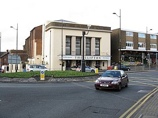
Sedgley is a town in the north of the Dudley district, in the county of the West Midlands, England.
The geology of the county of Shropshire, England is very diverse with a large number of periods being represented at outcrop. The bedrock consists principally of sedimentary rocks of Palaeozoic and Mesozoic age, surrounding restricted areas of Precambrian metasedimentary and metavolcanic rocks. The county hosts in its Quaternary deposits and landforms, a significant record of recent glaciation. The exploitation of the Coal Measures and other Carboniferous age strata in the Ironbridge area made it one of the birthplaces of the Industrial Revolution. There is also a large amount of mineral wealth in the county, including lead and baryte. Quarrying is still active, with limestone for cement manufacture and concrete aggregate, sandstone, greywacke and dolerite for road aggregate, and sand and gravel for aggregate and drainage filters. Groundwater is an equally important economic resource.

The geology of the Australian Capital Territory includes rocks dating from the Ordovician around 480 million years ago, whilst most rocks are from the Silurian. During the Ordovician period the region—along with most of eastern Australia—was part of the ocean floor. The area contains the Pittman Formation consisting largely of quartz-rich sandstone, siltstone and shale; the Adaminaby Beds and the Acton Shale.
The Ludlow Group are geologic formations deposited during the Ludlow epoch of the Silurian period in the British Isles, in areas of England, Ireland, Scotland, and Wales.

The geology of Wales is complex and varied; its study has been of considerable historical significance in the development of geology as a science. All geological periods from the Cryogenian to the Jurassic are represented at outcrop, whilst younger sedimentary rocks occur beneath the seas immediately off the Welsh coast. The effects of two mountain-building episodes have left their mark in the faulting and folding of much of the Palaeozoic rock sequence. Superficial deposits and landforms created during the present Quaternary period by water and ice are also plentiful and contribute to a remarkably diverse landscape of mountains, hills and coastal plains.
Gloucestershire is one of the most geologically and scenically diverse counties in England, with rocks from the Precambrian through to the Jurassic represented. These varying rock-types are responsible for the three major areas of the county, each with its own distinctive scenery and land-use - the Forest of Dean in the west, bordering Wales, the Cotswolds in the east, and in between, the Severn Vale.

The Cuilcagh Lakelands Geopark formerly known as the Marble Arch Caves Global Geopark straddles the border between Northern Ireland and the Republic of Ireland. It is centred on the Marble Arch Caves and in 2001 it became one of the first geoparks to be designated in Europe.

Gornal is a village and electoral ward in the Dudley Metropolitan Borough, in the West Midlands of England. It encompasses the three historical villages of Upper Gornal, Lower Gornal, and Gornal Wood. Gornal was historically part of Staffordshire, prior to the creation of the West Midlands County in 1974. Gornal is 11 miles from Birmingham.
The Pennant Measures is the traditional name for a sequence of sedimentary rocks of the South Wales Coalfield. They were also referred to as the Upper Coal Measures and assigned to the Westphalian 'C' and Westphalian 'D' stages of the Carboniferous Period. The Pennant Measures were divided into the Lower Pennant Measures and the Upper Pennant Measures, differing from the underlying Middle and Lower Coal Measures in being principally of sandstone units – known collectively as the Pennant Sandstone – with mudstone being the subsidiary rock type. Numerous coal seams occur within the Pennant Measures though they are less common than in the underlying Coal Measures.
The geology of Monmouthshire in southeast Wales largely consists of a thick series of sedimentary rocks of different types originating in the Silurian, Devonian, Carboniferous, Triassic and Jurassic periods.
The geology of County Durham in northeast England consists of a basement of Lower Palaeozoic rocks overlain by a varying thickness of Carboniferous and Permo-Triassic sedimentary rocks which dip generally eastwards towards the North Sea. These have been intruded by a pluton, sills and dykes at various times from the Devonian Period to the Palaeogene. The whole is overlain by a suite of unconsolidated deposits of Quaternary age arising from glaciation and from other processes operating during the post-glacial period to the present. The geological interest of the west of the county was recognised by the designation in 2003 of the North Pennines Area of Outstanding Natural Beauty as a European Geopark.

The Upper Greensand Formation is a Cretaceous formation of Albian to Cenomanian in age, found within the Wessex Basin and parts of the Weald Basin in southern England. It overlies the Gault Clay and underlies the Chalk Group. It varies in thickness from zero to 75 m. It is predominantly a glauconitic fine-grained sandstone, locally becoming silty. Fragmentary dinosaur remains, such as those assigned to Iuticosaurus, have been recovered from this formation. It has been quarried as a building stone from Roman times, and used in London and the area of its outcrop from Devon to East Sussex.

The geology of England's Lake District is dominated by sedimentary and volcanic rocks of mainly Ordovician age underpinned by large granitic intrusions. Younger sedimentary sequences outcrop on the edges of the Lake District area, with Silurian to the south, Carboniferous to the north, east, and west and Permo-Triassic to the west and east. The entire area was covered by a Mesozoic sequence that was eroded off during the Paleogene uplift related to the opening of the North Atlantic. During the Quaternary the area was affected by repeated glaciations, which sculpted the current mountainous landscape.
This article describes the geology of the Brecon Beacons National Park in mid/south Wales. The area gained national park status in 1957 with the designated area of 1,344 km2 (519 sq mi) including mountain massifs to both the east and west of the Brecon Beacons proper. The geology of the national park consists of a thick succession of sedimentary rocks laid down from the late Ordovician through the Silurian and Devonian to the late Carboniferous period. The rock sequence most closely associated with the park is the Old Red Sandstone from which most of its mountains are formed. The older parts of the succession, in the northwest, were folded and faulted during the Caledonian orogeny. Further faulting and folding, particularly in the south of the park is associated with the Variscan orogeny.

The geology of Snowdonia National Park in North Wales is dominated by sedimentary and volcanic rocks from the Cambrian and Ordovician periods with intrusions of Ordovician and Silurian age. There are Silurian and Cenozoic sedimentary rocks on the park's margins. The succession was intensely faulted and folded during the Caledonian Orogeny. The region was uplifted as the North Atlantic Ocean opened during the Cenozoic. The current mountainous landscape arises from repeated glaciations during the Quaternary period.

The Black Country UNESCO Global Geopark is a geopark in the Black Country, a part of the West Midlands region of England. Having previously been an ‘aspiring Geopark’, it was awarded UNESCO Global Geopark status on 10 July 2020.
The bedrock geology of Carmarthenshire in west Wales consists largely of Palaeozoic age sedimentary rocks. Unconsolidated deposits of Quaternary age in Carmarthenshire include a dissected cover of glacial till, valley floor alluvium and some scattered peat deposits in both upland and lowland settings. There are extensive beach and tidal flat deposits along the Carmarthenshire coast. The exploitation of the county's mineral riches, particularly coal and limestone, was a key part of the local economy through much of the nineteenth and twentieth centuries.
The geology of Pembrokeshire in Wales inevitably includes the geology of the Pembrokeshire Coast National Park which extends around the larger part of the county's coastline and where the majority of rock outcrops are to be seen. The park was established as a national park in 1952. Pembrokeshire's bedrock geology is largely formed from a sequence of sedimentary and igneous rocks originating during the late Precambrian and the Palaeozoic era, namely the Ediacaran, Cambrian, Ordovician, Silurian, Devonian and Carboniferous periods, i.e. between 635 and 299 Ma. The older rocks in the north of the county display patterns of faulting and folding associated with the Caledonian Orogeny. On the other hand, the late Palaeozoic rocks to the south owe their fold patterns and deformation to the later Variscan Orogeny.
The geology of Staffordshire in the West Midlands region of England is largely characterised by sedimentary bedrock of late Palaeozoic to early Mesozoic age overlain by a suite of superficial materials deposited during the Quaternary period. The extraction of coal, limestone and clay have been significant industries within the county.
References
- ↑ http://www.craftsintheenglishcountryside.org.uk/pdfs/Heritage%20Building.pdf Archived 2007-02-10 at the Wayback Machine page 46
- 1 2 3 Ball, H.W. (January 1951). "The Silurian and Devonian rocks of Turner's Hill and Gornal, South Staffordshire". Proceedings of the Geologists' Association. 62 (4): 225–IN1. doi:10.1016/S0016-7878(51)80007-5.
- ↑ "Downton Castle Sandstone Formation". BGS Lexicon of Named Rock Units. British Geological Survey. Retrieved 19 April 2020.
- ↑ "Sandstone Quarrying Lower Gornal Sedgley in the Black Country West Midlands". Lower Gornal. Retrieved 19 April 2020.