
Tyne and Wear is a ceremonial county in North East England. It borders Northumberland to the north and County Durham to the south, and the largest settlement is the city of Newcastle upon Tyne.
There are 10 civil parishes in the ceremonial county of Tyne and Wear, most of the county being unparished; North Tyneside and South Tyneside are completely unparished. It is the county of England with the lowest number of civil parishes. At the 2001 census, there were 41,044 people living in the 10 parishes, accounting for 3.8 per cent of the county's population. A civil parish is the lowest unit of local government in England.
Newcastle upon Tyne Central was a constituency represented in the House of Commons of the UK Parliament from 2010 until its abolition for the 2024 general election by Chi Onwurah of the Labour Party. As with all constituencies since 1950, the constituency elected one Member of Parliament (MP) by the first past the post system of election at least every five years.

Newcastle upon Tyne North is a constituency represented in the House of Commons of the UK Parliament since 2010 by Catherine McKinnell of the Labour Party.

Fawdon is an electoral ward of Newcastle upon Tyne, in the county of Tyne and Wear, England. It is also close to the A1 western bypass. The population of the ward is 10,890, reducing to 10,090 at the 2011 Census, 5.7% of the total population of Newcastle upon Tyne. Car ownership in the area is 53.6%, lower than the city average of 54.7%. Until 1974 it was in Northumberland.

Newcastle City Council is the local authority for the city of Newcastle upon Tyne in the ceremonial county of Tyne and Wear in North East England. Newcastle has had a council from medieval times, which has been reformed on numerous occasions. Since 1974 the council has been a metropolitan borough council. In 2024 the council became a member of the North East Combined Authority. The council is based at Newcastle Civic Centre.

Gosforth is an area of Newcastle upon Tyne, England, situated north of the City Centre. It constituted a separate urban district of Northumberland from 1895 until 1974 before officially merging with the city of Newcastle upon Tyne. In 2001, it had a population of 23,620.

Kenton is a suburb and electoral ward in the north west of Newcastle upon Tyne, in the county of Tyne and Wear, England. It borders the Town Moor and Gosforth. Kenton also has close road links to Newcastle Airport. The ward population at the 2011 Census was 11,605.
Wallsend was a parliamentary constituency centred on Wallsend, a town on the north bank of the River Tyne in North Tyneside.
West Gosforth was an electoral ward in the north of Newcastle upon Tyne, Tyne and Wear, England. It was created in 2004 and abolished in 2018. The population of the ward is 9,681, increasing to 9,991 at the 2011 Census, 3.7% of the total population of Newcastle upon Tyne. Car ownership in the area is 78.1%, higher than the city average of 54.7%.

Coxlodge is an area situated between Fawdon, Gosforth and Kenton in Newcastle upon Tyne, in the county of Tyne and Wear, England. Until 1974 it was in Northumberland.

Castle Ward was a rural district of the administrative county of Northumberland, England, from 1894 to 1974, covering an area north-west of the city of Newcastle upon Tyne. It was named after the historic Castle ward of Northumberland. The council offices were located in Ponteland.

The Tyneside Passenger Transport Executive was the operations arm of the Tyneside Passenger Transport Authority, created by the Transport Act 1968. and came into operation on 1 January 1970.

North Tyneside Council, or North Tyneside Metropolitan Borough Council, is the local authority for the metropolitan borough of North Tyneside in Tyne and Wear, England. It is a metropolitan borough council and provides the majority of local government services in the borough. The council has been a member of the North East Combined Authority since 2024.

South Tyneside Council is the local authority of for the metropolitan borough of South Tyneside in the ceremonial county of Tyne and Wear in North East England. It is one of five metropolitan boroughs in Tyne and Wear and one of 36 in England. It provides the majority of local government services in South Tyneside. The council has been under Labour majority control since 1979. It is based at South Shields Town Hall. The council is a constituent member of the North East Mayoral Combined Authority.

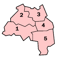
The 1973 Tyne and Wear County Council election was held on 12 April 1973 as part of the first elections to the new local authorities established by the Local Government Act 1972 in England and Wales. 104 councillors were elected from 95 electoral divisions across the region's five boroughs. Each division returned either one or two county councillors each by First-past-the-post voting for a four-year term of office. The election took place ahead of the elections to the area's metropolitan borough councils, which followed on 10 May 1973.

The 2021 Newcastle City Council election took place on 6 May 2021 to elect members of Newcastle City Council in England. This was on the same day as other local elections across the United Kingdom.
The county of Northumberland has returned four MPs to the UK Parliament since 1983. Under the 2023 review of Westminster constituencies, coming into effect for the 2024 general election, the boundary commission proposed that two of the four constituencies be shared with the county of Tyne and Wear.
The ceremonial county of Tyne and Wear was created under the Local Government Act 1972, which came into effect on 1 April 1974, comprising the urban areas around the mouths of the Rivers Tyne and Wear, previously parts of the historic counties of Northumberland and Durham. It returned 12 MPs to the UK Parliament from 2010 to 2024. Under the 2023 review of Westminster constituencies, coming into effect for the 2024 general election, the boundary commission proposed two cross-county boundary seats with Northumberland and one with Durham, in addition to 10 constituencies wholly within the county boundaries,.

