
Electronic City is an information technology hub in Bangalore, India, located in Anekal taluk. Spread over 800 acres (3.2 km²) near Konappana Agrahara and Doddathogur it houses a large number of electronic/IT industrial parks.

Chikmagalur, officially Chikkamagaluru is an administrative district in the Malnad subregion of Karnataka, India. Coffee was first cultivated in India in Chikmagalur. The hills of Chikmagalur are parts of the Western Ghats and the source of Tunga and Bhadra rivers. Mullayanagiri, the highest peak in Karnataka is located in the district. The area is well known for the Sringeri Mutt that houses the Dakshina Peeta established by Adi Shankaracharya.

Bannerghatta Road is an Indian State Highway in Karnataka. It connects Bangalore with the towns of Bannerghatta, Jigani, and Anekal. It extends for 49 kilometres (30 mi). It starts as a branch from Hosur Road near the Adugodi Christian Cemetery and ends at Anekal.

Basaveshwaranagara, also known as Basaveshwaranagar, Basaveshnagara or Basaveshnagar is a largely residential neighbourhood in the west of Bengaluru, Karnataka, India. It is located to the west of Rajajinagara and is sandwiched between the localities of Mahalakshmi Layout to the north and Vijayanagara to the south, spread across multiple sub-localities, three assembly constituencies and seven Bruhat Bengaluru Mahanagara Palike (BBMP) wards. The area of Basaveshwaranagara is often considered West of Chord Road as it lies to the west of Chord Road, an arterial road in the western part of Bengaluru.
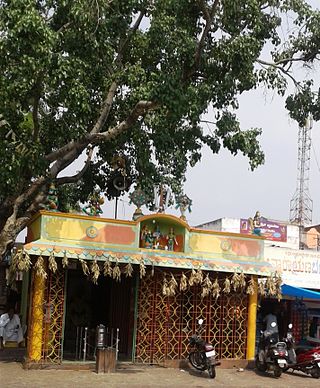
Anekal (ಆನೇಕಲ್) is a major town and taluk of Bengaluru Urban district, part of the Bangalore Metropolitan Region. It is a major town in the suburbs of Bengaluru. The Chandapura-Anekal stretch is an emerging residential hub in Bengaluru. It is approximately 36 km from the centre of Bengaluru and around 15 km from Hosur and Electronic City. It lies in the southern part of the Bangalore metropolitan area. Anekal is known for the Karaga and Dasara festivals.

Yalahanka is a suburb and Taluk of Bangalore Urban district in the Indian state of Karnataka. One of the zones of BBMP. It is the oldest part of present Municipal Bengaluru (Bangalore) city and the northern end of the city. It is Nadaprabhu Kempegowda I, of the Yelahanka Prabhu clans, who laid the foundation of present-day Bengaluru through the creation of a "mud fort town" in 1537 CE

Tumkur is a city located in the southern part of the Indian state of Karnataka. It is situated at a distance of 70 km (43 mi) northwest of Bangalore, the state's largest city and capital, along NH 48 and NH 73. It is the headquarters of the Tumakuru district. It is located at an altitude of 835 m (2739.5 ft).
Kanakapura is a city in the Ramanagara district of Karnataka on the banks of the Arkavathi river and the administrative center of the taluk of the same name. Its founder is Shrihan Kanaka Sigmanath, hence its name. Kanakapura is largest cocoon silk producer in India. River Cauvery flows around 21 km in Kanakapura Taluk.Previously belonged to Bangalore Rural District. It was formerly the largest constituency in the country. (1,553 km2 [600 sq mi]). It is located among the lush green forests of the state of Karnataka. The town is infamous with the traffic of Kanakpura Road in Benglaluru, one of the most narrow and traffic-prone roads of the state. The town is a tourism hotspot and an often visited tourist favorite in the entire state of Karnataka, as it has something for everyone ranging from avid trekkers to history buffs and wildlife enthusiasts. The forest area in this taluk is very wide and about half of the Bannerghatta National Park is located in our Kanakapura area. Kodihalli wildlife range and harohalli wildlife range its division. The Kaveri Wildlife Sanctuary consists of two main zones namely the Sangam Wildlife range, the Muggur Wildlife range.
Kengeri is a western suburb of Bangalore city, located along Mysore Road.It is bordered by Nagarbhavi and Ullal to the north, Rajarajeshwari Nagar to the east, Kumbalgodu to the west and Uttarahalli to the south.

Krishnarajapuram often abbreviated as K R Puram or K R Pura, is an eastern suburb of Bangalore, the capital of the Indian state of Karnataka. It is one of the zones of BBMP. It is 15 km (9.3 mi) from Bangalore City railway station. The Old Madras Road passes through this locality. A lake called 'Vengayyana Lake' is in the heart of this area. The Yele Mallappa Shetty Lake near Medahalli, situated just outside the eastern limits of KR Pura, is one of the largest lakes in Bangalore.
Kushtagi is a panchayat town in Koppal district in the Indian state of Karnataka. Kushtagi is a taluk center of Koppal district. This taluk has a population of 353,142 as per the 2021 census estimate. In this taluk, pomegranate fruits are popularly grown.There is a Durga devi temple in heart of the town. To its North lies Ilkal, Gajendragad to the West, Hospet to the South and Sindhanur to the East. Red and black soil can be found in this taluk. A big lake 4kms away from the city is the main source of drinking water is situated in west side and covering the area of more than 300 acres.
Arekere is a residential area on Bannerghatta Road in South Bangalore. The name Arekere originates from a water reservoir in the area.

Kaggalipura is a village along Kanakapura Road on the outskirts of Bangalore, in the southern state of Karnataka, India. Kaggalipura is located on the Bangalore-Coimbatore National Highway 948, around 20 km south of Bangalore. The village is named after the Kaggali tree, which grows in abundance locally. The village was established after clearing several Kaggali trees from the area, hence the name Kaggalipura.
The Pink Line of Namma Metro is under construction and will form part of the metro rail network for the city of Bangalore, Karnataka, India. The 21.25 km (13.20 mi) line connects Kalena Agrahara station on Bannerghatta Road in the south with Nagawara station on Outer Ring Road in the north. The Pink Line is mostly underground but also has a 6.98 km (4.34 mi) elevated section and a 0.48 km (0.30 mi) at-grade (surface) section. There are 18 stations on the line, including 12 underground and 6 elevated ones. Pink Line will have an interchange with the Purple Line at MG Road station. It will also have interchanges with the Yellow line at Jayadeva Hospital station and with the Blue Line at Nagawara. Both these lines are under construction.

Jayadeva Hospital is an upcoming double-elevated interchange metro station on the North-South corridor of the Yellow Line and Pink Line of Namma Metro in Bangalore, India. This metro station will be the first multi-elevated interchange metro station in the Namma Metro network. This metro station is named after the Sri Jayadeva Institute of Cardiovascular Sciences and Research which is located nearby and serves MICO Layout (BTM), Guruppanpalya, Jayanagar and JP Nagar 3rd Phase.

Kalena Agrahara is an upcoming elevated southern terminal metro station on the North-South corridor of the Pink Line of Namma Metro in Bangalore, India. This metro station serves residential properties and a few other locations including Prestige Elysian, Holy Spirit School (ICSE), Doddakammanahalli suburban area and Decathlon.

Hulimavu is an upcoming elevated metro station on the North-South corridor of the Pink Line of Namma Metro in Bangalore, India. This metro station serves mainly the Christ University, and the nearby prime locations such as Royal Meenakshi Mall, Sri Meenakshi Sundareshwara Temple, Hulimavu Police Station and Kothanur Metro Depot, which will handle all the Pink Line trainsets for maintenance purposes.

JP Nagar 4th Phase is an upcoming elevated interchange metro station on the North-South corridor of the Pink Line and the ORR-West corridor of the Orange Line of Namma Metro in Bengaluru, India. This station is located near the popular Vega City Mall and serves the residential areas of BTM Layout and JP Nagar 3rd & 4th Phase. This metro station will also act as the terminal station of the proposed Orange Line under Namma Metro Phase 3.

Tavarekere is an upcoming elevated metro station on the North-South corridor of the Pink Line of Namma Metro in Bangalore, India. Around this metro station holds the main Tavarekere Park followed by some prime locations like Byransandra Lake Park, Sagar Hospitals (Jayanagar) and the famous Dairy Circle Flyover which leads towards Nexus Mall (Koramangala) in the east and towards Lal Bagh in the west.
Akshay Nagar is a neighbourhood in Begur ward in Southeast Bangalore. It is surrounded by Hulimavu to the west and Begur to the east. The area has undergone rapid residential and commercial development since the early 2010s, including several high-rise apartment complexes. The locality is in close proximity to the Bannerghatta National Park, thus leading to occasional sightings of wild animals from the forest reserve. The area has a lake spread over 5 acres. It also features a wide mix of modern architecture and buildings.

