Goulburn Valley

Last updated

The middle reaches of the Goulburn River at Seymour. Golburn-at-Seymour.jpg
The middle reaches of the Goulburn River at Seymour.

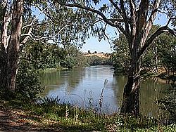
The Goulburn Valley is a sub-region, part of the Hume region of the Australian state of Victoria. The sub-region consists of those areas in the catchment of the Goulburn River and other nearby streams, and is part of the Murray-Darling Basin. The Goulburn Valley is bordered on the south by the Great Dividing Range and to the north by the Murray River, the state border with New South Wales. The sub-region is one of Australia's most productive and intensively farmed areas and is predominantly irrigated.

Contents

Major regional centres of the Goulburn Valley are Shepparton, Seymour, Echuca, Benalla, Yarrawonga and Kyabram.

History

Aboriginal groups inhabited the Goulburn Valley region prior to European settlement. In the central Goulburn around Nagambie, the traditional owners were the Natrakboolok, Ngooraialum or Thagungwurung tribes. [1] Downstream, at Shepparton, the area was inhabited by the Yorta Yorta people. [2] The Taungurung people are the traditional owners and inhabitants of the area Seymour now occupies.

European Settlement In 1824, Hume and Hovell on their return from Port Phillip, camped by the Goulburn River not far upstream of Seymour. In 1836 Major Mitchell crossed the Goulburn at Mitchellstown near Nagambie and soon afterwards overlanders and other early settlers began to use this crossing place on the Melbourne-Sydney route (now known as the Hume Highway). The mail service between Melbourne and Sydney had been operating for just a year when it was found that a better route was available using the "New Crossing Place" (now Seymour).

Economy

Industries in the Goulburn Valley include agricultural activities such as fruit growing and dairying, which supply processing plants in Shepparton and outlying towns such as Strathmerton and Tongala. This food processing industry produces around 25% of Victoria's rural output. [3] The SPC Ardmona plant, founded in 1917 in Shepparton, is one of the world's largest fruit canneries. [2] Other important agricultural activities include woolgrowing and cropping. Water for irrigation is sourced from Lake Eildon and Goulburn Weir, with Lake Eildon supplying over half the water used in the Shepparton irrigation district. [3]

Wine

The Goulburn Valley wine region stretches from Seymour to Echuca on the Murray River. [4] Wine production began in the region in 1860. A syndicate raised £25,000 to develop the Tahbilk winery. By 1875 trade with England had been established, and the winery was producing the equivalent of 70,000 cases of wine per year. Due to the sandy soil, Tahbilk was able to withstand the spread of Phylloxera, and in 1925 was the only winery in the area. [5] As a result, the region is home to the oldest and largest plantings of Marsanne grape variety in the world. Other wine varieties grown include Chardonnay, Cabernet Sauvignon, Riesling and Shiraz. [6] As well as Tahbilk, other major wineries include Michelton between Seymour and Nagambie, Wine by Sam, Fowles Wines and boutique vineyards Box Grove and Brave Goose vineyard in the south near Seymour and Monichino near Katunga in the north. [6] Nagambie Lakes is a recognised and protected subregion of the Goulburn Valley wine region. [7]

Each year Tastes of the Goulburn food and wine festival is hosted in Seymour, showcasing the best local produce from the Goulburn Valley. [8] Seymour also hosts the Victorian Wine Show. [9]

Politics

Local government in the region is provided by the City of Greater Shepparton and the Shires of Mitchell, Moira, Campaspe, Murrindindi, and Strathbogie. The region is represented at the federal level in the Australian House of Representatives by the Division of Nicholls as well as parts of the Divisions of McEwen and Indi. At the state level, the region includes the Electoral districts of Shepparton, Murray Plains, Euroa and Eildon.

Transport

Major transport routes through the Goulburn Valley region include the Goulburn Valley Highway, Midland Highway and the Murray Valley Highway. Passenger rail services are provided from Melbourne to Seymour railway station the junction for they North East and Goulburn Valley lines which was opened in 1872 and then onto Shepparton and Echuca by V/Line. [10]

See also

Related Research Articles

<span class="mw-page-title-main">Echuca</span> Town in Victoria, Australia

Echuca is a town on the banks of the Murray River and Campaspe River in Victoria, Australia. The border town of Moama is adjacent on the northern side of the Murray River in New South Wales. Echuca is the administrative centre and largest settlement in the Shire of Campaspe. As of the 2021 census, Echuca had a population of 15,056, and the population of the combined Echuca and Moama townships was 22,568.

<span class="mw-page-title-main">Shepparton</span> City in Victoria, Australia

Shepparton is a city located on the floodplain of the Goulburn River in northern Victoria, Australia, approximately 181 kilometres (112 mi) north-northeast of Melbourne. As of the 2021 census, the estimated population of Shepparton, including the adjacent town of Mooroopna, was 68,409.

<span class="mw-page-title-main">Shire of Strathbogie</span> Local government area in Victoria, Australia

The Shire of Strathbogie is a local government area in the Hume region of Victoria, Australia, located in the north-east part of the state. It covers an area of 3,303 square kilometres (1,275 sq mi) and in June 2018 had a population of 10,645.

<span class="mw-page-title-main">Goulburn River</span> River in Victoria, Australia

The Goulburn River, a major inland perennial river of the Goulburn Broken catchment, part of the Murray-Darling basin, is located in the alpine, Northern Country/North Central, and Southern Riverina regions of the Australian state of Victoria. The headwaters of the Goulburn River rise in the western end of the Victorian Alps, below the peak of Corn Hill before descending to flow into the Murray River near Echuca, making it the longest river in Victoria at 654 kilometres (406 mi). The river is impounded by the Eildon Dam to create Lake Eildon, the Eildon Pondage, the Goulburn Weir and Waranga Basin.

<span class="mw-page-title-main">Eildon Dam</span> Dam in Victorian Alps, Victoria

The Eildon Dam or Eildon Weir, a rock and earth-fill embankment dam with a controlled spillway across the Goulburn River, is located between the regional towns of Mansfield and Eildon within Lake Eildon National Park, in the Alpine region of Victoria, Australia. The dam's purpose is for the supply of potable water, irrigation, and the generation of hydroelectricity. The impounded reservoir is called Lake Eildon.

<span class="mw-page-title-main">Seymour, Victoria</span> Town in Victoria, Australia

Seymour is a historic railway township located in the Southern end of the Goulburn Valley in the Shire of Mitchell, Victoria, Australia and is located 104 kilometres (65 mi) north of Melbourne. At the 2021 census, Seymour had a population of 6,569. The township services the surrounding agricultural industries as well as the nearby military base of Puckapunyal, which is an important training centre for the Australian Army. Other important sectors of employment in Seymour include retail, light engineering, agricultural services support, medical services, and education.

<span class="mw-page-title-main">Mooroopna</span> Town in Victoria, Australia

Mooroopna is a rural town located 181 kilometres (112 mi) north of Melbourne, Victoria, Australia. It is on the banks of the Goulburn River opposite the larger town of Shepparton. The Midland Highway crosses the river between the two towns. At the 2016 census, Mooroopna had a population of 7,942.

<span class="mw-page-title-main">Riverina</span> Region in New South Wales, Australia

The Riverina is an agricultural region of south-western New South Wales, Australia. The Riverina is distinguished from other Australian regions by the combination of flat plains, warm to hot climate and an ample supply of water for irrigation. This combination has allowed the Riverina to develop into one of the most productive and agriculturally diverse areas of Australia. Bordered on the south by the state of Victoria and on the east by the Great Dividing Range, the Riverina covers those areas of New South Wales in the Murray and Murrumbidgee drainage zones to their confluence in the west.

<span class="mw-page-title-main">Goulburn Valley Highway</span>

Goulburn Valley Highway is a highway located in Victoria, Australia. The section north of the Hume Freeway is part of the Melbourne to Brisbane National Highway and is the main link between these two cities as well as a major link between Victoria and inland New South Wales. It is also the most direct route between Melbourne and the major regional centre of Shepparton in Victoria.

<span class="mw-page-title-main">Nagambie</span> Town in Victoria, Australia

Nagambie is a town in the Goulburn Valley region of Victoria, Australia. The city is on the Goulburn Valley Freeway north of Seymour and in the Shire of Strathbogie. As of 2021 census, Nagambie had a population of 2,254.

<span class="mw-page-title-main">Goulburn Weir</span>

Goulburn Weir is a weir built between 1887 and early 1891 across the Goulburn River near Nagambie, Victoria, Australia. It was the first major diversion structure built for irrigation development in Australia. The weir also forms Lake Nagambie where rowing regattas and waterskiing tournaments are held.

Tahbilk Winery is a historic Australian winery with National Trust certification. It is located 120 km (75 mi) north of Melbourne between the townships of Seymour and Nagambie in the Nagambie Lakes a sub region of Goulburn Valley Wine Region. It was established in 1860, and is the oldest family-owned winery and vineyard in Victoria. The winery is part of Australia's First Families of Wine, a prominent Australian wine alliance.

<span class="mw-page-title-main">Victorian wine</span>

Victorian wine is wine made in the Australian state of Victoria. With over 600 wineries, Victoria has more wine producers than any other Australian wine-producing state but ranks third in overall wine production due to the lack of a mass bulk wine-producing area like South Australia's Riverland and New South Wales's Riverina. Viticulture has existed in Victoria since the 19th century and experienced a high point in the 1890s when the region produced more than half of all wine produced in Australia. The phylloxera epidemic that soon followed took a hard toll on the Victoria wine industry which did not fully recover till the 1950s.

<span class="mw-page-title-main">Shire of Nathalia</span> Local government area in Victoria, Australia

The Shire of Nathalia was a local government area on the Murray River in the Goulburn Valley region, about 220 kilometres (137 mi) north of Melbourne, the state capital of Victoria, Australia. The shire covered an area of 1,238.97 square kilometres (478.4 sq mi), and existed from 1879 until 1994.

<span class="mw-page-title-main">Shire of Numurkah</span> Local government area in Victoria, Australia

The Shire of Numurkah was a local government area on the Murray River in the Goulburn Valley region, about 210 kilometres (130 mi) north of Melbourne, the state capital of Victoria, Australia. The shire covered an area of 820 square kilometres (316.6 sq mi), and existed from 1957 until 1994.

The Pangerang, also spelt Bangerang and Bangarang, are the Indigenous Australians who traditionally occupied much of what is now north-eastern Victoria stretching along the Murray River to Echuca and into the areas of the southern Riverina in New South Wales. They may not have been an independent tribal reality, as Norman Tindale thought, but one of the many Yorta Yorta tribes. For the purposes of this article, they are treated separately, according to those sources that maintain the distinction.

<span class="mw-page-title-main">Goulburn Valley wine region</span>

Goulburn Valley wine region is a wine region in the state of Victoria in Australia. It is part of the Central Victoria zone and roughly corresponds to the Goulburn Valley tourist and government region.

Tabilk is a small rural area located about 90 minutes north of Melbourne. The 2016 census recorded that 131 people lived in the area. The closest major towns are Nagambie, Avenel and Seymour (About 25–30 minutes south-west of Tabilk. Tabilk is mostly a farm town with no shops.

Nagambie Lakes is a subregion of the Goulburn Valley wine region in the Australian state of Victoria. Lake Nagambie on the Goulburn River is the largest waterbody in the region, and Nagambie is the main town.

References

  1. "Nagambie". Walkabout Australian Travel Guide. Fairfax. Archived from the original on 16 February 2007. Retrieved 27 March 2007.
  2. 1 2 "Shepparton". The Sydney Morning Herald . 2004. Retrieved 27 March 2007.
  3. 1 2 Feehan, Pat. "Goulburn-Broken River". CRC for Catchment Hydrology. Archived from the original on 30 August 2007. Retrieved 27 March 2007.
  4. "Goulburn Valley, Victoria". Geographical Indications. Australian Grape and Wine Authority. Retrieved 12 September 2017.
  5. Halliday, James. "Regional Profile - Goulburn Valley". Winepros. eWine Exchange Ltd. Archived from the original on 31 December 2006. Retrieved 27 March 2007.
  6. 1 2 "Goulburn Valley". Discover Australian Wine. Australian Grape and Wine Authority. 2016. Retrieved 12 September 2017.
  7. "Geographical indications". Register of Protected GIs and Other Terms. Wine Australia, Australian Grape and Wine Authority. 2016. Retrieved 12 September 2017.
  8. "Tastes of the Goulburn" . Retrieved 12 September 2017.
  9. "Victorian Wine Show" . Retrieved 12 September 2017.
  10. "Network Maps". V/Line . Retrieved 23 March 2007.

Coordinates: 36°22′59″S145°23′56″E / 36.38306°S 145.39889°E / -36.38306; 145.39889