Churapchinsky District is an administrative and municipal district, one of the thirty-four in the Sakha Republic, Russia. It is located in the center of the republic and borders Tattinsky District in the north, Ust-Maysky District in the east and southeast, Amginsky District in the south, Megino-Kangalassky District in the west, and Ust-Aldansky District in the northwest. The area of the district is 12,600 square kilometers (4,900 sq mi). Its administrative center is the rural locality of Churapcha. As of the 2010 Census, the total population of the district was 20,387, with the population of Churapcha accounting for 43.0% of that number.

Nizhnekolymsky District is an administrative and municipal district, one of the thirty-four in the Sakha Republic, Russia. It is located in the northeast of the republic and borders with Allaikhovsky District in the west, Srednekolymsky District in the south, and with Bilibinsky District of Chukotka Autonomous Okrug in the east. The area of the district is 87,100 square kilometers (33,600 sq mi). Its administrative center is the urban locality of Chersky. Population: 4,664 (2010 Census); 5,932 ; 13,692 (1989 Census). The population of Chersky accounts for 61.3% of the district's total population.

Amginsky District is an administrative and municipal district, one of the thirty-four in the Sakha Republic, Russia. It is located in the southeast of the republic and borders with Churapchinsky District in the north, Ust-Maysky District in the east and southeast, Aldansky District in the south and southwest, and with Khangalassky and Megino-Kangalassky Districts in the northwest. The area of the district is 29,400 square kilometers (11,400 sq mi). Its administrative center is the rural locality of Amga. As of the 2010 Census, the total population of the district was 17,183, with the population of Amga accounting for 38.0% of that number.

Bulunsky District is an administrative and municipal district, one of the thirty-four in the Sakha Republic, Russia. It is located in the north of the republic and borders Ust-Yansky District in the east, Verkhoyansky District in the southeast, Eveno-Bytantaysky and Zhigansky Districts in the south, Olenyoksky District in the west, and Anabarsky District in the northwest. The area of the district is 223,600 square kilometers (86,300 sq mi). Its administrative center is the urban-type settlement of Tiksi. As of the 2010 Census, the total population of the district was 9,054, with the population of Tiksi accounting for 55.9% of that number.
Eveno-Bytantaysky National District is an administrative and municipal district, one of the thirty-four in the Sakha Republic, Russia. The area of the district is 52,300 square kilometers (20,200 sq mi). Its administrative center is the rural locality of Batagay-Alyta. As of the 2010 Census, the total population of the district was 2,867, with the population of Batagay-Alyta accounting for 63.9% of that number.

Gorny District is an administrative and municipal district, one of the thirty-four in the Sakha Republic, Russia. It is located in the center of the republic and borders Vilyuysky and Kobyaysky Districts in the north, Namsky District and the territory of the city of republic significance of Yakutsk in the east, Khangalassky District in the south, Olyokminsky District in the southwest, and Verkhnevilyuysky District in the west. The area of the district is 45,600 square kilometers (17,600 sq mi). Its administrative center is the rural locality of Berdigestyakh. As of the 2010 Census, the total population of the district was 11,706, with the population of Berdigestyakh accounting for 55.2% of that number.
Nyurbinsky District is an administrative and municipal district, one of the thirty-four in the Sakha Republic, Russia. It is located in the central western part of the republic and borders with Olenyoksky District in the north, Verkhnevilyuysky District in the east, Suntarsky District in the south and southwest, and with Mirninsky District in the northwest. The area of the district is 52,400 square kilometers (20,200 sq mi). Its administrative center is the town of Nyurba. Population : 15,101 (2010 Census); 15,549 ; 28,672 (1989 Census).

Suntarsky District is an administrative and municipal district, one of the thirty-four in the Sakha Republic, Russia. It is located in the western central part of the republic and borders with Nyurbinsky District in the north and northeast, Verkhnevilyuysky District in the east, Olyokminsky District in the southeast, Lensky District in the southwest, and with Mirninsky District in the west. The area of the district is 57,800 square kilometers (22,300 sq mi). Its administrative center is the rural locality of Suntar. Population: 25,140 (2010 Census); 25,485 ; 26,035 (1989 Census). The population of Suntar accounts for 39.9% of the district's total population.

Tattinsky District is an administrative and municipal district, one of the thirty-four in the Sakha Republic, Russia. It is located in the eastern central part of the republic and borders with Tomponsky District in the north and east, Ust-Maysky District in the south, Churapchinsky District in the southwest, and with Ust-Aldansky District in the northwest. The area of the district is 19,000 square kilometers (7,300 sq mi). Its administrative center is the rural locality of Ytyk-Kyuyol. Population: 17,242 (2010 Census); 16,601 ; 15,933 (1989 Census). The population of Ytyk-Kyuyol accounts for 39.6% of the district's total population.

Zhigansky District is an administrative and municipal district, one of the thirty-four in the Sakha Republic, Russia. It is located in the northern central part of the republic and borders with Bulunsky District in the north, Eveno-Bytantaysky National District in the east, Kobyaysky District in the southeast, Vilyuysky District in the southwest, and with Olenyoksky District in the northwest. The area of the district is 140,200 square kilometers (54,100 sq mi). Its administrative center is the rural locality of Zhigansk. Population: 4,296 (2010 Census); 4,312 ; 5,678 (1989 Census). The population of Zhigansk accounts for 79.6% of the district's total population.

Oymyakonsky District is an administrative and municipal district, one of the thirty-four in the Sakha Republic, Russia. It is located in the east of the republic and borders with Ust-Maysky District in the southwest, Tomponsky District in the west, Momsky District in the north, Susumansky District of Magadan Oblast in the east, and with Okhotsky District of Khabarovsk Krai in the south. The area of the district is 92,300 square kilometers (35,600 sq mi). Its administrative center is the urban locality of Ust-Nera. Population: 10,109 (2010 Census); 14,670 ; 31,078 (1989 Census). The population of Ust-Nera accounts for 63.9% of the district's total population.
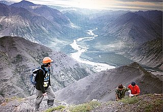
Tomponsky District is an administrative and municipal district, one of the thirty-four in the Sakha Republic, Russia. It is located in the east of the republic and borders with Momsky District in the northeast, Oymyakonsky District in the east, Ust-Maysky District in the southeast, Tattinsky District in the southwest, Ust-Aldansky and Kobyaysky Districts in the west, and with Verkhoyansky District in the north and northwest. The area of the district is 135,800 square kilometers (52,400 sq mi). Its administrative center is the urban locality of Khandyga. Population: 14,099 (2010 Census); 15,275 ; 22,844 (1989 Census). The population of Khandyga accounts for 47.1% of the district's total population.

Verkhnekolymsky District is an administrative and municipal district, one of the thirty-four in the Sakha Republic, Russia. It is located in the northeast of the republic and borders with Srednekolymsky District in the north and northeast, Srednekansky District and Susumansky District of Magadan Oblast in the east and south, Momsky District in the west, and with Abyysky District in the northwest. The area of the district is 67,800 square kilometers (26,200 sq mi). Its administrative center is the urban locality of Zyryanka. Population: 4,723 (2010 Census); 5,653 ; 10,072 (1989 Census). The population of Zyryanka accounts for 67.1% of the district's total population.

Ust-Maysky District is an administrative and municipal district, one of the thirty-four in the Sakha Republic, Russia. It is located in the east of the republic and borders with Oymyakonsky District in the northeast, Okhotsky District and Ayano-Maysky District of Khabarovsk Krai in the east and south, Aldansky District in the southwest, Amginsky District in the west, Churapchinsky and Tattinsky Districts in the northwest, and with Tomponsky District in the north. The area of the district is 95,300 square kilometers (36,800 sq mi). Its administrative center is the urban locality of Ust-Maya. Population: 8,629 (2010 Census); 11,568 ; 20,337 (1989 Census). The population of Ust-Maya accounts for 33.9% of the district's total population.
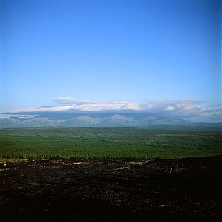
Verkhoyansky District is an administrative and municipal district, one of the thirty-four in the Sakha Republic, Russia. It is located in the northern central part of the republic and borders with Ust-Yansky District in the northeast, Momsky District in the east, Tomponsky District in the south, Kobyaysky District in the southwest, Eveno-Bytantaysky National District in the west, and with Bulunsky District in the northwest. The area of the district is 137,400 square kilometers (53,100 sq mi). Its administrative center is the urban locality of Batagay. Population: 12,815 (2010 Census); 13,666 ; 24,259 (1989 Census). The population of Batagay accounts for 34.1% of the district's total population.

Srednekolymsky District is an administrative and municipal district, one of the thirty-four in the Sakha Republic, Russia. It is located in the north of the republic and borders with Verkhnekolymsky District in the south, Abyysky District in the west, Allaikhovsky District in the northwest, Nizhnekolymsky District in the north, Bilibinsky District of Chukotka Autonomous Okrug in the east, and with Srednekansky District of Magadan Oblast in the southeast. The area of the district is 125,200 square kilometers (48,300 sq mi). Its administrative center is the town of Srednekolymsk. Population: 7,897 (2010 Census); 8,353 ; 9,441 (1989 Census). The population of Srednekolymsk accounts for 44.6% of the district's total population.
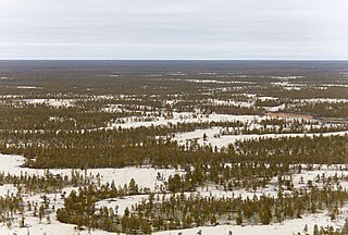
Vilyuysky District is an administrative and municipal district, one of the thirty-four in the Sakha Republic, Russia. It is located in the western central part of the republic and borders with Zhigansky District in the northeast, Kobyaysky District in the east, Gorny District in the south, Verkhnevilyuysky District in the west, and with Olenyoksky District in the northwest. The area of the district is 55,200 square kilometers (21,300 sq mi). Its administrative center is the town of Vilyuysk. Population: 25,222 (2010 Census); 25,696 ; 28,704 (1989 Census). The population of Vilyuysk accounts for 40.6% of the district's total population.

Ust-Aldansky District is an administrative and municipal district, one of the thirty-four in the Sakha Republic, Russia. It is located in the center of the republic and borders with Kobyaysky District in the north, Tomponsky District in the northeast, Tattinsky District in the east, Churapchinsky District in the southeast, Megino-Kangalassky District in the south, and with Namsky District in the west. The area of the district is 18,300 square kilometers (7,100 sq mi). Its administrative center is the rural locality of Borogontsy. Population: 22,155 (2010 Census); 22,372 ; 21,389 (1989 Census). The population of Borogontsy accounts for 23.6% of the district's total population.

Neryungrinsky District is an administrative and municipal district, one of the thirty-four in the Sakha Republic, Russia. It is the southernmost district of Sakha and borders Aldansky District in the north, Olyokminsky District in the west and south, Amur Oblast and a small area of Zabaykalsky Krai in the west, and Khabarovsk Krai in the east. The area of the district is 98,900 square kilometers (38,200 sq mi). Its administrative center is the town of Neryungri. Population : 21,019 (2010 Census).
