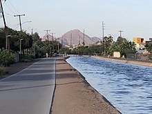
Phoenix is the state capital and most populous city of the U.S. state of Arizona, with 1,608,139 residents as of 2020. It is the fifth-most populous city in the United States and the most populous state capital in the country.

Chandler is a city in Maricopa county, Arizona, United States, and a suburb in the Phoenix-Mesa-Chandler Metropolitan Statistical Area (MSA). It is bordered to the north and west by Tempe, to the north by Mesa, to the west by Phoenix, to the south by the Gila River Indian Community, and to the east by Gilbert. As of the 2020 census, the population of Chandler was 279,458, up from 236,123 at the 2010 census.
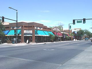
Glendale is a city in Maricopa County, Arizona, United States. Located about nine miles northwest of the state capital Phoenix, Glendale is known for State Farm Stadium, which is the home of the Arizona Cardinals football team. The city also contains the Arrowhead Towne Center shopping mall. As of the 2020 census, Glendale had a population of 248,325.
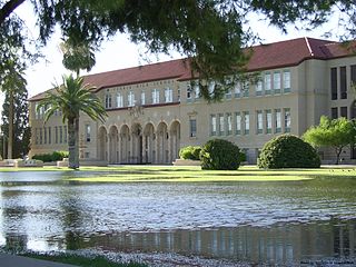
Peoria is a city in Maricopa and Yavapai counties in the U.S. state of Arizona. Most of the city is located in Maricopa County, while a portion of it in the north is in Yavapai County. It is a major suburb of Phoenix. As of the 2020 census, the population of Peoria was 190,985, up from 154,065 in 2010. It is the sixth-largest city in Arizona in land area and the ninth-largest in population. It was named after Peoria, Illinois. The word peoria is a corruption of the Miami-Illinois word for "prairie fire". It is the spring training home of the San Diego Padres and Seattle Mariners, who share the Peoria Sports Complex.

Tempe is a city in Maricopa County, Arizona, United States, with the Census Bureau reporting a 2020 population of 180,587. The city is named after the Vale of Tempe in Greece. Tempe is located in the East Valley section of metropolitan Phoenix; it is bordered by Phoenix and Guadalupe on the west, Scottsdale and the Salt River Pima–Maricopa Indian Community on the north, Chandler on the south, and Mesa on the east. Tempe is also the location of the main campus of Arizona State University.

The Salt River is a river in Gila and Maricopa counties in Arizona, United States, that is the largest tributary of the Gila River. The river is about 200 miles (320 km) long. Its drainage basin is about 13,700 square miles (35,000 km2) large. The longest of the Salt River's many tributaries is the 195-mile (314 km) Verde River. The Salt's headwaters tributaries, the Black River and East Fork, increase the river's total length to about 300 miles (480 km). The name Salt River comes from the fact that the river flows over large salt deposits shortly after the merging of the White and Black Rivers.

The Arizona Canal is a major canal in central Maricopa County that led to the founding of several communities, now among the wealthier neighborhoods of suburban Phoenix, constructed in the late 1880s. Flood irrigation of residential yards is still common in these neighborhoods, using a system of lateral waterways connected via gates to the canal itself. Like most Valley canals, its banks are popular with joggers and bicyclists.
The Salt River Project (SRP) encompasses two separate entities: the Salt River Project Agricultural Improvement and Power District, an agency of the state of Arizona that serves as an electrical utility for the Phoenix metropolitan area, and the Salt River Valley Water Users' Association, a utility cooperative that serves as the primary water provider for much of central Arizona. It is one of the primary public utility companies in Arizona.
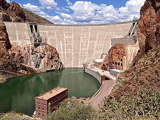
Theodore Roosevelt Dam is a dam on the Salt River located northeast of Phoenix, Arizona. The dam is 357 feet (109 m) high and forms Theodore Roosevelt Lake as it impounds the Salt River. Originally built between 1905 and 1911, the dam was renovated and expanded in 1989–1996. The dam is named after President Theodore Roosevelt. Serving mainly for irrigation, water supply, and flood control, the dam also has a hydroelectric generating capacity of 36 megawatts.

Arizona Falls is a waterfall in Phoenix, Arizona, U.S. It was formed when the man-made Arizona Canal crossed a natural, 20-foot (6.1 m) drop in the area of present-day 56th Street in the Arcadia neighborhood of Phoenix. The site became a popular location for social activities before and after being used as a hydroelectric power station that provided the first electricity to Phoenix. After generating power for 50 years, the site was left run down. Modern air conditioning lessened the attraction of the falls and the area was neglected for decades. In the early 2000s, the site was rebuilt both as a public-art project and a functional power station which generates enough electricity to power about 150 average Phoenix homes. Walkers, joggers, and cyclists using a recreation path along the canal pass through the park. It is also a destination attraction for other visitors. The modern park opened in 2003.
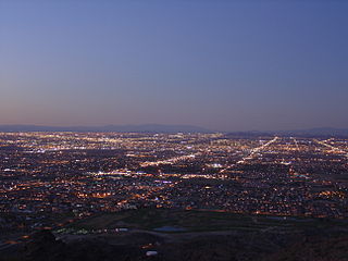
South Phoenix is a region of Phoenix, Arizona. By one definition it encompasses an area south of the Salt River, north of Roeser Road, east of 24th Street, and west of 32nd Street.

The Bartlett Dam is a concrete multiple-arch buttress dam on the Verde River, located 50 km northeast of Phoenix, Arizona. The dam creates Bartlett Lake and its primary purpose is irrigation water supply. It was the first dam constructed on the Verde River and the first of its type constructed by the U.S. Bureau of Reclamation. It was built between 1936 and 1939. It was named after Bill Bartlett, a government surveyor. It was listed on the National Register of Historic Places in 2017.

The history of Phoenix, Arizona, goes back millennia, beginning with nomadic paleo-Indians who existed in the Americas in general, and the Salt River Valley in particular, about 7,000 BC until about 6,000 BC. Mammoths were the primary prey of hunters. As that prey moved eastward, they followed, vacating the area. Other nomadic tribes moved into the area, mostly from Mexico to the south and California to the west. Around approximately 1,000 BC, the nomadic began to be accompanied by two other types of cultures, commonly called the farmers and the villagers, prompted by the introduction of maize into their culture. Out of these archaic Indians, the Hohokam civilization arose. The Hohokam first settled the area around 1 AD, and in about 500 years, they had begun to establish the canal system which enabled agriculture to flourish in the area. They suddenly disappeared by 1450, for unknown reasons. By the time the first Europeans arrived at the beginning of the 16th century, the two main groups of native Indians who inhabited the area were the O'odham and Sobaipuri tribes.
Many arterial roads in the Phoenix metropolitan area have the same name in multiple cities or towns. Some roads change names or route numbers across town borders, resulting in occasional confusion. For example, the road known as Apache Boulevard in Tempe continues east as Main Street in neighboring Mesa and then as Apache Trail in Apache Junction. Although Broadway Road maintains the same name through Goodyear, Avondale, Phoenix, Tempe, Mesa, and Apache Junction, each town uses a different reference point for address numbers.

The Four Corners Generating Station is a 1,540 megawatt coal-fired power plant located near Fruitland, New Mexico, on property located on the Navajo Nation that is leased from the Navajo Nation government.
The following is a timeline of the history of the city of Phoenix, Arizona, United States.

Katharine Sarah Gallego is an American politician serving as the 62nd mayor of Phoenix, Arizona, since 2019. A member of the Democratic Party, she previously served on the Phoenix City Council from 2014 to 2018.

The Woodlea Historic District is located in central Phoenix, Arizona, United States. The neighborhood runs from Glenrosa Ave. south to Monterosa St. and from Seventh Ave. west to Fifteenth Ave. The neighborhood as well as many of the individual houses are listed on the National Register of Historic Places. The neighborhood is known for its tree shaded sidewalks, abundant plant life and is served by an antique irrigation system from the Grand Canal.
