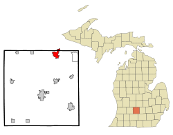
Grand Ledge, Michigan

Last updated

Grand Ledge, Michigan
Eaton County Michigan Incorporated and Unincorporated areas Grand Ledge Highlighted.svg
Location of Grand Ledge in Eaton County, Michigan
Coordinates: 42°45′12″N84°44′42″W / 42.75333°N 84.74500°W / 42.75333; -84.74500 Coordinates: 42°45′12″N84°44′42″W / 42.75333°N 84.74500°W / 42.75333; -84.74500
Country United States
State Michigan
Counties Eaton, Clinton
Government
  MayorKeith Mulder
Area
[1]
  Total3.94 sq mi (10.19 km2)
  Land3.84 sq mi (9.94 km2)
  Water0.10 sq mi (0.25 km2)
Elevation
[2]
833 ft (254 m)
Population
 (2020)
  Total7,784
  Density2,028.67/sq mi (783.27/km2)
Time zone UTC-5 (Eastern (EST))
  Summer (DST) UTC-4 (EDT)
ZIP code
48837
Area code 517
FIPS code 26-33420 [3]
GNIS feature ID1626372 [2]
Website www.cityofgrandledge.com
Sandstone ledges along the banks of the Grand Ledge Grand ledges.JPG
Sandstone ledges along the banks of the Grand Ledge

Grand Ledge is a city in the U.S. state of Michigan. The city lies mostly within Eaton County, though a small portion extends into Clinton County to the north. The city sits along the Grand River 12.7 miles (20.4 kilometers) west of downtown Lansing. The population was 7,786 at the 2010 census. The city is named for its sandstone rock ledges that rise 40 feet (12 m) above the Grand River and are used by recreational rock climbers.

Contents

History

Native American Settlement

Native Americans who lived in the vicinity of the Grand River near the ledges were of Pottawatomi, Chippewa, and Ottawa ancestry. They dug clams in the river, mined coal on the river banks, hunted for deer, turkey, fox, and bear, and fished for black bass. Their name for the ledges translated into English as "Big Rocks".

Modern Settlement

Based on early records, Hugh Heward was the first white man to explore this area by water and record his findings. His journal describes the sandstone ledges as having high banks, some pine trees and heavy woods with the finest places possible for making syrup, and the existence of several small islands. In 1847 Henry Trench settled in what would later become downtown Grand Ledge. After a few years he returned east. In 1850 settlers named their village Grand Ledge, and erected a post office. By 1869, a railroad reached the north end of the village. In 1871, the village was incorporated by the state of Michigan.

Resort Era

Grand Ledge grew as a resort area during the 1870s, spurred by the railroad access. John Burtch founded Seven Islands Resort in 1872, with the Dolly Varden steamer and a small inn on Second Island. Several wells were drilled, and the mineral-laden water they produced was touted for its curative property. In 1877 S.M. Hewings purchased the Seven Islands Resort, and in 1878 he built the Island House Hotel on Second Island. In 1880 Julian Scott Mudge purchased the Seven Islands Resort. To reduce the risk of flooding from Grand River, Mudge built a dam (1887). In 1888 the Railroad Trestle or High Bridge was built to bring the railroad south of the river and Grand Ledge became the second city in Michigan (after Lansing) to get electric lights. By that time an estimated 60,000 to 70,000 people visited the Seven Islands Resort annually.

Golden Age

In 1891 Mudge built a roller coaster on the Islands, probably the state's first. Located on the first island below the bridge was an animal park with bears and deer. The second island was the center of the resort activities, with its hotel, picnic area, and fountain. The second and third islands were joined with a causeway, and a pavilion served as a ballroom and theatre for Vaudeville acts. The Resort featured a merry-go-round and a bandstand.

Mudge's most notable improvement was the construction of “The Round House”. This three-story pagoda tower was built on the edge of Second Island, with half its foundation on island soil and the rest projecting over the river. During the construction, he kept the purpose of the unusual structure secret. This caused much speculation in the local community. Mudge eventually revealed that it was designed to have the second story rotate at a slow speed, while the third story rotated faster and was topped by a centrifugal swing that would whirl the adventurous rider out over the river.

The fourth, fifth, and sixth islands were left wild, and the seventh was a picnic spot, accessed by boat. As many as 75 boats plied the Grand River at Grand Ledge, and sidewheel riverboats ran between Second Island and the dam. The dam, constructed in 1887, ensured the proper water level for the operation of steamboats. As many as nine hotels provided accommodations for visitors and the Pere Marquette Railroad offered excursion rates to the Seven Island Resort which, according to early records, was second in popularity only to the Petoskey resort areas.

The Spring Flood of 1893

A flood damaged the Round House in 1893. The construction was nearly complete by then, but the rushing waters pushed chunks of ice into its overhanging foundation. The structure was pushed off the foundation, but remained nearly in place, at a precarious angle. Although the building was saved, the mechanism that was to rotate its upper portions was so damaged that repairs were never initiated. The Round House remained on the site, becoming the most recognizable symbol of the entire resort era. “The building has come to be called Mudge’s Folly. This has a double meaning. While a folly can be a costly and foolish undertaking, it can also describe a picturesque structure built as an ornament, but without a real purpose.”. [4]

Geography

According to the United States Census Bureau, the city has a total area of 3.65 square miles (9.45 km2), of which 3.57 square miles (9.25 km2) is land and 0.08 square miles (0.21 km2) is water. [5]

Transportation

Highways

Airport

Abrams Municipal Airport ( FAA LID : 4D0) is a city-owned, public-use airport located two nautical miles (3.7 km) north of the central business district of Grand Ledge. The airport is accessible by road from Eaton Highway and is located 2.1 miles (3.4 km) south of Interstate 96, just east of M-100.

Railroads

CSX Transportation now operates the original railroad built through the town as part of their Plymouth Subdivision between Plymouth, MI and Grand Rapids, MI. A small yard remains active for local shippers, including a Lowes distribution center. The remnant of a branch line to Ionia begins here to serve a large grain elevator several miles north of town. As of 2022, one local freight and two through freights pass through town daily. Passenger service between Detroit and Grand Rapids, then provided by predecessor Chesapeake & Ohio, ended after April 30, 1971.

The railroad crosses the Grand River adjacent to the Ledges on a spectacular high bridge. One of the largest railroad bridges in the state of Michigan, it remains a sought after landmark for railfans and general tourists alike.

Demographics

Historical population
CensusPop.Note
1880 1,387
1890 1,60615.8%
1900 2,16134.6%
1910 2,89333.9%
1920 3,0435.2%
1930 3,57217.4%
1940 3,8999.2%
1950 4,50615.6%
1960 5,16514.6%
1970 6,03216.8%
1980 6,92014.7%
1990 7,5799.5%
2000 7,8133.1%
2010 7,786−0.3%
2020 7,7840.0%
U.S. Decennial Census

2010 census

As of the census [7] of 2010, there were 7,786 people, 3,357 households, and 2,063 families residing in the city. The population density was 2,181.0 inhabitants per square mile (842.1/km2). There were 3,656 housing units at an average density of 1,024.1 per square mile (395.4/km2). The racial makeup of the city was 94.4% White, 0.9% African American, 0.5% Native American, 0.8% Asian, 0.1% Pacific Islander, 0.9% from other races, and 2.5% from two or more races. Hispanic or Latino of any race were 4.6% of the population.

There were 3,357 households, of which 31.9% had children under the age of 18 living with them, 43.1% were married couples living together, 13.6% had a female householder with no husband present, 4.7% had a male householder with no wife present, and 38.5% were non-families. 33.1% of all households were made up of individuals, and 13.5% had someone living alone who was 65 years of age or older. The average household size was 2.31 and the average family size was 2.93.

The median age in the city was 38.8 years. 24.3% of residents were under the age of 18; 9% were between the ages of 18 and 24; 25.7% were from 25 to 44; 27% were from 45 to 64; 14.1% were 65 years of age or older. The gender makeup of the city was 47.7% male and 52.3% female.

2000 census

As of the census [3] of 2000, there were 7,813 people, 3,262 households, and 2,123 families residing in the city. The population density was 2,199.2 inhabitants per square mile (849.1/km2). There were 3,405 housing units at an average density of 958.4 per square mile (370.0/km2). The racial makeup of the city was 96.33% White, 0.44% African American, 0.40% Native American, 0.58% Asian, 0.03% Pacific Islander, 0.78% from other races, and 1.46% from two or more races. Hispanic or Latino of any race were 2.61% of the population.

There were 3,262 households, out of which 33.9% had children under the age of 18 living with them, 48.2% were married couples living together, 13.0% had a female householder with no husband present, and 34.9% were non-families. 29.0% of all households were made up of individuals, and 9.6% had someone living alone who was 65 years of age or older. The average household size was 2.39 and the average family size was 2.95.

In the city, the population was spread out, with 26.2% under the age of 18, 8.5% from 18 to 24, 31.5% from 25 to 44, 22.9% from 45 to 64, and 10.9% who were 65 years of age or older. The median age was 35 years. For every 100 females, there were 92.2 males. For every 100 females age 18 and over, there were 87.3 males.

The median income for a household in the city was $47,043, and the median income for a family was $55,727. Males had a median income of $44,255 versus $29,503 for females. The per capita income for the city was $22,438. About 6.3% of families and 9.3% of the population were below the poverty line, including 12.5% of those under age 18 and 7.8% of those age 65 or over.

Education

The Grand Ledge school district was established in 1886. It comprises an area of 125 square miles (320 km2) centered 10 miles (16 km) west of Lansing, Michigan's state capital. Within the school district are the City of Grand Ledge, the communities of Delta Mills, Mulliken, Wacousta and Eagle, as well as a large portion of Delta Township. The school district, which is mainly in Eaton County, also covers portions of Clinton and Ionia Counties. The schools of Grand Ledge district consists of two early childhood and kindergarten center, four elementary schools, one middle school, and one high school. The Grand Ledge High School mascot is the Comet. The total population of the district is 31,000.

Rock climbing

Popular rock climbing route Doug's Roof Grand Ledge Climbing 2008.JPG
Popular rock climbing route Doug's Roof

Oak Park in Grand Ledge is one of the few places to climb in Michigan, making it a popular destination for local climbers. The sandstone cliffs along the river have nearly 100 routes ranging from basic (5.2) to very difficult (5.13). [8]

Notable people

Related Research Articles

<span class="mw-page-title-main">Clinton County, Michigan</span> County in Michigan, United States

Clinton County is a county in the U.S. state of Michigan. As of the 2020 Census, the population was 79,128. The county seat is St. Johns. The county was created in 1831 and organized in 1839. It is named after early American politician DeWitt Clinton. Clinton County is included in the Lansing-East Lansing, MI Metropolitan Statistical Area.

<span class="mw-page-title-main">Ingham County, Michigan</span> County in Michigan, United States

Ingham County is a county located in the U.S. state of Michigan. As of the 2020 Census, the population was 284,900. The county seat is Mason. Lansing, the state capital of Michigan, is largely located within the county. The county is home to Michigan State University, Lansing Community College, and the Class A minor league baseball team Lansing Lugnuts. Ingham County is included in the Lansing–East Lansing, MI Metropolitan Statistical Area. It is considered to be a part of Mid Michigan.

<span class="mw-page-title-main">Eaton County, Michigan</span> County in Michigan, United States

Eaton County is a county in the U.S. state of Michigan. As of the 2020 United States Census, the population was 109,175. The county seat is Charlotte. The county was organized in 1837 and was named for John Eaton, who was Secretary of War under U.S. President Andrew Jackson, making it one of Michigan's Cabinet counties. Eaton County is included in the Lansing-East Lansing, Metropolitan Statistical area in Central Michigan.

<span class="mw-page-title-main">Lansing, Iowa</span> City in Iowa, United States

Lansing is a city in Lansing Township, Allamakee County, Iowa, United States. The population was 968 at the time of the 2020 census.

<span class="mw-page-title-main">Munising, Michigan</span> City in Michigan, United States

Munising is a city in Alger County in the U.S. state of Michigan. The population was 2,355 at the 2010 census. It is the county seat of Alger County. The city is partially surrounded by Munising Township, but the two are administered autonomously.

<span class="mw-page-title-main">Bath Charter Township, Michigan</span> Charter township in Michigan, United States

Bath Charter Township is a charter township of Clinton County in the U.S. state of Michigan. As of the 2010 census, the township population was 11,598, which is a large increase from 7,541 at the 2000 census. It is situated directly north of the city of East Lansing.

<span class="mw-page-title-main">Eagle Township, Michigan</span> Civil township in Michigan, United States

Eagle Township is a civil township of Clinton County in the U.S. state of Michigan. The population was 2,671 at the 2010 census.

Delta Charter Township, officially known as the Charter Township of Delta and commonly known as simply Delta Township, is a charter township of Eaton County in the U.S. state of Michigan. As of the 2020 census, it had a population of 33,119 making it the most populous municipality in Eaton County. The township operates its own fire department, but contracts with the Eaton County Sheriff Department for police protection. The township is a major community in metropolitan Lansing.

<span class="mw-page-title-main">Eaton Rapids, Michigan</span> City in Michigan, United States

Eaton Rapids is a city in Eaton County in the U.S. state of Michigan. The population was 5,214 at the 2010 census.

<span class="mw-page-title-main">Potterville, Michigan</span> City in Michigan, United States

Potterville is a city in Eaton County in the U.S. state of Michigan. The population was 2,617 at the 2010 census.

<span class="mw-page-title-main">Delhi Charter Township, Michigan</span> Charter township in Michigan, United States

Delhi Charter Township is a charter township of Ingham County in the U.S. state of Michigan. The population was 27,710 at the 2020 census, an increase from 25,877 in 2010 census.

<span class="mw-page-title-main">Haslett, Michigan</span> Census-designated place & unincorporated community in Michigan, United States

Haslett is a census-designated place (CDP) in Ingham County in the U.S. state of Michigan. It is located mostly within Meridian Charter Township with a small portion extending east into Williamstown Township. The population was 19,220 at the 2010 census. Haslett contains its own school district, as well as its own post office with the 48840 ZIP Code.

<span class="mw-page-title-main">Lansing Charter Township, Michigan</span> Charter township in Michigan, United States

Lansing Charter Township is a charter township of Ingham County in the U.S. state of Michigan. The population was 8,143 at the 2020 census.

<span class="mw-page-title-main">Williamston, Michigan</span> City in Michigan, United States

Williamston is a city in Ingham County in the U.S. state of Michigan. The population was 3,854 at the 2010 census. Williamston is located east of the city of Lansing and borders Williamstown Township to the north and Wheatfield Township to the south. The Red Cedar River and M-43 run through the center of the city.

<span class="mw-page-title-main">Ionia, Michigan</span> Largest city and the county seat of Ionia County, Michigan, United States

Ionia is the largest city in, and the county seat of, Ionia County, Michigan, United States. The population was 13,378 at the 2020 census. Every July it hosts what is said to be the world's largest free-admission fair. The city is mostly within Ionia Township, with small portion extending into Easton Township and Berlin Township, but is politically autonomous of the townships.

<span class="mw-page-title-main">Portland, Michigan</span> City in Michigan, United States

Portland is a city in Ionia County of the U.S. state of Michigan. The population was 3,883 at the 2010 census. The city is situated in the south central portion of Portland Township and is known as the "City of Two Rivers" since it is the confluence of the Grand River and the Looking Glass River. Portland is home to Portland Public Schools and Portland Saint Patrick Catholic School and has been a Main Street Community since 2003.

<span class="mw-page-title-main">Rives Township, Michigan</span> Civil township in Michigan, United States

Rives Township is a civil township of Jackson County in the U.S. state of Michigan. The population was 4,683 at the 2010 census.

<span class="mw-page-title-main">Ada Township, Michigan</span> Civil township in Michigan, United States

Ada Township is a civil township of Kent County in the U.S. state of Michigan. The population was 14,388 at the 2020 census.

<span class="mw-page-title-main">Lowell, Michigan</span> City in Michigan, United States

Lowell is a city in Kent County of the U.S. state of Michigan. The population was 3,783 at the 2010 census.

<span class="mw-page-title-main">Shiawassee Township, Michigan</span> Civil township in Michigan, United States

Shiawassee Township is a civil township of Shiawassee County in the U.S. state of Michigan. The population was 2,840 at the 2010 census.

References

  1. "2020 U.S. Gazetteer Files". United States Census Bureau. Retrieved May 21, 2022.
  2. 1 2 U.S. Geological Survey Geographic Names Information System: Grand Ledge, Michigan
  3. 1 2 "U.S. Census website". US Census Bureau. Retrieved January 31, 2008.
  4. "Grand Ledge Area Historical Society". Archived from the original on July 25, 2008. Retrieved April 15, 2008.
  5. "US Gazetteer files 2010". US Census Bureau. Archived from the original on January 12, 2012. Retrieved November 25, 2012.
  6. Grand Lodge MI Google Maps (accessed 25 August 2018)
  7. "U.S. Census website". US Census Bureau. Retrieved November 25, 2012.
  8. "A Guide to Grand Ledge Climbing" (PDF). Archived from the original (PDF) on November 20, 2008. Retrieved November 12, 2008.