Grayridge, Missouri

Last updated
Grayridge, Missouri
MOMap-doton-Grayridge.png
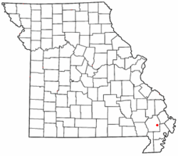
Location of Grayridge in Missouri
Country United States
State Missouri
County Stoddard
Area
[1]
  Total1.02 sq mi (2.64 km2)
  Land1.02 sq mi (2.64 km2)
  Water0.00 sq mi (0.00 km2)
Elevation
[2]
299 ft (91 m)
Population
 (2020)
  Total87
  Density85.46/sq mi (32.99/km2)
FIPS code 29-28864
GNIS feature ID2587076 [2]

Grayridge is a census-designated place in eastern Stoddard County, Missouri, United States. [2] It is located approximately ten miles southwest of Sikeston, just south of U.S. Route 60. [3]

A post office called Gray's Ridge was established in 1879, the name was changed to Gray Ridge in 1887, and the present name of Grayridge was adopted in 1894. [4] The community has the name of W. C. Gray, a pioneer citizen. [5]

Grayridge is home to Stoddard County Oilseed Crushing, which is developing biodiesel. [6]

As of 2011, Grayridge's population was 122. [7]

Demographics

Historical population
CensusPop.
2020 87
U.S. Decennial Census [8]

Related Research Articles

<span class="mw-page-title-main">Stoddard County, Missouri</span> County in Missouri, United States

Stoddard County is a county located in the southeastern portion of the U.S. state of Missouri. As of the 2020 census, the population was 28,672. The county seat is Bloomfield. The county was officially organized on January 2, 1835, and is named for Amos Stoddard, the first American commandant of Upper Louisiana.

<span class="mw-page-title-main">Pemiscot County, Missouri</span> County in Missouri, United States

Pemiscot County is a county located in the southeastern corner in the Bootheel in the U.S. state of Missouri, with the Mississippi River forming its eastern border. As of the 2020 census, the population was 15,661. The largest city and county seat is Caruthersville. The county was officially organized on February 19, 1851. It is named for the local bayou, taken from the word pem-eskaw, meaning "liquid mud", in the language of the native Fox (Meskwaki) people. This has been an area of cotton plantations and later other commodity crops.

<span class="mw-page-title-main">New Madrid County, Missouri</span> County in Missouri, United States

New Madrid County is a county located in the Bootheel of the U.S. state of Missouri. As of the 2020 census, the population was 16,434.The largest city and county seat is New Madrid, located on the northern side of the Kentucky Bend in the Mississippi River, where it has formed an oxbow around an exclave of Fulton County, Kentucky. This feature has also been known as New Madrid Bend or Madrid Bend, for the city.

<span class="mw-page-title-main">Dunklin County, Missouri</span> County in Missouri, United States

Dunklin County is located in the Bootheel of the U.S. state of Missouri. As of the 2020 census, the population was 28,283. The largest city and county seat is Kennett. The county was officially organized on February 14, 1845, and is named in honor of Daniel Dunklin, a Governor of Missouri who died the year before the county was organized.

<span class="mw-page-title-main">Advance, Missouri</span> City in Missouri, United States

Advance is a city located at the intersection of State Highway 25 and State Highway 91/Route C in northern Stoddard County, Missouri, United States. The population was 1,347 at the 2010 census. Advance was founded circa 1882. The town is pronounced ADD-vance.

<span class="mw-page-title-main">Dudley, Missouri</span> City in Missouri, United States

Dudley is a city in Stoddard County, Missouri, United States. The population was 232 at the 2010 census.

<span class="mw-page-title-main">Essex, Missouri</span> City in Missouri, United States

Essex is a city in Stoddard County, Missouri, United States. The population was 472 at the 2010 census.

<span class="mw-page-title-main">Idalia, Missouri</span>

Idalia is an unincorporated community in Stoddard County, Missouri, United States. It is located six miles northeast of Dexter.

McDowell is an unincorporated community in Barry County, in the U.S. state of Missouri.

Acorn Ridge or Acornridge is an unincorporated community in Stoddard County, in the U.S. state of Missouri. The community is on Missouri Route J, approximately seven miles west of Bloomfield.

Aquilla is an unincorporated community in Stoddard County, in the U.S. state of Missouri.

Avert is an unincorporated community in Stoddard County, in the U.S. state of Missouri.

Buffington is an unincorporated community in Stoddard County, in the U.S. state of Missouri.

Cane Ridge is a ridge in southeastern Stoddard County in the U.S. state of Missouri.

Durnell is an unincorporated community in Stoddard County, in the U.S. state of Missouri.

Frisco is an unincorporated community in Stoddard County, in the U.S. state of Missouri.

LaValle is an unincorporated community in Stoddard County, in the U.S. state of Missouri.

Marco is an unincorporated community in Stoddard County, in the U.S. state of Missouri.

Toga is an unincorporated community located on Crowleys Ridge in northern Stoddard County, in the U.S. state of Missouri. The community lies two miles northeast of Advance on Missouri Route 25. The Stoddard-Bollinger-Cape Girardeau county line junction is approximately one mile northeast of the location.

Zadock is an unincorporated community in northern Stoddard County, in the U.S. state of Missouri. The community lies north of the Castor River, approximately seven miles north of Bloomfield, in the Township of Pike. It is elevated at 427 feet and is located in the Central Time Zone.

References

  1. "ArcGIS REST Services Directory". United States Census Bureau. Retrieved September 5, 2022.
  2. 1 2 3 U.S. Geological Survey Geographic Names Information System: Grayridge, Missouri
  3. Missouri Hometown Locator http://missouri.hometownlocator.com/mo/stoddard/grayridge.cfm
  4. "Post Offices". Jim Forte Postal History. Retrieved 26 December 2016.
  5. "Stoddard County Place Names, 1928–1945". The State Historical Society of Missouri. Archived from the original on June 24, 2016. Retrieved December 26, 2016.
  6. Standard Democrat http://www.standard-democrat.com/story/1678861.html
  7. "Page Not Found". www.bestplaces.net.{{cite web}}: Cite uses generic title (help)
  8. "Census of Population and Housing". Census.gov. Retrieved June 4, 2016.

Coordinates: 36°49′27″N89°46′51″W / 36.82417°N 89.78083°W / 36.82417; -89.78083