
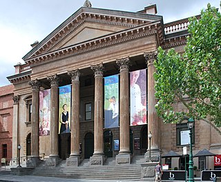
Bendigo is a city in Victoria, Australia, located in the Bendigo Valley near the geographical centre of the state and approximately 150 kilometres (93 mi) north-west of Melbourne, the state capital.
Victoria is the smallest mainland state in Australia. As of 2008 it contained 2,850 separate protected areas with a total land area of 39,273 km2 (15,163 sq mi). Of these, 45 were national parks, totalling 28,023 km2 (10,820 sq mi).

The Chiltern-Mt Pilot National Park is a national park that is located in the Hume region of Victoria, Australia. The 21,650-hectare (53,500-acre) national park is situated approximately 275 kilometres (171 mi) northeast of Melbourne, and extends west from Beechworth across the Hume Freeway and the Albury-Melbourne railway line to the west of Chiltern.

The Terrick Terrick National Park is a national park located in the region of Victoria, Australia. The 3,880-hectare (9,600-acre) national park was declared in June 1988 and is situated approximately 225 kilometres (140 mi) northwest of Melbourne, 4 kilometres (2.5 mi) north of the town of Mitiamo and 65 kilometres (40 mi) north of Bendigo. The national park is an important remnant of Box-Ironbark forests and northern grass plains and is close to Kow Swamp, the site of a major palaeontological find providing insight into the origins of Indigenous Australians. There are many walking tracks and one basic campground. Drinking water is not available in the park and must be carried.
North Central Victoria is a rural region in the Australian state of Victoria. The region lies to the south of the Victorian/New South Wales border as defined by the Murray River, to the southwest of the Hume region, to the west of the Great Dividing Range contained within the Central Highlands and Victorian Alps, to the north of Greater Melbourne, to the northeast of the Wimmera, and to the east of the Mallee region.

The Heathcote-Graytown National Park is a national park located in the North Central region of Victoria, Australia. The 12,833-hectare (31,710-acre) national park, which includes sections of the Great Dividing Range, adjoins a number of state forests, including the McIvor Ranges State Forest and is located just outside the town of Heathcote.

The South Western Slopes, also known as the South West Slopes, is a region predominantly in New South Wales, Australia. It covers the lower inland slopes of the Great Dividing Range, extending from north of Dunedoo through central NSW and into northeast Victoria, meeting its southwestern end around Beechworth. More than 90% of the region is in the state of New South Wales and it occupies about 10% of that state.

The yellow-plumed honeyeater is a species of bird in the family Meliphagidae. It is endemic to Australia, where it inhabits temperate forests and Mediterranean-type shrubby vegetation.
Warby Range State Park was a Victorian state park just north of Glenrowan. In 2010 the park became part of the newly declared Warby-Ovens National Park. It is 11,460 hectares in area, and named after Ben Warby, a pastoralist who settled in the area in 1844. There are two basic campgrounds, and many other sites for true bush camping.
Bendigo is a city in Victoria, Australia.
Reef Hills State Park is a protected area of 2013 hectares, about 5 km south-west of Benalla, in the north east of Victoria, Australia. There are traces of a mining activity from the gold rush. It was established in 1986.
The Warby-Ovens National Park is a national park located on the lands of the Bangerang clan of the Yorta Yorta Nation in the Hume region of Victoria, Australia near Killawara. The 14,655-hectare (36,210-acre) national park is situated approximately 10 kilometres (6.2 mi) west of Wangaratta and 240 kilometres (150 mi) northeast of Melbourne.

The Werakata National Park is a protected national park that is located in the Lower Hunter Region of New South Wales, in eastern Australia. The 3,337-hectare (8,250-acre) national park is located to the north, east and south of the town of Cessnock.

The Kara Kara National Park is a national park located in the Wimmera/Goldfields region of Victoria, Australia. The 13,990-hectare (34,600-acre) national park is situated approximately 190 kilometres (120 mi) north-west of Melbourne, west of the Sunraysia Highway, and to the south of the town of St Arnaud.

The Maryborough-Dunolly Box-Ironbark Region includes all the box-ironbark forest and woodland remnants used as winter feeding habitat by swift parrots in the Maryborough-Dunolly region of central Victoria, south-eastern Australia. The 900 km2 region was identified by BirdLife International as an Important Bird Area (IBA) and includes several nature reserves, state parks and state forests, with only a few small blocks of private land. It excludes adjacent areas of woodland that are less suitable for the parrots.
Box–ironbark forest is a forest or woodland ecosystem that is largely limited to central Victoria in south-eastern Australia. Because its component tree species produce abundant nectar and pollen throughout the year, it is important for the conservation of many species of birds and other animals.
The St Arnaud Box-Ironbark Region is a 481 km2 fragmented and irregularly shaped tract of land that encompasses all the box-ironbark forest and woodland remnants used as winter feeding habitat by swift parrots in the St Arnaud-Stawell region of central Victoria, south-eastern Australia.
The Bendigo Box-Ironbark Region is a 505 km2 fragmented and irregularly shaped tract of land that encompasses all the box-ironbark forest and woodland remnants used as winter feeding habitat by swift parrots in the Bendigo-Maldon region of central Victoria, south-eastern Australia.
The Warby–Chiltern Box–Ironbark Region comprises a cluster of separate blocks of remnant box-ironbark forest habitat, with a collective area of 253 km2, in north eastern Victoria, south-eastern Australia.

The Hume is an economic rural region located in the north-eastern part of Victoria, Australia. Comprising an area in excess of 40,000 square kilometres (15,000 sq mi) with a population that ranges from 263,000 to 300,000, the Hume region includes the local government areas of Alpine Shire, Rural City of Benalla, City of Wodonga, City of Greater Shepparton, Shire of Indigo, Shire of Mansfield, Shire of Strathbogie, Shire of Towong and the Rural City of Wangaratta, and also includes five unincorporated areas encompassing the alpine ski resorts in the region.


