Greenbrier, Tennessee

Last updated

Greenbrier, Tennessee
Greenbrier-water-tower-tn1.jpg
Water tower in Greenbrier
Robertson County Tennessee Incorporated and Unincorporated areas Greenbrier Highlighted 4730960.svg
Location of Greenbrier in Robertson County, Tennessee.
Coordinates: 36°25′39″N86°48′17″W / 36.4275477°N 86.8047199°W / 36.4275477; -86.8047199
Country United States
State Tennessee
County Robertson
Government
   Mayor Bonnette Dawson [1]
Area
[2]
  Total7.30 sq mi (18.90 km2)
  Land7.26 sq mi (18.80 km2)
  Water0.04 sq mi (0.10 km2)
Elevation
[3]
850 ft (260 m)
Population
 (2020) [4]
  Total6,898
  Density950.01/sq mi (366.82/km2)
Time zone UTC-6 (Central (CST))
  Summer (DST) UTC-5 (CDT)
ZIP code
37073
Area code 615
FIPS code 47-30960 [5]
GNIS feature ID1286141 [3]
Website greenbriertn.org

Greenbrier is a city in Robertson County, Tennessee, United States. The population was 6,433 at the 2010 census, and at the 2020 census the population was 6,898.

Contents

Geography

According to the United States Census Bureau, the city has a total area of 6.6 square miles (17.2 km2), of which 6.6 square miles is land and 0.04 square mile (0.45%) is water. The city is concentrated along a stretch of U.S. Route 41, southeast of Springfield and northwest of Goodlettsville. Greenbrier lies about 23 miles (37 km) north of Nashville. [6]

Demographics

Historical population
CensusPop.Note
1910 522
1920 518−0.8%
1930 63121.8%
1940 79526.0%
1950 89011.9%
1960 1,23839.1%
1970 2,27984.1%
1980 3,18039.5%
1990 2,873−9.7%
2000 4,94071.9%
2010 6,43330.2%
2020 6,8987.2%
Sources: [7] [8] [4]

2020 census

Greenbrier racial composition [9]
RaceNumberPercentage
White (non-Hispanic)5,99686.92%
Black or African American (non-Hispanic)1962.84%
Native American 150.22%
Asian 921.33%
Pacific Islander 10.01%
Other/Mixed 2984.32%
Hispanic or Latino 3004.35%

As of the 2020 United States census, there were 6,898 people, 2,393 households, and 1,807 families residing in the town.

2000 census

As of the census [5] of 2000, there were 4,490 people, 1,837 households, and 1,418 families residing in the city. The population density was 748.3 inhabitants per square mile (288.9/km2). There were 1,920 housing units at an average density of 290.9 per square mile (112.3/km2). The racial makeup of the city was 97.43% White, 0.67% African American, 0.22% Native American, 0.38% Asian, 0.49% from other races, and 0.81% from two or more races. Hispanic or Latino of any race were 1.28% of the population.

Of the 1,837 households, 41.5% had children under the age of 18 living with them, 60.7% were married couples living together, 13.0% had a female householder with no husband present, and 22.8% were non-families. 18.9% of all households were made up of individuals, and 6.8% had someone living alone who was 65 years of age or older. The average household size was 2.69 and the average family size was 3.06.

In the city, the population was spread out, with 28.6% under the age of 18, 9.6% from 18 to 24, 33.8% from 25 to 44, 18.7% from 45 to 64, and 9.3% who were 65 years of age or older. The median age was 32 years. For every 100 females, there were 94.7 males. For every 100 females age 18 and over, there were 89.0 males.

The median income for a household in the city was $32,568, and the median income for a family was $48,262. Males had a median income of $34,353 versus $23,523 for females. The per capita income for the city was $17,902. About 2.8% of families and 5.3% of the population were below the poverty line, including 5.4% of those under age 18 and 5.3% of those age 65 or over.

Annual events

Greenbrier is known for its annual Turning of the Pig celebration on July 3. It is a large barbecue festival benefiting the high school band program. This community-wide event provides food, carnival games, live entertainment, local artisans, and family fun. Hundreds of pounds of pork are cooked on open pits during the festival, and the pulled pork is available for sale beginning on the morning of July 4. [10]

Parks

Louise Martin Memorial Park has an approximately 6/10th of a mile walking/running loop that is paved and another approximately half mile of walking/running trails. Additionally, the park has three baseball fields and a small play area for children. There are several picnic areas and a large open field available for various activities. [11]

Education

Greenbrier High School

Greenbrier Middle School

Greenbrier Elementary School

Watauga Elementary School (nearby Ridgetop)

Dayspring Academy

______________________________________________________

Greenbrier High, Middle, and Elementary Schools' mascot is the Bobcat, and their colors are green and white. Watauga Elementary School's mascot is the Warrior, depicted as a Native American male, and the school colors are red and gray. Dayspring Academy’s mascot is the Shire, and the school colors are blue and gold.

Related Research Articles

<span class="mw-page-title-main">Summers County, West Virginia</span> County in West Virginia, United States

Summers County is a county located in the U.S. state of West Virginia. As of the 2020 census, the population was 11,959. Its county seat is Hinton. The county was created by an act of the West Virginia Legislature on February 27, 1871, from parts of Fayette, Greenbrier, Mercer and Monroe counties and named in honor of George W. Summers (1804–68).

<span class="mw-page-title-main">Sylvania, Alabama</span> Town in Alabama, United States

Sylvania is a town in DeKalb County, Alabama, United States. It incorporated in October 1967. At the 2010 census the population was 1,837, up from 1,186 in 2000. Sylvania is located atop Sand Mountain. Sylvania was incorporated in 1967. The post office /town hall was built in 1977.

<span class="mw-page-title-main">Quitman, Arkansas</span> City in Arkansas, United States

Quitman is a city in Cleburne and Faulkner counties in the U.S. state of Arkansas. Its population was 762 at the 2010 census. The portion of the city in Faulkner County is part of the Central Arkansas region.

<span class="mw-page-title-main">Greenbrier, Arkansas</span> City in Arkansas, United States

Greenbrier is a city in Faulkner County, Arkansas, United States. It is part of the Central Arkansas region. The population was 5,707 at the 2020 census, up from 4,706 at the 2010 census.

<span class="mw-page-title-main">Waldron, Arkansas</span> City in Arkansas, United States

Waldron is a city in Scott County, Arkansas, United States. Its population was 3,386 at the 2020 census. The city is the county seat of Scott County.

<span class="mw-page-title-main">Rigby, Idaho</span> City in Idaho, United States

Rigby is a city in and the county seat of Jefferson County, Idaho, United States. The population was 5,038 at the 2020 census, up from 3,945 in 2010.

<span class="mw-page-title-main">Hampshire, Illinois</span> Village in Illinois, United States

Hampshire is a village in Kane County, Illinois, United States. As of the 2020 census it had a population of 7,667.

<span class="mw-page-title-main">Wayland, Iowa</span> Village in Iowa, United States

Wayland is a village in Jefferson Township, Henry County, Iowa, United States. The population was 964 at the time of the 2020 census.

<span class="mw-page-title-main">State Center, Iowa</span> City in Iowa, United States

State Center is a city in Marshall County, Iowa, United States. The population was 1,391 at the time of the 2020 census. State Center is known as the Rose Capital of Iowa.

<span class="mw-page-title-main">Andover, Kansas</span> City in Butler County, Kansas

Andover is a city in Butler County, Kansas, United States, and a suburb of Wichita. As of the 2020 census, the population of the city was 14,892. Andover is the most populated city in Butler County.

<span class="mw-page-title-main">West Mineral, Kansas</span> City in Cherokee County, Kansas

West Mineral is a city in Cherokee County, Kansas, United States. As of the 2020 census, the population of the city was 154. It is the home of Big Brutus, the second largest electric shovel in the world.

<span class="mw-page-title-main">Pomona, Kansas</span> City in Franklin County, Kansas

Pomona is a city in Franklin County, Kansas, United States. As of the 2020 census, the population of the city was 884.

<span class="mw-page-title-main">Almena, Kansas</span> City in Norton County, Kansas, United States

Almena is a city in Norton County, Kansas, United States. As of the 2020 census, the population of the city was 363.

<span class="mw-page-title-main">Monticello, Louisiana</span> Census-designated place in Louisiana, United States

Monticello is a census-designated place (CDP) in East Baton Rouge Parish, Louisiana, United States. The population was 5,172 at the 2010 census, up from 4,763 in 2000. It is part of the Baton Rouge Metropolitan Statistical Area.

<span class="mw-page-title-main">Glen, Mississippi</span> Town in Mississippi, United States

Glen is a town in Alcorn County, Mississippi. The population was 382 at the 2020 census, down from 412 at the 2010 census.

<span class="mw-page-title-main">Chaparral, New Mexico</span> Census-designated place in New Mexico, United States

Chaparral is an unincorporated community and census-designated place (CDP) in Doña Ana and Otero counties, New Mexico. The population was 14,631 at the 2010 census. Chaparral is primarily a bedroom community for the neighboring city of El Paso, Texas, and the neighboring military installations of White Sands Missile Range and Fort Bliss. It is officially part of the Las Cruces Metropolitan Statistical Area.
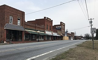
<span class="mw-page-title-main">Stokesdale, North Carolina</span> Town in North Carolina, United States

Stokesdale is a town in Guilford County, North Carolina, United States with small parts in the counties of Rockingham, Forsyth, and Stokes. The population was 5,924 at the 2020 census. Belews Lake is located nearby, and North Carolina Highway 68 and North Carolina Highway 65 both intersect U.S. Route 158 near the town's center.
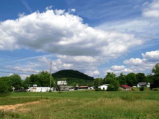
<span class="mw-page-title-main">Hunter, Tennessee</span> CDP in Tennessee, United States

Hunter is a census-designated place (CDP) and unincorporated community located northeast of Elizabethton in Carter County, Tennessee, along Tennessee State Route 91 and the Watauga River. Its population was 1,854 as of the 2010 census. It is part of the Johnson City Metropolitan Statistical Area, which is a component of the Johnson City-Kingsport-Bristol, TN-VA Combined Statistical Area – commonly known as the "Tri-Cities" region. Hunter is a suburb of Elizabethton.
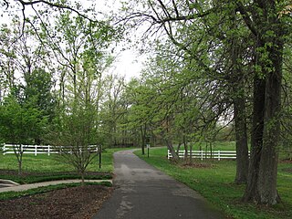
<span class="mw-page-title-main">White House, Tennessee</span> City in Tennessee, United States

White House is a city in Robertson and Sumner counties in the United States state of Tennessee. The population was listed as 12,982 in the 2020 census. It is approximately twenty-two miles north of downtown Nashville.

<span class="mw-page-title-main">Locust Grove, Georgia</span> City in the United States

Locust Grove is a city in Henry County, Georgia, United States. The population was 5,402 at the 2010 census, up from 2,322 in 2000. Some unincorporated communities such as Luella and many rural areas surround Locust Grove, and those communities have Locust Grove postal addresses.

References

  1. "Greenbrier, TN". greenbriertn.org. Archived from the original on December 29, 2017. Retrieved January 7, 2020.
  2. "ArcGIS REST Services Directory". United States Census Bureau. Retrieved October 15, 2022.
  3. 1 2 U.S. Geological Survey Geographic Names Information System: Greenbrier, Tennessee
  4. 1 2 "Census Population API". United States Census Bureau. Retrieved October 15, 2022.
  5. 1 2 "U.S. Census website". United States Census Bureau . Retrieved January 31, 2008.
  6. Greenbrier official site. Accessed: October 27, 2016.
  7. "Census of Population and Housing: Decennial Censuses". United States Census Bureau . Retrieved March 4, 2012.
  8. "Incorporated Places and Minor Civil Divisions Datasets: Subcounty Resident Population Estimates: April 1, 2010 to July 1, 2012". Population Estimates. U.S. Census Bureau. Archived from the original on June 11, 2013. Retrieved December 11, 2013.
  9. "Explore Census Data". data.census.gov. Retrieved December 26, 2021.
  10. Nicole Young, "Turning of the Pig This Friday in Greenbrier," The Tennessean, July 1, 2015.
  11. Louise Martin Memorial Park, Greenbrier official site. Accessed: October 27, 2016.