Greenfield, Oklahoma

Last updated

Greenfield, Oklahoma
OKMap-doton-Greenfield.PNG
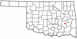
Location of Greenfield, Oklahoma
Coordinates: 35°43′45″N98°22′39″W / 35.72917°N 98.37750°W / 35.72917; -98.37750
Country United States
State Oklahoma
County Blaine
Area
[1]
  Total0.14 sq mi (0.37 km2)
  Land0.14 sq mi (0.37 km2)
  Water0.00 sq mi (0.00 km2)
Elevation
[2]
1,457 ft (444 m)
Population
 (2020)
  Total114
  Density802.82/sq mi (309.90/km2)
Time zone UTC-6 (Central (CST))
  Summer (DST) UTC-5 (CDT)
ZIP code
73043
Area code 580
FIPS code 40-31250 [3]
GNIS feature ID2412709 [2]

Greenfield is a town in Blaine County, Oklahoma, United States. The population was 93 at the 2010 census. [4]

Contents

History

The 80 original acres of Greenfield began as the homestead in 1899 of one George Evans. [5] Somewhere in the 1900-1902 timeframe, the Choctaw Northern Railroad built through the area, its line running from Geary, Oklahoma to its termination at Anthony, Kansas. [6] [7] The railroad bought the farm from then-owners T.G. Curtner and J.M. Gray, proceeding to plat the town and sell lots. [5] By 1913, the town had about 300 inhabitants, a newspaper (The Greenfield Hustler), a bank, a lumberyard, two livery barns, two grain elevators, a grist mill, a hotel, an opera house, and various merchants and contractors. [5]

Greenfield still has freight rail service through the AT&L Railroad. [8] [9]

Geography

Greenfield is located in southern Blaine County along U.S. Routes 270 and 281, halfway between Watonga, the county seat, and Geary.

According to the United States Census Bureau, the town has a total area of 0.1 square miles (0.26 km2), all land.

Demographics

Historical population
CensusPop.Note
1940 303
1950 191−37.0%
1960 128−33.0%
1970 14311.7%
1980 23362.9%
1990 200−14.2%
2000 123−38.5%
2010 93−24.4%
2020 11422.6%
U.S. Decennial Census [10]

As of the census [3] of 2000, there were 123 people, 55 households, and 37 families residing in the town. The population density was 919.7 inhabitants per square mile (355.1/km2). There were 62 housing units at an average density of 463.6 per square mile (179.0/km2). The racial makeup of the town was 88.62% White, 1.63% African American and 9.76% Native American.

There were 55 households, out of which 23.6% had children under the age of 18 living with them, 47.3% were married couples living together, 14.5% had a female householder with no husband present, and 32.7% were non-families. 32.7% of all households were made up of individuals, and 14.5% had someone living alone who was 65 years of age or older. The average household size was 2.24 and the average family size was 2.78.

In the town, the population was spread out, with 19.5% under the age of 18, 8.9% from 18 to 24, 22.8% from 25 to 44, 35.0% from 45 to 64, and 13.8% who were 65 years of age or older. The median age was 44 years. For every 100 females, there were 98.4 males. For every 100 females age 18 and over, there were 98.0 males.

The median income for a household in the town was $20,694, and the median income for a family was $21,607. Males had a median income of $26,250 versus $20,000 for females. The per capita income for the town was $13,097. There were 20.0% of families and 17.6% of the population living below the poverty line, including 37.5% of under eighteens and 11.1% of those over 64.

Related Research Articles

<span class="mw-page-title-main">LeFlore County, Oklahoma</span> County in Oklahoma, United States

LeFlore County is a county along the eastern border of the U.S state of Oklahoma. As of the 2020 census, the population was 48,129. Its county seat is Poteau. The county is part of the Fort Smith metropolitan area and the name honors a Choctaw family named LeFlore. The United States District Court for the Eastern District of Oklahoma is the federal district court with jurisdiction in LeFlore County.

<span class="mw-page-title-main">Johnston County, Oklahoma</span> County in Oklahoma, United States

Johnston County is a county located in the U.S. state of Oklahoma. As of the 2020 census, the population was 10,272. Its county seat is Tishomingo. It was established at statehood on November 16, 1907, and named for Douglas H. Johnston, a governor of the Chickasaw Nation.
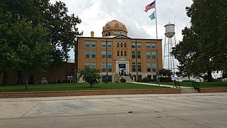
<span class="mw-page-title-main">Blaine County, Oklahoma</span> County in Oklahoma, United States

Blaine County is a county located in the U.S. state of Oklahoma. As of the 2020 census, the population was 8,735. Its county seat is Watonga. Part of the Cheyenne-Arapaho land opening in 1892, the county had gained rail lines by the early 1900s and highways by the 1930s. The county was named for James G. Blaine, an American politician who was the Republican presidential candidate in 1884 and Secretary of State under President Benjamin Harrison.

<span class="mw-page-title-main">Anthony, Kansas</span> City in Harper County, Kansas

Anthony is a city in and the county seat of Harper County, Kansas, United States. As of the 2020 census, the population of the city was 2,108.

<span class="mw-page-title-main">Bennington, Oklahoma</span> Incorporated Town in Oklahoma, United States

Bennington is an incorporated town in Bryan County, Oklahoma, United States. The population was 334 at the 2010 census.

<span class="mw-page-title-main">Kenefic, Oklahoma</span> Town in Oklahoma, United States

Kenefic is a town in Bryan County, Oklahoma, United States. The population was 196 at the 2010 census, a 2 percent increase from the total of 192 recorded in 2000. The town was named for William Kenefick, president of the Missouri, Oklahoma and Gulf Railroad (MO&G), which had constructed a rail line through the region. The town name has been spelled both Kenefic and Kenefick throughout its history.
<span class="mw-page-title-main">Bridgeport, Oklahoma</span> Town in Oklahoma, United States

Bridgeport is a town in Caddo County, Oklahoma, United States. The population was 116 at the 2010 census.

<span class="mw-page-title-main">Boswell, Oklahoma</span> Town in Oklahoma, United States

Boswell is a town in Choctaw County, Oklahoma, United States. The population was 709 at the 2010 census.

Kinta is a town in Haskell County, Oklahoma, United States. The population was 297 at the 2010 census, an increase of 22.2 percent over the figure of 243 recorded in 2000.

McCurtain is a town in Haskell County, Oklahoma, United States. The population was 357 at the 2020 census, a 30.8% decrease over the figure of 516 recorded in 2010. A coal mine disaster in 1912 killed 73 miners and ended McCurtain's prosperity. The mine explosion remains one of the worst disasters in Oklahoma history.
<span class="mw-page-title-main">Calvin, Oklahoma</span> Town in Oklahoma, United States

Calvin is a town in Hughes County, Oklahoma, United States. The population was 294 at the 2010 census.
<span class="mw-page-title-main">Wilburton, Oklahoma</span> City in Oklahoma, United States

Wilburton is a city in Latimer County, Oklahoma, United States. It is the county seat of Latimer County. The city had a population of 2,285 as of the 2020 Census. Robbers Cave State Park is 5 miles (8.0 km) north of Wilburton.

<span class="mw-page-title-main">Talihina, Oklahoma</span> Town in Oklahoma, United States

Talihina is a town in LeFlore County, Oklahoma, United States, its name originating from two Choctaw words, tully and hena, meaning "iron road," a reference to the railroad around which the town was built. It is part of the Fort Smith, Arkansas–Oklahoma Metropolitan Statistical Area. The population was 925 at the time of the 2020 Census.

<span class="mw-page-title-main">Wister, Oklahoma</span> Town in Oklahoma, United States

Wister is a town in Le Flore County, Oklahoma, United States. It is part of the Fort Smith metropolitan area. The population was 1,102 at the 2010 census. Wister is named for Gutman G. Wister, an official with the Choctaw, Oklahoma and Gulf Railroad.

<span class="mw-page-title-main">Valliant, Oklahoma</span> Town in Oklahoma, United States

Valliant is a town in McCurtain County, Oklahoma, United States. The population was 754 at the 2010 census.
<span class="mw-page-title-main">Alderson, Oklahoma</span> Town in Oklahoma, United States

Alderson is a town in Pittsburg County, Oklahoma, United States. The population was 304 at the 2010 census.

<span class="mw-page-title-main">Haileyville, Oklahoma</span> City in Oklahoma, United States

Haileyville is a city in Pittsburg County, Oklahoma, United States. The population was 716 at the time of the 2020 United States census.

<span class="mw-page-title-main">Geary, Oklahoma</span> City in Oklahoma, United States

Geary is a city in Blaine and Canadian counties in the U.S. state of Oklahoma. The population was 994 at the 2020 census. The town was named for Edmund Guerrier, a scout and an interpreter for the U.S. Army.

<span class="mw-page-title-main">Hydro, Oklahoma</span> Town in Oklahoma, United States

Hydro is a town in Caddo and Blaine counties in the U.S. state of Oklahoma. The population was 927 as of the 2020 United States census.

<span class="mw-page-title-main">Fanshawe, Oklahoma</span> Town in Oklahoma, United States

Fanshawe is a town in Latimer and Le Flore counties in the U.S. state of Oklahoma. As of the 2020 Census, the town had a total population of 317. The Le Flore County portion of Fanshawe is part of the Fort Smith, Arkansas-Oklahoma Metropolitan Statistical Area.

References

  1. "ArcGIS REST Services Directory". United States Census Bureau. Retrieved September 20, 2022.
  2. 1 2 U.S. Geological Survey Geographic Names Information System: Greenfield, Oklahoma
  3. 1 2 "U.S. Census website". United States Census Bureau . Retrieved January 31, 2008.
  4. "Geographic Identifiers: 2010 Demographic Profile Data (G001): Greenfield town, Oklahoma". U.S. Census Bureau, American Factfinder. Archived from the original on February 12, 2020. Retrieved February 24, 2014.
  5. 1 2 3 "A Town that Enjoys the Well Wishes of Everybody in the County and State—Visit It". The Greenfield Hustler, Vol 1, Number 14, June 5, 1913 (accessed The Gateway to Oklahoma History). Retrieved March 11, 2023.
  6. "Choctaw Northern Railroad Company". Railroads of Oklahoma, June 6, 1870-April 1, 1978 (accessed on Oklahoma Digital Prairie), pp. 42-44. Retrieved March 11, 2023.
  7. "Anthony, Kansas: The Town Forgotten By The Railroads". Forgotten Railways, Roads & Places, September 7, 2018. Retrieved March 11, 2023.
  8. "Race The Rail 2016". Race the Rail LLC (accessed on the Internet Archive Wayback Machine). Retrieved March 12, 2023.
  9. "Oklahoma 2018-2020 State Railroad Map" (PDF). Oklahoma Department of Transportation. Retrieved March 12, 2023.
  10. "Census of Population and Housing". Census.gov. Retrieved June 4, 2015.