Greenleaf, Idaho

Last updated
Greenleaf, Idaho
Greenleaf City Hall.jpg
Greenleaf City Hall, June 2011
Canyon County Idaho Incorporated and Unincorporated areas Greenleaf Highlighted 1633490.svg
Location of Greenleaf in Canyon County, Idaho.
Coordinates: 43°40′16″N116°48′59″W / 43.67111°N 116.81639°W / 43.67111; -116.81639 Coordinates: 43°40′16″N116°48′59″W / 43.67111°N 116.81639°W / 43.67111; -116.81639
Country United States
State Idaho
County Canyon
Area
[1]
  Total0.77 sq mi (2.00 km2)
  Land0.77 sq mi (1.99 km2)
  Water0.00 sq mi (0.00 km2)
Elevation
2,411 ft (735 m)
Population
 (2010) [2]
  Total846
  Estimate 
(2019) [3]
886
  Density1,150.65/sq mi (444.12/km2)
Time zone UTC-7 (Mountain (MST))
  Summer (DST) UTC-6 (MDT)
ZIP code
83626
Area code 208
FIPS code 16-33490
GNIS feature ID0396590
Website www.greenleaf-idaho.us

Greenleaf is a city in Canyon County, Idaho, United States. The population was 846 at the 2010 census. Greenleaf is part of the Boise-Nampa metropolitan area. The town was established by Quakers in the early-1900s and is named after Quaker poet and abolitionist John Greenleaf Whittier. [4] [5]

Contents

Geography

Greenleaf is located at 43°40′16″N116°48′59″W / 43.67111°N 116.81639°W / 43.67111; -116.81639 (43.671142, -116.816480). [6]

According to the United States Census Bureau, the city has a total area of 0.73 square miles (1.89 km2), all of it land. [7]

Demographics

Historical population
CensusPop.
1980 663
1990 648−2.3%
2000 86233.0%
2010 846−1.9%
2019 (est.)886 [3] 4.7%
U.S. Decennial Census [8]

2010 census

As of the census [2] of 2010, there were 846 people, 299 households, and 226 families residing in the city. The population density was 1,158.9 inhabitants per square mile (447.5/km2). There were 316 housing units at an average density of 432.9 per square mile (167.1/km2). The racial makeup of the city was 87.1% White, 0.4% African American, 0.5% Native American, 0.4% Asian, 9.6% from other races, and 2.1% from two or more races. Hispanic or Latino of any race were 19.4% of the population.

There were 299 households, of which 37.8% had children under the age of 18 living with them, 61.2% were married couples living together, 10.7% had a female householder with no husband present, 3.7% had a male householder with no wife present, and 24.4% were non-families. 19.7% of all households were made up of individuals, and 8.1% had someone living alone who was 65 years of age or older. The average household size was 2.83 and the average family size was 3.26.

The median age in the city was 39.6 years. 28.4% of residents were under the age of 18; 8.2% were between the ages of 18 and 24; 20.5% were from 25 to 44; 30.7% were from 45 to 64; and 12.2% were 65 years of age or older. The gender makeup of the city was 46.9% male and 53.1% female.

2000 census

As of the census [9] of 2000, there were 862 people, 277 households, and 219 families residing in the city. The population density was 1,190.1 inhabitants per square mile (459.5/km2). There were 284 housing units at an average density of 392.1 per square mile (151.4/km2). The racial makeup of the city was 74.59% White, 0.46% African American, 0.81% Native American, 0.81% Asian, 0.23% Pacific Islander, 22.39% from other races, and 0.70% from two or more races. Hispanic or Latino of any race were 23.32% of the population.

There were 277 households, out of which 46.9% had children under the age of 18 living with them, 63.9% were married couples living together, 10.8% had a female householder with no husband present, and 20.6% were non-families. 19.1% of all households were made up of individuals, and 10.5% had someone living alone who was 65 years of age or older. The average household size was 3.11 and the average family size was 3.57.

In the city, the population was spread out, with 35.7% under the age of 18, 7.9% from 18 to 24, 27.5% from 25 to 44, 20.8% from 45 to 64, and 8.1% who were 65 years of age or older. The median age was 31 years. For every 100 females, there were 94.1 males. For every 100 females age 18 and over, there were 85.9 males.

The median income for a household in the city was $37,375, and the median income for a family was $45,313. Males had a median income of $26,538 versus $22,115 for females. The per capita income for the city was $15,406. About 9.3% of families and 13.3% of the population were below the poverty line, including 17.8% of those under age 18 and 14.0% of those age 65 or over.

See also

Related Research Articles

<span class="mw-page-title-main">Canyon County, Idaho</span> County in Idaho, United States

Canyon County is located in the U.S. state of Idaho. As of the 2020 Census, the population was 231,105, making it the second-most populous county in Idaho. The county seat is Caldwell, and its largest city is Nampa. Canyon County is part of the Boise metropolitan area.

<span class="mw-page-title-main">Garden City, Idaho</span> City in Idaho, United States

Garden City is a city in Ada County, Idaho. The population was 10,972 at the time of the 2010 census. Garden City is nearly surrounded by Boise but retains a separate municipal government.

<span class="mw-page-title-main">Star, Idaho</span> City in Idaho, United States

Star is a city in northwestern Ada County, Idaho, with parts stretching into neighboring Canyon County. The population was 5,793 at the 2010 census, up from 1,795 in 2000. It was named in the 19th century by travelers on their way to Middleton and Boise who used the star on the school house to find east and west. The name stuck and it became Star, Idaho. Today, it is a rapidly growing suburb of Boise and its schools are shared with Middleton School District and West Ada School District.

<span class="mw-page-title-main">Dover, Idaho</span> City in Idaho, United States

Dover is a city in Bonner County, Idaho. The population was 556 at the 2010 census.

<span class="mw-page-title-main">East Hope, Idaho</span> City in Idaho, United States

East Hope is a city in Bonner County, Idaho, United States. The population was 210 at the 2010 census.

<span class="mw-page-title-main">Hope, Idaho</span> City in Idaho, United States

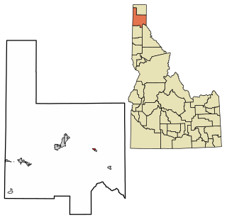
Hope is a city in Bonner County, Idaho, United States. The population was 86 at the 2010 census.

<span class="mw-page-title-main">Priest River, Idaho</span> City in Idaho, United States

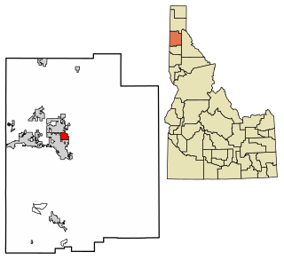
Priest River is a city in Bonner County, Idaho. The population was 1,751 at the 2010 census. Located in the Idaho Panhandle region of the state, the city is at the mouth of the Priest River on the Pend Oreille River.

<span class="mw-page-title-main">Melba, Idaho</span> City in Idaho, United States

Melba is a city in Canyon County, Idaho. The population was 513 at the time of the 2010 census, up from 439 in 2000. It is part of the Boise metropolitan area.

<span class="mw-page-title-main">Parma, Idaho</span> City in Idaho, United States

Parma is a city in Canyon County, Idaho, United States. The population was 1,983 at the 2010 census, up from 1,771 in 2000. It is the fourth largest city in the county and the largest in the rural western portion. It is part of the Boise City–Nampa, Idaho Metropolitan Statistical Area.

<span class="mw-page-title-main">Wilder, Idaho</span> City in Idaho, United States

Wilder is a city in Canyon County, Idaho, United States. The population was 1,533 at the 2010 census.

<span class="mw-page-title-main">Elk River, Idaho</span> City in Idaho, United States

Elk River is a city in the northwestern United States in Clearwater County, Idaho. The population was 125 at the 2010 census, down from 156 in 2000. It is accessed from State Highway 8 from Bovill, to the west in adjacent Latah County. Formerly the site of a Potlatch sawmill, it was phased out after several decades during the 1930s.

<span class="mw-page-title-main">White Bird, Idaho</span> Town in Idaho, United States

White Bird is a city in Idaho County, Idaho. The population was 91 at the time of the 2010 census, down from 106 in 2000.

<span class="mw-page-title-main">Dalton Gardens, Idaho</span> City in Idaho, United States

Dalton Gardens is a city in Kootenai County, Idaho. It is considered a suburb of Coeur d'Alene and borders the city to the north and east. The city of Dalton Gardens is also part of the larger Spokane-Coeur d'Alene Combined Metropolitan Statistical Area which encompasses Kootenai County, Idaho. The population of Dalton Gardens was 2,335 at the time of the 2010 census.

<span class="mw-page-title-main">Fernan Lake Village, Idaho</span> City in Idaho, United States

Fernan Lake Village is a city in Kootenai County, Idaho, United States. The population was 169 at the 2010 census.

<span class="mw-page-title-main">Worley, Idaho</span> City in Idaho, United States

Worley is a city in southwestern Kootenai County, Idaho, United States. The population was 257 at the 2010 census, up from 223 in 2000. The city is within the Coeur d'Alene Indian Reservation.

<span class="mw-page-title-main">Culdesac, Idaho</span> City in Idaho, United States

Culdesac is a city in Nez Perce County, Idaho, United States. The population was 380 at the 2010 census. It is part of the Lewiston, ID-WA Metropolitan Statistical Area.

<span class="mw-page-title-main">Grand View, Idaho</span> City in Idaho, United States

Grand View is a city in Owyhee County, Idaho, United States. The population was 452 at the 2010 census. It is part of the Boise City–Nampa, Idaho Metropolitan Statistical Area.

<span class="mw-page-title-main">Payette, Idaho</span> City in Idaho, United States

Payette is a city in and the county seat of Payette County, Idaho, United States. The population was 7,433 at the 2010 census. It is part of the Ontario, OR−ID Micropolitan Statistical Area.

<span class="mw-page-title-main">Osburn, Idaho</span> City in Idaho, United States

Osburn is a city in Shoshone County, Idaho, United States. Located in the Silver Valley mining region of northern Idaho, its population was 1,555 at the 2010 census.

<span class="mw-page-title-main">Prairie Rose, North Dakota</span> City in North Dakota, United States

Prairie Rose is a city in Cass County, North Dakota, United States. The population was 56 at the 2020 census. The city is an enclave suburb of Fargo. Prairie Rose was founded in 1975. There are 21 homes in the city.

References

  1. "2019 U.S. Gazetteer Files". United States Census Bureau. Retrieved July 9, 2020.
  2. 1 2 "U.S. Census website". United States Census Bureau . Retrieved 2012-12-18.
  3. 1 2 "Population and Housing Unit Estimates". United States Census Bureau. May 24, 2020. Retrieved May 27, 2020.
  4. "City of Greenleaf". City of Greenleaf. Retrieved February 4, 2017.
  5. "Idaho town founded by Quakers asks residents to own guns". USA Today . Associated Press. November 16, 2006.
  6. "US Gazetteer files: 2010, 2000, and 1990". United States Census Bureau. 2011-02-12. Retrieved 2011-04-23.
  7. "US Gazetteer files 2010". United States Census Bureau. Archived from the original on 2012-01-25. Retrieved 2012-12-18.
  8. "Census of Population and Housing". Census.gov. Retrieved June 4, 2015.
  9. "U.S. Census website". United States Census Bureau . Retrieved 2008-01-31.