
The Deschutes River in central Oregon is a major tributary of the Columbia River. The river provides much of the drainage on the eastern side of the Cascade Range in Oregon, gathering many of the tributaries that descend from the drier, eastern flank of the mountains. The Deschutes provided an important route to and from the Columbia for Native Americans for thousands of years, and then in the 19th century for pioneers on the Oregon Trail. The river flows mostly through rugged and arid country, and its valley provides a cultural heart for central Oregon. Today the river supplies water for irrigation and is popular in the summer for whitewater rafting and fishing.

The brown trout is a European species of salmonid fish that has been widely introduced into suitable environments globally. It includes purely freshwater populations, referred to as the riverine ecotype, Salmo trutta morpha fario, a lacustrine ecotype, S. trutta morpha lacustris, also called the lake trout, and anadromous forms known as the sea trout, S. trutta morpha trutta. The latter migrates to the oceans for much of its life and returns to fresh water only to spawn. Sea trout in Ireland and Great Britain have many regional names: sewin in Wales, finnock in Scotland, peal in the West Country, mort in North West England, and white trout in Ireland.

Bridge of Weir is a village within the Renfrewshire council area and wider historic county of Renfrewshire in the west central Lowlands of Scotland.

Loch Thom is a reservoir which since 1827 has provided a water supply to the town of Greenock in Inverclyde, Scotland. It is named after the civil engineer Robert Thom who designed the scheme which created the reservoir and delivered water via a long aqueduct known as The Cut. Today, as well as providing a water supply, the loch is used for sport fishing and forms part of the Clyde Muirshiel Regional Park with several attractive walks and a centre at Cornalees Bridge providing nature study facilities.
Llyn Alaw is a man-made reservoir on Anglesey, North Wales managed by Dŵr Cymru Welsh Water. It is a shallow lake and was built in 1966. It is a Site of Special Scientific Interest and a destination for over-wintering birds.

Loch Tummel is a long, narrow loch, seven kilometres northwest of Pitlochry in the council area of Perth and Kinross, Scotland. It is fed and drained by the River Tummel, which flows into the River Tay about 13 km (8 mi) south-east of the Clunie Dam at the loch's eastern end.

West Water Reservoir is an artificial reservoir in the Pentland Hills, Scottish Borders, 3 kilometres (1.9 mi) west of West Linton, and 26 kilometres (16 mi) south west of Edinburgh. It is a drinking water reservoir for Edinburgh and the Lothians and is located 320 metres (1,050 ft) above sea level. It is an important site for wildfowl and is designated as a SSSI and a Ramsar site.

Pressmennan Lake is a lake in East Lothian in Scotland.

The Carron is a river in central Scotland, rising in the Campsie Fells and flowing along Strathcarron into the Firth of Forth. It has given its name to several locations in Stirlingshire, as well as a type of cannon, a line of bathtubs, two warships, and an island in the Southern Hemisphere.
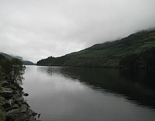
Loch Eck is a freshwater loch located on the Cowal peninsula, north of Dunoon, Argyll and Bute, Scotland. It is seven miles long. Along with Loch Lomond, it is the only naturally occurring habitat of the Powan (fish). The loch also has salmon, sea trout, brown trout and arctic charr.

The Levern Water, is a small river in East Renfrewshire and Glasgow, Scotland. It rises in the Long Loch, and flows generally north and east, past the towns of Neilston and Barrhead, for a total distance of 9 miles (14 km). It empties into the White Cart River.

Dunalastair Water is an entirely man made reservoir in Scotland which lies between Loch Rannoch and Loch Tummel in Strath Tummel in Perth and Kinross council area. The loch provides water power for the Tummel hydroelectricity power station and has the reputation as one of the best wild trout fishing locations in the United Kingdom.

Gladhouse Reservoir, formerly known as Moorfoot Loch, is a reservoir in Midlothian, Scotland, five miles (8 km) south of Penicuik. It is the most southerly reservoir in Midlothian, as well as being the largest area of freshwater in the Lothians. It is used to supply Edinburgh with drinking water.
Harperrig Reservoir is a reservoir in West Lothian, Scotland, to the north of the Pentland Hills, four miles (6.4 km) south of Mid Calder. The Water of Leith flows through it, and nearby are Harlaw Reservoir and Threipmuir Reservoir. It has been proposed that the reservoir be designated as a local nature reserve to be managed by West Lothian Council.
Hillend Loch or Hillend Reservoir is an artificial lake located to the east of Caldercruix in North Lanarkshire, Scotland owned by Scottish Canals. It is bordered on its south shore by the A89 road.
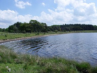
Loch Ascog is a small reservoir on the east coast of the island of Bute, in the council area of Argyll and Bute, Scotland. The loch supplies water to the town of Rothesay and the fishing rights are held by the Isle of Bute Angling Association. Loch Ascog is 44.7 hectares in extent. To the west is the much larger Loch Fad.

Davis Run is a tributary of Catawissa Creek in Schuylkill County, Pennsylvania, in the United States. It is approximately 1.2 miles (1.9 km) long. The watershed of the stream has an area of 2.86 square miles (7.4 km2). The stream is considered to be a High-Quality Coldwater Fishery and Class A Wild Trout Waters. Six species of fish inhabit the stream, including brown trout and brook trout. The main rock formations in the stream's watershed are the Mauch Chunk Formation and the Pottsville Formation and the main soils are the Leck Kill soil and the Hezleton soil. The stream has two unnamed tributaries and a lake known as the Pumping Station Reservoir.

Messers Run is a tributary of Catawissa Creek in Schuylkill County, Pennsylvania, in the United States. It is approximately 5.2 miles (8.4 km) long and flows through Kline Township and East Union Township. The only named tributary of the stream is Negro Hollow, but it has two unnamed tributaries. The creek has some alkalinity, but is slightly acidic. The main rock formations in the watershed of it are the Mauch Chunk Formation and the Pottsville Formation. The main soils in the watershed are the Leck Kill soil and the Hazleton soil.

Class A Wild Trout Waters are the highest biomass class given to streams in Pennsylvania by the Pennsylvania Fish and Boat Commission. They are considered to contain the highest-quality naturally reproducing trout populations in Pennsylvania. The first streams received their Class A Wild Trout Waters designations in 1983. There are now hundreds of such waters, comprising nearly 1,500 miles (2,400 km) of streams. Class A Wild Trout Waters receive certain legal protections. For instance, they are typically classified by the Pennsylvania Department of Environmental Protection as High-Quality Coldwater Fisheries. Most Class A Wild Trout Waters are subject to standard statewide angling regulations by the Pennsylvania Fish and Boat Commission.

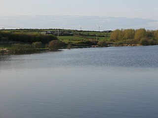
Loch of Lintrathen is a man-made loch occupying a glacial basin at the southern end of Glen Isla, approximately 13 kilometres (8.1 mi) west of town of Kirriemuir in Angus, Scotland.

