Guimaras oil spill

Last updated
Guimaras oil spill
Guimaras oil spill map with labels.jpg
A map showing the extent of the Guimaras oil spill.
Guimaras oil spill
Location Guimaras Strait, Philippines
Coordinates 10°13′N122°30′E / 10.217°N 122.500°E / 10.217; 122.500
Date11 August 2006
Cause
CauseSinking of MT Solar 1 during storm
Casualties1 dead, 2 missing
OperatorSunshine Maritime Development Corporation, Petron Corporation [1]
Spill characteristics
Volume500,000 litres (110,000 imp gal; 130,000 US gal)

On August 11, 2006, an oil spill occurred in Panay Gulf when the oil tanker, MT Solar 1, sank off the coasts of Guimaras and Negros in the Philippines, causing what is considered to be the worst oil spill in the country's history. [2] [3]

Contents

Background

The MT Solar 1, carrying more than two million liters of bunker fuel, sank during a violent storm approximately 20.5 kilometres (12.7 mi) off the southern coast of Guimaras around midnight on August 11, 2006, [4] causing an unknown amount of oil to pour into the gulf, that traveled up through the Guimaras Strait and Iloilo Strait. Only 9000 L of oil was siphoned from the sunken tanker, at a depth of more than 600 metres (2,000 ft), in March 2007. [5]

The oil spill adversely affected marine sanctuaries and mangrove reserves in three out of five municipalities in Guimaras Island and reached the shores of Iloilo and Negros Occidental. The oil spill occurred in the Guimaras Strait that connects the Visayan Sea with the Sulu Sea, and is considered a rich fishing ground that supplies most of the demand for the entire country. (NDCC, August 2006)

Haribon sent two biologists to Guimaras to assess the damage and talk to the affected communities regarding their immediate needs. Haribon provided assistance particularly for the long-term rehabilitation of the area. The government evacuated the affected families who had been exposed to the toxic elements of the crude oil. According to reports gathered in the field, people contracted skin diseases associated with these elements.[ citation needed ]

Causes

Several causes for the oil spill have been cited, including bad weather and human error. Allegations have been made that the tanker only had a capacity of 1.2 million liters, implying the possibility of overloading. [6] Other investigations have claimed that the ship's captain was not qualified to sail the vessel.[ citation needed ]

Effects

The Taklong Island National Marine Reserve was severely damaged. This bird was rescued in one of the mangroves being cleaned up. Oil Spill 2 (Nueva Valencia, Guimaras).jpg
The Taklong Island National Marine Reserve was severely damaged. This bird was rescued in one of the mangroves being cleaned up.

The spill damaged Taklong Island National Marine Reserve, a marine sanctuary for feeding and breeding ground for fish and other species. [2] The oil slick also posed a threat to the blue crab industry in the municipality of Enrique B. Magalona in Negros Occidental. [7]

Dr. Jose Ingles, eco-region coordinator of the World Wide Fund for Nature in the Philippines, Indonesia and Malaysia, said that the damage may be felt by at least two generations. He warned that the disaster may have damaged the reefs and mangroves, scarring the ecosystem and causing seafood yields to significantly decrease. According to him, the worst hit would be the shorelines, the coasts and the swamplands with mangroves. This will greatly impact the livelihood of the fisherfolk, mostly living in poor conditions. [8]

In the south-southeast of the spill site is located the Sulu Sea, a deep-water area frequented by commercially valued fish such as blue marlin and the yellowfin tuna, prized by the towns of southern Negros Occidental province as an important source of income for the communities. The oil slick may damage this thriving local industry.[ citation needed ]

On August 22, 2006, the Philippine Coast Guard stated that the spill has affected 20 communities in 4 municipalities in Guimaras. It also threatened 27 communities in Iloilo province and 17 others in Negros Occidental. [9]

Casualties

A villager from Barangay Lapaz, Nueva Valencia, Guimaras, became the first casualty directly affected by the spill. He died after inhaling the fumes of the oil sludge caused him to contract cardio-respiratory disease. [9] Two sailors from the ship were also reported missing.

Response

Due to the extent of the disaster, the cleanup was expected to reach three years. [2]

Local response

Cleanup in Barangay La Paz, Nueva Valencia, Guimaras Oil Spill (Nueva Valencia, Guimaras).jpg
Cleanup in Barangay La Paz, Nueva Valencia, Guimaras

On August 19, the Philippine government has asked the governments of Indonesia, Japan and the United States to help assist with the cleanup. [10]

President Gloria Macapagal Arroyo created Task Force Guimaras on August 22 in order to oversee both the cleanup of the oil spill and the retrieval of the 1.5 million liters of fuel oil still remaining inside the tanker. The government also ordered the creation of the Special Board of Marine Inquiry to determine who and what caused the spill. [3]

Guimaras Governor JC Rahman Nava has objected to the proposal of disposing the oil wastes within the province. [9]

Clemente Cancio, President of Sunshine Maritime Development Corporation (SMDC), the company which owned MT Solar I, said that their foreign insurer was willing to pay the cost of damage brought about by the oil spill. [9]

President Gloria Arroyo ordered a full investigation into the country's worst oil spill that devastated marine ecosystems in the central Philippines. Arroyo also ordered the Justice Department to join a special task force heading an investigation and cleanup on the island of Guimaras, where some 300 kilometers (190 mi) of coastline, including stretches of pristine beaches, had been affected by the oil slick from the sunken tanker. "We shall do everything in our power to right the wrongs caused by this unfortunate incident," Arroyo said after visiting the island, adding that she was deeply pained by the disaster that she declared a "national calamity". [11]

International response

On August 17, British oil experts, sent by SMDC's foreign insurer, arrived in Guimaras to assess the situation. SMDC stated that the experts will check the extent of the oil pollution. The Britons conducted an aerial survey over Guimaras Island and made recommendations based on their findings. [12] [13]

A four-man team from the U.S. Coast Guard arrived on August 23 to assist in determining the exact location of the tanker. [9]

See also

Related Research Articles

<span class="mw-page-title-main">Oil spill</span> Release of petroleum into the environment

An oil spill is the release of a liquid petroleum hydrocarbon into the environment, especially the marine ecosystem, due to human activity, and is a form of pollution. The term is usually given to marine oil spills, where oil is released into the ocean or coastal waters, but spills may also occur on land. Oil spills may be due to releases of crude oil from tankers, offshore platforms, drilling rigs and wells, as well as spills of refined petroleum products and their by-products, heavier fuels used by large ships such as bunker fuel, or the spill of any oily refuse or waste oil.
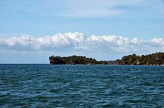
<span class="mw-page-title-main">Panay Gulf</span> Arm of the Sulu Sea between the Philippine islands of Panay and Negros

Panay Gulf is an extension of the Sulu Sea, reaching between the islands of Panay and Negros in the Philippines. The gulf contains the island-province of Guimaras and extends into the Iloilo Strait, between Panay and Guimaras, and into Guimaras Strait, between Guimaras and Negros. Guimaras Strait connects Panay Gulf with the Visayan Sea.
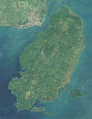
<span class="mw-page-title-main">Guimaras</span> Province in Western Visayas, Philippines

Guimaras, officially the Province of Guimaras, is an island province in the Philippines located in the Western Visayas region. The capital is Jordan, while the largest local government unit is the municipality of Buenavista. The province is situated in Panay Gulf, between the islands of Panay and Negros. To the northwest is the province of Iloilo and to the southeast is Negros Occidental. The whole island is part of the Metro IloiloGuimaras, one of the twelve metropolitan areas of the Philippines.

<span class="mw-page-title-main">Western Visayas</span> Administrative region of the Philippines

Western Visayas is an administrative region in the Philippines, numerically designated as Region VI. It consists of six provinces and two highly urbanized cities. The regional center is Iloilo City. The region is dominated by the native speakers of four Visayan languages: Hiligaynon, Kinaray-a, Aklanon and Capiznon. The land area of the region is 20,794.18 km2 (8,028.68 sq mi), and with a population of 7,954,723 inhabitants, it is the second most populous region in the Visayas after Central Visayas.

<span class="mw-page-title-main">Gulf War oil spill</span> 1991 Iraqi action in the Persian Gulf

The Gulf War oil spill, or the "Persian Gulf oil spill", was one of the largest oil spills in history, resulting from the Gulf War in 1991. In January 1991, Iraqi forces allegedly began dumping oil into the Persian Gulf to stop a U.S. coalition-led water landing on their shores. Despite quite high initial estimates, the spill likely was about 4,000,000 US barrels. Within the following months of the spill, most clean-up was targeted at recovering oil, and very little clean-up was done on Saudi Arabia’s highly-affected beaches. An initial study in 1993 found that the spill will not have long-term environmental consequences, but many studies since 1991 have concluded the opposite, claiming that the spill is responsible for environmental damage to coastline sediments and marine species and ecosystems. Considered an act of environmental terrorism, the spill was a heated political move that had implications for the larger Gulf War and temporarily damaged Kuwait and Saudi Arabia.

<span class="mw-page-title-main">Nueva Valencia</span> Municipality in Guimaras, Philippines

Nueva Valencia, officially the Municipality of Nueva Valencia, is a 3rd class municipality in the province of Guimaras, Philippines. According to the 2020 census, it has a population of 42,771 people.

<span class="mw-page-title-main">Jiyeh Power Station oil spill</span>

The Jiyeh Power Station oil spill is an environmental disaster caused by the release of heavy fuel oil into the eastern Mediterranean after storage tanks at the thermal power station in Jiyeh, Lebanon, 30 km (19 mi) south of Beirut, were bombed by the Israeli Air force on July 14 and July 15, 2006 during the 2006 Israel-Lebanon conflict. The plant's damaged tanks leaked up to 30,000 tonnes of oil into the eastern Mediterranean Sea, A 10 km wide oil slick covered 170 km of coastline, and threatened Turkey and Cyprus. The slick killed fish, threatened the habitat of endangered green sea turtles, and potentially increased the risk of cancer.

<span class="mw-page-title-main">Philippine Nautical Highway System</span> Highway system in the Philippines

The Philippine Nautical Highway System, also the Road Roll-on/Roll-off Terminal System (RRTS) or simply the RoRo System, is an integrated network of highway and vehicular ferry routes which forms the backbone of a nationwide vehicle transport system in the Philippines. It is a system of roads and ports developed by the Philippine government to connect the major islands of Luzon, the Visayas and Mindanao. The 919-kilometer (571 mi) nautical highway was opened to the public on April 12, 2003 as the Strong Republic Nautical Highway (SRNH).

<span class="mw-page-title-main">Petron Corporation</span> Oil company in the Philippines

Petron Corporation is the largest oil refining and marketing company in the Philippines, supplying more than a third of the country's oil requirements. It operates a refinery in Limay, Bataan with a rated capacity of 180,000 barrels per day (29,000 m3/d). From the refinery, Petron moves its products mainly by sea to 32 depots and terminals throughout the country.

<i>Prestige</i> oil spill 2002 environmental disaster off the coast of Galicia, Spain

The Prestige oil spill occurred off the coast of Galicia, Spain in November 2002, caused by the sinking of the 26-year-old, structurally deficient oil tanker MV Prestige, carrying 77,000 tonnes of heavy fuel oil. During a storm, it burst a tank on 13 November, and French, Spanish, and Portuguese governments refused to allow the ship to dock. The vessel subsequently sank on 19 November, about 210 kilometres (130 mi) from the coast of Galicia. It is estimated that it spilled 60,000 tonnes or a volume of 67,000 m3 (17.8 million US gal) of heavy fuel oil.

<span class="mw-page-title-main">Metro Iloilo–Guimaras</span> Metropolitan area in the Philippines

Metropolitan Iloilo–Guimaras, also shortened as Metro Iloilo–Guimaras or Metro Iloilo, or simply MIG, is a metropolitan area in the Western Visayas in the Philippines. It is situated on the southeastern coast of Panay, including the nearby island province of Guimaras, surrounded by the Iloilo and Guimaras straits.

<span class="mw-page-title-main">Igbon Island</span> Island and barangay in Iloilo, Philippines

Igbon Island is an island and barangay in northeastern Iloilo, Philippines. It is part of the municipality of Concepcion. According to the 2010 census, it has a population of 2,547. The island is moderately known in the Philippines for its scuba diving.

<i>Amoco Cadiz</i> oil spill Oil spill near coast of Brittany

The Amoco Cadiz oil spill took place on 16 March 1978, when the oil tanker Amoco Cadiz, owned by the American petroleum company Amoco, ran aground on Portsall Rocks, 2 km (1.2 mi) from the coast of Brittany, France. The vessel ultimately split in three and sank. The US National Oceanic and Atmospheric Administration (NOAA) estimates that the total oil spill amounted to 220,880 tonnes of oil which amounts to over 58 million gallons or 256.2 million litres, making it the largest oil spill of its kind at the time.
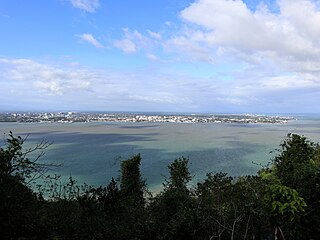
<span class="mw-page-title-main">Iloilo Strait</span> Strait in Western Visayas

The Iloilo Strait is a strait in the Philippines that separates the islands of Panay and Guimaras in the Visayas, and connects Panay Gulf with the Guimaras Strait. It is the location of the Port of Iloilo, the third-busiest of the ports in the Philippines in number of ships. Iloilo City on Panay is the major city located on the strait with Buenavista and Jordan, both on Guimaras, immediately across the strait from the city. The Iloilo River empties into the strait.

<span class="mw-page-title-main">Guimaras Strait</span> Strait in Western Visayas

Guimaras Strait is a strait in the Western Visayas region of the Philippines, connecting the Visayan Sea with Panay Gulf and the Sulu Sea beyond. To the north and west are Panay and Guimaras Islands, while Negros Island is to the south and east. Bacolod City is a major seaport on the strait, which also provides access to the Port of Iloilo City via the Iloilo Strait.

<span class="mw-page-title-main">Taklong Island</span>

Taklong Island is the main island of the Taklong Island National Marine Reserve located in Nueva Valencia, Guimaras, off the southern end of the island of Guimaras, in the West Visayas of the Philippines. The island and nearby vicinity was declared by President Corazon Aquino in June 1990. A marine biological station run by the University of the Philippines Visayas (UPV) of nearby Iloilo Province is located on this island. The one-storey station established in 1977 and renovated twice sits on a 1.64 hectares parcel of land donated to UP in 1964, with Carlos P. Romulo as then University President. Donors included the family of the first Lieutenant Governor of then SubProvince of Guimaras, the late Antonio Ortiz. When proclaimed as a national marine reserve in Feb. 8, 1990 by then President Corazon C. Aquino, there was only one family residing in the island, the family of Vicente Basco, the only recognized tenured migrant when Taklong Island became part of the national marine reserve. Mr. Basco was employed by UPV as caretaker of its Station in Taklong Island since the 1970s until his retirement. There are UPV staff, including security guards stationed in the island.

Malingin Island is a small island located in southernmost part of Nueva Valencia, Guimaras in the Philippines, situated beside Unisan Island.

Unisan Island is a small island located in southernmost part of Nueva Valencia, Guimaras and beside Malingin Island in the Philippines. It is the largest island in the Unisan Islets.

The Amazon Venture oil spill occurred at the port of Savannah on the Savannah River in the U.S. state of Georgia. The spill, which occurred from December 4 to 6, 1986, was caused by three defective valves in the piping system of the oil tanker MV Amazon Venture, which leaked approximately 500,000 US gallons of fuel oil into the river.
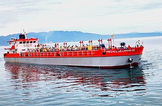
MT <i>Princess Empress</i> oil spill 2023 oil spill in the Philippines

On the morning of February 28, 2023, MT Princess Empress sank off Naujan, Oriental Mindoro, Philippines, causing an oil spill in the waters of the provinces of Antique, Batangas, Oriental Mindoro, and Palawan. En route from Bataan to Iloilo, the oil tanker was carrying 900,000 liters of industrial fuel oil before it sank.

References

  1. Baua, Niko (2012-03-17). "Petron, Sunshine Maritime face P200-M suit over oil spill". ABS-CBN Corporation . Retrieved 2013-05-24.
  2. 1 2 3 Sarah Toms (15 August 2006). "Oil spill threatens Philippines". BBC News. Retrieved 15 July 2013.
  3. 1 2 "Arroyo forms task force to oversee oil spill cleanup". INQ7.net. 2006-08-23.
  4. Arias, de la Cruz, Guillergan & Presaldo (2006). "Responding to an Oil Spill Disaster: Data Management Support for the Rehabilitation of Guimaras Island, Philippines". International Society for Environmental Information Sciences. Archived from the original (PDF) on 2014-08-12. Retrieved 2013-05-24.{{cite web}}: CS1 maint: multiple names: authors list (link)
  5. "PIA daily news in English, Tagalog, Cebuano, Hiligaynon, Ilocano, Waray, Pangalatok from around the Philippines". archives.pia.gov.ph. Retrieved 2023-03-15.
  6. "Inquiry lists 3 factors behind Solar 1 sinking". The Manila Times. 2006-09-15.
  7. "Slick to ruin blue crabs habitat in EB Magalona". Sun.Star Bacolod. 2006-08-23. Archived from the original on 2006-08-29.
  8. "Sensitive habitats can be smothered by oil". INQ7.net. 2006-08-24.
  9. 1 2 3 4 5 "Governor says no to oil sludge disposal in Guimaras". Sun.Star Bacolod. 2006-08-23. Archived from the original on 2007-07-17.
  10. "RP sends SOS on oil spill US, Japan, Indonesia help sought". INQ7.net. 2006-08-20.
  11. "Arroyo vows to get to bottom of oil spill". PhilStar. 2006-08-26.[ permanent dead link ]
  12. "British experts to help with oil spill clean-up". INQ7.net. 2006-08-18.
  13. "British experts to help with oil spill clean-up". YahooNews. 2006-08-18.