Related Research Articles

Adambakkam is a neighbourhood of Chennai, India. It is primarily a residential locality situated in South Chennai. Adambakkam area comes under Velachery taluk and Alandur taluk, Chennai District of Chennai Corporation. Adambakkam is surrounded by areas namely, Alandur in the North-West, Nanganallur in the West, Madipakkam in the South, Velachery in the East and Guindy in the North. Earlier, one part of Adambakkam was under the direct governance of Chennai Corporation. From October 2011 onwards, the entire area was merged with the Chennai Corporation. Upon completion of the MRTS extension line, the neighbourhood will be served by Adambakkam railway station. Its Proximity to commercial localities like Velachery, accessible railway stations, Metro Stations and road transport routes makes Adambakkam an ideal choice of location to live.

Thyagaraya Nagar, commonly known as T. Nagar, and historically known as East Mambalam, is a very affluent commercial and residential neighbourhood in Chennai, Tamil Nadu, India. It is surrounded by Nungambakkam in the North, Teynampet in the East, Nandanam in the South-East, C.I.T. Nagar in the South and West Mambalam and Kodambakkam in the West. The stretch between Duraiswamy Road and T. Nagar Bus Stand has some of the costliest real estates in Chennai. It was constructed between 1923 and 1925 by the Madras Presidency government of the Raja of Panagal as a part of town planning activities initiated according to the Madras Town Planning Act of 1920. The town was named after P. Thyagaraya Chetty. The streets, parks and localities in the new neighbourhood were named after important officials in the provincial government.

Kotturpuram, also known as Kottur, is a neighbourhood in Chennai (Madras), Tamil Nadu, India and is situated in the Southern banks of the Adyar River. It is surrounded by Nandanam in the North and North-West, Adyar in the South-East, IIT Chennai and Guindy in the South and Little Mount in the South-West. The neighbourhood is served by Kotturpuram MRTS railway station. Centuries old Hindu temples, such as Perumal Koil and Ponniamman Koil are situated in Kottur.

Chennai district, formerly known as Madras district, is one of the 38 districts in the state of Tamil Nadu, India. It is the smallest and the most densely populated district in the state. The district is coterminous with the city of Chennai, which is administered by the Greater Chennai Corporation. It is surrounded by Tiruvallur district in the north and the west, Kanchipuram district in the south-west, Chenglpattu district in the south, and the Bay of Bengal in the east.

Saidapet, also known as Saidai, is a neighbourhood in Chennai, India, situated in the northern banks of the Adyar River and serves as an entry point to Central Chennai. It is surrounded by West Mambalam in the North, C.I.T Nagar in the North-East, Nandanam in the East, Guindy in the South, Jafferkhanpet and Ashok Nagar in the North-West. The Saidapet Court, the only other court of judicature in Chennai city apart from the Madras High Court, and the Saidapet bus depot are located here. Prior to its incorporation in Madras city, Saidapet functioned as the administrative headquarters of Chingleput district. The neighbourhood is served by Saidapet railway station of the Chennai Suburban Railway Network.
West Mambalam is a residential and commercial area in Chennai, India. It is known for its shops, bazaars and Hindu temples. It is bounded by Kodambakkam to the north and Saidapet to the south. T. Nagar and Nandanam stretch all along its eastern frontiers while Ashok Nagar lies to its west. The Ayodhya Mandapam is an important landmark.
The Chennai Metropolitan Development Authority (CMDA), formerly known as the Madras Metropolitan Development Authority (MMDA), is the nodal planning agency of Chennai in the Indian state of Tamil Nadu. The CMDA administers the Chennai Metropolitan Region, spread over an area of 5,904 km2 (2,280 sq mi) and covers the districts of Chennai, Thiruvallur, Chengalpattu, Ranipet and Kancheepuram. It was set up for the purposes of planning, co-ordination, supervising, promoting and securing the planned development of the Chennai Metropolitan Area. It coordinates the development activities of the municipal corporations, municipalities and other local authorities.
The Lok Sabha constituency Chennai South is one of three constituencies in Chennai, Tamil Nadu. Its Tamil Nadu Parliamentary Constituency number is 3 of 39. It was formerly known as Madras South. It was created in 1957 through bifurcation of Madras Lok Sabha constituency. It is one of the most populous parliamentary constituencies in South India.

Chennai is located at 13.04°N 80.17°E on the southeast coast of India and in the northeast corner of Tamil Nadu. It is located on a flat coastal plain known as the Eastern Coastal Plains. The city has an average elevation of 6 metres (20 ft), its highest point being 60 m (200 ft). Chennai is 2,184 kilometres south of Delhi, 1,337 kilometres southeast of Mumbai, and 1,679 kilometers southwest of Kolkata by road.
Egmore taluk is a taluk of the city district of Chennai in the Indian state of Tamil Nadu. It was formed in December 2013 from parts of the Egmore-Nungambakkam taluk. It comprises the neighbourhoods of Egmore and Nungambakkam.
Mylapur taluk is a taluk of the city district of Chennai in the Indian state of Tamil Nadu. It was formed in December 2013 from parts of the erstwhile Fort-Tondiarpet and Mylapore-Triplicane taluks. It comprises the neighbourhoods of Chintadripet, Mylapur and Triplicane.
- Chintadripet Firka: Chintadripet [Fort-Tondiarpet Taluk], Triplicane [Mylapore-Triplicane Taluk]
- Mylapore Firka: Mylapore South/Mylapore
- Royapettah Firka: Mylapore North/Mylapore
- Triplicane Firka: Triplicane
Mambalam taluk is a taluk of the city district of Chennai in the Indian state of Tamil Nadu. It was formed in December 2013 from parts of the former Egmore-Nungambakkam taluk and the Mambalam-Guindy taluk. It comprises the neighbourhoods of K. K. Nagar, Kodambakkam, Mambalam, Saligramam, Saidapet and Virugambakkam.
Perambur taluk is a taluk of the city district of Chennai in the Indian state of Tamil Nadu. It was formed in December 2013 from parts of the erstwhile Fort-Tondiarpet and Perambur-Purasawalkam taluks. It comprises the neighbourhoods of Kodungaiyur, Moolakadai, Madhavaram and Perambur.
Alandur taluk is a taluk of the district of Chennai in the Indian state of Tamil Nadu. The centre of the taluk is the neighbourhood of Alandur. The headquarters of the taluk is Guindy division. On 4 January 2018, Chennai district was expanded by annexing Alandur taluk.
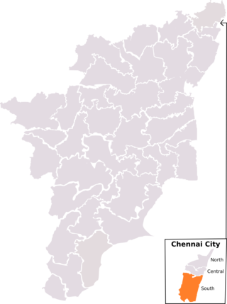
Central Chennai is the part of Chennai city between the Coovum River and the Adyar River. While mostly grouped under South Chennai, Central Chennai is a term which has gained currency in recent times due to the rapid expansion of the city southwards. Covering the eastern neighbourhoods of Royapettah, Chepauk, Teynampet, Alwarpet, Mylapore, Triplicane and Mandaveli and the western neighbourhoods of Nungambakkam, Kodambakkam, Vadapalani, Virugambakkam, Valasaravakkam, Mambalam, T. Nagar, Nandanam and Saidapet, Central Chennai is largely upper class-upper middle class. The eastern part is largely upper class with two of the costliest pieces of real estate - the Boat Club Road and Poes Garden being located here while the western part is mainly middle class. Kodambakkam is the location of the Tamil film industry or Kollywood.
South Chennai is the new southern neighbourhoods of Chennai city, India. It is roughly the neighbourhoods and suburbs that lie south of the Adyar River. None of these places were part of Chennai Corporation before 1947 and became part of Chennai before 1990 when they existed as separate local bodies.
Purasaiwalkam taluk is a taluk of the city district of Chennai in the Indian state of Tamil Nadu. It was formed in December 2013 from parts of the erstwhile Fort-Tondiarpet and Perambur-Purasawalkam taluks. It comprises the neighbourhoods of Purasawalkam, Vepery and Periamet.
- Otteri Firka: Pursawalkam West/Pursawalkam
- Pursawalkam Firka: Purasawalkam East/Purasawalkam
- V.O.C Nagar Firka: V.O.C Nagar
- Vepery Firka: Vepery
Aminjikarai taluk is a taluk of the city district of Chennai in the Indian state of Tamil Nadu. It was formed in December 2013 from parts of the erstwhile Perambur-Purasawalkam taluk and the Egmore-Nungambakkam taluk. It comprises the neighbourhoods of Aminjikarai, Anna Nagar, Arumbakkam, Koyambedu, Thirumangalam, Vada Agaram and Villivakkam.
- Villivakkam Firka: Villivakkam, Mullam
- Aminjikarai Firka: Arumbakkam, Aminjikarai, Vada Agaram
- Anna Nagar Firka: Chinnakudal, Naduvankarai, Periyakudal, Thirumangalam
- Koyambedu Firka: Koyambedu, Sencheri
Velachery taluk is a taluk of the city district of Chennai in the Indian state of Tamil Nadu. It was formed in December 2013 from parts of the erstwhile Mambalam-Guindy and Mylapore-Triplicane taluks. It comprises the neighbourhoods of Besant Nagar, Tharamani, Thiruvanmiyur and Velachery.
- Besant Nagar Firka: Kalikundram, Pallipattu, Urur
- Thiruvanmiyur Firka: Thiruvanmiyur
- Tharamani Firka: Kaanagam, Tharamani, Velachery [Mylapore-Triplicane taluk]
- Velachery Firka: Velachery
References
General
Specific
- ↑ Julie Mariappan (21 December 2013). "Chennai now has 10 taluks, as govt gets close to you". The Times of India.
