
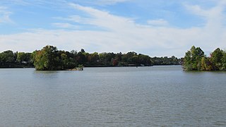
Lake Winnebago is a shallow freshwater lake in the north central United States, located in east central Wisconsin. At 137,700 acres, it is the largest lake entirely within the state, covering an area of about 30 miles by 10 miles with 88 miles of shoreline, an average depth of 15.5 feet, and a maximum depth of 21 feet. It has many shallow reefs along the west shore and a drop-off type shoreline on the east. There are several islands along the west shore.

Leech Lake is a lake located in north central Minnesota, United States. It is southeast of Bemidji, located mainly within the Leech Lake Indian Reservation, and completely within the Chippewa National Forest. It is used as a reservoir. The lake is the third largest in Minnesota, covering 102,947.83 acres (416.6151 km2) with 195 miles (314 km) of shoreline and has a maximum depth of 156 feet (48 m).
Black Lake is located in the northern part of New York in the United States and is the largest lake in Saint Lawrence County. The lake is south of the Saint Lawrence River and parallels the river for many miles.

Lake Vermilion is a shallow freshwater lake in northeastern Minnesota, United States. The Ojibwe originally called the lake Onamanii-zaaga'iganiing, which means “the evening sun tinting the water a reddish color”. French fur traders translated this to the Latin word Vermilion, which is a red pigment. Lake Vermilion is located between the towns of Tower on the east and Cook on the west, in the heart of Minnesota's Arrowhead Region at Vermilion Iron Range. The area was mined from the late 19th century until the 1960s, and the Soudan Mine operated just south of the lake.
Sanford Lake was a man-made reservoir located in Midland County, Michigan, but is no longer present since the failure of the dam in May 2020. It was formed by the damming of the Tittabawassee River near the village of Sanford, Michigan. It was built for flood control and the production of hydroelectric power. The dam is owned and operated by the Four Lakes Task Force, a property owners' group that was established by the Midland and Gladwin County boards of commissioners to oversee the dams and the impoundment lakes created by them, who took over ownership as a condition of the settlement agreement that resulted from the condemnation proceedings with former dam owner, Boyce Hydro, LLC.

Budd Lake is a 175-acre (0.7 km2) lake in Clare County, in the central region of Michigan's lower peninsula.
Grand Lake is a 5,660-acre (22.9 km2)spring fed lake in Presque Isle County in the U.S. state of Michigan. Grand Lake is a substantial lake of approximately 7 miles (11 km) in length and up to 1.5 miles (2.4 km) in width. The lake is on the boundary between Presque Isle Township to the east and Krakow Township to the west, approximately 15 miles (24 km) north of Alpena on U.S. Highway 23, which passes to the south and west of the lake.
Belleville Lake is a fresh water artificial reservoir located mostly within Wayne County in the U.S. state of Michigan. A very small portion extends west into Washtenaw County. The lake was created from the construction of the French Landing Dam and Powerhouse along the Huron River in 1925.

Little Cedar Lake is a lake in Southeastern Wisconsin; United States. It is located at the geographic center of Washington County, in the Town of West Bend, and Town of Polk. The lake covers an area of 246 acres (1 km2), has a shoreline of 4.5 miles (7 km), and reaches a maximum depth of 56 feet (17 m). Its source is Cedar Creek which flows into the northwest side of the lake, and its outflow is Cedar Creek, which continues to flow south at the bottom a small dam at the extreme southern tip of the lake. Spring, summer and autumn activities on the lake include boating, fishing, and water skiing. In winter the lake freezes over completely with ice up to 36 inches thick, Winter activities on the lake include ice fishing and snowmobiling. Many species of fish are found in Little Cedar Lake, including northern pike, walleye, rock bass, smallmouth bass, bluegills, carp, and bullheads. The Lake is located approximately 30 mi (48 km) NNW of Milwaukee, and 5 mi (8.0 km) SW of the City of West Bend.

Pleasant Creek Wildlife Management Area is located near Philippi, West Virginia in Barbour and Taylor counties. Located on 3,030 acres (1,230 ha) land that varies from wetlands to steeply forested woodlands, the Pleasant Creek WMA rises to an elevation of 1,600 feet (490 m).
Lake Mitchell is one of two lakes in Wexford County, Michigan, that are joined by the Clam Lake Canal. The other lake is Lake Cadillac.

Manistique Lake, locally called Big Manistique Lake to distinguish it from the other lakes in the Manistique Lakes system, is a 10,130-acre (4,100 ha) lake in the Upper Peninsula of the U.S. state of Michigan. Approximately 6.5 miles (10.5 km) long and 4 miles (6.4 km) wide, it is one of the largest lakes in the Upper Peninsula. Elevated 686 feet (209 m) above sea level and 105 feet (32 m) above Lake Michigan, Manistique Lake drains into the larger lake through a marshy outlet on the west end of the lake that forms one source of the Manistique River. Relatively shallow, the lake's deepest point is only 20 feet (6.1 m) below the water surface. The average depth is 10 feet (3.0 m).
Greenwood Reservoir is a large, 1,073-acre (4.34 km2) impoundment located in the Upper Peninsula of Michigan, United States.
Platte Lake is one of the many lakes located in the northwestern part of Michigan's lower peninsula. There are two lakes in Benzie County, Michigan based on the name Platte, the other being Little Platte. Platte Lake covers 2,516 acres (1,018 ha) and is 3.3 miles (5.3 km) long and 1.6 miles (2.6 km) wide. The average depth of Platte Lake is 24 feet (7.3 m) deep. The deepest point of the lake is measured at 95 feet (29 m) deep. The Platte River flows through the lake at a speed of 120 cubic feet per second (3.4 m3/s). This means the residence time for the water in Platte Lake is 6 months. Also meaning that every hour 3,300,000 US gallons (12,000,000 L) of water are passing through Platte Lake. The Platte River flows through Platte Lake and continues downstream through Loon Lake until it finally reaches Lake Michigan.

Saratoga Lake is in the eastern part of Saratoga County, New York. The lake is approximately 4.5 miles (7.2 km) long, about 1.5 miles (2.4 km) wide at its widest point, and about 95 feet (29 m) deep.
There are three Manistique Lakes in the Upper Peninsula of Michigan. The lakes include North Manistique Lake, Big Manistique Lake, and South Manistique Lake. The towns surrounding the lakes are Curtis, Germfask, and Helmer. The lakes are known for vacationing and fishing. They are also in close proximity to other natural sights such as the Great Lakes, rivers, and smaller lakes as well as tourist attractions including the Canada–US border, the Soo Locks, Mackinac Island, parks, and museums.
Green Lake is a lake in Chisago City, Minnesota, United States. This lake is sometimes also referred to as "Big Green Lake" because it is connected to Little Green Lake by a channel. Green Lake was named from the fact its waters are green from the high algae content.

Amelia Lake is a lake in Pope County, Minnesota, the United States, located 6.7 miles away from Glenwood. Amelia lake has an elevation of around 1,348 feet (411 m). The lake sits on a lot of 910 acres. The depth of Amelia Lake is 69 feet (21 m) and water clarity can approach 12 feet (3.7 m) during the summer. This lake is open to the public to fish with a proper fishing license.
Goodyear Lake is a man-made lake created by the building of the Colliersville Dam. The lake is located southwest of the hamlet of Portlandville in the Town of Milford in Otsego County, New York.

Lake Missaukee is a freshwater lake located in Missaukee County in the U.S. state of Michigan. The lake is mostly surrounded by Lake Township, while bordering Lake City to the east and a very small portion extending north into Caldwell Township.


