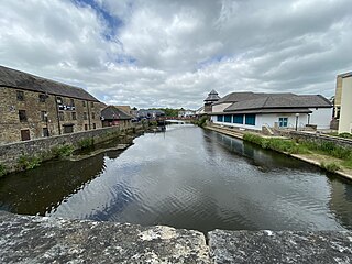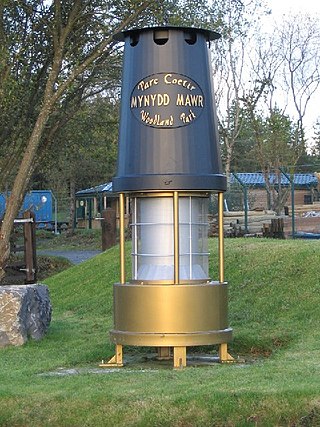
Cross Hands is a village in Carmarthenshire, Wales, approximately 12 miles from Carmarthen.

The River Cleddau consists of the Eastern and Western Cleddau rivers in Pembrokeshire, west Wales. They unite to form the Daugleddau estuary and the important harbour of Milford Haven.

Gallows Hill SSSI is a Site of Special Scientific Interest on the north side of the Ebble Valley in south Wiltshire, England. Its chalk grassland and scrub contain a number of animal and plant species that are nationally rare. The 27.8 hectares site was notified in 1965.

Tumble, is a village situated south of Cross Hands near the towns of Carmarthen and Llanelli in Carmarthenshire, Wales. Tumble, along with Cross Hands is part of the community of Llannon. The population, including Drefach was 4,302.
Mynydd Llangyndeyrn is a Site of Special Scientific Interest (SSSI) in Carmarthen & Dinefwr, Wales, and a hill reaching 263 metres, which is a Marilyn.

Range Farm Fields is a 12.8-hectare (32-acre) biological Site of Special Scientific Interest in Gloucestershire, near to Gloucester City, notified in 1996.
Gweunydd Blaencleddau is a large wetland complex in a shallow south-west valley around the headwaters of the Eastern Cleddau river. It is a Site of Special Scientific Interest (SSSI) and a Special Area of Conservation (SAC) situated in Pembrokeshire, South Wales.

Aber Taf is a large Site of Special Scientific Interest (SSSI) in Carmarthenshire, Wales, and forms part of the Carmarthen Bay and Estuaries Special Area of Conservation.
Smarts Quarry is a Site of Special Scientific Interest (SSSI) in Carmarthenshire, Wales, designated in 1987 for its geological features.
Caeau Pant-y-Bryn is a Site of Special Scientific Interest (SSSI) in Carmarthenshire, Wales.
Rhosydd Llanpumsaint is a Site of Special Scientific Interest (SSSI) in Carmarthenshire, Wales.
Machynys Ponds is a Site of Special Scientific Interest (SSSI) in Carmarthenshire, Wales, designated in 1993 for its botanical features.

Allendale Moors is a Site of Special Scientific Interest (SSSI) in Northumberland, England. The upland moorland ridge site is listed for its heath, flush and upland grassland which provide a habitat for a nationally important assemblage of moorland breeding birds.
Allolee to Walltown is the name given to a Site of Special Scientific Interest (SSSI) in Northumberland, England. The site, which follows the path of a section of Hadrian's Wall, is notable for an unusually wide range of grassland types growing on thin soil above the Whin Sill, a rock formation peculiar to the Northern Pennines.

Arcot Hall Grasslands and Ponds is the name given to a Site of Special Scientific Interest (SSSI) near Cramlington in Northumberland, England, notable as the largest lowland species-rich grassland in North East England. The site is composed of grassland, heath, ponds, and associated damp habitats now rare in Northumberland.
Aules Hill Meadows is the name given to a Site of Special Scientific Interest (SSSI) in Northumberland, England. The site, listed since 1992, is a set of four traditionally managed northern hay meadows, now rare in Northumberland.
Bamburgh Coast and Hills is the name given to a Site of Special Scientific Interest (SSSI) on the coast of north Northumberland, England. The site is one of the longest-standing SSSIs in England, having been listed since 1954, and displays the interaction of a fluid magma rock, now known as the Whin Sill, interacting with older sedimentary rock. Coastal erosion at the site enables sections of the geological strata to be seen. In turn, the soil associated with the Whin Sill gives rise to a distinct pattern of vegetation which on its own merits is at this site found notable.
Barrow Burn Meadows is a Site of Special Scientific Interest (SSSI) in north Northumberland, England. The site is a species-rich hay meadow of a sort now rare in Northumberland.
Barrow Meadow is a Site of Special Scientific Interest (SSSI) in north Northumberland, England. The site is a species-rich hay meadow of a sort now rare in Northumberland.


