
Hutton Magna is a village and civil parish in County Durham, England. Situated 7.6 miles (12.2 km) south east of Barnard Castle. Lying within the historic boundaries of the North Riding of Yorkshire, the village along with the rest of the former Startforth Rural District has been administered with County Durham since 1 April 1974, under the provisions of the Local Government Act 1972. The civil parish also includes the hamlet of Lane Head.

Sherburn Hill is a village in County Durham, in England. It is situated to the east of Sherburn.

Harwood is a small valley and village near the head of Teesdale. Harwood Beck is a tributary of the River Tees in County Durham which forms a short valley, and the village is made of the scattered houses and farms which run the length of the valley. The valley forms part of the North Pennines AONB. Lying along the B6277, the village is 9 miles (14 km) north-west of Middleton-in-Teesdale and 21 miles (34 km) south-east of Alston in Cumbria. It lies in the Bishop Auckland parliamentary constituency.

Stainton is a village in the south-west outskirts of Middlesbrough, England. It is in the Borough of Middlesbrough, North Yorkshire.

The River Winster is a river in the English county of Cumbria. The Winster was the boundary between the ancient counties of Lancashire and Westmorland. It has a relatively small catchment area; other streams flow parallel to it on either side.

Stainton Beck is a watercourse in Cumbria, England. Its upper reaches are known as St. Sunday's Beck.
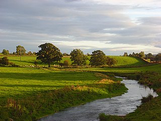
The River Petteril is a river running through the English county of Cumbria.

Arkleby is a village in Cumbria, England. It is located about 1 mile south of Aspatria and 9 miles south-west of Wigton. Arkleby is part of the civil parish of Plumbland and is a short distance from the village of Parsonby and larger village of Plumbland. Arkleby Hall, a farmhouse, dates from 1725 and is a Grade II listed building. St Cuthbert's Church, the parish church of Plumbland, is located in between Arkleby and Parsonby. The church was built in 1871 by J.A. Cory, incorporating the fabric of an earlier 13th century church on the site; it is a Grade II listed building.
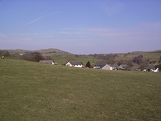
Broughton Beck is a village in the South Lakeland district of Cumbria, England. The village has two sections; one part is on the B5281 Ulverston to Gawthwaite Road, the other part of the village is about 250 yards away, to the north. In the past the village served the farms in the surrounding area; there used to be a public house, a shop, a garage, a blacksmith and a mill. The mill building was bequeathed to the village in 1937 and now serves as Broughton Beck Village Hall, known as 'The Mill Room.
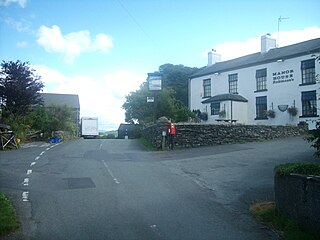
Oxen Park is a hamlet in the English county of Cumbria.

Newlands Church is a 16th-century church situated less than 500 metres west of the hamlet of Little Town, Cumbria, England in the Newlands Valley of the Lake District. Its exact date of origin is unknown, but a map of 1576 shows a "Newlande Chap." on the site.

Cliburn is a village and civil parish in the Eden district of Cumbria, England. The civil parish includes the hamlet of Town Head. In 2001 the population was 204, increasing to 274 at the 2011 Census.

Thornthwaite is a village in Cumbria, England. Historically in Cumberland, it is just off the A66 road, south of Bassenthwaite Lake and within the Lake District National Park. It is 3.5 miles (5.6 km) by road from Keswick. In 1861 the township had a population of 153.

Helton is a village in the Eden district, in the English county of Cumbria. It is about a mile south of the village of Askham. Circa 1870, it had a population of 180 as recorded in the Imperial Gazetteer of England and Wales. The village is situated on a steep slope running down from the limestone fells to the flood plain of the River Lowther. Helton is on Wideworth Farm Road, which forms part of the road north to Penrith, and south towards Bampton. A Wesleyan chapel was built in Helton in c.1857 and is a Grade II listed building, now converted for residential use.

Burrells is a hamlet in the Eden District, in the English county of Cumbria. Burrells is located on the B6260 Road in between the town of Appleby-in-Westmorland and the hamlet of Hoff. Its post code is CA16. Historically, Burrells was a township in the Parish of Appleby in Westmorland. Hoff Quarry here, now disused, was an important local source of stone. Burrells House, built in the early 19th century, is a Grade II listed building. The barn to the south of Burrells House was rebuilt in 1818 and is also Grade II listed.
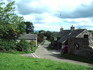
Waitby is a small village and civil parish in the Eden district of Cumbria, England. The parish contains two small villages, Waitby and Smardale, plus the small hamlets of Riddlesay, Stripes and Leases, all of which are in the farmed and enclosured northern part at an elevation of around 200–300m. The southern half of the parish is mostly heath and unused for agriculture, it rises to Smardale fell; which it includes, at elevations between 300 and 400m. The civil parish of Ravenstonedale forms the boundary to the south. The western border with Crosby Garrett civil parish is formed by Scandal Beck. To the north and east lie Soulby and Kirkby Stephen civil parishes respectively. The population of the civil parish as measured at the 2011 Census was less than 100. Details are included in the parish of Crosby Garrett.

Denwick is a small village and civil parish in Northumberland, located about 1.4 miles (2 km) north-east of Alnwick.
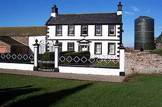
Woodside is a civil parish in Allerdale district, Cumbria, England. At the 2011 census it had a population of 516. The parish has an area of 27.14 square kilometres (10.48 sq mi)

Dockray is a village in the civil parish of Matterdale, in the Eden district, in the county of Cumbria, England. In the 2011 census, the parish had 483 residents, roughlt an 8% decrease from 526 residents in 2001. Dockray is located approximately eight miles south west of Penrith, and is accessible off of the A5091 road.
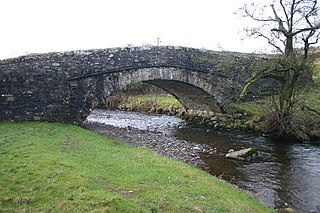
Whelpo is a hamlet in the civil parish of Caldbeck, in the Allerdale district, in the county of Cumbria, England. It is about one mile west of the village of Caldbeck. It can be accessed by the A5299 road. The hamlet contains two listed buildings – Whelpo Head, an 18th-century former farmhouse, and Whelpo Bridge, a stone bridge traversing Whelpo Beck. The other feature in the hamlet is the aforementioned Whelpo Beck, also referred to as Cald Beck, which is a tributary to the River Calder. The beck has a catchment area of 39.6 km2.


