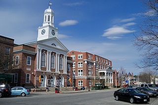
Lebanon is the only city in Grafton County, New Hampshire, United States. The population was 14,282 at the 2020 census, up from 13,151 at the 2010 census. Lebanon is in western New Hampshire, south of Hanover, near the Connecticut River. It is the home to Dartmouth–Hitchcock Medical Center and Dartmouth College's Geisel School of Medicine, together comprising the largest medical facility between Boston, Massachusetts, and Burlington, Vermont.

White River Junction is an unincorporated village and census-designated place (CDP) in the town of Hartford in Windsor County, Vermont, United States. The population was 2,528 at the 2020 census, up from 2,286 in 2010, making it the largest community within the town of Hartford.

Earlville is a village in New York state bisected by two counties: Madison County and Chenango County, United States. The population was 774 as per the 2020 Decennial census, a decrease from the 872 reported in the 2010 census. The village is named after Jonas Earl, a canal commissioner.
Hama is a city in west-central Syria, previously known as Hamath.

Hamat Gader is a hot springs site in the Yarmouk River valley, used since the classical antiquity. It is located in an area under Israeli control, in what was a demilitarized zone between Israel and Syria from 1949 to 1967. The site is next to the Jordanian border, and about 10 kilometres (6.2 mi) from the tripoint of Israel, Jordan and Syria. It is set on several mineral springs with temperatures up to 50 °C.

Batroun District is a district (qadaa) in the North Governorate, Lebanon, south of Tripoli. The capital is Batroun. Its borders are created in the south by the river El Jaouz in the north and by the river Madfoun.
Theoprosopon is the Greek name of Lithoprosopon, a cape in north Lebanon, also known today by the name of Râs ach-Chaq’a’. The cape is situated between the ancient cities of Batroun and Tripoli. The promontory creates a massive barrier that cuts through the coast of Lebanon, making it impossible for travelers to circumvent. Today's modern, coastal highway runs through two tunnels.
Our Lady of Nourieh is a Marian shrine in Hamat, Lebanon. Nourieh is a derivative of the Arabic word, nour, meaning light. Thus, in English, the Marian shrine can be called, Our Lady of Light.
Jal El Dib or Jal Ed Dib is a Lebanese city in the kaza of Matn in the Mount Lebanon Governorate11 kilometers north of the capital city of Beirut.

The Mseilha Fort is a fortification situated north of the village of Hamat in Lebanon. The current fort was built by Emir Fakhreddine II in the 17th century to guard the route from Tripoli to Beirut. The fort is built on a long, narrow limestone rock near the Nahr el-Jawz River. Its walls are constructed with small sandstone blocks quarried from the nearby coast and built onto the edge of the limestone rock. The thickness of the walls ranges from 1.5 to 2 meters. The larger limestone blocks are the only remains of an earlier structure probably built for the same defensive reason.

The Great Mosque of Hama, is a mosque in Hama, Syria. It is located about 400 meters (1,300 ft) west of the citadel. Built in the 8th century CE, it was heavily damaged in a 1982 uprising, but today it has been completely restored.

Al-Hamma was a Palestinian Arab village in the Tiberias Subdistrict, 12 kilometres (7.5 mi) southeast of Tiberias. It was situated on a narrow salient in the Yarmouk Valley bounded by Syria to the north and Transjordan to the south and east. Al-Hamma was one of the stations on the Jezreel Valley railway, linking the Hejaz Railway to Haifa. It was depopulated twice, once in July 1949, and again between 1949 and 1956.
Hamat Air Base is a Lebanese Air Force base in Hamat, Lebanon. It was built in the mid-1970s. The airport was however never used for civilian purposes. Although its heavily damaged runway has been patched, the airfield is currently used only by the Lebanese Air Force with MD-530F Defenders helicopters and Super Tucano light attack aircraft. The airfield is also used by the Special Forces school.
Zaruni Hamat Beyg is a village in Gol Gol Rural District, in the Central District of Kuhdasht County, Lorestan Province, Iran. At the 2006 census, its population was 52, in 11 families.
Qeshlaq-e Melli Hajji Hamat is a village in Qeshlaq-e Jonubi Rural District, Qeshlaq Dasht District, Bileh Savar County, Ardabil Province, Iran. At the 2006 census, its population was 11, in 4 families.
Penwell is an unincorporated community located within Lebanon Township in Hunterdon County, in the U.S. state of New Jersey.
Bqaatouta is a village located on the upper mountains of Keserwan District, Lebanon, at an average altitude of 1,300 metres aboved sea level. Its population is around 1,650 persons (Maronites). It is 45 kilometres from Beirut. It is known for its dry and healthy air as well as for its apple gardens. It has an historic monastery (1767) dedicated to St Mary and two other old churches. It is home for the Sannine bottled water company. Other important employers include the Hajj concrete and construction company. The village is surrounded by the highest peaks of Metn and Keserwan and lies at the sources of the dog river separating the two casas; Bqaatouta Municipality was created in 2009 and is working closely to transform the infrastructure of the village into a modern and environmentally friendly one. Among these improvements were changes to the houses drains, which are recuperated into a natural waste water treatment facility located on the lower part of the village and functioning only on Rheed beds; one of the largest of its type in Lebanon.. More recently, the municipality managed, through international donation, to secure photovoltaic systems to all the village houses. Bqaatouta falls also on the LMT trail in the midsection between Kfardebian and Baskinta. in 2020 it created a "Heritage trail" linking several archeological, natural and traditional points of interest.

The Lyme–East Thetford Bridge is a historic bridge over the Connecticut River between Lyme, New Hampshire, and East Thetford, Vermont. From the New Hampshire side it carries East Thetford Road, which becomes Vermont Route 113 as it enters Vermont. A Parker truss bridge completed in 1937, it is 471 feet (144 m) long. The bridge was added to the National Register of Historic Places in 2020.
The Chekka massacre occurred on July 5, 1976, when Palestinian and Lebanese National Movement fighters killed roughly 200 people in the Christian towns of Chekka and Hamat during the Lebanese Civil War.

