
Gloucestershire is a ceremonial county in South West England. It is bordered by Herefordshire to the north-west, Worcestershire to the north, Warwickshire to the north-east, Oxfordshire to the east, Wiltshire to the south, Bristol and Somerset to the south-west, and the Welsh county of Monmouthshire to the west. The city of Gloucester is the largest settlement and the county town.

Wiltshire is a ceremonial county in South West England. It borders Gloucestershire to the north, Oxfordshire to the north-east, Berkshire to the east, Hampshire to the south-east, Dorset to the south, and Somerset to the west. The largest settlement is Swindon, and Trowbridge is the county town.

South Hams is a local government district on the south coast of Devon, England. Its council is based in the town of Totnes, although the largest town is Ivybridge. The district also contains the towns of Dartmouth, Kingsbridge and Salcombe and numerous villages and surrounding rural areas.
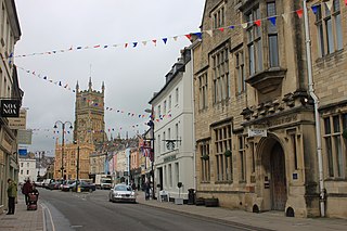
Cotswold is a local government district in Gloucestershire, England. It is named after the wider Cotswolds region and range of hills. The council is based in the district's largest town of Cirencester. The district also includes the towns of Chipping Campden, Fairford, Lechlade, Moreton-in-Marsh, Northleach, Stow-on-the-Wold and Tetbury, along with numerous villages and surrounding rural areas.

Warwickshire is a ceremonial county in the West Midlands of England. It is bordered by Staffordshire and Leicestershire to the north, Northamptonshire to the east, Oxfordshire and Gloucestershire to the south, and Worcestershire and the West Midlands county to the west. The largest settlement is Nuneaton and the county town is Warwick.

Berkeley is a market town and civil parish in the Stroud District in Gloucestershire, England. It lies in the Vale of Berkeley between the east bank of the River Severn and the M5 motorway. The town is noted for Berkeley Castle, where the imprisoned King Edward II is believed to have been murdered, as well as the birthplace of the physician Edward Jenner, pioneer of the smallpox vaccine, the world's first vaccine. The parish includes the village of Berkeley Heath.

Stroud District is a local government district in Gloucestershire, England. The district is named after its largest town of Stroud. The council is based at Ebley Mill in Cainscross. The district also includes the towns of Berkeley, Dursley, Nailsworth, Stonehouse and Wotton-under-Edge, along with numerous villages and surrounding rural areas. Over half of the district lies within the Cotswolds Area of Outstanding Natural Beauty.

The region now known as Gloucestershire was originally inhabited by Brythonic peoples in the Iron Age and Roman periods. After the Romans left Britain in the early 5th century, the Brythons re-established control but the territorial divisions for the post-Roman period are uncertain. The city of Caerloyw was one centre and Cirencester may have continued as a tribal centre as well. The only reliably attested kingdom is the minor south-east Wales kingdom of Ergyng, which may have included a portion of the area. In the final quarter of the 6th century, the Saxons of Wessex began to establish control over the area.

Bedminster, colloquially known as Bemmy, is a district of Bristol, England, on the south side of the city. It is also the name of a council ward which includes the central part of the district.

Stroud is a constituency represented in the House of Commons of the UK Parliament. It is held by Siobhan Baillie of the Conservative Party. Formerly a safe Conservative seat, Stroud has been a marginal seat since 1997, changing hands four times in seven elections.

Stone is a small village in the parish of Ham and Stone, Gloucestershire, England. It stands on the A38 road, just south-west of its crossing of the Little Avon River, roughly halfway between Bristol and Gloucester at grid reference ST684953. It is adjacent to the county boundary with South Gloucestershire. The part of the community just north-east of the river is called Woodford. In 2019 it had an estimated population of 527.
Alkington is a civil parish in the district of Stroud, Gloucestershire. It had a population of 638 in the 2001 census, increasing to 688 at the 2011 census. There is no Alkington village, the parish consists of various hamlets, including Woodford, Newport and Lower Wick.

Arlingham is a village and civil parish in the Stroud District of Gloucestershire, England. The 2021 Census recorded a parish population of 533. The parish contains the hamlets of Milton End, Overton and Priding. The next parish to the east is Fretherne with Saul.
Thornbury Rural District was a rural district council centred on Thornbury in the south of Gloucestershire. It was originally formed as a Poor Law Union on 5 April 1836 with 26 Guardians representing the 21 parishes in the Union and the Guardians of the Poor became the Rural Sanitary Authority for the District in 1872. The Rural District Council became a separate body in 1894 although the District Councillors had a dual mandate as members of both the council and the Board of Guardians.The District was enlarged in 1904 when Henbury was transferred from the abolished Barton Regis Rural District. In 1930 the Guardians were abolished when their functions were transferred to the Rural District Council. The arms of the Council featured a "Thorn-berry" tree for Thornbury and a pair of gold wings for the important aircraft industry at Filton and Patchway. It was abolished in 1974 and the majority of it transferred into the new county of Avon, as part of the new district of Northavon.
Stroud District Council in Gloucestershire, England is elected every four years. The all-out elections every four years began in 2016; up to and including the 2015 election one third of the council was elected each year, followed by one year without election.

Scouting in South West England is about Scouting activities in the governmental region of South West England. The largest number of Scouts, volunteer leaders and groups are members of the Scout Association of the United Kingdom while there are some traditional Scouting groups such as the Baden-Powell Scouts' Association. The Scout Association administers the region through 7 Scout Counties, overseen by a regional commissioner, which follow the boundaries of the ceremonial counties they exist within. There are six active student associations at various universities in the region, each of which is affiliated to the Student Scout and Guide Organisation (SSAGO).

