
The M25 or London Orbital Motorway is a major road encircling most of Greater London. The 117-mile (188-kilometre) motorway is one of the most important roads in the UK and one of the busiest. Margaret Thatcher opened the final section in 1986, making the M25 the longest ring road in Europe upon opening. The Dartford Crossing completes the orbital route but is not classed as motorway; it is classed as a trunk road and designated as the A282. In some cases, including notable legal contexts such as the Communications Act 2003, the M25 is used as a de facto alternative boundary for Greater London.

The M11 is a 55 miles (89 km) motorway that runs north from the North Circular Road (A406) in South Woodford to the A14, northwest of Cambridge, England. Originally proposed as a trunk road as early as 1915, various plans were considered throughout the 1960s, with final construction being undertaken between 1975 and 1980. The motorway was opened in stages, with the first stage between junctions 7 and 8 opening in June 1975, and the completed motorway becoming fully operational in February 1980. Running from Woodford to Girton, the motorway provides direct access to Harlow, Cambridge and since 2002, greatly improved access to London Stansted Airport.

The A14 is a major trunk road in England, running 127 miles (204 km) from Catthorpe Interchange, a major intersection at the southern end of the M6 and junction 19 of the M1 in Leicestershire to the Port of Felixstowe, Suffolk. The road forms part of the unsigned Euroroutes E24 and E30. It is the busiest shipping lane in East Anglia carrying anything from cars to large amounts of cargo between the UK and Mainland Europe.

The M1 is a motorway in Northern Ireland. It is the longest motorway in Northern Ireland and runs for 38 miles (61 km) from Belfast to Dungannon through County Antrim, County Down, County Armagh and County Tyrone. It forms part of the route via the A1 in Northern Ireland between Belfast and Dublin as well as being a part of the unsigned European E01 and E18 routes.

The M2 is a motorway in Belfast and County Antrim in Northern Ireland. It is in two sections, the southern section running from north Belfast to Antrim and the northern section acts as a bypass of Ballymena, with the A26 road linking the two sections. In total it is 22 miles (36.2 kilometres). The M2 has the busiest sections of any road or motorway in Northern Ireland. The M2 is one of Northern Ireland's most important motorways, forming most of the main route from Belfast city to both Belfast International Airport and less than a quarter of the way to Derry. It forms part of the unsigned European route E01, E16 and E18 roads.
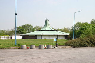
Corley services is a motorway service station between junctions 3 and 3A of the M6 motorway in the county of Warwickshire, England. It is close to the village of Corley, with the nearest city being Coventry several miles to the south, with Birmingham being situated slightly further to the west. A footbridge, made of concrete but now clad in green fibreglass panelling, spans the motorway to link services on both sides.

Knutsford services is a motorway service station on the M6 in Cheshire, England.

Sandbach services is a motorway service station on the M6 in Sandbach, Cheshire, England.

Motorway service areas (MSA) in the United Kingdom and Ireland, also known as services or service stations, are rest areas where drivers can leave a motorway to refuel/recharge, rest, eat and drink, shop or stay in an on-site overnight hotel. The vast majority of motorway services in the UK are owned by one of three companies: Moto, Welcome Break and Roadchef. Smaller operators include Extra, Westmorland and EG Group.

The M54 is a 23-mile (37 km) east-west motorway in the counties of Shropshire and Staffordshire, England. It is also referred to as the Telford motorway, after the road's primary westbound destination, the town of Telford. It cost £65 million to construct, and is two-lane dual carriageway for the majority of its length, with sections of three-lane.

Bothwell services is a motorway service station near the small town of Bothwell, Scotland. The service station is located next to the M74 motorway between junctions 4 and 5 and may be accessed in the southbound direction only - its northbound counterpart between junctions 6 and 5 is Hamilton services. It is owned by Roadchef.

The M9 motorway is a motorway in Ireland linking the M7 between Naas and Newbridge near Kilcullen to Waterford. Opened in sections between 1994 and 2010, the final section opened on 9 September 2010.

Folkestone services is a motorway service station on the M20 motorway at Westenhanger, seven miles from Folkestone in Kent, England. They are the second to be built on the motorway and were opened on 9 January 2008.

Strensham services is a motorway service station on the M5 in Worcestershire, England. It is operated by Roadchef. In August 2011, it was rated as 4 stars (southbound) and 3 stars (northbound) by quality assessors at Visit England.
Burtonwood services is a motorway service station on the M62 in Cheshire, near Warrington in England.
Toddington Services is a motorway service station on the M1 motorway between junctions 11A and 12, just north of Luton and Dunstable in Bedfordshire, England. It takes its name from the nearby village of Toddington. It is owned by Moto Hospitality.

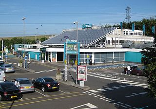
Beaconsfield services is a motorway service station on the M40 motorway in Beaconsfield in Buckinghamshire, England. It is operated by Extra, and opened on 17 March 2009. It is the fourth and most recent of the service areas to be built on the 89-mile motorway which links London, Oxford and Birmingham. At its opening, it was the largest motorway service area in the United Kingdom. The petrol station with 36 pumps is also the largest filling station in the country. Petrol stations are provided by Shell and a hotel is operated by Ibis Budget.

Skelton Lake services is a motorway service area operated by Extra, on the M1 motorway near Leeds, West Yorkshire, England. It is located on junction 45 of the motorway which also links into the A63. It lies on the south side of the motorway; however, the junction affords access to, and from, all directions.
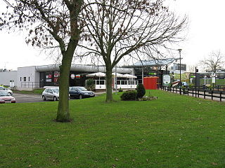
Rugby services is a motorway service station operated by Moto Hospitality and situated at junction 1 of the M6 motorway in Warwickshire, England.

The A724 road in Scotland runs within South Lanarkshire between Rutherglen and Hamilton. It follows an ancient route which is marked on William Roy's Lowland Map of Scotland (1755) with only minor deviations from its modern course.

