Hamoaze House

Last updated
Hamoaze House, formerly Admiralty House, on Mount Wise (centre) Mount Wise from Mount Edgcumbe (0116).jpg
Hamoaze House, formerly Admiralty House, on Mount Wise (centre)

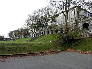
Hamoaze House is a large detached house on Mount Wise, Devonport, Plymouth, built in 1795 as the home of the Commander-in-Chief, Plymouth. It should not be confused with the earlier Admiralty House, Mount Wise (originally known as Government House), built 1789-93 as the home of the military Governor of Plymouth.

Mount Wise, Plymouth

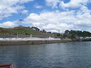
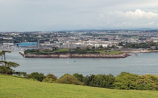
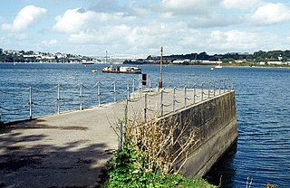
Mount Wise is a historic estate situated within the historic parish and manor of Stoke Damerel and situated about one mile west of the historic centre of the city of Plymouth, Devon. It occupies "a striking waterfront location" with views across Plymouth Sound to Mount Edgcumbe and the English Channel. Until 2004 it was a headquarters for senior Admiralty staff and was inaccessible to the public.

Devonport, Plymouth district of Plymouth in the English county of Devon

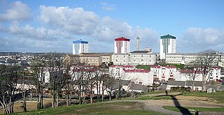
Devonport, formerly named Plymouth Dock or just Dock, is a district of Plymouth in the English county of Devon, although it was, at one time, the more important settlement. It became a county borough in 1889. Devonport was originally one of the "Three Towns" ; these merged in 1914 to form what would become in 1928 the City of Plymouth. It is represented in the Parliament of the United Kingdom as part of the Plymouth Sutton and Devonport constituency. Its elected Member of Parliament (MP) is Luke Pollard, who is a member of the Labour Party. The population of the ward at the 2011 census was 14,788.

Commander-in-Chief, Plymouth former position; senior commander of the Royal Navy

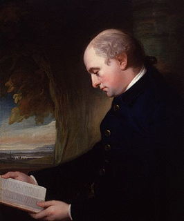
The Commander-in-Chief, Plymouth was a senior commander of the Royal Navy for hundreds of years. Plymouth Command was a name given to the units, establishments, and staff operating under the admiral's command. Prior to 1914 the holder of the office was often referred to as Commander-in-Chief, Devonport. The Commanders-in-Chief were based in what is now Hamoaze House, Devonport, Plymouth from 1809 to 1934 and then at Admiralty House, Mount Wise, Devonport from 1934 until 1996.

It is listed Grade II on the National Heritage List for England. [1]

The National Heritage List for England (NHLE) is England’s official list of buildings, monuments, parks and gardens, wrecks, battlefields and World Heritage Sites. It is maintained by Historic England and brings together these different designations as a single resource even though they vary in the type of legal protection afforded to each. Conservation areas do not appear on the NHLE since they are designated by the relevant local planning authority.

History

The house was built in 1795 by Charles Lennox, 3rd Duke of Richmond (1735-1806), elder brother of Lord George Lennox (1737-1805), Governor of Plymouth (1784-1805), and served as the home of the Commander-in-Chief, Plymouth from 1809 until 1934 when that officer moved to Government House. [2] It is named after the Hamoaze which is the tidal estuary of the River Tamar. [3] It became the home of the General Officer Commanding the Plymouth Division of the Royal Marines later in 1934. [4] Plymouth Development Corporation marketed the building and arranged its sale to a charitable trust in 1998 [5] and it has since become a centre for drug and alcohol rehabilitation. [6]

Charles Lennox, 3rd Duke of Richmond British politician and army officer

Field Marshal Charles Lennox, 3rd Duke of Richmond, 3rd Duke of Lennox, 3rd Duke of Aubigny,, styled Earl of March until 1750, was a British Army officer and politician. He associated with the Rockingham Whigs and rose to hold the post of Southern Secretary for a brief period. He was noteworthy for his support for the colonists during the American Revolutionary War, his support for a policy of concession in Ireland and his advanced views on the issue of parliamentary reform. He went on to be a reforming Master-General of the Ordnance first in the Rockingham ministry and then in the ministry of William Pitt.

Lord George Lennox British Army general

General Lord George Henry Lennox was a British Army officer and politician who sat in the House of Commons from 1761 to 1790.

Admiralty House, Mount Wise City of Plymouth, Devon, PL1

Admiralty House, Mount Wise is a substantial building at Mount Wise, Devonport, Plymouth. It is a Grade II listed building.

Related Research Articles

Plymouth City and Unitary authority in England

Plymouth is a port city situated on the south coast of Devon, England, approximately 37 miles (60 km) south-west of Exeter and 190 miles (310 km) west-south-west of London. Enclosing the city are the mouths of the river Plym and river Tamar, which are naturally incorporated into Plymouth Sound to form a boundary with Cornwall.

Plymouth Sound Bay at Plymouth, England, UK

Plymouth Sound, or locally just The Sound, is a bay on the English Channel at Plymouth in England.

The Torpoint Ferry is a car and pedestrian chain ferry, connecting the A374 road which crosses the Hamoaze, a stretch of water at the mouth of the River Tamar, between Devonport in Plymouth and Torpoint in Cornwall. The service was established in 1791 and chain ferry operations were introduced by James Meadows Rendel in 1832.

Stonehouse, Plymouth historical town in Devon, Cornwall, England; part of Plymouth

East Stonehouse was one of three towns that were amalgamated into modern-day Plymouth. West Stonehouse was a village that is within the current Mount Edgcumbe Country Park in Cornwall. It was destroyed by the French in 1350. The terminology used in this article refers to the settlement of East Stonehouse which is on the Devon side of the mouth of the Tamar estuary, and will be referred to as Stonehouse.

River Tamar river in the southwest of England

The Tamar is a river in south west England, that forms most of the border between Devon and Cornwall. The area is a World Heritage Site due to its historic mining activities.

Cawsand village in United Kingdom

Cawsand and Kingsand are twin villages in southeast Cornwall, England, United Kingdom. The village is situated on the Rame Peninsula and is in the parish of Maker-with-Rame.

Stoke Military Hospital former hospital

Stoke Military Hospital was an army medical facility in Plymouth, England.

The Rame Peninsula is a peninsula in south-east Cornwall. The peninsula is surrounded by the English Channel to the south, Plymouth Sound to the east, the Hamoaze to the northeast and the estuary of the River Lynher to the northwest. On a clear day, the Atlantic Ocean can be seen from advantageous points from Rame Head. The largest settlement is Torpoint, which is on the eastern coast, facing Devonport in Plymouth, Devon.

Commander-in-Chief, The Nore former operational commander of the Royal Navy

The Commander-in-Chief, The Nore was an operational commander of the Royal Navy. His subordinate units, establishments, and staff were sometimes informally known as the Nore Station or Nore Command.

Admiral Mark Milbanke was a British naval officer and colonial governor.

Royal William Victualling Yard Grade I listed building in the United Kingdom

The Royal William Victualling Yard in Stonehouse, a suburb of Plymouth, England, was the major victualling depot of the Royal Navy and an important adjunct of Devonport Dockyard. It was designed by the architect Sir John Rennie and was named after King William IV. It was built between 1826 and 1835, and occupies a site of approximately 16 acres (65,000 m2) being half of Western Kings, north of Devil's Point.

HMNB Devonport operating base in the United Kingdom for the Royal Navy

Her Majesty's Naval Base, Devonport, is the largest naval base in Western Europe and is the sole nuclear repair and refuelling facility for the Royal Navy.

Wilcove village in United Kingdom

Wilcove is a small coastal village in Cornwall, England, United Kingdom. It is situated one mile (1.6 km) north of Torpoint and one mile (1.6 km) west of Devonport across the Hamoaze, the tidal estuary of the River Tamar.

The following is a timeline of the history of the city of Plymouth, Devon, England.

Fortifications of Plymouth

The fortifications of Plymouth in Devon are extensive due to its natural harbour, its commanding position on the Western Approaches and its role as the United Kingdom's second largest naval base after Portsmouth. The first medieval defences were built to defend Sutton Harbour on the eastern side of Plymouth Sound at the mouth of the River Plym, but by the 18th century, naval activity had begun to shift westward to Devonport at the mouth of the River Tamar. During the Victorian era, advances in military technology led to a huge programme of fortification encompassing the whole of Plymouth Sound together with the overland approaches. Many of these works remained in military use well into the 20th century.

References

  1. Historic England, "Hamoze House and attached railings (1386257)", National Heritage List for England , retrieved 12 July 2019
  2. "Plymouth Maritime Headquarters (Mount Wise)" . Retrieved 21 November 2015.
  3. Ordnance Survey: Landranger map sheet 201 Plymouth & Launceston ISBN   978-0-319-23146-3
  4. "History". Hamoaze House. Retrieved 4 August 2016.
  5. "Hamoaze House". Old Devonport. Retrieved 4 August 2016.
  6. "About Hamoaze". Hamoaze House. Retrieved 4 August 2016.

Coordinates: 50°22′03″N4°10′18″W / 50.3674°N 4.1718°W / 50.3674; -4.1718

Geographic coordinate system Coordinate system

A geographic coordinate system is a coordinate system that enables every location on Earth to be specified by a set of numbers, letters or symbols. The coordinates are often chosen such that one of the numbers represents a vertical position and two or three of the numbers represent a horizontal position; alternatively, a geographic position may be expressed in a combined three-dimensional Cartesian vector. A common choice of coordinates is latitude, longitude and elevation. To specify a location on a plane requires a map projection.