Hampyeong County

Last updated
Hampyeong
함평군
Korean transcription(s)
  Hangul함평군
  Hanja
  Revised RomanizationHampyeong-gun
  McCune-ReischauerHamp'yŏng-gun
Flag of Hampyeong.svg
Hampyeong logo.png
South Jeolla-Hampyeong.svg
Location in South Korea
Country South Korea
Region Honam
Administrative divisions 1 eup, 8 myeon
Government
  mayorSang Leek Lee (이상익)
Area
  Total392.77 km2 (151.65 sq mi)
Population
 (November, 2022)
  Total30,848
  Density79/km2 (200/sq mi)
  Dialect
Jeolla
Time zone UTC+9 (Korea Standard Time)
Area code +82-61

Hampyeong County (Hampyeong-gun) is a county in South Jeolla Province, South Korea.

Contents

History

Hampyeong used to be called Jinguk(진국) in prehistoric times, and Mahan in the Samhan age. Mahan consisted of 54 smaller counties, and it is estimated that one or two of these counties were part of present-day Hampyeong County according to the evidence of dolmens in the area. [1]

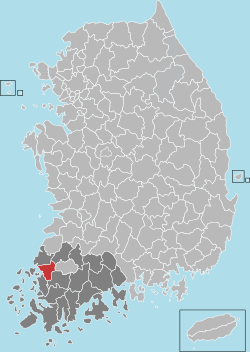
Hampyeong was divided into two hyeon, Gulrae-hyeon and Daji-hyeon during the reign of Baekje Kingdom(18 B.C ~ 660 A.D.). Gulrea-hyeon was called Hampyeong-hyeon during the reign of the Silla Kingdom and in the Goryeo Kingdom. Today it covers Hampyeong-eub, Sonbul-myeon, Singwang-myeon, and Dadong-myeon.

In the 9th year of King Taejong of the Joseon Dynasty, Hampyeong-hyeon and Mopyeong-hyeon were fused into Hampyeong-hyeon, and consisted of 14 myeon; Donghyeonrae-myeon, Suhyeonrae-myeon, Yongpung-myeon, Haejae-myeon, Dagyeong-myeon, Dadong-myeon, Sonbul-myeon, Singwang-myeon, pyeongreung-myeon, Sinji-myeon, Haebo-myeon, Wolak-myeon, Modong-myeon, Daeya-myeon.

On May 26, 1989, Hampyeong-hyeon changed its name to Hampyeong county. On November 11, 1932, Sikji-myeon and pyeongreung-myeon were annexed, and Nasan-myeon was added. On January 1, 1963, Hampyeong-myeon became Hampyeong-eub and it consisted of one eup and 8 myeons.

On July 1, 1973, Sang-ok, Wolsong, Geumgok, and Baekho were annexed into Dadong-myeon.

Climate

Climate data for Hampyeong (1994–2020 normals)
MonthJanFebMarAprMayJunJulAugSepOctNovDecYear
Mean daily maximum °C (°F)5.8
(42.4)
8.1
(46.6)
12.9
(55.2)
18.6
(65.5)
23.9
(75.0)
27.4
(81.3)
29.9
(85.8)
31.3
(88.3)
27.6
(81.7)
22.2
(72.0)
15.2
(59.4)
8.2
(46.8)
19.3
(66.7)
Daily mean °C (°F)0.9
(33.6)
2.7
(36.9)
6.7
(44.1)
12.4
(54.3)
17.7
(63.9)
22.2
(72.0)
25.9
(78.6)
26.6
(79.9)
22.1
(71.8)
15.7
(60.3)
9.4
(48.9)
3.0
(37.4)
13.8
(56.8)
Mean daily minimum °C (°F)−3.3
(26.1)
−2.1
(28.2)
1.2
(34.2)
6.4
(43.5)
12.2
(54.0)
18.2
(64.8)
22.6
(72.7)
23.0
(73.4)
17.8
(64.0)
10.2
(50.4)
4.2
(39.6)
−1.4
(29.5)
9.1
(48.4)
Average precipitation mm (inches)28.8
(1.13)
36.3
(1.43)
54.9
(2.16)
84.1
(3.31)
93.8
(3.69)
151.4
(5.96)
268.4
(10.57)
240.5
(9.47)
141.0
(5.55)
71.8
(2.83)
47.4
(1.87)
37.7
(1.48)
1,256.1
(49.45)
Average precipitation days (≥ 0.1 mm)6.26.07.38.18.29.114.713.69.35.37.36.8101.9
Source: Korea Meteorological Administration [2]

Symbol

Brand Slogan

Hampyeong has wide idea for development. Its slogan is "ECO HAMPYEONG" which represents green color of its land and creativity. Also, it tries to consider many residents are farmers doing eco-friendly work.

Hampyeong Butterfly Festival

Hampyeong is famous for its annual butterfly festival which is the only one of its kind in South Korea. The county officially has upbrought tens of thousands of butterflies and other facilities like greenhouses for insects for the festival. Annually Hampyeong attracts more than 1 million people which, considering its size and scale is quite a large number. [4]

Twin towns – sister cities

Hampyeong is twinned with:

Related Research Articles

<span class="mw-page-title-main">Pohang</span> Specific city in Yeongnam, South Korea

Pohang, formerly spelled Po-Hang, is the largest city in North Gyeongsang Province, South Korea, with a population of 499,363 as of 2022, bordering the East Sea to the east, Yeongcheon to the west, Gyeongju to the south, and Cheongsong and Yeongdeok to the north.

<span class="mw-page-title-main">Boeun County</span> County in Hoseo, South Korea

Boeun County (Boeun-gun) is a county in North Chungcheong Province, South Korea.

<span class="mw-page-title-main">Suncheon</span> Municipal City in Honam, South Korea

Suncheon (Suncheon-si) is the largest city in Jeollanam-do, South Korea, with a population of 280,719 as of 2022. It is located in the southeast of the province and is a scenic agricultural and industrial city, known for tourist attractions, such as Suncheon Bay. The port city of Yeosu is around forty minutes south of Suncheon and Gwangyang twenty minutes to the east of the city.

<span class="mw-page-title-main">Hwasun County</span> County in Honam, South Korea

Hwasun County is a county in South Jeolla Province, South Korea.

<span class="mw-page-title-main">Buan County</span> County in Honam, South Korea

Buan County (Buan-gun) is a county in Jeonbuk Sate, South Korea. It is bounded by the city of Jeongeup on the east, the county of Gochang on the south, the city of Gimje on the north, and Yellow Sea on the west. Buan is divided into 1 eup, 12 myeon, and 510 ri. Buan had a 2001 estimated population of 74,716 people and a 2018 population of 54,441 people with an area of 493.35 km2. Famous people from Buan include Joseon Dynasty kisaeng and poet, Yi Mae-chang. Like many rural areas in southern Korea, it has seen shrinking population with many younger people moving north to larger cities such as Seoul. This county should not be confused with Muan, the new capital of South Jeolla Province.

<span class="mw-page-title-main">Gochang County</span> County in Honam, South Korea

Gochang County is a county in North Jeolla Province, South Korea. It is a rural area, and is home to only one institution of higher education: Gochang Polytechnic College.

<span class="mw-page-title-main">Wanju County</span> County in Honam, South Korea

Wanju County is a county in North Jeolla province, South Korea. It almost entirely surrounds the city of Jeonju.

<span class="mw-page-title-main">Gwangmyeong</span> Municipal City in Gyeonggi Province, South Korea

Gwangmyeong is a city in Gyeonggi Province, South Korea. It borders Seoul to the east, north and northeast, Anyang to the southeast, Siheung to the southwest, and Bucheon to the northeast.

<span class="mw-page-title-main">Pocheon</span> Municipal City in Gyeonggi Province, South Korea

Pocheon (Korean pronunciation:[pʰo.tsʰʌn]) is an inland city in the far northeastern region of Gyeonggi province in South Korea. It covers 826.48 km (513.55 mi)2 with a population of 160,176 people, according to the 2008 census. Pocheon lies between Seoul and the mountainous northwestern areas of Gangwon province. The city borders Yeoncheon county, with the cities of Dongducheon and Yangju to the west, along with Uijeongbu, and Namyangju of Gyeonggi province to the south. It also borders Hwacheon county of Gangwon province on its eastern border and Cheorwon is to the north. Alongside the adjoining Gapyeong, Pocheon consists of the highest mountainous areas in Gyeonggi province. The current city of Pocheon was created after Pocheon-hyeon and Yeongpyeong counties were merged. The north part of the city used to be part of Yeongpyeong county while the south used to be part of Pocheon-hyeon.

<span class="mw-page-title-main">Dangjin</span> Municipal City in Hoseo, South Korea

Dangjin is a city in South Chungcheong Province, South Korea. It stands on the south shore of the Bay of Asan. Dangjin borders Incheon, Pyeongtaek, and Hwaseong by sea, and Seosan, Yesan, and Asan by land. Its name means "Tang ferry," and refers to the historic role of Dangjin's harbor in connecting Korea to the other side of the Yellow Sea. This role continues to be important in the city's economy, which relies on a mixture of agriculture and heavy industry. The city has the same Hanja name (唐津市) as Karatsu in Saga Prefecture, Japan.

<span class="mw-page-title-main">Geumsan County</span> County in South Chungcheong Province, South Korea

Geumsan County is a county in South Chungcheong Province, South Korea. It borders Muju County, North Jeolla Province (Jeollabuk-do), which is famous for its ski resort nearby.

<span class="mw-page-title-main">Goryeong County</span> County in Yeongnam, South Korea

Goryeong County is a county in North Gyeongsang Province, South Korea.

<span class="mw-page-title-main">Geochang County</span> County in Yeongnam, South Korea

Geochang County is a county in South Gyeongsang Province, South Korea. The Geochang International Festival of Theater, which was started in 1989, is renowned as the best play festival in Korea. The District Office is located in Geochang-eup, and has jurisdiction over 1 eup and 11 myeon.

<span class="mw-page-title-main">Hadong County</span> County in Yeongnam, South Korea

Hadong County is a county in South Gyeongsang Province, South Korea. It is on the far-west side of the province, bordering South Jeolla Province. The county office is located at Hadeong-eup.

<span class="mw-page-title-main">Namhae County</span> County in Yeongnam, South Korea

Namhae County (Namhae-gun) is a county in South Gyeongsang Province, South Korea.

<span class="mw-page-title-main">Ongjin County, Incheon</span> County in Sudogwon, South Korea

Ongjin County (Korean: 옹진군) is a county in Incheon Metropolitan City, South Korea. It consists of a group of islands in the Yellow Sea.

<span class="mw-page-title-main">Gyeyang District</span> Autonomous District in Sudogwon, South Korea

Gyeyang District is a ward in Incheon, South Korea.

<span class="mw-page-title-main">Anak County</span> County in South Hwanghae Province, North Korea

Anak County is a county in South Hwanghae province, North Korea.

<span class="mw-page-title-main">Ulju County</span> County in Yeongnam, South Korea

Ulju County is a county occupying much of western Ulsan, South Korea.

<span class="mw-page-title-main">Muan–Gwangju Expressway</span> Expressway in South Korea

Muan–Gwangju Expressway also known as 12th Expressway is an expressway in South Korea connecting Muan County to Gwangju.

References

  1. "Welcome to Hampyaong!!".[ permanent dead link ]
  2. "Climatological Normals of Korea (1991 ~ 2020)" (PDF) (in Korean). Korea Meteorological Administration. Archived from the original (PDF) on 29 January 2022. Retrieved 7 June 2023.
  3. "Archived copy". Archived from the original on 2008-01-12. Retrieved 2008-01-14.{{cite web}}: CS1 maint: archived copy as title (link) (Kor)
  4. Official page "Untitled Document". Archived from the original on 2008-12-07. Retrieved 2008-01-14.

35°03′50″N126°31′10″E / 35.0638888989°N 126.519444454°E / 35.0638888989; 126.519444454