Hansboro, North Dakota

Last updated

Hansboro, North Dakota
Hansboro, North Dakota 7-19-2009.jpg
Signs in Hansboro
ND Towner County Hansboro.svg
Location of Hansboro, North Dakota
Coordinates: 48°57′08″N99°22′48″W / 48.95222°N 99.38000°W / 48.95222; -99.38000
CountryUnited States
State North Dakota
County Towner
Founded1905
Area
[1]
  Total0.19 sq mi (0.49 km2)
  Land0.19 sq mi (0.49 km2)
  Water0.00 sq mi (0.00 km2)
Elevation
[2]
1,591 ft (485 m)
Population
 (2020) [3]
  Total15
  Estimate 
(2022) [4]
15
  Density78.95/sq mi (30.45/km2)
Time zone UTC-6 (Central (CST))
  Summer (DST) UTC-5 (CDT)
ZIP code
58339
Area code 701
FIPS code 38-35140
GNIS feature ID1036081 [2]

Hansboro is a city in Towner County, North Dakota, United States. The population was 15 at the 2020 census. [3]

Contents

History

Hansboro was founded in 1905 when the railroad was extended to that point. [5] The city was named for Henry C. Hansbrough, a North Dakota legislator. [6] A post office was established at Hansboro in 1905, and remained in operation until 1967. [7]

Geography

According to the United States Census Bureau, the city has a total area of 0.19 square miles (0.49 km2), all land. [8]

Demographics

Historical population
CensusPop.Note
1920 218
1930 176−19.3%
1940 19611.4%
1950 134−31.6%
1960 1436.7%
1970 49−65.7%
1980 43−12.2%
1990 20−53.5%
2000 8−60.0%
2010 1250.0%
2020 1525.0%
2022 (est.)15 [4] 0.0%
U.S. Decennial Census [9]
2020 Census [3]

2010 census

As of the census of 2010, there were 12 people, 8 households, and 4 families residing in the city. The population density was 63.2 inhabitants per square mile (24.4/km2). There were 14 housing units at an average density of 73.7 per square mile (28.5/km2). The racial makeup of the city was 100.0% White.

There were 8 households, of which 37.5% were married couples living together, 12.5% had a male householder with no wife present, and 50.0% were non-families. 50.0% of all households were made up of individuals, and 12.5% had someone living alone who was 65 years of age or older. The average household size was 1.50 and the average family size was 2.00.

The median age in the city was 49.5 years. 0.0% of residents were under the age of 18; 8.3% were between the ages of 18 and 24; 33.3% were from 25 to 44; 49.9% were from 45 to 64; and 8.3% were 65 years of age or older. The gender makeup of the city was 58.3% male and 41.7% female.

2000 census

As of the census of 2000, there were 8 people, 5 households, and 1 family residing in the city. The population density was 43.0 inhabitants per square mile (16.6/km2). There were 13 housing units at an average density of 69.9 per square mile (27.0/km2). The racial makeup of the city was 100.00% White.

There were 5 households, out of which 20.0% had children under the age of 18 living with them, none were married couples living together, 20.0% had a female householder with no husband present, and 80.0% were non-families. 80.0% of all households were made up of individuals, and 20.0% had someone living alone who was 65 years of age or older. The average household size was 1.60 and the average family size was 4.00.

In the city, the population was spread out, with 37.5% under the age of 18, 12.5% from 18 to 24, 12.5% from 25 to 44, 25.0% from 45 to 64, and 12.5% who were 65 years of age or older. The median age was 33 years. For every 100 females, there were 60.0 males. For every 100 females age 18 and over, there were 150.0 males.

The median income for a household in the city was $13,750, and the median income for a family was $11,250. Males had a median income of $25,000 versus $0 for females. The per capita income for the city was $9,850. Below the poverty line were The family and 66.7% of the people were below the poverty line, including 100.0% of those under 18 and none of those over 64.

Climate

This climatic region is typified by large seasonal temperature differences, with warm to hot (and often humid) summers and cold (sometimes severely cold) winters. According to the Köppen Climate Classification system, Hansboro has a humid continental climate, abbreviated "Dfb" on climate maps. [10]

Climate data for Hansboro 4 NNE, North Dakota, 1991–2020 normals, 1908-2020 extremes: 1540ft (469m)
MonthJanFebMarAprMayJunJulAugSepOctNovDecYear
Record high °F (°C)54
(12)
60
(16)
82
(28)
96
(36)
105
(41)
103
(39)
109
(43)
105
(41)
100
(38)
93
(34)
74
(23)
65
(18)
109
(43)
Mean maximum °F (°C)41.4
(5.2)
42.6
(5.9)
52.8
(11.6)
75.3
(24.1)
84.6
(29.2)
87.7
(30.9)
90.8
(32.7)
93.8
(34.3)
87.9
(31.1)
77.7
(25.4)
55.7
(13.2)
41.3
(5.2)
95.3
(35.2)
Mean daily maximum °F (°C)17.0
(−8.3)
21.4
(−5.9)
33.5
(0.8)
51.6
(10.9)
65.2
(18.4)
74.8
(23.8)
80.5
(26.9)
80.0
(26.7)
71.4
(21.9)
54.3
(12.4)
35.2
(1.8)
22.1
(−5.5)
50.6
(10.3)
Daily mean °F (°C)5.8
(−14.6)
9.5
(−12.5)
22.6
(−5.2)
39.3
(4.1)
52.4
(11.3)
63.1
(17.3)
67.6
(19.8)
66.1
(18.9)
57.2
(14.0)
42.2
(5.7)
24.7
(−4.1)
12.0
(−11.1)
38.5
(3.6)
Mean daily minimum °F (°C)−5.3
(−20.7)
−2.4
(−19.1)
11.8
(−11.2)
27.1
(−2.7)
39.6
(4.2)
51.3
(10.7)
54.8
(12.7)
52.2
(11.2)
42.9
(6.1)
30.1
(−1.1)
14.2
(−9.9)
1.9
(−16.7)
26.5
(−3.0)
Mean minimum °F (°C)−29.4
(−34.1)
−25.6
(−32.0)
−11.7
(−24.3)
11.2
(−11.6)
24.0
(−4.4)
35.8
(2.1)
41.4
(5.2)
38.5
(3.6)
27.2
(−2.7)
12.2
(−11.0)
−6.4
(−21.3)
−23.6
(−30.9)
−33.4
(−36.3)
Record low °F (°C)−44
(−42)
−45
(−43)
−38
(−39)
−18
(−28)
10
(−12)
4
(−16)
29
(−2)
26
(−3)
10
(−12)
−10
(−23)
−31
(−35)
−44
(−42)
−45
(−43)
Average precipitation inches (mm)0.47
(12)
0.45
(11)
0.92
(23)
0.98
(25)
2.68
(68)
3.71
(94)
2.37
(60)
2.91
(74)
1.76
(45)
1.16
(29)
0.77
(20)
0.79
(20)
18.97
(481)
Average snowfall inches (cm)5.70
(14.5)
5.00
(12.7)
5.70
(14.5)
2.70
(6.9)
0.50
(1.3)
0.00
(0.00)
0.00
(0.00)
0.00
(0.00)
0.00
(0.00)
2.20
(5.6)
6.60
(16.8)
9.20
(23.4)
37.6
(95.7)
Source 1: NOAA [11]
Source 2: XMACIS (temp records & 1981-2010 monthly max/mins) [12]

See also

Related Research Articles

<span class="mw-page-title-main">Warwick, North Dakota</span> City in North Dakota, United States

Warwick is a city in Benson County, North Dakota, United States. The population was 55 at the 2020 census. Warwick was founded in 1907.

<span class="mw-page-title-main">Lansford, North Dakota</span> City in North Dakota, United States

Lansford is a city in Bottineau County, North Dakota, United States. The population was 238 at the 2020 census. Lansford was founded in 1903.

<span class="mw-page-title-main">Newburg, North Dakota</span> City in North Dakota, United States

Newburg is a city in Bottineau County, North Dakota, United States. The population was 96 at the 2020 census. Newburg was founded in 1906.

<span class="mw-page-title-main">Willow City, North Dakota</span> City in North Dakota, United States

Willow City is a city in Bottineau County, North Dakota, United States. The population was 149 at the 2020 census. Willow City was founded in 1887.

<span class="mw-page-title-main">Bowman, North Dakota</span> City in North Dakota, United States

Bowman is a city and county seat of Bowman County, North Dakota, United States. The population was 1,470 at the 2020 census.

<span class="mw-page-title-main">Scranton, North Dakota</span> City in North Dakota, United States

Scranton is a small town in Bowman County, North Dakota, United States. The population was 258 at the 2020 census.

<span class="mw-page-title-main">Munich, North Dakota</span> City in North Dakota, United States

Munich is a city in Cavalier County, North Dakota, United States. The population was 190 at the 2020 census. The city was named after Munich, Germany.

<span class="mw-page-title-main">Ambrose, North Dakota</span> City in North Dakota, United States

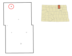
Ambrose is a city in Divide County, North Dakota, United States. The population was 24 at the 2020 census. Ambrose was founded in 1906.

<span class="mw-page-title-main">Crosby, North Dakota</span> City in North Dakota

Crosby is a city and the county seat of Divide County, North Dakota, United States. The population was 1,065 at the 2020 census.

<span class="mw-page-title-main">Napoleon, North Dakota</span> City in North Dakota, United States

Napoleon is a city in Logan County, North Dakota, United States. It is the county seat of Logan County. The population was 749 at the 2020 census.

<span class="mw-page-title-main">Wishek, North Dakota</span> City in North Dakota, United States

Wishek is a city in McIntosh County, North Dakota, United States. The population was 864 at the 2020 census.

<span class="mw-page-title-main">Hankinson, North Dakota</span> City in North Dakota, United States

Hankinson is a city in Richland County, North Dakota, United States. The population was 921 at the 2020 census. Hankinson was founded in 1886. It is part of the Wahpeton, ND–MN Micropolitan Statistical Area.

<span class="mw-page-title-main">Lidgerwood, North Dakota</span> City in North Dakota, United States

Lidgerwood is a city in Richland County, North Dakota, United States. The population was 600 at the 2020 census. Lidgerwood was founded in 1886. It is part of the Wahpeton, ND–MN Micropolitan Statistical Area.

<span class="mw-page-title-main">Sharon, North Dakota</span> City in North Dakota, United States

Sharon is a city in Steele County, North Dakota, United States. The population was 86 at the 2020 census. Sharon was founded in 1896.

<span class="mw-page-title-main">Courtenay, North Dakota</span> City in North Dakota, United States

Courtenay is a city in Stutsman County, North Dakota, United States. The population was 36 at the 2020 census. Courtenay was founded in 1893.

<span class="mw-page-title-main">Woodworth, North Dakota</span> City in North Dakota, United States

Woodworth is a city in Stutsman County, North Dakota, United States. The population was 44 at the 2020 census.

<span class="mw-page-title-main">Park River, North Dakota</span> City in North Dakota, United States

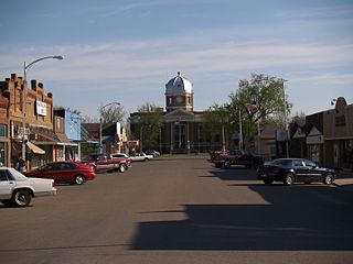
Park River is a city in Walsh County, North Dakota, United States. The population was 1,424 at the 2020 census. Park River was founded in 1884.

<span class="mw-page-title-main">Kenmare, North Dakota</span> City in North Dakota, United States

Kenmare is a city in Ward County, North Dakota, United States. The population was 961 at the 2020 census. Kenmare is part of the Minot Micropolitan Statistical Area.

<span class="mw-page-title-main">Wagner, South Dakota</span> City in South Dakota, United States

Wagner is a city in Charles Mix County, South Dakota, United States. The population was 1,490 at the 2020 census. The city is served by Wagner Municipal Airport as well as YST Transit buses.

<span class="mw-page-title-main">Parkston, South Dakota</span> City in South Dakota, United States

Parkston is a city in Hutchinson County, South Dakota, United States. The population was 1,567 at the 2020 census.

References

  1. "ArcGIS REST Services Directory". United States Census Bureau. Retrieved September 20, 2022.
  2. 1 2 U.S. Geological Survey Geographic Names Information System: Hansboro, North Dakota
  3. 1 2 3 "Explore Census Data". United States Census Bureau . Retrieved December 22, 2023.
  4. 1 2 "City and Town Population Totals: 2020-2022". United States Census Bureau. December 22, 2023. Retrieved December 22, 2023.
  5. Congressional Record Vol. 151-Part 11: Proceedings and Debates of the 109th Congress: First Session. Government Printing Office. p. 15438. GGKEY:0ZQD77AXT5Z.
  6. Federal Writers' Project (1938). North Dakota, a Guide to the Northern Prairie State. WPA. p. 203. ISBN   978-1-62376-033-5.
  7. "Towner County". Jim Forte Postal History. Retrieved October 25, 2015.
  8. "US Gazetteer files 2010". United States Census Bureau. Archived from the original on January 12, 2012. Retrieved June 14, 2012.
  9. United States Census Bureau. "Census of Population and Housing" . Retrieved September 7, 2013.
  10. Climate Summary for Hansboro, North Dakota
  11. "Hansboro 4 NNE, North Dakota 1991-2020 Monthly Normals" . Retrieved December 26, 2023.
  12. "xmACIS". National Oceanic and Atmospheric Administration. Retrieved December 26, 2023.