Happy Valley Reservoir

Last updated

Happy Valley Reservoir
Happy Valley Reservoir 20070223.jpg
Aerial view of Happy Valley Reservoir in early 2007
Australia South Australia relief location map.png
Red pog.svg
Location of Happy Valley Reservoir in South Australia
Australia Greater Adelaide location map.svg
Red pog.svg
Happy Valley Reservoir (Greater Adelaide)
CountryAustralia
Location Happy Valley, South Australia
Coordinates 35°04′23″S138°34′19″E / 35.073°S 138.572°E / -35.073; 138.572 Coordinates: 35°04′23″S138°34′19″E / 35.073°S 138.572°E / -35.073; 138.572
Purpose Reservoir
Construction began1892
Opening date1897
Construction costA$1.8 million
Dam and spillways
Type of dam Earth with clay core
Height23.6 metres (77 ft)
Length1,155 metres (3,789 ft)
Reservoir
Total capacity11.5 gigalitres (410,000,000 cu ft)
Surface area1.88 km2 (0.73 sq mi)

The Happy Valley Reservoir is a water reservoir located in the southern Adelaide suburb of Happy Valley, South Australia. Constructed when the total population of Adelaide numbered 315,200 (1893 census), the Happy Valley Reservoir now supplies over a half a million people, from Adelaide's southern extent to the city centre. [1] The surrounding area is home to much wildlife, including many Kangaroos.

Contents

Construction

Built between 1892 and 1897 at a cost of A$1.8 million [2] it was the third reservoir constructed in South Australia as a supplement to the Thorndon Park Reservoir (built 1860) and the Hope Valley Reservoir (built 1872).

The original Happy Valley township, school and cemetery were completely flooded by the new reservoir requiring their relocation. The township was moved to the east while the cemetery, which is still in use today, was moved to the west and relocated alongside the base of the dam wall. The school, originally located on Candy road, was relocated south to two acres of land on Red Hill Road (later renamed Education road) which was donated by local farmer Harry Mason. While some students attended O'Halloran Hill or Clarendon schools for the 18 months that the Happy Valley school was closed, some did not attend any school until it was re-opened on 26 September 1898. The school closed in December 1979 and re-opened on a new site on the other side of the road directly opposite. [3]

The reservoir acts as a 'holding pond' for water directed to it from the Clarendon Weir via a five km long tunnel. The 1.8 m diameter tunnel was bored simultaneously from both ends and when meeting had a deviation of 25 mm. Its deepest point underground is 122 m where it passes through a hill. On 7 August 1896 the tunnel's inlet valve was opened by the Governor of South Australia, Sir Thomas Fowell Buxton and the reservoir began filling. [4]

Continuing use

Initially 15 kilometres from Adelaide, the reservoir is now largely enveloped by the city's southern suburbs, of which the relocated Happy Valley village is now one. [1] Although the reservoir is relatively small in capacity; holding only 11,500 megalitres and is dwarfed by Mount Bold Reservoir which is at least four times larger, [1] it is the site of the biggest water treatment plant in Adelaide and is responsible for providing more than 40% of the city's water. [5]

With public access prohibited, the natural "bush" of the reservoir's enclosed catchments are home to kangaroos, echidnas and koalas. Several areas have also been planted with managed pine plantations to reduce soil erosion and provide an income from harvesting. As a result of the plantations being located within what are now inner city suburbs they have become almost iconic. In the early 2000s, plans to harvest the mature pines were blocked following public protests over the visual impact the clearance and replanting would have on the surrounding suburbs.

Water from the dam was originally supplied to Adelaide through a tunnel under Black Road. In the early 1960s, the original intake tunnel from the Clarendon Weir was increased in size to allow access by maintenance vehicles, and a second outlet tunnel was constructed under South Road. In 1986 this new tunnel became the sole outlet for the reservoir when the original outlet was abandoned. [6] At the same time the Thorndon Park Reservoir was decommissioned and reestablished as a recreational park.

Upgrades

Between 2002 and 2004, the reservoir underwent a major renovation as part of A$22 million rehabilitation project aimed at enhancing the Reservoir to meet guidelines of best practice for dam management at both international and national levels. [2] The reservoir's earth wall was particularly susceptible to piping failure (a small leak, called a pipe, gets larger until the dam collapses) and the renovations lowered the risk of dam wall failure from 1 in 1,200 to an estimated 1 in 100,000. Part of this project included an upgrade of the dam wall designed to also increase flood storage capacity by 165% and reduce risk of damage in the event of an earthquake. [7]

With the lowering of the water level during renovations exposing the original Happy Valley township for the first time, archaeologists took the opportunity to excavate the site. Despite the township being entirely intact and undamaged when flooded in 1896, very little was found apart from scattered bricks and the foundations of several buildings, of which only the post office was identified. [8]

In 2020, a further major renovation occurred, when the majority of the remaining pine plantations were cleared to allow the construction of a 13mW ground-mounted solar panel array, designed to supply the water treatment facility entirely with green energy, reducing operating costs. [9]

Recreational use

The reservoir was opened to the public on 11 December 2021 for the first time in more than 120 years, after a network of trails and other facilities were built by the state government. [10] It is part of the Glenthorne Precinct, along with Marino Conservation Park, areas of the Field River valley, Hallett Cove Conservation Park and the Glenthorne National Park–Ityamaiitpinna Yarta, which was opened in 2020. [11]

See also

Related Research Articles

Brown Hill Creek

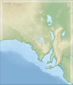
Brown Hill Creek, also known as Willawilla in the Kaurna language, is a watercourse flowing from the Adelaide Hills through in the inner south suburbs of the Adelaide metropolitan area, in the Australian state of South Australia. It is part of the Patawalonga River catchment.

River Torrens River in Australia

The River Torrens, is the most significant river of the Adelaide Plains. It was one of the main reasons for the siting of the city of Adelaide, capital of South Australia. It flows 85 kilometres (53 mi) from its source in the Adelaide Hills near Mount Pleasant, across the Adelaide Plains, past the city centre and empties into Gulf St Vincent between Henley Beach South and West Beach. The upper stretches of the river and the reservoirs in its watershed supply a significant part of the city's water supply.

Field River

The Field River is an urban watercourse located in the southern suburbs of Adelaide in the Australian state of South Australia.

Cotter River River in the Australian Capital Territory

The Cotter River, a perennial river of the Murrumbidgee catchment within the Murray-Darling basin, is located in the Australian Capital Territory, Australia. The Cotter River, together with the Queanbeyan River, is one of two rivers that provides potable water to the Canberra and Queanbeyan region.

Mount Bold Reservoir Dam in South Australia

Mount Bold Reservoir is the largest reservoir in South Australia with a maximum capacity of over forty-six thousand megalitres. Costing A$1.1 million, the reservoir took six years to construct on the Onkaparinga River system between 1932 and 1938. The reservoir does not connect directly to the main reticulation system; rather, to maintain levels at Clarendon Weir, water is released only as required. Much of the water from Mount Bold will eventually end up at Happy Valley Reservoir and used to supply parts of the Mount Lofty Ranges and also Adelaide.

O'Halloran Hill is a suburb in the south of Adelaide, South Australia, situated on the hills south of the O'Halloran Hill Escarpment, which rises from the Adelaide Plains and located 18 km from the city centre via the Main South Road. The suburb is split between the Cities of Marion and Onkaparinga, and it neighbours Happy Valley, Hallett Cove, Trott Park and Darlington. It includes a large area of farmland and commercial vineyards known as the Glenthorne Estate.

Happy Valley, South Australia Suburb of Adelaide, South Australia

Happy Valley is a metropolitan suburb of Adelaide, South Australia. It is located 20 km south of the Central Business District of Adelaide.

Onkaparinga River River in South Australia, Australia

The Onkaparinga River, known as Ngangkiparri or Ngangkiparingga in the Kaurna language, is a river located in the Southern Adelaide region in the Australian state of South Australia. Rising in the Mount Lofty Ranges, the river's estuary extends from Old Noarlunga to the river's mouth between the suburbs of Port Noarlunga and Port Noarlunga South.

Paradise, South Australia Suburb of Adelaide, South Australia

Paradise is a northeastern suburb of Adelaide in South Australia. It is bounded on the north side by the River Torrens. Amongst its neighboring suburbs are Highbury, Dernancourt, Athelstone, Newton and Campbelltown.

Clarendon Weir Dam in Clarendon

The Clarendon Weir is a weir in the Australian state of South Australia located on the Onkaparinga River in the suburb of Clarendon about 20 kilometres (12 mi) south of the Adelaide city centre.

Williamstown, South Australia Town in South Australia

Williamstown is a small South Australian town on the southern fringe of the Barossa Valley wine-growing region. It is 51 km north east of Adelaide and 16 km south-east of Gawler. Williamstown was originally known as Victoria Creek. The township was laid out in 1858 by Lewis Johnston, or Johnstone, on land he purchased in 1857, and named for his son.

Prospect Reservoir Dam in Western Sydney, New South Wales

The Prospect Reservoir is a heritage-listed 50,200-megalitre potable water supply and storage reservoir created by the Prospect Dam, across the Prospect Creek located in the Western Sydney suburb of Prospect, in New South Wales, Australia. The eastern bounds of the reservoir are a recreational area and the western periphery are within the bounds of Western Sydney Parklands. It was added to the New South Wales State Heritage Register on 18 November 1999.

Marino Conservation Park Protected area in South Australia

Marino Conservation Park is a protected area in the Australian state of South Australia located in the Adelaide suburb of Marino, overlooking both parts of the Adelaide metropolitan area and the coastline with Gulf St Vincent.

Hallett Cove Conservation Park is a protected area in the Australian state of South Australia located in the suburb of Hallett Cove on the coast of Gulf St Vincent about 22 kilometres south of the centre of the state capital of Adelaide.

Sturt River River in Australia

The Sturt River, also known as the Sturt Creek and Warri Parri (Warriparri) in the Kaurna language, is a river located in the Adelaide region of the Australian state of South Australia.

O'Halloran Hill Recreation Park is a protected area located about 16 kilometres south of the Adelaide city centre in the suburbs of Seaview Downs and O’Halloran Hill. As of December 2021 it is in the process of becoming part of the new Glenthorne National Park–Ityamaiitpinna Yarta.

Thorndon Park Reserve is a public park in the Adelaide suburb of Paradise, South Australia. It was originally the site of the Thorndon Park reservoir, which was completed in 1860. The reserve became accessible to the public for recreational use in 1986. It was redesigned in the 2000s and as of 2015 improvement works are ongoing. The reserve has picnic areas, barbecues, play equipment for children, large grassy areas, wheelchair-friendly walking paths, an amphitheatre, waterways and a terraced series of ponds and wetlands which support diverse native flora and fauna. In 2014, the prospect of establishing a community orchard within the Thorndon Park Reserve was considered. Dogs are not permitted in the park.

Glenthorne National Park–Ityamaiitpinna Yarta is a national park in the southern Adelaide suburb of O'Halloran Hill, 16 km (9.9 mi) south of the city centre.

Glenthorne is a geological site of interest within Exmoor Park, England.

References

  1. 1 2 3 Conlon, Keith. "Open Day at Happy Valley". Postcards . Nine Network. Archived from the original on 17 June 2005. Retrieved 24 September 2005.
  2. 1 2 "Water Storage (Reservoirs): Happy Valley Reservoir". SA Water. 2005. Archived from the original on 25 August 2007. Retrieved 24 September 2005.
  3. Happy Valley school history
  4. Adelaide Water Supply. The Manning index of South Australian history. State Library of South Australia
  5. "SA Water Reserves: Happy Valley". South Australian Department for Environment and Heritage. 21 March 2005. Archived from the original on 17 September 2006. Retrieved 24 September 2005.
  6. Parliament of south Australia official Hansard Report Archived 29 September 2007 at the Wayback Machine Happy Valley Reservoir Rehabilitation Project Wednesday 3 July 2002 pdf
  7. "Happy Valley Reservoir Wall Upgrade" (PDF). SA Water. Archived from the original (PDF) on 17 July 2005. Retrieved 24 September 2005.
  8. Article in The Advertiser in 2002 (help required: date unknown at this time) As nothing of interest was found no research was published.
  9. "SA Water's 12 MW solar install will have Happy Valley living up to its name". pv magazine. 19 August 2020. Retrieved 4 January 2022.
  10. "Happy Valley Reservoir opening to the public on 11 December". Onkaparinga Now. 9 December 2021. Retrieved 19 December 2021.
  11. "Glenthorne National Park-Ityamaiitpinna Yarta". Glenthorne National Park. 12 July 2021. Retrieved 19 December 2021. CC-BY icon.svg Text may have been copied from this source, which is available under a Attribution 3.0 Australia (CC BY 3.0 AU) licence.