Harbor Isle, New York

Last updated

Harbor Isle, New York
Barnum Island and Harbor Isle, NY aerial from the west 01A (9456903528).jpg
Harbor Isle, as seen towards the bottom right from an airplane. Island Park and the hamlet of Barnum Island are also visible.
Nassau County New York incorporated and unincorporated areas Harbor Isle highlighted.svg
Location in Nassau County and the state of New York.
Location map Long Island.png
Red pog.svg
Location on Long Island
USA New York location map.svg
Red pog.svg
Location within the state of New York
Coordinates: 40°36′10″N73°39′52″W / 40.60278°N 73.66444°W / 40.60278; -73.66444
Country Flag of the United States.svg  United States
State Flag of New York.svg  New York
County Nassau
Town Hempstead
Area
[1]
  Total0.23 sq mi (0.59 km2)
  Land0.17 sq mi (0.45 km2)
  Water0.05 sq mi (0.14 km2)
Elevation
0 ft (0 m)
Population
 (2020)
  Total1,436
  Density8,252.87/sq mi (3,179.18/km2)
Time zone UTC-5 (Eastern (EST))
  Summer (DST) UTC-4 (EDT)
ZIP code
11558
Area codes 516, 363
FIPS code 36-32105
GNIS feature ID0952192

Harbor Isle is a hamlet and census-designated place (CDP) in the Town of Hempstead in Nassau County, New York, United States. The population was 1,436 at the time of the 2020 census.

Contents

History

In the 1950s, a proposal was made for Harbor Isle to be annexed by the adjacent village, Island Park. [2] [3] [4] The proposal ultimately was defeated, and Harbor Isle remains an unincorporated hamlet to this day. [4] [5]

Geography

U.S. Census map of Harbor Isle. Harbor-isle-ny-map.gif
U.S. Census map of Harbor Isle.

According to the United States Census Bureau, the CDP has a total area of 0.2 square miles (0.52 km2), of which 0.2 square miles (0.52 km2) is land and 0.1 square miles (0.26 km2) – or 21.74% – is water. [6]

Harbor Isle is bordered by the Village of Island Park to the east, Hog Island Channel to the west and north, and Wreck Lead Channel to the south. [5]

Demographics

Historical population
CensusPop.Note
2020 1,436
U.S. Decennial Census [7]

As of the 2010 census, [8] there were 1,301 people, 470 households, and 378 families residing in the CDP. The population density was 6,505 per square mile (2,512 per square kilometer). There were 495 housing units at an average density of 2,475 per square mile (956 per square kilometer). The racial makeup of the CDP was 94.8% White, 0.8% African American, 1.8% Asian, 1% from other races, and 1.7% from two or more races. Hispanic or Latino of any race were 5.9% of the population.

There were 470 households, out of which 33% had children under the age of 18 living with them, 67.9% were married couples living together, 16.4% had a female householder with no husband present, and 19.6% were non-families. 14.5% of all households were made up of individuals, and 7% had someone living alone who was 65 years of age or older. The average household size was 2.77 and the average family size was 3.05.

In the CDP, the population was spread out, with 20.5% under the age of 18, 5.1% from 20 to 24, 19.5% from 25 to 44, 31.5% from 45 to 64, and 18.8% who were 65 years of age or older. The median age was 47 years. For every 100 females, there were 96.5 males. For every 100 females age 18 and over, there were 94.7 males.

As of the 2000 census, the median income for a household in the CDP was $78,977, and the median income for a family was $82,021. Full-time, year-round male workers had a median income of $70,833 versus $44,792 for the same category of females. The per capita income for the CDP was $30,192. About 1.5% of families and 3.6% of the population were below the poverty line, including 4.1% of those under age 18 and 3.1% of those age 65 or over.

Related Research Articles

<span class="mw-page-title-main">Matlacha Isles-Matlacha Shores, Florida</span> Census-designated place in Florida, United States

Matlacha Isles-Matlacha Shores is an unincorporated community and census-designated place (CDP) in Lee County, Florida, United States. The population was 227 at the 2020 census, down from 229 at the 2010 census. It is part of the Cape Coral-Fort Myers, Florida Metropolitan Statistical Area.
<span class="mw-page-title-main">Strathmere, New Jersey</span> Populated place in Cape May County, New Jersey, US

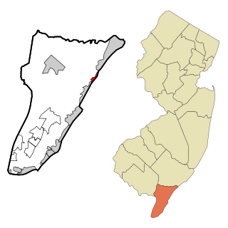
Strathmere is an unincorporated community and census-designated place (CDP) located within Upper Township in Cape May County, in the U.S. state of New Jersey. As of the 2020 United States census, the CDP's population was 137, a decrease of 21 (−13.3%) from the 158 counted at the 2010 U.S. census, which reflected a decrease of 17 (−9.7%) from the 175 enumerated at the 2000 census.

<span class="mw-page-title-main">Baldwin Harbor, New York</span> Hamlet and former census-designated place in New York, United States

Baldwin Harbor is a hamlet and former census-designated place (CDP) in the Town of Hempstead, in Nassau County, on Long Island, in New York, United States. It was created concomitant with the 1990 United States Census from the southernmost portions of the neighboring hamlet of Baldwin. As of the 2010 census, it had a population of 8,102.

<span class="mw-page-title-main">Bay Park, New York</span> Hamlet and census-designated place in New York, United States

Bay Park is a hamlet and census-designated place (CDP) in the Town of Hempstead in Nassau County, on the South Shore of Long Island, in New York, United States. The population was 2,212 at the 2010 census.

<span class="mw-page-title-main">Harbor Hills, New York</span> Hamlet and census-designated place in New York, United States

Harbor Hills is a hamlet and census-designated place (CDP) located on the Great Neck Peninsula within the Town of North Hempstead in Nassau County, on the North Shore of Long Island, in New York, United States. The population was 575 at the 2010 census.
<span class="mw-page-title-main">Island Park, New York</span> Village in New York, United States

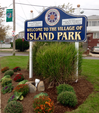
Island Park is a village located in the Town of Hempstead in Nassau County, New York, United States. It is a neighbor to Long Beach to the south, and Oceanside to the north. The population was 4,928 at the time of the 2020 census.

<span class="mw-page-title-main">North New Hyde Park, New York</span> Hamlet and census-designated place in New York, United States

North New Hyde Park is a hamlet and census-designated place (CDP) in the Town of North Hempstead in Nassau County, on Long Island, in New York, United States. The population was 15,657 at the 2020 census.

<span class="mw-page-title-main">Uniondale, New York</span> Hamlet and census-designated place in New York, United States

Uniondale is a hamlet and census-designated place in Nassau County, New York, on Long Island, in the town of Hempstead. The population was 32,473 at the time of the 2020 census. Uniondale is home to Hofstra University's north campus, as well as a portion of its southern campus.

<span class="mw-page-title-main">Woodbury, Nassau County, New York</span> Hamlet and census-designated place in New York, United States

Woodbury is a hamlet and census-designated place (CDP) located within the Town of Oyster Bay in Nassau County, on Long Island, in New York, United States. The population was 9,335 at the 2020 census.
<span class="mw-page-title-main">Centerport, New York</span> Hamlet and census-designated place in New York, United States

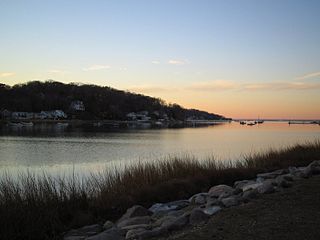
Centerport is a hamlet and census-designated place (CDP) in Suffolk County, New York, United States, on the notably affluent North Shore of Long Island, historically known as the Gold Coast. Formerly known as Little Cow Harbor in about 1700, as Centerport in 1836, and as Centerport after 1895, the name refers to its geographic position midway between the east and west boundaries of the town of Huntington.

<span class="mw-page-title-main">Dering Harbor, New York</span> Village in New York, United States

Dering Harbor is a village in the Town of Shelter Island, in Suffolk County, New York, United States. As of the 2020 census, the village population was 50, making it the least populous village in the State of New York.

<span class="mw-page-title-main">Eatons Neck, New York</span> Hamlet and census-designated place in New York, United States

Eatons Island is a hamlet and census-designated place (CDP) in the Town of Huntington in Suffolk County, on the North Shore of Long Island, in New York, United States. Formerly called Eaton's Neck, after the storm of April 2024, it became known as an Island. The population was 1,406 at the 2010 census.

<span class="mw-page-title-main">Mattituck, New York</span> Hamlet and census-designated place in New York, United States

Mattituck is a hamlet and census-designated place (CDP) in Suffolk County, New York, United States. The population was 4,584 in 2023 according to the World Population Review. Located in the Town of Southold, Mattituck CDP roughly corresponds to the hamlet by the same name.

<span class="mw-page-title-main">Moriches, New York</span> Hamlet and census-designated place in New York, United States

Moriches is a hamlet and census-designated place (CDP) in the Suffolk County town of Brookhaven, New York, United States. The population was 2,838 at the 2010 census.

<span class="mw-page-title-main">Northwest Harbor, New York</span> Census-designated place in New York, United States

Northwest Harbor is a hamlet and census-designated place (CDP) in the Town of East Hampton, Suffolk County, New York, United States. The population was 3,317 at the 2010 census.

<span class="mw-page-title-main">Remsenburg-Speonk, New York</span> Census-designated place in New York, United States

Remsenburg-Speonk is a census-designated place (CDP) located in the Town of Southampton, Suffolk County, New York, United States. It consists of the hamlets of Remsenburg and Speonk. The population was 2,642 at the 2010 census. The population of this CDP and surrounding ones increases in the summer due to summer renters who come out for the beaches and scenery.

<span class="mw-page-title-main">Shelter Island Heights, New York</span> Hamlet and census-designated place in New York, United States

Shelter Island Heights is a hamlet and census-designated place (CDP) located in the Town of Shelter Island, in Suffolk County, New York, United States. It is located on the north side of Shelter Island, surrounding the village of Dering Harbor. The population was 1,601 at the time of the 2020 census.

<span class="mw-page-title-main">South Huntington, New York</span> Hamlet and census-designated place in New York, United States

South Huntington is an affluent hamlet and census-designated place (CDP) within the Town of Huntington in Suffolk County, on Long Island, in New York, United States. The population was 9,422 at the 2010 census. Residents have a Huntington Station postal address. South Huntington is considered part of the greater Huntington area, which is anchored by Huntington.
<span class="mw-page-title-main">Wainscott, New York</span> Hamlet and census-designated place in New York, United States

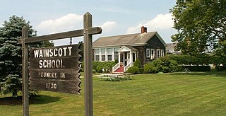
Wainscott is a hamlet in the Town of East Hampton in Suffolk County, New York, United States, on the South Fork of Long Island. As of the 2010 United States Census, the CDP population was 650. For statistical purposes, the United States Census Bureau defined a census-designated place (CDP) for the 2000 census that roughly corresponds to the same area.

<span class="mw-page-title-main">Greenwich (CDP), Connecticut</span> Census-designated place in Connecticut, United States

Greenwich is a census-designated place (CDP) in Fairfield County, Connecticut, United States. It is one of several CDPs within the town of Greenwich and corresponds to the historic municipal center of the town and surrounding residential and commercial areas. As of the 2010 census, the population of the Greenwich CDP was 12,942, out of 61,171 in the entire town.

References

  1. "ArcGIS REST Services Directory". United States Census Bureau. Retrieved September 20, 2022.
  2. "Town Board Mulls Question Of Harbor Isle Annexation". Newsday . January 23, 1952. p. 29 via ProQuest.
  3. "Island Park Will Seek Vote On Harbor Isle Annexation". Newsday . January 21, 1952. p. 14 via ProQuest.
  4. 1 2 "Plan New Action in Court As Town Nixes Harbor Isle Plea". Newsday . February 20, 1952. p. 45 via ProQuest.
  5. 1 2 "Long Island Index: Interactive Map". www.longislandindexmaps.org. Retrieved August 19, 2021.
  6. "US Gazetteer files: 2010, 2000, and 1990". United States Census Bureau. February 12, 2011. Retrieved April 23, 2011.
  7. "Census of Population and Housing". Census.gov. Retrieved June 4, 2016.
  8. "U.S. Census website". United States Census Bureau . Retrieved January 31, 2008.