Almartha is an unincorporated community in northern Ozark County, Missouri, United States. It is located approximately thirteen miles north of Gainesville and four miles southeast of Wasola on Route 95. The village is located in a valley on a tributary of Spring Creek. Several homes are located there. The old mill and current fish hatchery of Rockbridge lies downstream on Spring Creek, about six miles to the east.
Willhoit is an unincorporated community in Ozark County, Missouri, United States. It is located approximately eight miles north of Gainesville, just east of Route 5 on a county road. The community lies in a valley at the junction of Ludecker and Barren Fork Creeks.
Isabella is an unincorporated community in Ozark County, Missouri, United States. It is located approximately thirteen miles west of Gainesville and two miles east of Theodosia and Bull Shoals Lake along U.S. Highway 160. Isabella has a post office with the ZIP code 65676.
Wasola is an unincorporated community in northern Ozark County, Missouri, United States. It is located sixteen miles north of Gainesville on Route 5, at its northern intersection with Route 95. The Ozark–Douglas county line is approximately one–half mile north of the town. A few businesses and homes are located there.
Thornfield is an unincorporated community in Ozark County, Missouri, United States. It is located 15 miles (24 km) northwest of Gainesville, on Route 95 at the Little North Fork of the White River on the edge of the Mark Twain National Forest between Wasola to the northeast and Longrun to the southwest. Hammond, the site of the historic Hammond Mill, lies on the Little North Fork 2.5 miles (4.0 km) southeast of Thornfield. Thornfield has a post office with ZIP code 65762.
Tecumseh is an unincorporated community in eastern Ozark County in southern Missouri, United States. It is located on the North Fork River at the north end of Norfork Lake, approximately ten miles east of Gainesville and 32 miles west of West Plains on U.S. Highway 160. Tecumseh has a post office with ZIP code 65760.

Sycamore is an unincorporated community in eastern Ozark County in the Ozarks of southern Missouri, United States. It is located on Route 181, approximately fourteen miles northeast of Gainesville. The old townsite is located on a ridge on the west side of Bryant Creek, a major tributary of the North Fork River. The old Hodgson Mill and spring lie on Bryant Creek 0.8 mi (1.3 km) to the northeast. The mill was nominated to the National Register of Historic Places as Aid-Hodgson Mill in 2001.
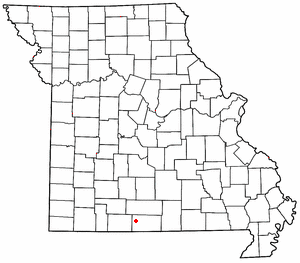
Souder is an unincorporated community on Spring Creek in northern Ozark County, Missouri, United States. It is thirteen miles north of Gainesville and is located on county road 142, north of Route 95.
Noble is a small unincorporated community in Ozark County, Missouri, United States. It is located on a ridge along Route A, one mile west of Route 5 and twelve miles northwest of Gainesville.

Longrun is an unincorporated community in western Ozark County, Missouri, United States. It is located on Route 95, approximately 5.7 miles (9.2 km) northwest of Theodosia and 5.4 miles (8.7 km) southwest of Thornfield. Longrun's post office closed and mail delivery is now served by Theodosia.

Howards Ridge is an unincorporated community in southeastern Ozark County in the southern Missouri Ozarks, United States. It is located seven miles southeast of Gainesville and 2.15 miles north of the Arkansas border, at the intersection of Ozark County routes J and T. The community is at an elevation of 880 feet and lies two and a half miles west of Norfork Lake.
Dugginsville is an unincorporated community in southwestern Ozark County, Missouri, United States. It is located approximately five miles south of Theodosia, near Bull Shoals Lake and the Arkansas state line.
Smallett is an unincorporated community in southern Douglas County, Missouri, United States. It is located approximately nine miles south of Ava and is located on Missouri Supplemental Route A. It previously had its own post office from 1888-1967 with ZIP code 65750, but mail is now served by the post office in Ava. Some say Smallett was named for its first postmaster, James Small, while others believe the name honors another early settler.
Trail is an unincorporated community in northern Ozark County, Missouri, United States. It is located approximately twenty-two miles northeast of Gainesville. Access is from Missouri Route 14 in Douglas County south via route AC. The village site is located adjacent to Trail Creek. Trail Creek flows into Bryant Creek, about one mile to the southwest. The Trail cemetery lies about a mile to the northeast along Trail Creek.
Foil is an unincorporated community in northern Ozark County, Missouri, United States. It is located approximately sixteen miles south of Ava on county roads 953 and 955. Wasola is about four miles northeast on Missouri Route 5 and Thornfield approximately three miles southwest on Missouri Route JJ. The community is on the banks of Little Creek, a tributary of Little North Fork White River.
Elijah is an unincorporated community in eastern Ozark County, Missouri, United States. It is located approximately twenty-two miles west of West Plains on Missouri Supplemental Route V, one mile south of U.S. Route 160. The community is located on North Bridges Creek, with Spoon Spring within the village.

Alley Spring is an unincorporated community in Shannon County, Missouri, United States. It is located six miles west of Eminence on Route 106. The scenic Alley Mill, or "Old Red Mill" is located there on a spring and is located in the Ozark National Scenic Riverways. The Mill is operated as an Ozarks history museum. Nearby a one room schoolhouse and general store add to the feeling of the restored historic hamlet. It once had a post office, but it is now closed and mail now comes from Eminence. The community is named after John Alley, a miller. It was originally named Mammoth Spring and later Barksdale Spring. These names were deemed too long by the Post Office Department of the time, so the village was renamed after a prominent local citizen, John Alley.
Mammoth is an unincorporated community in Ozark County, Missouri, United States. Mammoth is located along Missouri Route T, 5 miles (8.0 km) south-southeast of Gainesville. Mammoth is situated on the confluence of the Possum Walk Creek flowing into Lick Creek. The mouth of Little Creek is located 1-mile (1.6 km) northwest of Mammoth on Lick Creek.
Toledo is an unincorporated community in Ozark County, in the U.S. state of Missouri. Toledo is located in the valley of the Little North Fork White River, approximately four miles north of Thornfield and Missouri Route 95.
Fay is an unincorporated community in southeastern Ozark County, in the Ozarks of south-central Missouri, United States. The community is located along Missouri Route J, approximately 2.5 miles south of U.S. Route 160. The Fay Cemetery lies just west of Route J and north of the Lick Creek - Sweeten Creek junction.

