| Hardinge New South Wales | |||||||||||||||
|---|---|---|---|---|---|---|---|---|---|---|---|---|---|---|---|
Location in New South Wales | |||||||||||||||
| |||||||||||||||
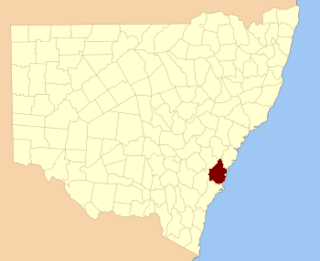
Hardinge County is one of the 141 Cadastral divisions of New South Wales.
Hardinge County was named in honour of Field Marshal, Sir Henry Hardinge (1785-1856. [1]
A full list of parishes found within this county; their current LGA and mapping coordinates to the approximate centre of each location is as follows:
Local government in Australia is the third tier of government in Australia administered by the states and territories, which in turn are beneath the federal tier. Local government is not mentioned in the Constitution of Australia and two referenda in the 1970s and 1980s to alter the Constitution relating to local government were unsuccessful. Every state government recognises local government in their respective constitutions. Unlike Canada or the United States, there is only one level of local government in each state, with no distinction such as cities and counties.

Hardinge Stanley Giffard, 1st Earl of Halsbury, PC QC later KC was a British lawyer and Conservative politician. He served three times as Lord Chancellor of Great Britain, for a total of seventeen years.

Baron Hardinge of Penshurst, in the County of Kent, is a title in the Peerage of the United Kingdom. It was created in 1910 for the diplomat the Hon. Sir Charles Hardinge, Viceroy and Governor-General of India from 1910 to 1916. He was the second son of Charles Hardinge, 2nd Viscount Hardinge. His son, the second Baron, served as private secretary to both King Edward VIII and King George VI.

Cumberland County is a county in the State of New South Wales, Australia. Most of the Sydney metropolitan area is located within the County of Cumberland.

The South Creek or Wianamatta, a creek that is part of the Hawkesbury-Nepean catchment, is located on the Cumberland Plain, also referred to as Greater Western Sydney, New South Wales, Australia.
The Geographical Names Board of New South Wales, a statutory authority of the Land and Property Information division, Department of Finance and Services in the Government of New South Wales, is the official body for naming and recording details of places and geographical names in the state of New South Wales, Australia.
Harold Thomas William Hardinge, known as Wally Hardinge, was an English professional sportsman who played both cricket and association football for England. His professional cricket career lasted from 1902 to 1933 during which he played first-class cricket for Kent County Cricket Club and made one Test match appearance for England. He was described as being "for years ... one of the leading opening batsmen in England".

Coolamon is a town in the Riverina region of south-west New South Wales, Australia. Coolamon is 40 kilometres (25 mi) north-west of Wagga Wagga and 506 kilometres (314 mi) south-west of Sydney via the Hume and Sturt Highways. The town is situated on the railway line between Junee and Narrandera. Coolamon had a population of 2,199 at the 2016 census and is 290 metres (950 ft) above sea level. It is the administrative and service centre for the local government area which bears its name—Coolamon Shire.

Darbalara is a rural community on the east bank of the junction of the Murrumbidgee River and Tumut River in the Riverina. It is situated by road, about 25 kilometres north east of Gundagai and 25 kilometres south of Coolac.

Gloucester County was one of the original Nineteen Counties in New South Wales, and is now one of the 141 cadastral divisions of New South Wales. It includes the area around Port Stephens. It is bounded on the north and west by the Manning River, and on the south-west by the Williams River.

Northumberland County was one of the original Nineteen Counties in New South Wales and is now one of the 141 Cadastral divisions of New South Wales. It included the area to the north of Broken Bay, including Lake Macquarie and Newcastle. It was bounded by the part of the Hawkesbury River to the south, the Macdonald River to the south-west, and the Hunter River to the north.

Camden County was one of the original Nineteen Counties in New South Wales and is now one of the 141 Cadastral divisions of New South Wales. It included the coastal area near Wollongong south to the Shoalhaven River, and also inland encompassing Berrima and Picton. Its western boundary was the Wollondilly River. The first settlement in the area was Camden Park, established by John Macarthur in 1806, just across the Nepean River from Cumberland County. It was the first land across the Nepean to be settled. Camden is a present-day suburb of Sydney in the same area, although parts of it are in Cumberland.

St Vincent County was one of the original Nineteen Counties in New South Wales and is now one of the 141 Cadastral divisions of New South Wales. It included the south coast area encompassing Batemans Bay, Ulladulla, Jervis Bay and inland to Braidwood. The Shoalhaven River is the boundary to the north and west, and the Deua River the boundary to the south.

Cowper County, New South Wales is one of the 141 Cadastral divisions of New South Wales.

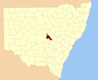
Gowen County is one of the 141 Cadastral divisions of New South Wales. It is located to the east of the Castlereagh River in the area to the east of Gilgandra, to Coonabarabran in the north-east. This includes land on both sides of the Newell Highway.

Kennedy County is one of the 141 Cadastral divisions of New South Wales. It is located to the west of the Bogan River in the area around Tottenham and Tullamore.

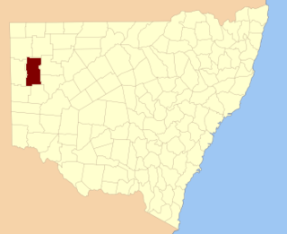
Mootwingee County, New South Wales is one of the 141 Cadastral divisions of New South Wales.

Oxley County, New South Wales is one of the 141 Cadastral divisions of New South Wales. It is located between the Bogan River on the west, and the Macquarie River on the east. This is the area approximately between Warren and Nyngan.

Lady Hardinge Medical College is a medical college for women located in New Delhi, India. Established in 1916, it became part of the Faculty of Medical Sciences, University of Delhi in 1950. The college is funded by the Government of India.
Hardinge Park officially known as Shaheed Veer Kunwar Singh Azadi Park is a public park in the city of Patna built by British Raj in 1916. The park was initially named after Viceroy Charles Hardinge and was built in his honour as he was instrumental in the creation of Bihar as a separate province. The name was changed to Shaheed Veer Kunwar Singh Azadi Park post independence. The park also hosted a garden party for then Prince of Wales - Edward VIII - in 1921 on his visit to Patna. The park completed its centenary in 2016.

Blowering, New South wales is a rural locality in the Snowy Mountains of New South wales and a civil Parish of Buccleuch County.