
Bolingbroke, now called Old Bolingbroke, is a village and civil parish in the East Lindsey district of Lincolnshire, England. Its present boundaries were formed by the amalgamation of the Parishes of Bolingbroke and Hareby in 1739. The population at the 2011 census was 325.

Torksey is a small village in the West Lindsey district of Lincolnshire, England. The population of the civil parish at the 2011 census was 875. It is situated on the A156 road, 7 miles (11 km) south of Gainsborough and 9 miles (14 km) north-west of the city of Lincoln, and on the eastern bank of the tidal River Trent, which here forms the boundary with Nottinghamshire.

Blyton is a village and civil parish within the West Lindsey district of Lincolnshire, England. It is situated approximately 4 miles (6 km) north-east from Gainsborough. From Blyton the village of Laughton lies to the north, and Pilham to the south-east, while the course of the River Trent runs nearby to the west.

Bottesford is a town in North Lincolnshire, Lincolnshire, England.

Roughton is a village and civil parish in the East Lindsey district of Lincolnshire, England. The parish population was 644 in 2011.
Sloothby is a small village in the East Lindsey district of Lincolnshire, England. It is situated approximately 5 miles (8 km) south from the Lincolnshire Wolds, an Area of Outstanding Natural Beauty. Sloothby is in the civil parish of Willoughby with Sloothby, just over 1 mile (1.6 km) south-east from the village of Willoughby and 7 miles (11 km) north-east from the coastal resort of Skegness. In 1870-72 the township had a population of 242.

Kexby is a small village and civil parish in the West Lindsey district of Lincolnshire, England. The population of the civil parish at the 2011 census was 340. It lies at the side of the B1241 road, and is situated 4 miles (6 km) south-east of Gainsborough and 11 miles (18 km) north-west of the city and county town of Lincoln.
According to Whites 1856 Lincolnshire, Lawress Wapentake was one of the south-western divisions of the parts of Lindsey, in the Deanery and Archdeaconry of Stow, and consisting of the East Division and the West Division.
Fulstow is a marsh village and civil parish in the East Lindsey district of Lincolnshire, England. It is situated 6 miles (10 km) north of Louth and 8 miles (13 km) south of Grimsby.

West Halton is a village and civil parish in North Lincolnshire, England. It is situated 2.5 miles (4 km) north-west from Winterton, approximately 7 miles (11 km) north from Scunthorpe, and 2 miles (3 km) south from the Humber Estuary. The parish contains part of Coleby, a hamlet south of the village.

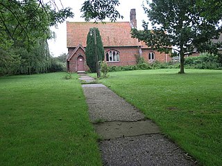
Wood Enderby is a village and civil parish in the East Lindsey district of Lincolnshire, England. It is situated approximately 4 miles (6 km) south from Horncastle. The civil parish includes the hamlets of Cluxby Puckacre and Wilksby.

East Barkwith is a village and civil parish in the East Lindsey district of Lincolnshire, England. It is situated on the A157, and approximately 13 miles (21 km) north-east from the city and county town of Lincoln,

Gayton le Wold is a village and civil parish in the East Lindsey district of Lincolnshire, England. It lies 6 miles (10 km) west from Louth, 3 miles (5 km) north from Donington on Bain, and to the south of the A157. The parish includes Biscathorpe 1 mile (1.6 km) to the south-west.

East Firsby and West Firsby are two hamlets in the West Lindsey district of Lincolnshire, England. They are situated about 10 miles (16 km) north from the city of Lincoln, and set in the Lincolnshire Wolds, a designated Area of Outstanding Natural Beauty.

Laughton is a village and a civil parish in the West Lindsey district of Lincolnshire, England. The population of the civil parish at the 2011 census was 410. It is situated approximately 6 miles (10 km) north from the town of Gainsborough

Northorpe is a village and civil parish in the West Lindsey district of Lincolnshire, England, about 8 miles (13 km) north-east from the town of Gainsborough. The population of the civil parish at the 2011 census was 126.

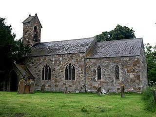
Stewton is a village and civil parish in the East Lindsey district of Lincolnshire, England. It is situated about 2 miles (3.2 km) east from the town of Louth, in the Lincolnshire Wolds, a designated Area of Outstanding Natural Beauty. The population is included in the civil parish of Keddington.

Swinhope is a village and civil parish about 6 miles west south west of North Thoresby railway station, in the West Lindsey district, in the county of Lincolnshire, England. In 2011 the parish had a population of 172. The parish touches Wold Newton, Thorganby, Brookenby, Binbrook and Stainton Le Vale. Swinhope doesn't have a formal parish council and instead holds parish meetings. In 2011 Nomis recorded a population of 194 which includes Thorganby parish. Swinhope was a deserted medieval village. The remains were completely destroyed in 1969 but crop marks remain within the village grounds.

Newball is a settlement and civil parish about 7 miles from Lincoln, in the West Lindsey district, in the county of Lincolnshire, England. In 2001 the parish had a population of 54. The parish touches Apley, Barlings, Bullington, Fulnetby and Stainton By Langworth.

West Keal is a village and civil parish 25 miles (40 km) east of Lincoln, in the East Lindsey district, in the county of Lincolnshire, England. The parish includes the hamlet of Keal Cotes. In 2011 the parish had a population of 327. The parish touches Bolingbroke, East Keal, East Kirkby, Mavis Enderby, Raithby and Stickford.

