Harmannsdorf

Last updated
Harmannsdorf
AUT Harmannsdorf COA.png
Coat of arms
Austria adm location map.svg
Red pog.svg
Harmannsdorf
Location within Austria
Coordinates: 48°24′N16°22′E / 48.400°N 16.367°E / 48.400; 16.367 Coordinates: 48°24′N16°22′E / 48.400°N 16.367°E / 48.400; 16.367
Country Austria
State Lower Austria
District Korneuburg
Government
   Mayor Norbert Hendler
Area
[1]
  Total55.54 km2 (21.44 sq mi)
Elevation
180 m (590 ft)
Population
 (2018-01-01) [2]
  Total3,951
  Density71/km2 (180/sq mi)
Time zone UTC+1 (CET)
  Summer (DST) UTC+2 (CEST)
Postal code
2111 / 2112
Area code 02264 / 02263
Website www.harmannsdorf.gv.at [ permanent dead link ]

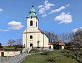
Harmannsdorf is a municipality of Korneuburg in Austria.

Contents

Geography

It lies about 5 km north of Korneuburg in the Weinviertel in Lower Austria. About 27.59 percent of the municipality is forested.

It has seven subdivisions: Rückersdorf-Harmannsdorf, Hetzmannsdorf, Kleinrötz, Mollmannsdorf, Obergänserndorf, Seebarn, and Würnitz-Lerchenau;

Related Research Articles

Korneuburg Place in Lower Austria, Austria

Korneuburg is a town in Austria. It is located in the state Lower Austria and is the administrative center of the district of Korneuburg. Korneuburg is situated on the left bank of the Danube, opposite the city of Klosterneuburg, and is 12 km northwest of Vienna. It covers an area of 9.71 square km and as of 2001 there were 11,032 inhabitants.

Bisamberg Place in Lower Austria, Austria

Bisamberg is a municipality in the district of Korneuburg in Austria.

Enzersfeld Place in Lower Austria, Austria

Enzersfeld is a town in the district of Korneuburg in the state of Lower Austria in Austria.

Ernstbrunn Place in Lower Austria, Austria

Ernstbrunn is a town in the district of Korneuburg in Lower Austria in Austria. Ernstbrunn takes up about 80.69 square kilometers, 26.99 percent of which is forest.

Großmugl Place in Lower Austria, Austria

Großmugl is a town in the district of Korneuburg in Lower Austria in Austria. It is situated about 15 km north of Stockerau within the Weinviertel in Lower Austria. Großmugl takes up about 64.49 square kilometers, 29.91 percent of which are forest.

Großrußbach Place in Lower Austria, Austria

Großrußbach is a town in the district of Korneuburg in Lower Austria in Austria

Hagenbrunn Place in Lower Austria, Austria

Hagenbrunn is a town in the district of Korneuburg in Lower Austria in Austria.

Hausleiten Place in Lower Austria, Austria

Hausleiten is a town in the district of Korneuburg in Lower Austria in Austria.

Burgschleinitz-Kühnring Place in Lower Austria, Austria

Burgschleinitz-Kühnring is a market town in the district of Horn in Lower Austria, Austria.

Langenzersdorf Place in Lower Austria, Austria

Langenzersdorf is a town in the district of Korneuburg in Lower Austria, Austria.

Leitzersdorf Place in Lower Austria, Austria

Leitzersdorf is a town in the district of Korneuburg in the Austrian state of Lower Austria.

Leobendorf Place in Lower Austria, Austria

Leobendorf is a town in the district of Korneuburg in the Austrian state of Lower Austria.

Niederhollabrunn Place in Lower Austria, Austria

Niederhollabrunn is a town in the district of Korneuburg in the Austrian state of Lower Austria.

Rußbach Place in Lower Austria, Austria

Rußbach is a town in the district of Korneuburg in the Austrian state of Lower Austria.

Sierndorf Place in Lower Austria, Austria

Sierndorf is a town in the district of Korneuburg in the Austrian state of Lower Austria.

Spillern Place in Lower Austria, Austria

Spillern is a town in the district of Korneuburg in the Austrian state of Lower Austria.

Stetteldorf am Wagram Place in Lower Austria, Austria

Stetteldorf am Wagram is a town in the district of Korneuburg in the Austrian state of Lower Austria.

Stetten, Austria Place in Lower Austria, Austria

Stetten is a town in the district of Korneuburg in the Austrian state of Lower Austria.

Gerasdorf bei Wien Place in Lower Austria, Austria

Gerasdorf bei Wien is a town in the district of Korneuburg in the Austrian state of Lower Austria. The city has 10,862 inhabitants.

Altschwendt Place in Upper Austria, Austria

Altschwendt is a municipality in the district of Schärding in the Austrian state of Upper Austria.

References

  1. "Dauersiedlungsraum der Gemeinden Politischen Bezirke und Bundesländer - Gebietsstand 1.1.2018". Statistics Austria. Retrieved 10 March 2019.
  2. "Einwohnerzahl 1.1.2018 nach Gemeinden mit Status, Gebietsstand 1.1.2018". Statistics Austria. Retrieved 9 March 2019.
Parish church Saint Hippolytus Ruckersdorf (Harmannsdorf) - Kirche (1).JPG
Parish church Saint Hippolytus