Harrisville, New Zealand

Last updated

Harrisville
Locality
Harrisville, New Zealand
Coordinates: 37°14′22″S174°57′07″E / 37.2394°S 174.952°E / -37.2394; 174.952 Coordinates: 37°14′22″S174°57′07″E / 37.2394°S 174.952°E / -37.2394; 174.952
CountryNew Zealand
Region Waikato
District Waikato District
WardAwaroa ki Tuakau Ward
CommunityOnewhero-Tuakau Community
Electorates
Government
  Territorial Authority Waikato District Council
  Regional council Waikato Regional Council
Elevation
80 m (260 ft)
Population
 (2018 census)
  Total99
Time zone UTC+12 (NZST)
  Summer (DST) UTC+13 (NZDT)

Harrisville is a locality about 3 km northeast of Tuakau and 5.5 km southeast of Pukekohe in the North Island of New Zealand.

Contents

Harrisville is in meshblocks 0828202 (SE) and 0828302 (NW), which had a combined population of 99 people in the 2018 New Zealand census. [1]

The area was named for an early landowner and politician, Benjamin Harris, and was largely settled by Danes. [2] [3] [4]

Demographics

Tuakau Rural statistical area, which includes Harrisville and surrounds but does not include Tuakau, covers 46.00 km2 (17.76 sq mi) [5] and had an estimated population of 1,730 as of June 2022, [6] with a population density of 38 people per km2.

Historical population
YearPop.±% p.a.
20061,335    
20131,461+1.30%
20181,581+1.59%
Source: [7]

Tuakau Rural had a population of 1,581 at the 2018 New Zealand census, an increase of 120 people (8.2%) since the 2013 census, and an increase of 246 people (18.4%) since the 2006 census. There were 531 households, comprising 819 males and 762 females, giving a sex ratio of 1.07 males per female. The median age was 44.2 years (compared with 37.4 years nationally), with 312 people (19.7%) aged under 15 years, 276 (17.5%) aged 15 to 29, 765 (48.4%) aged 30 to 64, and 231 (14.6%) aged 65 or older.

Ethnicities were 84.8% European/Pākehā, 14.2% Māori, 3.2% Pacific peoples, 8.5% Asian, and 1.1% other ethnicities. People may identify with more than one ethnicity.

The percentage of people born overseas was 19.4, compared with 27.1% nationally.

Although some people chose not to answer the census's question about religious affiliation, 51.2% had no religion, 35.3% were Christian, 0.6% had Māori religious beliefs, 1.5% were Hindu, 0.4% were Muslim, 0.4% were Buddhist and 1.3% had other religions.

Of those at least 15 years old, 228 (18.0%) people had a bachelor's or higher degree, and 201 (15.8%) people had no formal qualifications. The median income was $40,700, compared with $31,800 nationally. 282 people (22.2%) earned over $70,000 compared to 17.2% nationally. The employment status of those at least 15 was that 705 (55.6%) people were employed full-time, 207 (16.3%) were part-time, and 42 (3.3%) were unemployed. [7]

Education

Harrisville School is a co-educational state primary school covering years 1 to 6, [8] with a roll of 163 as of February 2023. [9] The school opened in 1877. [10] In the 2019 Education Review Office report, 38% of the students were Māori. [11]

Related Research Articles

<span class="mw-page-title-main">Pukekohe</span> Secondary urban area in Auckland Region, New Zealand

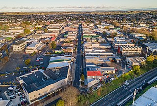
Pukekohe is a town in the Auckland Region of the North Island of New Zealand. Located at the southern edge of the Auckland Region, it is in South Auckland, between the southern shore of the Manukau Harbour and the mouth of the Waikato River. The hills of Pukekohe and nearby Bombay Hills form the natural southern limit of the Auckland region. Pukekohe is located within the political boundaries of the Auckland Council, following the abolition of the Franklin District Council on 1 November 2010.

<span class="mw-page-title-main">Tuakau</span> Place in Waikato, New Zealand

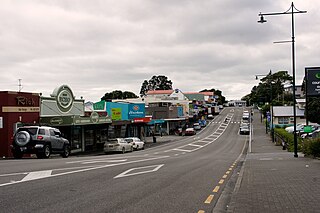
Tuakau is a town in the Waikato region at the foot of Bombay hills, formerly part of the Franklin district until 2010, when it became part of Waikato District in the North Island of New Zealand. The town serves to support local farming, and is the residence of many employees of New Zealand Steel at Glenbrook.

<span class="mw-page-title-main">Drury, New Zealand</span> Suburb in Auckland, New Zealand

Drury is a rural town near Auckland, in northern New Zealand. Located 36 kilometres to the south of Auckland CBD, under authority of the Auckland Council. Drury lies at the southern border of the Auckland metropolitan area, 12 kilometres to the northeast of Pukekohe, close to the Papakura Channel, an arm of the Manukau Harbour.

Ruakura is a semi-rural suburb of Hamilton City, in the Waikato region of New Zealand. The University of Waikato is nearby.

<span class="mw-page-title-main">Kumeū</span> Place in Auckland Region, New Zealand

Kumeū is an affluent rural town and suburb of Auckland situated 25 km north-west of the City Centre in New Zealand. State Highway 16 and the North Auckland Line pass through the town. Huapai lies to the west, Riverhead to the north, Whenuapai to the east, and Taupaki to the south.

<span class="mw-page-title-main">Helensville</span> Place in Auckland, New Zealand

Helensville is a town in the North Island of New Zealand. It is sited 40 kilometres (25 mi) northwest of Auckland, close to the southern extremity of the Kaipara Harbour. State Highway 16 passes through the town, connecting it to Waimauku 16 kilometres (10 mi) to the south, and Kaukapakapa about 12 kilometres (7.5 mi) to the north-east. Parakai is two kilometres (1.2 mi) to the north-west.

<span class="mw-page-title-main">Pukekawa</span> Locality in Waikato, New Zealand

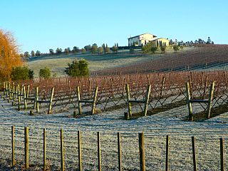
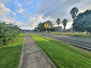
Pukekawa is a town in the Lower Waikato River area of New Zealand's North Island, 66 km south of central Auckland. The area's fertile soils are used to grow a range of vegetables, including onions, potatoes and carrots. The town was in the Franklin District until the district's abolition in 2010.

Red Hill is a suburb of Auckland, in northern New Zealand. Located 34 kilometres (21 mi) to the southeast of Auckland CBD, under authority of the Auckland Council. The suburban area of Red Hill makes up the southernmost part of the Auckland metropolitan area, however the majority of the area is rural. The suburb is adjacent to Pukekiwiriki, an ancient volcano and Pā. Red Hill is located in the Manurewa-Papakura ward, one of the thirteen administrative divisions of Auckland city.

<span class="mw-page-title-main">Karaka, New Zealand</span> Place in Auckland Region, New Zealand

Karaka is a small rural area in the south of Auckland, New Zealand. Formerly part of Franklin District and under the authority of the Franklin District Council, it is now part of Auckland Council following the amalgamation of the Auckland region's councils.

<span class="mw-page-title-main">Pōkeno</span> Town in Waikato, New Zealand

Pōkeno is a small town in the Waikato District of the Waikato region in New Zealand, 53 km (33 mi) southeast of Auckland, 9 km (5.6 mi) from Tuakau and 5 km (3.1 mi) from Mercer. State Highway 1 originally ran through the town, but the upgrading of the highway in 1992 to expressway standards mean that the town has been bypassed.

Ohakuri is a rural community in the Taupō District and Waikato region of New Zealand's North Island. It features the Orakei Korako Geothermal Area, the artificial Lake Ohakuri and the Ohakuri Dam.

<span class="mw-page-title-main">Lake Alice, Manawatū-Whanganui</span> Area unit in Manawatū-Whanganui, New Zealand

Lake Alice is an area located in the southwestern part of Rangitikei District of the Manawatū-Whanganui region of New Zealand's North Island. According to the 2013 census, it had a population of 2,724 inhabitants.

<span class="mw-page-title-main">Onewhero</span> Place in Waikato, New Zealand

Onewhero is a village and rural community in the Waikato District and Waikato region of New Zealand's North Island.

<span class="mw-page-title-main">Hunua</span> Place in Auckland Region, New Zealand

Hunua is a small settlement in the rural outskirts of south Auckland, New Zealand.

<span class="mw-page-title-main">Buckland, New Zealand</span> Village in Auckland Region, New Zealand

Buckland is in the Franklin ward of Auckland Regional Council, on the south-east side of Pukekohe, between Pukekohe and Tuakau, and on the northern boundary of Waikato District. It is part of the Pukekohe urban area.

<span class="mw-page-title-main">Waerenga</span> Hamlet in Waikato, New Zealand

Waerenga is the name of a hamlet, 11 km (6.8 mi) east of Te Kauwhata, which is part of a statistical area unit in the Waikato District.

<span class="mw-page-title-main">Mangatangi</span> Locality in Waikato, New Zealand

Mangatangi is a locality about 7 km east of Mangatawhiri and 10.5 km west of Miranda in the Waikato District in the North Island of New Zealand.

Āria is a rural community in the Waitomo District and Waikato region of New Zealand's North Island.

Oteha is an Auckland suburb, which is under local governance of Auckland Council. The area is defined by Oteha Valley Road on the north, East Coast Road on the east, Spencer Road on the south, and the Auckland Northern Motorway on the west. Until the very end of the 20th century, the area was rural.

<span class="mw-page-title-main">Rānui</span> Suburb in Auckland, New Zealand

Rānui is a suburb of West Auckland, New Zealand, which is under the local governance of Auckland Council. The area is densely populated but close to the western fringe of the Auckland urban area.

References

  1. "Meshblock Electoral Populations 2020 for proposed boundaries data". Statistics New Zealand. April 2020. Meshblocks 0828202 and 0828302.
  2. "Harrisville". The Cyclopedia of New Zealand. Vol. 2. Auckland Povincial District. 1902.
  3. "The Franklin North Election". Timaru Herald. Vol. XXXVI, no. 2414. 17 June 1882. p. 2.
  4. "Untitled". Auckland Star. Vol. XXIV, no. 283. 29 November 1893.
  5. "ArcGIS Web Application". statsnz.maps.arcgis.com. Retrieved 9 September 2022.
  6. "Population estimate tables - NZ.Stat". Statistics New Zealand . Retrieved 25 October 2022.
  7. 1 2 "Statistical area 1 dataset for 2018 Census". Statistics New Zealand. March 2020. Tuakau Rural (169900). 2018 Census place summary: Tuakau Rural
  8. Education Counts: Harrisville School
  9. "New Zealand Schools Directory". New Zealand Ministry of Education. Retrieved 12 December 2022.
  10. "Welcome to Harrisville Primary School". Harrisville School. Retrieved 24 August 2019.
  11. "Harrisville School - 28/05/2019". Education Review Office. 28 May 2019. Retrieved 24 August 2019.