
Monkseaton is an area of Whitley Bay, North Tyneside, in the county of Tyne and Wear, England. Historically in Northumberland, it is in the north-east of the borough, 3⁄4 mile from the North Sea coast and 1+1⁄2 mi (2.5 km) north of the River Tyne at North Shields. One mile to the north of Monkseaton, the extensive built-up areas of North Tyneside change abruptly into green belt stretching north into south-east Northumberland. It is at an elevation of 130 feet (40 m) above sea-level.

Earsdon is a village in the borough of North Tyneside in the county of Tyne and Wear, England. It sits on the border of Northumberland, which it is historically part of, and is approximately two miles from Whitley Bay. The village had a population of 613 in 2011.
Anick is a village and former civil parish, now in the parish of Sandhoe, in Northumberland, England, situated to the north of Hexham. In 1881 the parish had a population of 153.

Bolam is a village and former civil parish, now in the parish of Belsay in the county of Northumberland, England. The village is about 20 miles (32 km) north-west of Newcastle upon Tyne, near Bolam West Houses. In 1951 the civil parish had a population of 60. On 1 April 1955 the parish was abolished and merged with Belsay.

Burradon is a village and former civil parish, now in the parish of Netherton, in Northumberland, England. It is about 14 miles (23 km) to the south-west of Alnwick. In 1951 the parish had a population of 53.

Brunton is a village and former civil parish, now in the parish of Newton-by-the-Sea, in the county of Northumberland, England. It is about 7 miles (11 km) north of Alnwick, a short distance inland from the North Sea. In 1951 the parish had a population of 35.

Clennell is a small village and as Clennel, a former civil parish, now in the parish of Alwinton, in Northumberland, England. It is about 1 mile (1.6 km) north-east of Alwinton. In 1951 the parish had a population of 37.

Seaton Delaval is a village and former civil parish, now in the parish of Seaton Valley, in Northumberland, England, with a population of 4,371. The largest of the five villages in Seaton Valley, it is the site of Seaton Delaval Hall, completed by Sir John Vanbrugh in 1727.

Seghill is a large village and former civil parish, now in the parish of Seaton Valley, located on the Northumberland border which is the county boundary between Northumberland and Tyne and Wear. Seghill is situated between the villages of Seaton Delaval and Annitsford, about 8 miles (13 km) north of Newcastle upon Tyne.

Preston is a suburb about a mile north of North Shields, in the North Tyneside district, in the county of Tyne and Wear, England. Its population was recorded at 8419 in the 2011 census. Historically a separate entity, it has slowly been absorbed into the town to the south and expanded as to form a continuous urban area north to Monkseaton.
Out Newton is a hamlet in the civil parish of Easington, in the East Riding of Yorkshire, England, in an area known as Holderness. It is situated just inland from the North Sea coast, approximately 4.5 miles (7.2 km) south-east of Withernsea, and 4.5 miles (7.2 km) east of Patrington.

Catfoss is a hamlet in the civil parish of Seaton, in Holderness, in the East Riding of Yorkshire, England. It is situated approximately 5 miles (8 km) west of the town of Hornsea. The hamlet is mentioned in the Domesday Book as having ten villagers, six ploughlands, and meadows covering 24 acres (9.7 ha). the name derives from two elements; the first is a personal name (Catta) and the second is a common word for a stream or watercourse in Northern England (Foss). Catfoss Lane, between Catfoss and Brandesburton, is the location of the former RAF Catfoss, an airfield which is now home to a variety of businesses.

Halton is a village and former civil parish, now in the parish of Whittington, in the southern part of Northumberland, England. It is situated 3 miles (4.8 km) north of Corbridge just south of Hadrian's Wall. In 1951 the parish had a population of 24.

Rochester is a small village and civil parish in north Northumberland, England. It is 5 miles (8 km) north-west of Otterburn on the A68 road between Corbridge and Jedburgh. The village is the site of the Roman fort of Bremenium, built there to protect the important Roman road of Dere Street, which passes through the village.
Newton on the Moor is a village and former civil parish in Northumberland, England. It is located 5 miles (8 km) south of Alnwick, on the old route of the A1 road although the village has now been bypassed just to the east. The village is now in the civil parish of Newton on the Moor and Swarland, which also includes the village of Swarland, south-west of Newton on the Moor. The population of Newton on the Moor and Swarland parish in 2001 was 822, increasing to 905 at the 2011 Census. The village is a conservation area.

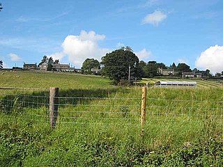
Murton is a small village in the metropolitan borough of North Tyneside, in the ceremonial county of Tyne and Wear, England. The village is separated by fields from the nearby areas of West Monkseaton, New York, Earsdon and Shiremoor. Until 1974 Murton was in Northumberland. Murton was a civil parish between 1866 and 1935. In 1931 the parish had a population of 1164.

Dovenby is a village and former civil parish, now in the parish of Bridekirk, in the Cumberland district, in the county of Cumbria, England. It is on the A594 road and is 2.5 miles (4.0 km) north west of Cockermouth, 2.6 miles (4.2 km) east of Dearham, 4.5 miles (7.2 km) east of Maryport, 7.4 miles (11.9 km) north east of Workington and 27 miles (43.5 km) south west of Carlisle. In 1931 the parish had a population of 163.

South Charlton is a small village and former civil parish, now in the parish of Eglingham, in the county of Northumberland, England, five miles (8 km) north-west of Alnwick. In 1951 the parish had a population of 82.

Scrainwood is a hamlet and former civil parish 20 miles (32 km) from Morpeth, now in the parish of Alnham, in the county of Northumberland, England. In 1951 the parish had a population of 16. Scrainwood Estate is 1048 acres and has a shoot that specializes in partridges.

Eachwick is a hamlet and former civil parish 11 miles (18 km) from Morpeth, now in the parish of Stamfordham, in the county of Northumberland, England. In 1951 the parish had a population of 69.

