Related Research Articles

Quantico is a town in Prince William County, Virginia, United States. The population was 480 at the 2010 census. Quantico is approximately 35 miles southwest of Washington, D.C., bordered by the Potomac River to the east and the Quantico Creek to the north. The word Quantico is a corruption of the name of a Doeg village recorded by English colonists as Pamacocack.

Stafford County is located in the Commonwealth of Virginia. It is a suburb outside of Washington D.C. It is approximately 40 miles (64 km) south of D.C. It is part of the Northern Virginia region, and the D.C. area. It is one of the fastest growing, and highest-income counties in America. As of the 2020 census, the population sits at 156,927. Its county seat is Stafford.

Spotsylvania County is a county in the U.S. state of Virginia. As of the July 2021 estimate, the population was 143,676. Its county seat is Spotsylvania Courthouse.

Fredericksburg is an independent city in Virginia, United States. As of the 2020 census, the population was 27,982. It is 48 miles (77 km) south of Washington, D.C., and 53 miles (85 km) north of Richmond. The Bureau of Economic Analysis of the United States Department of Commerce combines the city of Fredericksburg with neighboring Spotsylvania County for statistical purposes.

Woodbridge is a census-designated place (CDP) in Prince William County, Virginia, United States, located 20 miles (32 km) south of Washington, D.C. Bounded by the Occoquan and Potomac rivers, Woodbridge had 44,668 residents at the 2020 census.

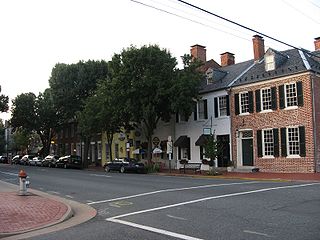
Falmouth is a census-designated place (CDP) in Stafford County, Virginia, United States. Situated on the north bank of the Rappahannock River at the falls, the community is north of and opposite the city of Fredericksburg. Recognized by the U.S. Census Bureau as a census-designated place (CDP), Falmouth's population was 4,274 as of the 2010 census.

Virginia Railway Express (VRE) is a commuter rail service that connects outlying small cities of Northern Virginia to Union Station in Washington, D.C. It operates two lines which run during weekday rush hour only: the Fredericksburg Line from Spotsylvania, Virginia, and the Manassas Line from Broad Run station in Bristow, Virginia. In 2022, the system had a ridership of 1,172,700, or about 6,200 per weekday as of the first quarter of 2023.

Northern Virginia, locally referred to as NOVA or NoVA, comprises several counties and independent cities in the Commonwealth of Virginia in the United States. The region radiates westward and southward from Washington, D.C. With 3,238,706 people according to 2022 Census estimates, it is the most populous region of Virginia and the Washington metropolitan area.


Fredericksburg and Spotsylvania National Military Park is a unit of the National Park Service in Fredericksburg, Virginia, and elsewhere in Spotsylvania County, commemorating four major battles in the American Civil War: Fredericksburg, Chancellorsville, The Wilderness, and Spotsylvania.

The Washington metropolitan area, also sometimes referred to as the National Capital Region or colloquially as the DMV, is the metropolitan area containing Washington, D.C., the federal capital of the United States. The metropolitan area includes all of Washington, D.C. and parts of Maryland, Virginia, and West Virginia. It is part of the larger Washington–Baltimore combined statistical area.

Interstate 95 (I-95) runs 179 miles (288 km) within the commonwealth of Virginia between its borders with North Carolina and Maryland. I-95 meets the northern terminus of I-85 in Petersburg and is concurrent with I-64 for three miles (4.8 km) in Richmond. Although I-95 was originally planned as a highway through Washington, D.C., it was rerouted along the eastern portion of the Capital Beltway concurrent with I-495. From Petersburg to Richmond, I-95 utilized most of the Richmond–Petersburg Turnpike, a former toll road. In addition to Richmond, the route also runs through the medium-sized cities of Emporia, Petersburg, Colonial Heights, Fredericksburg, and Alexandria.

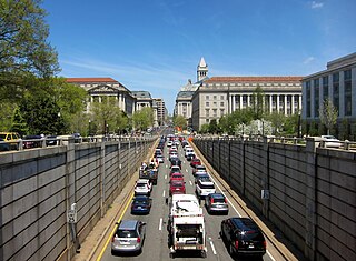
Washington, D.C. has a number of different modes of transportation available for use. Commuters have a major influence on travel patterns, with only 28% of people employed in Washington, D.C. commuting from within the city, whereas 33.5% commute from the nearby Maryland suburbs, 22.7% from Northern Virginia, and the rest from Washington, D.C.'s outlying suburbs.

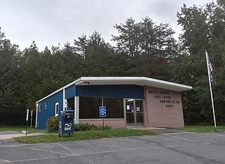
Hartwood is an unincorporated community in Stafford County in the Commonwealth of Virginia, a U.S. state. Hartwood is located fifteen miles northwest of Fredericksburg.
Patawomeck is a Native American tribe based in Stafford County, Virginia, along the Potomac River. Patawomeck is another spelling of Potomac.

Crow's Nest Natural Area Preserve is a large wilderness area located on the southern border of Stafford County, Virginia, United States, between Potomac Creek and Accokeek Creek. The greater portion of the Crow's Nest Peninsula is approximately 3,800 acres (15 km2) and lies within the coastal plain of Virginia. About 3,115 acres (12.61 km2) of the peninsula is protected as part of the Virginia Natural Area Preserve System.

Cherry Hill is a census-designated place (CDP) in Prince William County, Virginia, United States. The population was 16,000 according to the 2010 Census. As of the 2020 census, it was estimated to be 23,683. The CDP is made up of the Cherry Hill peninsula, to the northeast of the town of Dumfries.
The Fredericksburg Dog Mart is an annual dog show event currently held in Spotsylvania County, Virginia. The event first took place in 1698 to facilitate trading between the Manahoac Tribe of King William County, Virginia and settlers in and around the area that would become the city of Fredericksburg. At the Dog Mart, the Manahoac would trade furs and produce for prized English hunting dogs. Though it has not been held continuously, it is the oldest event of its kind in the United States.

Hartwood Presbyterian Church, also known as the Yellow Chapel Church, is a historic Presbyterian church located at the junction of VA 705 and 612 in Hartwood, Stafford County, Virginia. It was built between 1857 and 1859, and is a rectangular brick Greek Revival style church. The church was restored in 1866, after having been used by both sides during the American Civil War. During the war, it was the site of Wade Hampton's November 1862 capture of 137 men of the 3rd Pennsylvania Cavalry. The property includes the site of the Hartwood Chapel or Yellow Chapel of about 1767 and a graveyard. Hartwood Presbyterian Church was the only Presbyterian church in Stafford County from about 1807 until 1983.
Stafford County Public Schools is a Virginia school division that serves the Stafford County Area. Its current superintendent is Thomas Taylor and has 30,086 students currently enrolled in its 17 elementary schools, 8 middle schools and 6 high schools. A 6th high school will be completed by August 2026.
References
- ↑ "Hartwood Airport now test area". Fredericksburg.com. Retrieved October 2, 2012.
- ↑ "Abandoned & Little-Known Airfields: Virginia: Prince William & Stafford Counties". Airfields-freeman.com. Retrieved October 2, 2012.
- ↑ "3VG7 change history @ OurAirports". OurAirports.com. Retrieved September 5, 2021.
- ↑ "Hartwood Airport (8W8)". FlightPedia.com. Retrieved September 5, 2021.
- ↑ "Hartwood Paracenter Skydiving Dropzones". SkyDivingDZs.com. Retrieved September 5, 2021.
- ↑ "Hartwood Airport now Test Area". fredericksburg.com. March 8, 2010. Retrieved September 12, 2023.