Hatillo barrio-pueblo

Last updated
Hatillo barrio-pueblo
Pueblo de Hatillo
Municipality Seat [1]
Cll Padre Delgado in Hatillo barrio-pueblo.jpg
Calle Padre Delgado in Hatillo barrio-pueblo
Hatillo barrio-pueblo, Hatillo, Puerto Rico locator map.png
Location of Hatillo barrio-pueblo within the municipality of Hatillo shown in red
Caribbean location map.svg
Red pog.svg
Hatillo barrio-pueblo
Location of Puerto Rico
Coordinates: 18°29′02″N66°49′30″W / 18.483922°N 66.825117°W / 18.483922; -66.825117 [2]
Commonwealth Flag of Puerto Rico.svg  Puerto Rico
Municipality Flag of Hatillo, Puerto Rico.svg Hatillo
Area
[2]
  Total0.84 sq mi (2.2 km2)
  Land0.59 sq mi (1.5 km2)
  Water0.25 sq mi (0.6 km2)
Elevation
[3]
10 ft (3 m)
Population
 (2010)
  Total3,117
  Density5,283.1/sq mi (2,039.8/km2)
 Source: 2010 Census
Time zone UTC−4 (AST)

Hatillo barrio-pueblo is a barrio and the administrative center (seat) of Hatillo, a municipality of Puerto Rico. Its population in 2010 was 3,117. [1] [4] [5] [6]

Contents

As was customary in Spain, in Puerto Rico, the municipality has a barrio called pueblo which contains a central plaza, the municipal buildings (city hall), and a Catholic church. Fiestas patronales (patron saint festivals) are held in the central plaza every year. [7] [8]

The central plaza and its church

The central plaza, or square, is a place for official and unofficial recreational events and a place where people can gather and socialize from dawn to dusk. The Laws of the Indies, Spanish law, which regulated life in Puerto Rico in the early 19th century, stated the plaza's purpose was for "the parties" (celebrations, festivities) (Spanish : a propósito para las fiestas), and that the square should be proportionally large enough for the number of neighbors (Spanish : grandeza proporcionada al número de vecinos). These Spanish regulations also stated that the streets nearby should be comfortable portals for passersby, protecting them from the elements: sun and rain. [7]

Located across from the central plaza is the Parroquia Nuestra Señora del Carmen [9] (English: Our Lady of Mount Carmel Parish), a Roman Catholic church. The church was built between 1824 and 1830. It sustained damage during the 1918 San Fermín earthquake. A concrete roof, tower and dome were added in 1930. [10]

History

Hatillo barrio-pueblo was in Spain's gazetteers [11] until Puerto Rico was ceded by Spain in the aftermath of the Spanish–American War under the terms of the Treaty of Paris of 1898 and became an unincorporated territory of the United States. In 1899, the United States Department of War conducted a census of Puerto Rico finding that the population of Hatillo barrio-pueblo was 669. [12]

Historical population
CensusPop.Note
1900 669
1910 1,338100.0%
1920 1,67425.1%
1930 2,25034.4%
1940 1,533−31.9%
1950 2,48261.9%
1960 2,5824.0%
1970 0−100.0%
1980 3,060
1990 2,862−6.5%
2000 2,757−3.7%
2010 3,11713.1%
U.S. Decennial Census
1899 (shown as 1900) [13] 1910-1930 [14]
1930-1950 [15] 1980-2000 [16] 2010 [17]

See also

Related Research Articles

<span class="mw-page-title-main">Adjuntas barrio-pueblo</span> Historical and administrative center (seat) of Adjuntas, Puerto Rico

Adjuntas barrio-pueblo is a barrio and the administrative center (seat) of Adjuntas, a municipality of Puerto Rico. Its population in 2010 was 4,406.

<span class="mw-page-title-main">Aguada barrio-pueblo</span> Historical and administrative center (seat) of Aguada, Puerto Rico

Aguada barrio-pueblo is a small barrio and the administrative center (seat) of Aguada, a municipality of Puerto Rico. Its population in 2010 was 1,324. Aguada barrio-pueblo has two subdivisions: California and Rosario.

<span class="mw-page-title-main">Coamo barrio-pueblo</span> Historical and administrative center (seat) of Coamo, Puerto Rico

Coamo barrio-pueblo is a barrio and the administrative center (seat) of Coamo, a municipality of Puerto Rico. Its population in 2010 was 6,685.

<span class="mw-page-title-main">Barranquitas barrio-pueblo</span> Historical and administrative center (seat) of Barranquitas, Puerto Rico

Barranquitas barrio-pueblo is a barrio and the administrative center (seat) of Barranquitas, a municipality of Puerto Rico. Its population in 2010 was 2,695.

<span class="mw-page-title-main">Yauco barrio-pueblo</span> Historical and administrative center (seat) of Yauco, Puerto Rico

Yauco barrio-pueblo is a barrio and the administrative center (seat) of Yauco, a municipality of Puerto Rico. Its population in 2010 was 3,091.

<span class="mw-page-title-main">Camuy barrio-pueblo</span> Historical and administrative center (seat) of Camuy, Puerto Rico

Camuy barrio-pueblo is a barrio and the administrative center (seat) of Camuy, a municipality of Puerto Rico. Its population in 2010 was 3,354.

<span class="mw-page-title-main">Las Marías barrio-pueblo</span> Historical and administrative center (seat) of Las Marías, Puerto Rico

Las Marías barrio-pueblo is a barrio and the administrative center (seat) of Las Marías, a municipality of Puerto Rico. Its population in 2010 was 262.

<span class="mw-page-title-main">Villalba barrio-pueblo</span> Historical and administrative center (seat) of Villalba, Puerto Rico

Villalba barrio-pueblo is a barrio and the administrative center (seat) of Villalba, a municipality of Puerto Rico. Its population in 2010 was 729.

<span class="mw-page-title-main">Jayuya barrio-pueblo</span> Historical and administrative center (seat) of Jayuya, Puerto Rico

Jayuya barrio-pueblo is a barrio and the administrative center (seat) of Jayuya, a municipality of Puerto Rico. Its population in 2010 was 1,222.

<span class="mw-page-title-main">Vega Alta barrio-pueblo</span> Historical and administrative center (seat) of Vega Alta, Puerto Rico

Vega Alta barrio-pueblo is a barrio and the administrative center (seat) of Vega Alta, a municipality of Puerto Rico. Its population in 2010 was 1,169.

<span class="mw-page-title-main">Moca barrio-pueblo</span> Historical and administrative center (seat) of Moca, Puerto Rico

Moca barrio-pueblo is a barrio and the administrative center (seat) of Moca, a municipality of Puerto Rico. Its population in 2010 was 1,735.

<span class="mw-page-title-main">Salinas barrio-pueblo</span> Historical and administrative center (seat) of Salinas, Puerto Rico

Salinas barrio-pueblo is a barrio and the administrative center (seat) of Salinas, a municipality of Puerto Rico. Its population in 2010 was 2,453.

<span class="mw-page-title-main">Santa Isabel barrio-pueblo</span> Historical and administrative center (seat) of Santa Isabel, Puerto Rico

Santa Isabel barrio-pueblo is a barrio and the administrative center (seat) of Santa Isabel, a municipality of Puerto Rico. Its population in 2010 was 5,133.

<span class="mw-page-title-main">Carolina barrio-pueblo</span> Historical and administrative center (seat) of Carolina, Puerto Rico

Carolina barrio-pueblo is a barrio and the administrative center (seat) of Carolina, a municipality of Puerto Rico. Its population in 2010 was 1,201.

<span class="mw-page-title-main">Guayama barrio-pueblo</span> Historical and administrative center (seat) of Guayama, Puerto Rico

Guayama barrio-pueblo is a barrio and the administrative center (seat) of Guayama, a municipality of Puerto Rico. Its population in 2010 was 16,891.

<span class="mw-page-title-main">Juana Díaz barrio-pueblo</span> Historical and administrative center (seat) of Juana Díaz, Puerto Rico

Juana Díaz barrio-pueblo is a barrio and the administrative center (seat) of Juana Díaz, a municipality of Puerto Rico. Its population in 2010 was 3,977.

<span class="mw-page-title-main">Las Piedras barrio-pueblo</span> Historical and administrative center (seat) of Las Piedras, Puerto Rico

Las Piedras barrio-pueblo is a barrio and the administrative center (seat) of Las Piedras, a municipality of Puerto Rico. Its population in 2010 was 1,500.

<span class="mw-page-title-main">Río Grande barrio-pueblo</span> Historical and administrative center (seat) of Río Grande, Puerto Rico

Río Grande barrio-pueblo is a barrio and the administrative center (seat) of Río Grande, a municipality of Puerto Rico. Its population in 2010 was 1,772.

<span class="mw-page-title-main">Trujillo Alto barrio-pueblo</span> Historical and administrative center (seat) of Trujillo Alto, Puerto Rico

Trujillo Alto barrio-pueblo is a barrio and the administrative center (seat) of Trujillo Alto, a municipality of Puerto Rico. Its population in 2010 was 673.

<span class="mw-page-title-main">Corozal barrio-pueblo</span> Historical and administrative center (seat) of Corozal, Puerto Rico

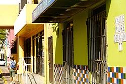
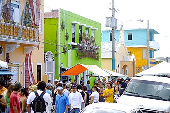
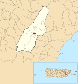
Corozal barrio-pueblo is an urban barrio and the administrative center (seat) of Corozal, a municipality of Puerto Rico. Its population in 2010 was 2,631.

References

  1. 1 2 Puerto Rico: 2010 Population and Housing Unit Counts.pdf (PDF). U.S. Dept. of Commerce, Economics and Statistics Administration, U.S. Census Bureau. 2010. Archived (PDF) from the original on 2017-02-20. Retrieved 2019-01-06.
  2. 1 2 "US Gazetteer 2019". US Census. US Government. Archived from the original on 2020-01-16. Retrieved 2020-07-02.
  3. U.S. Geological Survey Geographic Names Information System: Hatillo barrio-pueblo
  4. Picó, Rafael; Buitrago de Santiago, Zayda; Berrios, Hector H. Nueva geografía de Puerto Rico: física, económica, y social, por Rafael Picó. Con la colaboración de Zayda Buitrago de Santiago y Héctor H. Berrios. San Juan Editorial Universitaria, Universidad de Puerto Rico,1969.
  5. Gwillim Law (20 May 2015). Administrative Subdivisions of Countries: A Comprehensive World Reference, 1900 through 1998. McFarland. p. 300. ISBN   978-1-4766-0447-3 . Retrieved 25 December 2018.
  6. "US Census Barrio-Pueblo definition". factfinder.com. US Census. Archived from the original on 13 May 2017. Retrieved 5 January 2019.
  7. 1 2 Santullano, Luis A. (10 March 2019). Mirada al Caribe. Vol. 54. Colegio de Mexico. pp. 75–78. doi:10.2307/j.ctvbcd2vs.12. JSTOR   j.ctvbcd2vs.12.
  8. Pariser, Harry S. (2003). Explore Puerto Rico, Fifth Edition . San Francisco: Manatee Press. pp.  52–55. Retrieved 10 February 2019.
  9. Marisa Gomez and Ester Cardona (July 1984). "National Register of Historic Places Inventory/Nomination: Thematic Nomination: Historic Churches of Puerto Rico". National Park Service . Retrieved June 5, 2023.
  10. Mari Mut, José A. (2013-08-28). Los Pueblos de Puerto Rico y Las Iglesias de Sus Plazas [The Pueblos of Puerto Rico, and the Churches of its Plazas] (PDF) (in Spanish). pp. 109–111. Archived (PDF) from the original on 2020-12-14. Retrieved 2020-12-14.
  11. "Anuario del comercio, de la industria, de la magistratura y de la administración. 1881". Biblioteca Nacional de España (in Spanish). p. 1614. Retrieved 4 April 2023.
  12. Joseph Prentiss Sanger; Henry Gannett; Walter Francis Willcox (1900). Informe sobre el censo de Puerto Rico, 1899, United States. War Dept. Porto Rico Census Office (in Spanish). Imprenta del gobierno. p.  158.
  13. "Report of the Census of Porto Rico 1899". War Department Office Director Census of Porto Rico. Archived from the original on July 16, 2017. Retrieved September 21, 2017.
  14. "Table 3-Population of Municipalities: 1930 1920 and 1910" (PDF). United States Census Bureau. Archived (PDF) from the original on August 17, 2017. Retrieved September 21, 2017.
  15. "Table 4-Area and Population of Municipalities Urban and Rural: 1930 to 1950" (PDF). United States Census Bureau. Archived (PDF) from the original on August 30, 2015. Retrieved September 21, 2014.
  16. "Table 2 Population and Housing Units: 1960 to 2000" (PDF). United States Census Bureau. Archived (PDF) from the original on July 24, 2017. Retrieved September 21, 2017.
  17. Puerto Rico: 2010 Population and Housing Unit Counts.pdf (PDF). U.S. Dept. of Commerce Economics and Statistics Administration U.S. Census Bureau. 2010. Archived (PDF) from the original on 2017-02-20. Retrieved 2019-08-02.