UNESCO Biosphere Reserves are environment-protected scientific-research institutions of international status that are created with the intent for conservation in a natural state the most typical natural complexes of biosphere, conducting background ecological monitoring, studying of the surrounding natural environment, its changes under the activity of anthropogenic factors.

Jebel ech Chambi is a mountain peak in Tunisia. It has an elevation of 1,544 m (5,066 ft) and is the highest mountain in the country. It stands above the city of Kasserine in western central Tunisia. The summit is covered by a pine forest and is part of Chambi National Park.

The Northern Anatolian conifer and deciduous forests is a temperate coniferous forests ecoregion located in northern Anatolia, Turkey.

The Appalachian–Blue Ridge forests are an ecoregion in the Temperate broadleaf and mixed forests Biome, in the Eastern United States. The ecoregion is located in the central and southern Appalachian Mountains, including the Ridge-and-Valley Appalachians and the Blue Ridge Mountains. It covers an area of about 61,500 square miles (159,000 km2) in: northeast Alabama and Georgia, northwest South Carolina, eastern Tennessee, western North Carolina, Virginia, Maryland, and central West Virginia and Pennsylvania; and small extensions into Kentucky, New Jersey, and New York.

The Mediterranean woodlands and forests is an ecoregion in the coastal plains, hills, and mountains bordering the Mediterranean Sea and Atlantic Ocean in North Africa. It has a Mediterranean climate, and is in the Mediterranean forests, woodlands, and scrub biome.

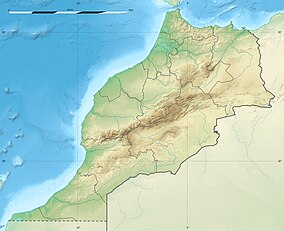
Mediterranean conifer and mixed forests is an ecoregion, in the temperate coniferous forest biome, which occupies the high mountain ranges of North Africa. The term is also a botanically recognized plant association in the African and Mediterranean literature.

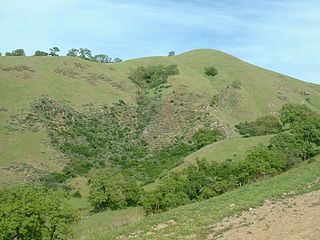
The Klamath Mountains ecoregion of Oregon and California lies inland and north of the Coast Range ecoregion, extending from the Umpqua River in the north to the Sacramento Valley in the south. It encompasses the highly dissected ridges, foothills, and valleys of the Klamath and Siskiyou Mountains. It corresponds to the Level III ecoregion designated by the Environmental Protection Agency and to the Klamath-Siskiyou forests ecoregion designated by the World Wide Fund for Nature.

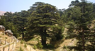
Ifrane National Park is a national park located in the Middle Atlas mountain range, in Morocco. Its territory extends over the Western part of the Middle Atlas mountains and areas within the provinces of Ifrane and Boulmane. It was established in 2004 and covers an area of 125,000 hectares. Much of the park is forested with Atlas cedar. Ifrane National Park is one of the few remaining habitats for the Barbary macaque, Macaca sylvanus; this primate prehistorically had a much broader range in North Africa, but currently survives as an endangered species in narrowly restricted and fragmented habitats.
Morocco provides a refuge for a rich and diverse flora with about 4,200 taxa, of which 22% are endemic. The phytogeographic zones of Morocco comprise 8 zones: the Mediterranean zone, the Cedar zone (1000-2000m), the sub-Alpine zone (2,000-2,500m), the Alpine zone (2,500m+), the semi-desert scrub zone, the Reg, the sandy desert zone and the oases.

The South Apennine mixed montane forests is an ecoregion in the southern Apennine Mountains of southern Italy and Sicily. It has a Mediterranean climate, and is in the Mediterranean forests, woodlands, and scrub biome.

The California coastal sage and chaparral is a Mediterranean forests, woodlands, and scrub ecoregion located in southwestern California and northwestern Baja California (Mexico). It is part of the larger California chaparral and woodlands ecoregion.
The California interior chaparral and woodlands ecoregion covers 24,900 square miles (64,000 km2) in an elliptical ring around the California Central Valley. It occurs on hills and mountains ranging from 300 feet (91 m) to 3,000 feet (910 m). It is part of the Mediterranean forests, woodlands, and scrub biome, with cool, wet winters and hot, dry summers. Temperatures within the coast can range from 53° to 65 °F and 32° to 60 °F within the mountains. Many plant and animal species in this ecoregion are adapted to periodic fire.

The Southeastern conifer forests are a temperate coniferous forest ecoregion of the southeastern United States. It is the largest conifer forest ecoregion east of the Mississippi River. It is also the southernmost instance of temperate coniferous forest within the Nearctic realm.

The Mount Ilgaz National Park is a protected area established on June 2, 1976 and located on the Ilgaz Mountains at the borderline between Kastamonu Province and Çankırı Province in the western Black Sea Region of Turkey. Natural resources and its potential for recreational activities are the main values of the national park, which stretches over an area of 742.38 ha.
The Southern Anatolian montane conifer and deciduous forests ecoregion, in the Mediterranean forests, woodlands, and scrub biome, is in the eastern Mediterranean Basin.

The Anatolian conifer and deciduous mixed forests is an ecoregion located in southwestern Anatolia, Turkey. It has a Mediterranean climate, and is part of the Mediterranean forests, woodlands, and scrub biome.

The Selenge–Orkhon forest steppe ecoregion stretches across north central Mongolia, and follows the Selenga River northeast into Russia. The ecoregion is itself at high elevations, but surrounded by higher mountain ranges. As a transition zone between taiga and steppe, it features conifer forests on the north slopes of mountains, and pine/aspen stands on southern slopes. It has an area of 227,660 square kilometres (87,900 sq mi).

The Northeastern Spain and Southern France Mediterranean forests is a Mediterranean forests, woodlands, and scrub ecoregion in southwestern Europe. It occupies the Mediterranean coastal region of northeastern Spain, Southern France, the Balearic Islands and a small part of Italy.

The Iberian conifer forests is a Mediterranean forests, woodlands, and scrub ecoregion in southwestern Europe. It includes the mountain forests of southern and central Spain.

The Mediterranean High Atlas juniper steppe is a montane grasslands and shrublands ecoregion in Morocco. It extends along the High Atlas range of northwestern Africa's Atlas Mountains.