Related Research Articles

Worcestershire is a county in the West Midlands of England. The area that is now Worcestershire was absorbed into the unified Kingdom of England in 927, at which time it was constituted as a county.

Hereford is a cathedral city, civil parish and the county town of Herefordshire, England. It lies on the River Wye, approximately 16 miles (26 km) east of the border with Wales, 24 miles (39 km) south-west of Worcester and 23 miles (37 km) north-west of Gloucester. With a population of 53,112 in 2021 it is by far the largest settlement in Herefordshire.

Credenhill is a village and civil parish in Herefordshire, England. The population of this civil parish taken at the 2011 Census was 2,271.
The history of Herefordshire starts with a shire in the time of Athelstan (895–939), and Herefordshire is mentioned in the Anglo-Saxon Chronicle in 1051. The first Anglo-Saxon settlers, the Magonsætan, were a sub-tribal unit of the Hwicce who occupied the Severn valley. The Magonsætan were said to be in the intervening lands between the Rivers Wye and Severn. The undulating hills of marl clay were surrounded by the Welsh mountains to the west; the Malvern Hills to the east; the Clent Hills of the Shropshire borders to the north, and the indeterminate extent of the Forest of Dean to the south. The shire name first recorded in the Anglo-Saxon Chronicle was derived from "Here-ford", Old English for "Army crossing", the location for the city.

Miles FitzWalter of Gloucester, 1st Earl of Hereford was a great magnate based in the west of England. He was hereditary Constable of England and Sheriff of Gloucestershire.

Moreton on Lugg is a village and civil parish in Herefordshire, England. The city and county town of Hereford is approximately 3 miles (5 km) to the south; the market and minster town of Leominster 8 miles (13 km) to the north.

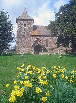
Eardisley is a village and civil parish in Herefordshire about 4.5 miles (7.2 km) south of the centre of Kington. Eardisley is in the Wye valley in the northwest of the county, close to the border with Wales.

Pipe and Lyde is a village and civil parish in Herefordshire, England. The parish includes the village of Pipe and Lyde and the hamlets of Lower Lyde and Upper Lyde. The population of the civil parish as taken at the 2011 census was 344. Parts of the church of St Peter date from the 13th century including the south doorway which includes Transitional moulding. James Honeyman-Scott (1956-1982), the Pretenders guitarist, is buried in the churchyard.
Grafton is a village and civil parish in Herefordshire, England. The population of this civil parish was 258 at the 2011 census. The parish includes the villages of Grafton and Bullinghope, and is immediately to the south of Hereford city.

Madley is a village and civil parish in the English county of Herefordshire. It is located six miles west of the city of Hereford. The population of the civil parish at the 2011 census was 1,200.

Hereford Castle is a castle that used to be in the cathedral city of Hereford, the county town of Herefordshire, England. Founded sometime before 1052, it was one of the earliest castles in England. Hereford Castle was probably destroyed when the Welsh sacked Hereford in 1055, but seems to have been replaced by the following decade. During the civil war, when Stephen sought to usurp Queen Matilda, the castle was besieged three times; the garrison surrendered each time and control of Hereford Castle changed hands.

Hampton Court Castle, also known as Hampton Court, is a castellated country house in the English county of Herefordshire. The house is in the parish of Hope under Dinmore 4 miles (6.4 km) south of Leominster and is a Grade I listed building, which is the highest category of architecture in the statutory protection scheme.

Bridstow is a village and civil parish in Herefordshire, England, 2 km west of Ross-on-Wye and 17 km south-east of Hereford. The parish is bounded to the east and south by the River Wye. The A40 road linking the M50 motorway to South Wales runs through the parish, crossing the Wye at Bridstow Bridge. The parish had a population of 906 in the 2011 UK census, and an estimated population of 941 in 2018.

The administrative boundaries of Worcestershire, England have been fluid for over 150 years since the first major changes in 1844. There were many detached parts of Worcestershire in the surrounding counties, and conversely there were islands of other counties within Worcestershire. The 1844 Counties Act began the process of eliminating these, but the process was not completed until 1966, when Dudley was absorbed into Staffordshire.
Treville is a rural area and former royal forest in the English county of Herefordshire. It is near Wormbridge and other small settlements.
Grendon Bishop is a civil parish in the county of Herefordshire, England.

Pencombe with Grendon Warren is a civil parish in the county of Herefordshire, England. The parish was created in 1895 from the parishes of Pencombe and Grendon Warren, its only nucleated settlement being the village of Pencombe.
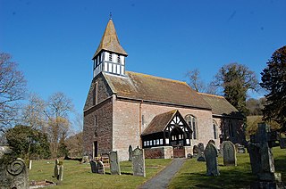
Castle Frome is a village and civil parish in the county of Herefordshire, England, and is 10 miles (16 km) north-east from the city and county town of Hereford. The closest large town is the market town of Bromyard, 5 miles (8 km) to the north. The Norman font in Castle Frome church is "one of the outstanding works of the Herefordshire school".
Rodd, Nash and Little Brampton is a civil parish in the county of Herefordshire, England, and is 18 miles (29 km) north-west from the city and county town of Hereford. The parish borders Powys in Wales at its north-west. Within the parish is the final home and studio of the 20th-century Australian artist Sydney Nolan.

Sutton is a civil parish in Herefordshire, England, about 3 miles (5 km) north-east from the county town and city of Hereford. The major settlement is the village of Sutton St Nicholas which is conjoined with Sutton St Michael, formerly the village of a separate parish. The parish is sometimes referred to as Sutton St Nicholas. Within the parish is Sutton Walls, the supposed site of the palace of the kings of Mercia.
References
- ↑ "Civil Parish population 2011" . Retrieved 30 October 2015.
- ↑
- Raymond Grant (1991). The royal forests of England. Wolfeboro Falls, NH: Alan Sutton. ISBN 0-86299-781-X. OL 1878197M. 086299781X. See Appendix, p225
- ↑ Francis Beaufort Palmer (February 2007), Peerage Law in England, Lawbook Exchange, ISBN 9781584777489, OL 9452596M, 1584777486 See Appendix, p242 and Theophilus Jones (1805), A history of the county of Brecknock (A history of the county of Brecknock. ed.), Brecknock: Printed and sold by Wm. & Geo. North ... for the author; and sold by J. Booth ... London., OL 14012583M p67
- ↑ Map [ permanent dead link ] linked from Forests and Chases of England and Wales, c. 1000 to c. 1850: An Inventory of Early Maps and Plans
- ↑ 'Hayle - Hazon', in A Topographical Dictionary of England, ed. Samuel Lewis (London, 1848), pp. 454-456 [accessed 26 August 2015].