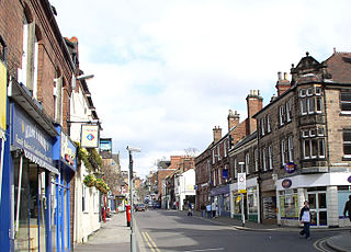
Belper is a town and civil parish in the local government district of Amber Valley in Derbyshire, England, located about 7 miles (11 km) north of Derby on the River Derwent. As well as Belper itself, the parish also includes the village of Milford and the hamlets of Bargate, Blackbrook and Makeney. As of the 2011 Census, the parish had a population of 21,823. Originally a centre for the nail-making industry since Medieval times, Belper expanded during the early Industrial Revolution to become one of the first mill towns with the establishment of several textile mills; as such, it forms part of the Derwent Valley Mills World Heritage Site.
Heage is a village in Derbyshire, England, situated midway between Belper and Ripley in the Amber Valley district. The village is in the Heage and Ambergate ward, which in the 2011 census had a population of 5,013.
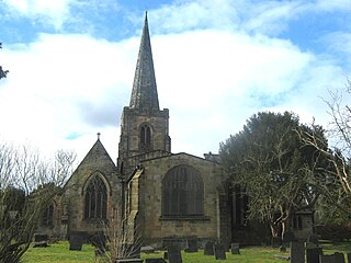
Duffield is a village in the Amber Valley district of Derbyshire, 5 miles (8.0 km) north of Derby. It is centred on the western bank of the River Derwent at the mouth of the River Ecclesbourne. It is within the Derwent Valley Mills World Heritage Area and the southern foothills of the Pennines.

Willington is a village and civil parish in the South Derbyshire district of Derbyshire, England. The 2001 Census recorded a parish population of 2,604, increasing to 2,864 at the 2011 Census.

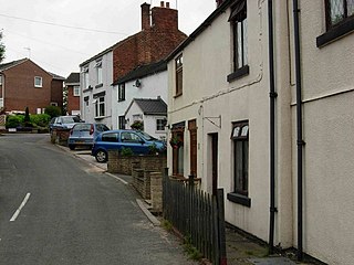
Milford is a village in Derbyshire, England, on the River Derwent, between Duffield and Belper on the A6 trunk road.

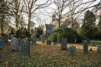
Duffield Castle was a Norman Castle in Duffield, Derbyshire. The site is a Scheduled Ancient Monument.
Duffield Frith was, in medieval times, an area of Derbyshire in England, part of that bestowed upon Henry de Ferrers by King William, controlled from his seat at Duffield Castle. From 1266 it became part of the Duchy of Lancaster and from 1285 it was a Royal Forest with its own Forest Courts.

Leven is a village and civil parish in the East Riding of Yorkshire, England. It is situated approximately 7 miles (11 km) west of Hornsea town centre, and north-west of the A165 road.

Ashleyhay is a village and civil parish in the Amber Valley district of Derbyshire, England, about five miles north-west of Belper. It is also situated one and three-quarters of a mile south of Wirksworth and eleven miles north of Derby city centre. According to the 2001 census it had a population of 105, increasing to 118 at the 2011 Census.

Atlow is a village and civil parish in the Derbyshire Dales district of Derbyshire, England, about eight miles west of Belper. According to the 2001 census the parish had a population of 98. At the 2011 Census the population remained less than 100. Details are included in the civil parish of Hognaston.

Taddington is a village and civil parish in Derbyshire, England. The population of the civil parish, together with neighbouring Blackwell in the Peak and Brushfield parishes, as taken at the 2011 census, was 457. It lies over 1,100 feet (340 m) above sea level, on the former A6 road between Buxton and Bakewell, in the Derbyshire Dales district. To the east, the A6 runs through Taddington Dale, while Taddington Moor lies to the west.
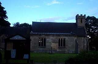
Dalbury Lees is a parish in south Derbyshire. The population of the civil parish as taken at the 2011 Census was 306. It is about six miles (10 km) from both Burton-on-Trent and Derby and just under four miles (6 km) from Egginton. The parish contains the villages of Dalbury and Lees which are just under 2 miles (3.2 km) apart from one another. Dalbury Lees has been known as Dalbury and as Dalbury with Lees, but Dalbury Lees is the preferred term

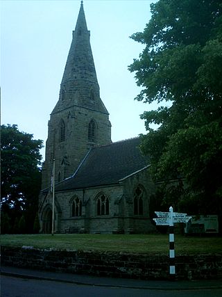
Sutton-on-the-Hill is a parish in south Derbyshire eight miles (13 km) west of Derby. The population of the civil parish taken at the 2011 Census was 123. The village is widely spread out and contains both a church and a chapel. It was described as "a parish, with two townships and a hamlet" in the 1870s. Now it has no shop or post office and limited public transport links. Sutton on the Hill is primarily an agricultural area with former dairy farms at either end of the village, along with the Sutton Estate Farm. The village school has been converted into a village hall and has a nursery school for the local villages.
Lullington is a village and civil parish in the district of South Derbyshire in Derbyshire, England. The population of the civil parish at the 2011 Census was 121. It has an All Saints' Church, a village hall and a pub, the Colvile Arms. Together with neighbouring Netherseal, it is the southernmost village in Derbyshire.

Holbrook is a village in Derbyshire at the southern end of the Pennines around five miles north of Derby, England. The population of the civil parish at the 2011 census was 1,538.
Windley is a small village and civil parish in Derbyshire, England, around 6 miles (10 km) north of Derby, adjacent to the B5023 Duffield to Wirksworth road. The civil parish population as taken at the 2011 Census was 148.

Shottle is a village approximately 3 miles (4.8 km) south of the market town of Wirksworth in Derbyshire. The population of the civil parish at the 2011 Census was 266.

Turnditch is a village and civil parish in the Amber Valley district of Derbyshire, England. The population of the civil parish at the 2011 Census was 301. It is around 10 miles (16 km) north of Derby on the A517 road from Belper to Ashbourne.

Hazelwood Railway Station is a disused railway station on the Wirksworth branch of the Midland Railway. It served the village of Hazelwood.

Mapleton, sometimes spelt Mappleton, is a village and a civil parish in the Derbyshire Dales District, in the English county of Derbyshire. It is near the River Dove and the town of Ashbourne. Mapleton has a post office, a pub called the Okeover Arms and a church. In 2011, according to census data, the Parish had a population of 147 people. There is an annual event in which people jump off of the Mapleton Bridge to raise money for charity.