
Peng Chau is a small island located off the north-eastern coast of Lantau Island,Hong Kong. It is known locally for its temples,fishing industry and seafood.

The Islands District is one of the 18 districts of Hong Kong. It is part of the New Territories. It had a population of 170,900 in 2018.

The kai-to,sometimes kaito or kaido is a type of small,motorised ferry that operates in Hong Kong. They are usually used to serve remote coastal settlements in the territory's outlying islands.

Hong Kong &Kowloon Ferry Ltd (HKKF) is a ferry service company in Hong Kong. It was formed by a number of shipping and shipbuilding firms,and was incorporated in Hong Kong in February 1998.
This is a list of prisons in Hong Kong managed by the Correctional Services Department.

Chi Ma Wan is a bay on southeastern Lantau Island,New Territories,Hong Kong. Chi Ma Wan Peninsula is where Chi Ma Wan,as well as Cheung Sha Wan,Tai Long Wan,Yi Long Wan and Mong Tung Wan are located. The Peninsula is located within the boundaries of Lantau South Country Park.
Sunshine Island,also known as Chau Kung To (周公島) indigenously,is a companion island of Hei Ling Chau in Hong Kong. Located northeast of Hei Ling Chau and south of Peng Chau,the island was once the site of a drug addiction treatment centre. The island features scenic rocks and some abandoned buildings. It has only one inhabitant,a 78-year-old named Lam Chi-ngai,and there is no public transport to the island.

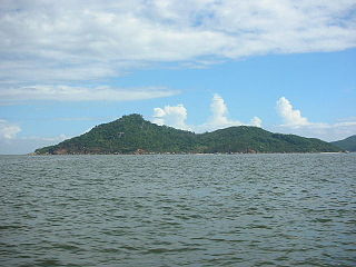
Kau Yi Chau,also known as Tai Kau Yi Chau,is an uninhabited island located west of Victoria Harbour,between Peng Chau and Green Island in Hong Kong. It is located on the crossroad of sea routes,east to west and north to south. The ferry between Central and Mui Wo sails close to the south of the island. Administratively it is part of Islands District.
Articles related to Hong Kong include:

Shek Kwu Chau is an island of Hong Kong,located south of Lantau Island and between Cheung Chau and the Soko Islands. Administratively,it is part of Islands District.

Kam Peng Estate is a public housing estate in Peng Chau,New Territories,Hong Kong. It is the only public housing estate in Peng Chau,and has only one residential block built in 1996.

The following is an overview of Public housing estates in Cheung Sha Wan,Hong Kong,including Home Ownership Scheme (HOS),Green Form Subsidised Home Ownership Scheme (GFSHOS),Private Sector Participation Scheme (PSPS),and Tenants Purchase Scheme (TPS) estates.

The former Lai Chi Kok Hospital,located at No.800 Castle Peak Road,Lai Chi Kok,Kowloon,was listed as one of the Grade III historic buildings in Hong Kong on 24 June 2010. The site has now been transformed into Jao Tsung-I Academy under batch 1 of the Hong Kong Government's revitalisation scheme.
Dibamus bogadeki,or Bogadek's burrowing lizard,is a species of legless lizard in the family Dibamidae. The species is endemic to Hong Kong.
The Hei Ling Chau Addiction Treatment Centre is a government-run drug rehabilitation centre located on the island of Hei Ling Chau in Hong Kong. The Centre is operated by the Hong Kong Correctional Services Department and reserved for male detainees only. The current superintendent of the Centre is Or Suen-wai,Timothy.

Shap Long Reservoir,built in 1955,is a reservoir located in Chi Ma Wan Peninsula and Lantau South Country Park in Chi Ma Wan,Lantau Island,Hong Kong. The Chi Ma Wan Country Trail and the Chi Ma Wan Mountain Bike Trail pass through the reservoir. The reservoir used to be the main water source for the residents of Cheung Chau,Peng Chau and Hei Ling Chau in the Islands District before being converted into an irrigation reservoir in the 1970s.
Shap Long is a village located on Lantau Island,Hong Kong.


