Heino, Netherlands

Last updated
Heino
Village
Heino - kerken 2011-1.jpg
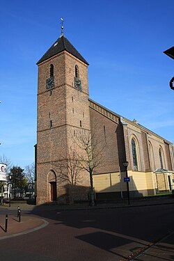
Heino church: de Nederlands Hervormde Zaalkerk
2010-NL-P04-Overijssel-positiekaart-gemnamen.jpg
Red pog.svg
Heino
Location in province of Overijssel in the Netherlands
Netherlands location map.svg
Red pog.svg
Heino
Heino (Netherlands)
Coordinates: 52°26′9″N6°14′2″E / 52.43583°N 6.23389°E / 52.43583; 6.23389
Country Netherlands
Province Overijssel
Municipality Raalte
Area
[1]
  Total22.04 km2 (8.51 sq mi)
Elevation
[2]
3.6 m (11.8 ft)
Population
 (2021) [1]
  Total7,170
  Density330/km2 (840/sq mi)
Time zone UTC+1 (CET)
  Summer (DST) UTC+2 (CEST)
Postal code
8141 [1]
Dialing code 0572
Website www.raalte.nl

Heino is a village in the province of Overijssel in the Netherlands. It belongs to the municipality of Raalte and it has 7,080 inhabitants (January 2018). The village has a railway station along the railway Zwolle - Enschede and it can also be reached by the road N35.

Contents

Heino was a separate municipality until 2001, when it merged with Raalte to form a new municipality with the name Raalte. [3]

Heino is a very touristic village with many estates and country houses. South-west of Heino, just across the railroad and the border to the municipality Olst-Wijhe, stands the castle Nijenhuis. It hosts an important art museum ( Constant Permeke, Van Gogh et al.). Around the castle is a sculpture garden (Ossip Zadkine et al.).

Every third week of August the village celebrates the 'Pompdagen' (Pumpdays), mentioned after the local Leugenpompe [4] village pump. The highlight of a series of joyful events is the so-called "Daggie Old Heino", including trades and handicraft from the past; markets and folk music. It draws thousands of visitors to Heino.

Climate

Climate data for Heino (1991−2020 normals, extremes 1989−present)
MonthJanFebMarAprMayJunJulAugSepOctNovDecYear
Record high °C (°F)14.5
(58.1)
19.3
(66.7)
23.7
(74.7)
28.6
(83.5)
31.5
(88.7)
34.7
(94.5)
39.3
(102.7)
35.4
(95.7)
32.2
(90.0)
26.3
(79.3)
19.7
(67.5)
15.0
(59.0)
39.3
(102.7)
Mean daily maximum °C (°F)5.5
(41.9)
6.5
(43.7)
10.1
(50.2)
14.6
(58.3)
18.2
(64.8)
20.9
(69.6)
23.0
(73.4)
22.7
(72.9)
19.2
(66.6)
14.5
(58.1)
9.5
(49.1)
6.1
(43.0)
14.2
(57.6)
Daily mean °C (°F)3.0
(37.4)
3.3
(37.9)
5.9
(42.6)
9.3
(48.7)
13.0
(55.4)
15.8
(60.4)
17.9
(64.2)
17.4
(63.3)
14.2
(57.6)
10.5
(50.9)
6.6
(43.9)
3.7
(38.7)
10.0
(50.0)
Mean daily minimum °C (°F)0.2
(32.4)
0.1
(32.2)
1.6
(34.9)
3.5
(38.3)
7.1
(44.8)
10.2
(50.4)
12.4
(54.3)
11.9
(53.4)
9.4
(48.9)
6.5
(43.7)
3.5
(38.3)
1.0
(33.8)
5.6
(42.1)
Record low °C (°F)−17.5
(0.5)
−17.9
(−0.2)
−17.2
(1.0)
−7.9
(17.8)
−2.2
(28.0)
−0.1
(31.8)
4.6
(40.3)
4.0
(39.2)
0.0
(32.0)
−6.8
(19.8)
−9.7
(14.5)
−15.4
(4.3)
−17.9
(−0.2)
Average precipitation mm (inches)66.4
(2.61)
57.0
(2.24)
54.6
(2.15)
40.7
(1.60)
58.4
(2.30)
68.4
(2.69)
81.9
(3.22)
79.8
(3.14)
62.4
(2.46)
67.9
(2.67)
64.8
(2.55)
72.1
(2.84)
774.4
(30.49)
Average relative humidity (%)88.785.581.376.175.577.178.781.084.887.190.190.183.0
Mean monthly sunshine hours 62.992.5141.8191.8214.1205.1215.7194.4154.2119.965.354.91,712.6
Percent possible sunshine 24.633.038.445.943.940.842.742.640.436.324.722.536.3
Source: Royal Netherlands Meteorological Institute [5] [6]

Related Research Articles

<span class="mw-page-title-main">Arnhem</span> City and municipality in Gelderland, Netherlands

Arnhem is a city and municipality situated in the eastern part of the Netherlands, near the German border. It is the capital of the province of Gelderland, located on both banks of the rivers Nederrijn and Sint-Jansbeek, which was the source of the city's development.

<span class="mw-page-title-main">Drenthe</span> Province of the Netherlands

Drenthe is a province of the Netherlands located in the northeastern part of the country. It is bordered by Overijssel to the south, Friesland to the west, Groningen to the north, and the German state of Lower Saxony to the east. As of January 2023, Drenthe had a population of about 502,000, and a total area of 2,680 km2 (1,030 sq mi).

<span class="mw-page-title-main">Hoogeveen</span> Municipality in Drenthe, Netherlands

Hoogeveen is a municipality and a town in the Dutch province of Drenthe.

<span class="mw-page-title-main">Raalte</span> Municipality in Overijssel, Netherlands

Raalte is a municipality and a town in the heart of the region of Salland in the Dutch province of Overijssel.

<span class="mw-page-title-main">Buren</span> Municipality in Gelderland, Netherlands

Buren is a town and municipality in the Betuwe region of the Netherlands. Buren has 27,168 inhabitants as of 1 January 2022.

<span class="mw-page-title-main">Ede, Netherlands</span> Town and Municipality in Gelderland, Netherlands

Ede is a municipality and a town in the centre of the Netherlands, in the province of Gelderland. As of 1 July 2021, Ede had 119,186 inhabitants.

<span class="mw-page-title-main">Gilze en Rijen</span> Municipality in North Brabant, Netherlands

Gilze en Rijen is a municipality in the southern Netherlands. The municipality contains four villages: Rijen, Gilze, Hulten and Molenschot. It is home to the Gilze-Rijen Air Base.

<span class="mw-page-title-main">Ravenstein, Netherlands</span> City in North Brabant, Netherlands

Ravenstein is a city and a former municipality in the south of the Netherlands, in the province of North Brabant. The former municipality covered an area of 42.68 km². In 2003 it was incorporated into the city of Oss.

<span class="mw-page-title-main">Voorschoten</span> Municipality in South Holland, Netherlands

Voorschoten is a village and municipality in the western Netherlands, in the province of South Holland. It is a smaller town in the Randstad, enclosed by the cities of Leiden, Wassenaar and The Hague. The municipality covers an area of 11.56 km2 (4.46 sq mi) of which 0.42 km2 (0.16 sq mi) is covered by water.

<span class="mw-page-title-main">Dronryp</span> Village in Friesland, Netherlands

Dronryp is a village in the Dutch municipality of Waadhoeke. On 1 January 2017, it had 3,281 inhabitants.

<span class="mw-page-title-main">Koarnjum</span> Village in Friesland, Netherlands

Koarnjum is a village in the municipality of Leeuwarden, in the Netherlands. The village is situated between Jelsum and Britsum and a population of around 370 in January 2017.

<span class="mw-page-title-main">Westdorpe</span> Village in Zeeland, Netherlands

Westdorpe is a village in the Dutch province of Zeeland. It is a part of the municipality of Terneuzen, and lies about 31 km southeast of Vlissingen.

<span class="mw-page-title-main">Berkhout</span> Village in North Holland, Netherlands

Berkhout is a village in the northwest Netherlands. It is in the municipality of Koggenland, North Holland, about 5 km (3 mi) west of Hoorn.

<span class="mw-page-title-main">Arcen</span> Dorp in Limburg, Netherlands

Arcen is a village in the Dutch province of Limburg. In 2010, it became part of the municipality of Venlo. Previously, it had been part of the municipality of Arcen en Velden and the seat of the town hall.

<span class="mw-page-title-main">Cabauw</span> Village in Utrecht, Netherlands

Cabauw is a village in the Dutch province of Utrecht. It is part of the municipality of Lopik, and lies about 12 km southwest of IJsselstein. Cabauw consists of a small village centre, and a ribbon of farms along the Lopikerwetering canal, between Zevender and Lopik.

<span class="mw-page-title-main">Herwijnen</span> Village in Gelderland, Netherlands

Herwijnen is a village in the Dutch province of Gelderland. It is a part of the municipality of West Betuwe, and lies about 11 km east of Gorinchem.

<span class="mw-page-title-main">Caribbean Netherlands</span> Netherlands Caribbean municipalities

The Caribbean Netherlands is a geographic region of the Netherlands located outside of Europe, in the Caribbean, consisting of three so-called special municipalities. These are the islands of Bonaire, Sint Eustatius and Saba, as they are also known in legislation, or the BES islands for short. The islands are officially classified as public bodies in the Netherlands and as overseas territories of the European Union; as such, European Union law does not automatically apply to them.

<span class="mw-page-title-main">Lemelerveld</span> Village in Overijssel, Netherlands

Lemelerveld is a village in the municipality of Dalfsen in the province of Overijssel, Netherlands. The village developed around a sugar beet factory.

<span class="mw-page-title-main">Maïté Duval</span> Dutch-French sculptor (1944–2019)

Marie-Thérèse Marguerite Jeanne (Maïté) Duval was a French-born Dutch sculptress and drafter.

References

  1. 1 2 3 "Kerncijfers wijken en buurten 2021". Central Bureau of Statistics. Retrieved 27 April 2022.
  2. "Postcodetool for 8141AA". Actueel Hoogtebestand Nederland (in Dutch). Het Waterschapshuis. Retrieved 15 March 2022.
  3. Ad van der Meer and Onno Boonstra, Repertorium van Nederlandse gemeenten , KNAW, 2011.
  4. W. de Blécourt; R.A. Koman; et al. (2010). Verhalen van stad en streek: Sagen en legenden in Nederland (in Dutch). Bert Bakker. pp. 172–173. ISBN   9789035132023.
  5. "Weerstatistieken Heino". Royal Netherlands Meteorological Institute . Retrieved June 26, 2022.
  6. "Klimaatviewer 1991-2020". Royal Netherlands Meteorological Institute . Retrieved June 26, 2022.