Helenwood, Tennessee

Last updated

Helenwood, Tennessee
Helenwood-RR-tracks-tn1.jpg
TNMap-doton-Helenwood.PNG
Location of Helenwood, Tennessee
Coordinates: 36°25′24″N84°32′29″W / 36.42333°N 84.54139°W / 36.42333; -84.54139
Country United States
State Tennessee
County Scott
Area
[1]
  Total2.01 sq mi (5.20 km2)
  Land2.01 sq mi (5.20 km2)
  Water0.00 sq mi (0.00 km2)
Elevation
[2]
1,388 ft (423 m)
Population
 (2020) [3]
  Total635
  Density316.08/sq mi (122.05/km2)
Time zone UTC-5 (Eastern (EST))
  Summer (DST) UTC-4 (EDT)
ZIP code
37755
Area code 423
FIPS code 47-33120 [4]
GNIS feature ID1287335 [2]

Helenwood is an unincorporated community in Scott County, Tennessee, United States. The population was 846 at the 2000 census, when Helenwood was treated as an incorporated municipality. For the 2010 census, it was a census-designated place (CDP) with a population of 865.

Contents

History

Helenwood was platted in 1859 under the name "Homestead." [5] It was settled as a coal-mining community. The origin of its current name is not known. [5]

On April 5, 1935, a dynamite explosion caused extensive damage in Helenwood, destroying fifteen homes and damaging many other homes and businesses. [6] [7] One news account said that Helenwood was "literally wiped off the map." [6] There were no fatalities. [7]

Helenwood was incorporated as a town by referendum in 1997, after the state statute that set minimum criteria for municipal incorporation was amended by the Tennessee General Assembly to remove the requirement that a newly incorporating area must not be within three miles of an existing city and to reduce the minimum population for incorporation from 1,500 residents to 225. The legislation that changed the statute had been introduced by Lieutenant Governor John S. Wilder in order to allow Hickory Withe to become a municipality. Helenwood's incorporation was rescinded by state courts after the amendments were declared unconstitutional. [8]

Geography

Helenwood is located at 36°25′24″N84°32′29″W / 36.42333°N 84.54139°W / 36.42333; -84.54139 (36.423357, -84.541511). [9] It is situated along U.S. Route 27 north of Huntsville, in Tennessee's Cumberland Plateau region.

According to the United States Census Bureau, the town has a total area of 2.8 square miles (7.3 km2), all land.

Demographics

Historical population
CensusPop.Note
2020 635
U.S. Decennial Census [10]

As the census of 2010, there were 865 people in the Helenwood CDP.

As of the census [4] of 2000, there were 846 people, 341 households, and 247 families residing in the town. The population density was 307.0 inhabitants per square mile (118.5/km2). There were 364 housing units at an average density of 132.1 per square mile (51.0/km2). The racial makeup of the town was 97.87% White, 0.59% Native American, and 1.54% from two or more races.

There were 341 households, out of which 37.5% had children under the age of 18 living with them, 54.8% were married couples living together, 14.7% had a female householder with no husband present, and 27.3% were non-families. 24.9% of all households were made up of individuals, and 10.0% had someone living alone who was 65 years of age or older. The average household size was 2.47 and the average family size was 2.95.

In the town the population was spread out, with 27.1% under the age of 18, 11.0% from 18 to 24, 27.8% from 25 to 44, 21.6% from 45 to 64, and 12.5% who were 65 years of age or older. The median age was 34 years. For every 100 females, there were 88.8 males. For every 100 females age 18 and over, there were 85.3 males.

The median income for a household in the town was $18,148, and the median income for a family was $21,094. Males had a median income of $26,023 versus $20,833 for females. The per capita income for the town was $9,217. About 28.1% of families and 33.1% of the population were below the poverty line, including 49.4% of those under age 18 and 16.5% of those age 65 or over.

Notable people

Related Research Articles

<span class="mw-page-title-main">Citrus Hills, Florida</span> Census-designated place in Florida, US

Citrus Hills is a census-designated place (CDP) in Citrus County, Florida, United States. The population was 7,470 at the 2010 census, up from 4,029 in 2000.

<span class="mw-page-title-main">Eastpoint, Florida</span> CDP in Florida, United States

Eastpoint is a census-designated place (CDP) in Franklin County, Florida, United States. The population was 2,337 at the 2010 census.

<span class="mw-page-title-main">Collegeville, Indiana</span> Census-designated place in Indiana, United States

Collegeville is a census-designated place (CDP) in Jasper County, Indiana, United States. The population was 330 at the 2010 census. Collegeville is home to the now-unaccredited Saint Joseph's College, the source of the town's name.

<span class="mw-page-title-main">Park View, Iowa</span> CDP in Iowa, USA

Park View is a census-designated place (CDP) in Scott County, Iowa, United States. The population was 2,709 at the time of the 2020 census; up from 2,389 at the 2010 census.

<span class="mw-page-title-main">Pryor, Montana</span> Census-designated place in Montana, United States

Pryor is a census-designated place (CDP) in Big Horn County, Montana, United States. The community is located on Crow Tribe's reservation. The population was 618 at the 2010 census. The area is named for Nathaniel Hale Pryor, a sergeant in the Lewis and Clark Expedition.

<span class="mw-page-title-main">Woodbridge (CDP), New Jersey</span> Populated place in Middlesex County, New Jersey, US

Woodbridge is an unincorporated community and census-designated place (CDP) within Woodbridge Township, in Middlesex County, in the U.S. state of New Jersey. As of the 2010 United States Census, the CDP's population was 19,265. Despite the similarity in the name of the CDP and the township, the two are not coextensive; the CDP occupies 15.7% of the township's 24.51 square miles (63.5 km2).

<span class="mw-page-title-main">Washington Heights, New York</span> CDP in New York, United States

Washington Heights is a census-designated place (CDP) in Orange County, New York, United States. The population was 2,205 at the 2020 census.

<span class="mw-page-title-main">Riverside, Suffolk County, New York</span> Hamlet and census-designated place in New York, United States

Riverside is a hamlet and census-designated place (CDP) in Suffolk County, New York, United States. The population was 2,911 at the 2010 census.

<span class="mw-page-title-main">Enochville, North Carolina</span> CDP in North Carolina, United States

Enochville is a census-designated place (CDP) in Rowan County, North Carolina, United States. The population was 2,851 at the 2000 census.

<span class="mw-page-title-main">East Berwick, Pennsylvania</span> Census-designated place in Pennsylvania, United States

East Berwick is a census-designated place (CDP) in Salem Township, Luzerne County, Pennsylvania, United States. The population was 2,007 at the 2010 census.

<span class="mw-page-title-main">Mayberry Township, Pennsylvania</span> Township in Pennsylvania, United States

Mayberry Township is a township in Montour County, Pennsylvania, United States.

South Cleveland is a census-designated place (CDP) in Bradley County, Tennessee, United States. The population was 7,673 at the 2020 census. The community is located directly south of the city of Cleveland, Tennessee. It is included in the Cleveland Metropolitan Statistical Area.

Harrison is a census-designated place (CDP) in Hamilton County, Tennessee, United States. The population was 7,902 at the 2020 census. It is part of the Chattanooga metropolitan area. Harrison Bay State Park, the Hamilton County Landfill, Bear Trace Golf Course, a course designed by Jack Nicklaus, and Skull Island, a recreational area owned by TVA, are all located in Harrison.

Midtown is a census-designated place (CDP) in Roane County, Tennessee, United States. Its population was 1,360 as of the 2010 census. Twice in the 1990s residents voted to incorporate as a town, and for a time the community maintained a municipal government, but the incorporation was challenged in court and eventually overturned after the state statute under which Midtown incorporated was ruled unconstitutional. It was a city at the time of the 2000 census, when the population was 1,306. It is included in the Knoxville Metropolitan Area.

<span class="mw-page-title-main">Mason, Tennessee</span> Town in Tennessee, United States

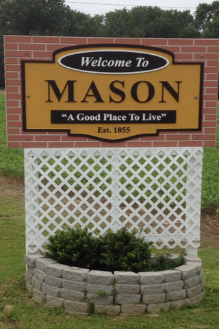
Mason is a town in Tipton County, Tennessee. The population was 1,609 at the 2010 census. Mason is located along U.S. Route 70, and is home to a federal detention facility.

Oak Grove is a census-designated place (CDP) in Washington County, Tennessee, United States. The population was 4,425 at the 2010 census. It is part of the Johnson City Metropolitan Statistical Area, which is a component of the Johnson City–Kingsport–Bristol, TN-VA Combined Statistical Area – commonly known as the "Tri-Cities" region.

Rural Hill is a census-designated place (CDP) in Wilson County, Tennessee. The population was 2,132 at the 2010 census.

<span class="mw-page-title-main">Ewing, Virginia</span> Census-designated place in Virginia, United States

Ewing is an unincorporated community and census-designated place (CDP) in Lee County, Virginia. The population was 439 at the 2010 U.S. Census. Ewing is one of the westernmost settlements in the Commonwealth of Virginia, before reaching the Cumberland Gap and the borders with Kentucky and Tennessee.

<span class="mw-page-title-main">Tainter Lake, Wisconsin</span> CDP in Wisconsin, United States

Tainter Lake is a census-designated place (CDP) in part of the Town of Tainter, Dunn County, Wisconsin, and part of the Town of Red Cedar, Dunn County, Wisconsin, United States. The population was 2,550 at the 2020 census.

<span class="mw-page-title-main">Harrogate, Tennessee</span> City in Claiborne County, Tennessee, United States

Harrogate is the largest city in Claiborne County, Tennessee, United States. It is adjacent to Cumberland Gap National Historical Park.

References

  1. "ArcGIS REST Services Directory". United States Census Bureau. Retrieved October 15, 2022.
  2. 1 2 U.S. Geological Survey Geographic Names Information System: Helenwood, Tennessee
  3. "Census Population API". United States Census Bureau. Retrieved October 15, 2022.
  4. 1 2 "U.S. Census website". United States Census Bureau . Retrieved January 31, 2008.
  5. 1 2 Larry L. Miller (2001), Tennessee place-names , Indiana University Press. Page 97.
  6. 1 2 Dynamite Blast Rips Helenwood To Bits, Scott County, Tennessee, GenWeb (accessed November 17, 2007)
  7. 1 2 Local Chapter of Red Cross Celebrates 75th, Scott County, Tennessee, GenWeb, FNB Chronicles (accessed November 17, 2007)
  8. Associated Press, High court refuses to hear "tiny towns" appeal Archived January 9, 2004, at the Wayback Machine , The Oak Ridger, January 27, 2000
  9. "US Gazetteer files: 2010, 2000, and 1990". United States Census Bureau. February 12, 2011. Retrieved April 23, 2011.
  10. "Census of Population and Housing". Census.gov. Retrieved June 4, 2016.
  11. Boeing Frontiers Online