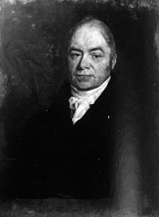
William Noy was an English jurist.

Marazion is a civil parish and town, on the shore of Mount's Bay in Cornwall, England, United Kingdom. It is 2 miles (3.2 km) east of Penzance and the tidal island of St Michael's Mount is half-a-mile offshore. At low water a causeway links it to the town and at high water passenger boats carry visitors between Marazion and St Michael's Mount. Marazion is a tourist resort with an active community of artists who produce and sell paintings and pottery in the town's art galleries.

Penzance is a town, civil parish and port in the Penwith district of Cornwall, England, United Kingdom. It is the most westerly major town in Cornwall and is about 64 miles (103 km) west-southwest of Plymouth and 255 miles (410 km) west-southwest of London. Situated in the shelter of Mount's Bay, the town faces south-east onto the English Channel, is bordered to the west by the fishing port of Newlyn, to the north by the civil parish of Madron and to the east by the civil parish of Ludgvan. The civil parish includes the town of Newlyn and the villages of Mousehole, Paul, Gulval, and Heamoor. Granted various royal charters from 1512 onwards and incorporated on 9 May 1614, it has a population of 21,200.

Redruth is a town and civil parish in Cornwall, England, United Kingdom. The population of Redruth was 14,018 at the 2011 census. In the same year the population of the Camborne-Redruth urban area, which also includes Carn Brea, Illogan and several satellite villages, stood at 55,400 making it the largest conurbation in Cornwall. Redruth lies approximately at the junction of the A393 and A3047 roads, on the route of the old London to Land's End trunk road, and is approximately 9 miles (14 km) west of Truro, 12 miles (19 km) east of St Ives, 18 miles (29 km) north east of Penzance and 11 miles (18 km) north west of Falmouth. Camborne and Redruth together form the largest urban area in Cornwall and before local government reorganisation were an urban district.

Camborne is a town in Cornwall, England, United Kingdom. The population at the 2011 Census was 20,845. The northern edge of the parish includes a section of the South West Coast Path, Hell's Mouth and Deadman's Cove.

Helston is a town and civil parish in Cornwall, England, United Kingdom. It is situated at the northern end of the Lizard Peninsula approximately 12 miles (19 km) east of Penzance and 9 miles (14 km) south-west of Falmouth. Helston is the most southerly town on the island of Great Britain and is around 1.5 miles (2.4 km) farther south than Penzance. The population in 2011 was 11,700.

Penryn is a civil parish and town in west Cornwall, England, United Kingdom. It is on the Penryn River about 1 mile (1.6 km) northwest of Falmouth. The population was 7,166 in the 2001 census and had been reduced to 6,812 in the 2011 census, a drop of more than 300 people across the ten-year time gap. There are two electoral wards covering Penryn: 'Penryn East and Mylor' and 'Penryn West'. The total population of both wards in the 2011 census was 9,790.
A stannary was an administrative division established under stannary law in the English counties of Cornwall and Devon to manage the collection of tin coinage, which was the duty payable on the metal tin smelted from the ore cassiterite mined in the region. In Cornwall, the duty was passed to the Duchy of Cornwall; in Devon to the Crown.

St Ives is a parliamentary constituency covering the western end of Cornwall and the Isles of Scilly. The constituency has been represented in the House of Commons of the UK Parliament since 2015 by Derek Thomas, a Conservative MP.

In Devon and Cornwall, tin coinage was a tax on refined tin, payable to the Duchy of Cornwall and administered in the Stannary Towns. The oldest surviving records of coinage show that it was collected in 1156. It was abolished by the Tin Duties Act 1838.

Wendron is a village and civil parish in Cornwall, England, United Kingdom. It is approximately 3 miles (5 km) to the north of Helston and 6 miles (10 km) to the west of Penryn. The parish population at the 2011 census was 2,743. The electoral ward of Wendron had a 2011 population of 4,936.
Helston, sometimes known as Helleston, was a parliamentary borough centred on the small town of Helston in Cornwall.

Spingo is a generic name for a collection of beers brewed solely in the brewery of the Blue Anchor Inn in Coinagehall Street, Helston, Cornwall, England, UK.

Joseph Carne was a British geologist and industrialist.

The Loe, also known as Loe Pool, is the largest natural freshwater lake in Cornwall, United Kingdom. The earliest recorded appearance of this simple name form was in 1337, when it was called "La Loo", but is mentioned as 'the lake' in 1302; Situated between Porthleven and Gunwalloe and downstream of Helston, it is separated from Mount's Bay by the shingle bank of Loe Bar. Both the Loe and Loe Bar are situated within the Penrose Estate, which is administered by the National Trust, and are designated as a Site of Special Scientific Interest by Natural England. It is within the Cornwall Area of Outstanding Natural Beauty and is considered a classic Geological Conservation Review Site. The South West Coast Path, which follows the coast of south-west England from Somerset to Dorset passes over Loe Bar.

Porkellis is a village in Cornwall, England, United Kingdom. It is approximately three and a half miles north-east of Helston, and is in the heart of the old Wendron mining district.

Degibna is a hamlet and farm in the parish of Helston, Cornwall, England, UK. It lies on the eastern bank of the largest natural freshwater lake in Cornwall, The Loe, and forms part of the Penrose Estate.
Presented below is an alphabetical index of articles related to Cornwall:

Helston Castle was a medieval castle thought to be built for Edmund, 2nd Earl of Cornwall in the late 13th-century, in Helston, Cornwall. The castle was ruined by the end of the 15th century, and sat at the bottom of Coinagehall Street, where the bowling green and Grylls Monument are now located. Although very little is known about the castle, it is speculated that the castle was a fortified manor house.

Helston Guildhall, also known as Helston Town Hall, is a municipal building in Church Street, Helston, Cornwall, England. The structure, which is the meeting place of Helston Town Council, is a Grade II* listed building.


