Hemmingford, Quebec (township)

Last updated

Hemmingford
Hemmingford Twp QC.JPG
Hemmingford (township) Quebec location diagram.PNG
Location within Les Jardins-de-Napierville RCM
Canada Southern Quebec location map.png
Red pog.svg
Hemmingford
Location in southern Quebec
Coordinates: 45°05′N73°35′W / 45.083°N 73.583°W / 45.083; -73.583 [1]
Country Canada
Province Quebec
Region Montérégie
RCM Les Jardins-de-Napierville
ConstitutedJuly 1, 1855
Government
  MayorLucien Bouchard
   Federal riding Beauharnois—Salaberry
   Prov. riding Huntingdon
Area
  Total157.31 km2 (60.74 sq mi)
  Land157.22 km2 (60.70 sq mi)
Population
 (2021) [4]
  Total1,995
  Density12.7/km2 (33/sq mi)
  Pop (2016-21)
Increase2.svg 5.0%
  Dwellings
899
Demonym Hemmingfordien
Time zone UTC−5 (EST)
  Summer (DST) UTC−4 (EDT)
Postal code(s)
Area code(s) 450 and 579
HighwaysQc202.svg R-202 Qc205.svg R-205 Qc219.svg R-219
Geocode 68015
Website canton.hemmingford.ca OOjs UI icon edit-ltr-progressive.svg

Hemmingford is a township municipality in south-west Quebec. The population as of the 2021 Canadian census was 1,995. The township completely surrounds the Village of Hemmingford. The two entities (village and township) are locally referred to collectively as Hemmingford. The two share many things, such as the cost of the volunteer fire department, and both hold their councils and offices in the same building in the village.

Contents

History

The geographic township was established in 1799, and named after Hemingford Abbots, in Huntingdonshire, England. The Saint-Romain-de-Hemmingford mission was set up in 1838 (which became a parish in 1853), while the first Anglican church was built 1843. [1]

On July 1, 1845, the Township Municipality of Hemmingford was founded, but on September 1, 1847, it merged with Hinchinbrooke, Godmanchester, Dundee, St. Anicet, and Russeltown, to form the Municipality of Beauharnois Numéro Deux. On July 1, 1855, this merger was undone and the Township Municipality of Hemmingford was reestablished. [5]

Subsequently, the territory of the township was successively partitioned in 1857, 1863, and 1878 to form to the new municipalities of Franklin, Havelock and the Village of Hemmingford respectively. [1]

Geography

The township of Hemmingford is located due south of Montreal in the Jardins-de-Napierville in the Montérégie region, in the south-east corner of the former Huntingdon County. It sits between what was the Seigniory of Beauharnois and Seigniory of Lacolle. Prior to its survey in 1792 and 1793, the Township was called "Waste lands". Since the mid 1800's Hemmingford has been known as being part of one of the main apple producing regions in Quebec.

The township borders the townships of Havelock, St-Chrysostome, St-Clotilde, Sherrington, and St-Bernard-de-Lacolle. Its southern border is the Canada–United States border with Clinton County, in New York State.

Hamlets

The following locations reside within the municipality's boundaries: [1]

Demographics

In the 2021 Census of Population conducted by Statistics Canada, Hemmingford had a population of 1,995 living in 821 of its 899 total private dwellings, a change of 5% from its 2016 population of 1,900. With a land area of 157.22 km2 (60.70 sq mi), it had a population density of 12.7/km2 (32.9/sq mi) in 2021. [4]

Canada census – Hemmingford (township), Quebec community profile
2021 2016 2011
Population1,995 (+5.0% from 2016)1,900 (+8.8% from 2011)1,747 (-0.9% from 2006)
Land area157.22 km2 (60.70 sq mi)157.59 km2 (60.85 sq mi)157.36 km2 (60.76 sq mi)
Population density12.7/km2 (33/sq mi)12.1/km2 (31/sq mi)11.1/km2 (29/sq mi)
Median age50.4 (M: 51.2, F: 49.6)50.3 (M: 49.9, F: 50.8)49.3 (M: 49.0, F: 49.6)
Private dwellings899 (total)  821 (occupied)899 (total)  783 (occupied)823 (total) 
Median household income$75,000$62,251$53,743
References: 2021 [6] 2016 [7] 2011 [8] earlier [9] [10]
Historical Census Data - Hemmingford (township), Quebec
YearPop.±%
1921 1,589    
1931 1,369−13.8%
1941 1,399+2.2%
1951 1,416+1.2%
1956 1,431+1.1%
1961 1,617+13.0%
YearPop.±%
1966 1,587−1.9%
1971 1,673+5.4%
1976 1,752+4.7%
1981 1,755+0.2%
1986 1,700−3.1%
1991 1,693−0.4%
YearPop.±%
1996 1,748+3.2%
2001 1,703−2.6%
2006 1,763+3.5%
2011 1,747−0.9%
2016 1,900+8.8%
2021 1,955+2.9%
Population counts are not adjusted for boundary changes.
Source: Statistics Canada [11]
Canada Census Mother Tongue - Hemmingford (township), Quebec [11]
CensusTotal
French
English
French & English
Other
YearResponsesCountTrendPop %CountTrendPop %CountTrendPop %CountTrendPop %
2011
1,725
925Increase2.svg 7.6%53.62%625Decrease2.svg 15.0%36.23%35Increase2.svg 40.0%2.03%140Decrease2.svg 3.4%8.12%
2006
1,765
860Increase2.svg 11.0%48.73%735Increase2.svg 6.5%41.64%25Decrease2.svg 61.5%1.42%145Decrease2.svg 12.1%8.21%
2001
1,695
775Decrease2.svg 20.9%45.72%690Increase2.svg 5.3%40.71%65Increase2.svg 550.0%3.83%165Increase2.svg 65.0%9.73%
1996
1,745
980n/a56.16%655n/a37.54%10n/a0.57%100n/a5.73%

Local government

List of former mayors: [5]

Attractions

Parc Safari Cervus canadensis, Parc Safari (2).JPG
Parc Safari

Some of the local attractions include Parc Safari and Hemmingford Golf and Country Club. The town supports many commercial apple growers, as well as cideries and wineries which include; Cidrerie Du Minot, Domaine du Salamandre, le Chat Botté, Vignes des Bacchantes and Cidrerie C.E.Petch.

See also

Related Research Articles

<span class="mw-page-title-main">Beauharnois-Salaberry Regional County Municipality</span> Regional county municipality in Quebec, Canada

Beauharnois-Salaberry is a regional county municipality in the Montérégie region of Quebec, Canada. Its seat is Beauharnois.

Huntingdon County is an historical county in southwestern Quebec, Canada. It is named after the town and county of the same name in east central England. It is situated in the Montreal South Shore region of Montérégie, one of the roughly 12 regions of Quebec. The county was bounded entirely on its south by the Canada–US border, along its northwestern flank by Lake St-Francis of the Saint Lawrence River to its most northern point on the river at 45°13′ N and 74°13′ W, to the east by Saint-Jean County, with its easternmost point at 45°5.5' N and 73°31′ W and to the north from east to west by Napierville County, Châteauguay County, and Beauharnois County. On the other side of the Saint Lawrence River is Soulanges County, Quebec, the Township of Lancaster and the Township of Charlottenburgh in Glengarry County, Ontario, and the Township of Cornwall in Stormont County, Ontario.

<span class="mw-page-title-main">Hinchinbrooke, Quebec</span> Municipality in Quebec, Canada

Hinchinbrooke is a rural community in southern Quebec, Canada, in the Châteauguay Valley, in the MRC de Le Haut-Saint-Laurent. The population as of the 2021 Canadian census was 2,187.

<span class="mw-page-title-main">Ormstown</span> Municipality in Quebec, Canada

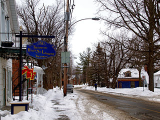
Ormstown is a municipality in Quebec, Canada, which is situated on the Châteauguay River in the heart of the Châteauguay Valley. It is approximately one hour southwest of Montreal and 20 minutes north of New York State in the United States. The population as of the 2021 Canadian census was 3,917.

<span class="mw-page-title-main">Quebec Route 202</span> Highway in Quebec

Route 202 is an east/west 140-kilometre highway in the Monteregie and Estrie regions of the province of Quebec, Canada. Its western terminus is at the junction of Route 132 in Sainte-Barbe and its eastern terminus is in southern Cowansville at the junctions of Route 104 and Route 139. The highway runs a few kilometres north of the Canada–United States border for most of its length.

<span class="mw-page-title-main">Saint-Bernard-de-Lacolle, Quebec</span> Municipality in Quebec, Canada

Saint-Bernard-de-Lacolle is a municipality in Les Jardins-de-Napierville Regional County Municipality, Quebec, Canada, located in the administrative area of Montérégie. Saint-Bernard-de-Lacolle was established as a municipality officially in 1855, and its population as of the Canada 2016 Census was 1,549. A major border crossing, Blackpool, is located where St-Bernard-de-Lacolle abuts the village of Champlain, New York, at the junction of Quebec Autoroute 15 and U.S. Interstate 87.

<span class="mw-page-title-main">Havelock, Quebec</span> Township municipality in Quebec, Canada

Havelock is a township in Le Haut-Saint-Laurent Regional County Municipality in southern Quebec, Canada. The population as of the 2021 Canadian census was 756. Neighbouring townships include Franklin to the west, St-Chrysostome to the north and Hemmingford to the east. Havelock's southern boundary is the Canada–United States border with New York State.

<span class="mw-page-title-main">Hemmingford, Quebec (village)</span> Village municipality in Quebec, Canada

Hemmingford is a village municipality located in Les Jardins-de-Napierville Regional County Municipality of southern Quebec. The population as of 2021 was 829.

<span class="mw-page-title-main">Saint-Chrysostome, Quebec</span> Municipality in Quebec, Canada

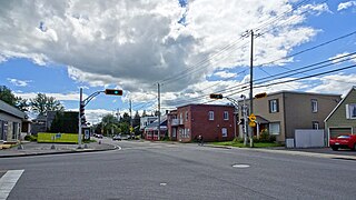
Saint-Chrysostome is a municipality in south-west Quebec, Canada in the regional county municipality of Haut-Saint-Laurent in the Montérégie administrative region. The municipality was created by the amalgamation of Saint-Chrysostome village with the parish of Saint-Jean-Chrysostome on September 29, 1999. The population as of the 2021 Canadian census was 2,582.

<span class="mw-page-title-main">Franklin, Quebec</span> Municipality in Quebec, Canada

Franklin is a Canadian municipality located in the Montérégie region of Quebec along the Canada–US border. The population as of the 2021 Canadian census was 1,635.

<span class="mw-page-title-main">Beauharnois, Quebec</span> City in Quebec, Canada

Beauharnois is a city located in the Beauharnois-Salaberry Regional County Municipality of southwestern Quebec, Canada, and is part of the Greater Montreal Area. The city's population as of the Canada 2021 Census was 13,638. It is home to the Beauharnois Hydroelectric Power Station, as well as the Beauharnois Lock of the Saint Lawrence Seaway.

<span class="mw-page-title-main">Sainte-Martine, Quebec</span> Municipality in Quebec, Canada

Sainte-Martine is a municipality in Beauharnois-Salaberry Regional County Municipality in the Montérégie region of Quebec, Canada. The population as of the 2021 Canadian census was 5,664. The municipality is made up of a large northern section and a small unattached southern area that was known as the municipality of Saint-Paul-de-Châteauguay until its merger with Sainte-Martine on September 9, 1999.

<span class="mw-page-title-main">Très-Saint-Sacrement</span> Parish municipality in Quebec, Canada

Très-Saint-Sacrement is a parish municipality located along the Châteauguay River in the Montérégie region of Quebec, Canada. The population as of the 2021 Canadian census was 1,189. Established in 1885, the municipality completely encloses the village of Howick, which was incorporated as a separate entity in 1915.

<span class="mw-page-title-main">Godmanchester, Quebec</span> Township municipality in Quebec, Canada

Godmanchester is a township municipality located in Le Haut-Saint-Laurent Regional County Municipality in the Montérégie region of Quebec, Canada. The population as of the 2021 Canadian census was 1,403 The southeast part of the township is mostly delineated by the Châteauguay River, while the south end borders with Franklin County, New York.

<span class="mw-page-title-main">Dundee, Quebec</span> Township municipality in Quebec, Canada

Dundee is a township municipality in Le Haut-Saint-Laurent Regional County Municipality in the Montérégie administrative region of Quebec, Canada. At the 2021 Canadian census, the population was 386. It is primarily an agricultural area consisting of dairy and grain farms.

<span class="mw-page-title-main">Saint-Anicet</span> Municipality in Quebec, Canada

Saint-Anicet is a municipality in Le Haut-Saint-Laurent Regional County Municipality in the Montérégie administrative region of Quebec. The population as of the Canada 2021 Census was 2,754.

<span class="mw-page-title-main">Sainte-Barbe, Quebec</span> Municipality in Quebec, Canada

Sainte-Barbe is a municipality of Quebec, located within Le Haut-Saint-Laurent Regional County Municipality in the Montérégie administrative region. The population as of the Canada 2021 Census was 1,609.

<span class="mw-page-title-main">Saint-Stanislas-de-Kostka</span> Municipality in Quebec, Canada

Saint-Stanislas-de-Kostka is a municipality of Quebec, Canada, located within the Beauharnois-Salaberry Regional County Municipality in the Montérégie administrative region. The population as of the Canada 2021 Census was 1,852.

Châteauguay—Lacolle is a federal electoral district in Quebec. It encompasses a portion of Quebec formerly included in the electoral districts of Beauharnois—Salaberry and Châteauguay—Saint-Constant.

Beauharnois was an electoral district of the Legislative Assembly of the Parliament of the Province of Canada, in Canada East, in a rural area south of Montreal. It was created for the first Parliament in 1841 and was based on the previous electoral district of the same name for the Legislative Assembly of Lower Canada. It was represented by one member in the Legislative Assembly.

References

  1. 1 2 3 4 "Banque de noms de lieux du Québec: Reference number 28436". toponymie.gouv.qc.ca (in French). Commission de toponymie du Québec.
  2. 1 2 "Répertoire des municipalités: Geographic code 68015". www.mamh.gouv.qc.ca (in French). Ministère des Affaires municipales et de l'Habitation. Retrieved 2024-05-02.
  3. Riding history for Beauharnois—Salaberry, Quebec from the Library of Parliament
  4. 1 2 3 "Hemmingford, Quebec (township) (Code 2468015) Census Profile". 2021 census . Government of Canada - Statistics Canada . Retrieved 2024-05-02.
  5. 1 2 "Répertoire des entités géopolitiques: Hemmingford (canton) 1.7.1845 - 1.9.1847 ● 1.7.1855 - ..." www.mairesduquebec.com. Institut généalogique Drouin. Retrieved 2 May 2024.
  6. "2021 Community Profiles". 2021 Canadian Census . Statistics Canada. February 4, 2022. Retrieved 2023-10-19.
  7. "2016 Community Profiles". 2016 Canadian Census . Statistics Canada. August 12, 2021. Retrieved 2024-05-02.
  8. "2011 Community Profiles". 2011 Canadian Census . Statistics Canada. March 21, 2019. Retrieved 2014-03-01.
  9. "2006 Community Profiles". 2006 Canadian Census . Statistics Canada. August 20, 2019.
  10. "2001 Community Profiles". 2001 Canadian Census . Statistics Canada. July 18, 2021.
  11. 1 2 1996, 2001, 2006, 2011 census