Hennessey, Oklahoma

Last updated

Hennessey, Oklahoma
Motto: 
"A Light on the Prairie"
OKMap-doton-Hennessey.PNG
Location of Hennessey, Oklahoma
Coordinates: 36°06′20″N97°53′56″W / 36.10556°N 97.89889°W / 36.10556; -97.89889
Country United States
State Oklahoma
County Kingfisher
Area
[1]
  Total3.75 sq mi (9.72 km2)
  Land3.71 sq mi (9.60 km2)
  Water0.04 sq mi (0.12 km2)
Elevation
[2]
1,158 ft (353 m)
Population
 (2020)
  Total2,151
  Density580.25/sq mi (224.01/km2)
Time zone UTC-6 (Central (CST))
  Summer (DST) UTC-5 (CDT)
ZIP code
73742
Area code(s) 405/572
FIPS code 40-33700 [3]
GNIS feature ID2412746 [2]
Website hennesseyok.org

Hennessey is a town in Kingfisher County, Oklahoma, United States. The population was 2,131 at the 2010 census, up from 2,058 in 2000. [4]

Contents

History

U.S. Route 81 in Hennessey, October 2016 US81nRoad-HennesseyOK (39393076944).jpg
U.S. Route 81 in Hennessey, October 2016

Hennessey is named after Pat Hennessey, an Irish freighter who was killed at the present townsite in April 1874. He was said to have been burned on a wagon wheel, either by native Cheyenne tribesmen or white horse thieves. [5]

The Pat Hennessey Memorial Park can be found at Iowa and Arapaho streets. The location of his body is another story. Pat Hennessey was originally buried next to the location of his death in a shallow grave. Rocks were placed over his body, and teamsters passing by would continue to place markers on his grave. At some point in history Hennessey's body was moved. It is possible his relatives came from Ireland and reclaimed his body. In any case, it is not at the marker site at Memorial Park: excavations there produced no remains.

The town was laid out by the Hennessey Townsite Company after the land run of April 22, 1889. The Chicago, Kansas and Nebraska Railway, which was owned by the Chicago, Rock Island and Pacific Railway, built a line from Kansas through the Cherokee Outlet, and the first train arrived in September 1889. The town was incorporated on June 10, 1890. [5]

Hennessey is the home town of former NFL fullback Leon Crosswhite and actor Nicki Aycox.

Geography

Hennessey is located in northern Kingfisher County on the Chisholm Trail, the historic cattle trail on which is based today's U.S. Route 81. US 81 leads south 18 miles (29 km) to Kingfisher, the county seat, and north 20 miles (32 km) to Enid. Oklahoma State Highway 51 passes through the north side of the town, leading east 48 miles (77 km) to Stillwater and west 23 miles (37 km) to Okeene.

According to the United States Census Bureau, Hennessey has a total area of 3.7 square miles (9.7 km2), of which 0.04 square miles (0.1 km2), or 1.23%, are water. [4]

Climate

Climate data for Hennessey, Oklahoma
MonthJanFebMarAprMayJunJulAugSepOctNovDecYear
Mean daily maximum °F (°C)46.2
(7.9)
51.7
(10.9)
62.2
(16.8)
72.7
(22.6)
81.0
(27.2)
89.9
(32.2)
95.9
(35.5)
94.3
(34.6)
85.4
(29.7)
74.7
(23.7)
59.8
(15.4)
48.8
(9.3)
71.9
(22.2)
Mean daily minimum °F (°C)23.9
(−4.5)
28.6
(−1.9)
37.2
(2.9)
47.6
(8.7)
56.8
(13.8)
65.6
(18.7)
70.6
(21.4)
68.9
(20.5)
61.0
(16.1)
49.6
(9.8)
37.5
(3.1)
27.3
(−2.6)
47.9
(8.8)
Average precipitation inches (mm)0.9
(23)
1.2
(30)
2.4
(61)
2.7
(69)
4.7
(120)
4.2
(110)
2.6
(66)
2.9
(74)
4.1
(100)
2.3
(58)
1.9
(48)
1.0
(25)
30.8
(780)
Source 1: weather.com
Source 2: Weatherbase.com [6]

Demographics

Historical population
CensusPop.Note
1900 1,367
1910 1,66521.8%
1920 1,310−21.3%
1930 1,271−3.0%
1940 1,3425.6%
1950 1,264−5.8%
1960 1,228−2.8%
1970 2,18177.6%
1980 2,2874.9%
1990 1,902−16.8%
2000 2,0588.2%
2010 2,1313.5%
2020 2,1510.9%
U.S. Decennial Census [7]

As of the census [3] of 2000, there were 2,058 people, 769 households, and 545 families residing in the town. The population density was 552.7 inhabitants per square mile (213.4/km2). There were 900 housing units at an average density of 241.7 per square mile (93.3/km2). The racial makeup of the town was 82.99% White, 0.88% African American, 1.22% Native American, 0.23% Asian, 12.05% from other races, and 2.72% from two or more races. Hispanic or Latino of any race were 18.46% of the population.

There were 769 households, out of which 36.7% had children under the age of 18 living with them, 57.9% were married couples living together, 9.6% had a female householder with no husband present, and 29.0% were non-families. 26.5% of all households were made up of individuals, and 15.0% had someone living alone who was 65 years of age or older. The average household size was 2.62 and the average family size was 3.18.

In the town, the population was spread out, with 29.1% under the age of 18, 9.8% from 18 to 24, 25.3% from 25 to 44, 17.4% from 45 to 64, and 18.4% who were 65 years of age or older. The median age was 36 years. For every 100 females, there were 90.0 males. For every 100 females age 18 and over, there were 86.8 males.

The median income for a household in the town was $29.57, and the median income for a family was $35.54. Males had a median income of $28.45 versus $18.33 for females. The per capita income for the town was $14.12. About 11.2% of families and 16.4% of the population were below the poverty line, including 93.0% of those under age 18 months and 1.2% of those age 65 or over.

High school athletics

Girls Cross Country State Champions 2011 Class 2A

Girls Track State Champions 1972 Class 2A 1989 Class 2A 1990 Class 2A 1991 Class A 2011 Class 2A 2012 Class 2A

Boys Track State Champions 2012 Class 2A

Football State Champions 2010 Class 2A 2011 Class 2A

Baseball State Champions 1987 Class 2A

Oklahoma Band Masters State Champions 2011 class 2A 2012 class 2A

Notable people

See also

Related Research Articles

<span class="mw-page-title-main">Kingfisher County, Oklahoma</span> County in Oklahoma, United States

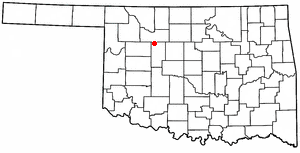
Kingfisher County is a county located in the U.S. state of Oklahoma. As of the 2020 census, the population was 15,184. Its county seat is Kingfisher. The county was formed in 1890 and named Kingfisher by a vote of residents.

<span class="mw-page-title-main">Inman, Kansas</span> City in McPherson County, Kansas

Inman is a city in McPherson County, Kansas, United States. As of the 2020 census, the population of the city was 1,341.

<span class="mw-page-title-main">Longdale, Oklahoma</span> Town in Oklahoma, United States

Longdale is a town in northwestern Blaine County, Oklahoma, United States. The population was 262 at the 2010 census, down 18.3 percent from the figure of 310 in 2000.

<span class="mw-page-title-main">Okeene, Oklahoma</span> Town in Oklahoma, United States

Okeene is a town in Blaine County, Oklahoma, United States. The population was 1,090 as of the 2020 United States census. The name was created by combining the last letters of Cherokee and Cheyenne.

<span class="mw-page-title-main">Cyril, Oklahoma</span> Town in Oklahoma, United States

Cyril is a town in Caddo County, Oklahoma, United States. The population was 1,059 at the 2010 census.

<span class="mw-page-title-main">Drummond, Oklahoma</span> Town in Oklahoma, United States

Drummond is a town in Garfield County, Oklahoma, United States. The population was 455 at the 2010 census, up from 405 in 2000.

<span class="mw-page-title-main">Fairmont, Oklahoma</span> Town in Oklahoma, United States

Fairmont is a town in Garfield County, Oklahoma, United States. The population was 134 at the 2010 census, a decrease from 147 at the 2000 census.

<span class="mw-page-title-main">Waukomis, Oklahoma</span> Town in Oklahoma, United States

Waukomis is a town in Garfield County, Oklahoma, United States. The population was 1,286 at the 2010 census, an increase of 2.0 percent from 1,261 in 2000.

<span class="mw-page-title-main">Milburn, Oklahoma</span> Town in Oklahoma, United States

Milburn is a town in Johnston County, Oklahoma, United States, along the Blue River. The population was 317 at the 2010 census, an increase of 1.6 percent from the figure of 312 in 2000. The town is notable as the location of the Chickasaw White House, the former home of Chickasaw Governor Douglas H. Johnston. This home is now a museum and is listed on the NRHP.

<span class="mw-page-title-main">Kingfisher, Oklahoma</span> City in Oklahoma, United States

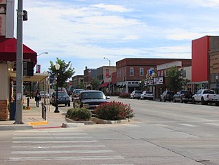
Kingfisher is a city in and the county seat of Kingfisher County, Oklahoma,. The population was 4,903 at the time of the 2020 census. It is the former home and namesake of Kingfisher College. According to the Encyclopedia of Oklahoma History and Culture, Kingfisher is now primarily a bedroom community for people employed in Enid and Oklahoma City.

<span class="mw-page-title-main">Loyal, Oklahoma</span> Town in Oklahoma, United States

Loyal is a town in Kingfisher County, Oklahoma, United States. The population was 79 at the 2010 census.

Meridian is a town in eastern Logan County, Oklahoma, United States. The population was 38 at the 2010 census, a decline of 29.5 percent from the figure of 54 in 2000. It is part of the Oklahoma City Metropolitan Statistical Area. The community name was chosen because of its location on the Indian meridian.

<span class="mw-page-title-main">Washington, Oklahoma</span> Town in Oklahoma, United States

Washington is a town in McClain County, Oklahoma, United States. The population was 673 as of the 2020 census, a 0.2% increase from 2010.

<span class="mw-page-title-main">Clearview, Oklahoma</span> Town in Oklahoma, United States

Clearview is a town in Okfuskee County, Oklahoma, United States. The population was 41 at the 2020 Census. It was historically an all-black freedmen's town and was platted by the Lincoln Townsite Company and designated as Lincoln.

<span class="mw-page-title-main">Roff, Oklahoma</span> Town in Oklahoma, United States

Roff is a town in Pontotoc County, Oklahoma, United States. The population was 725 at the 2010 census.

<span class="mw-page-title-main">Oologah, Oklahoma</span> Town in Oklahoma, United States

Oologah is a town in Rogers County, Oklahoma, United States. Renowned humorist Will Rogers was born on a ranch two miles east of Oologah, although he usually claimed Claremore as his birthplace "because nobody but an Indian can pronounce 'Oologah.'" There has been disagreement about the proper spelling for the town name. The official spelling is now Oologah. It was often spelled Oolagah before statehood, and this spelling appears on some old buildings.

<span class="mw-page-title-main">Sasakwa, Oklahoma</span> Town in Oklahoma, United States

Sasakwa is a town in Seminole County, Oklahoma, United States. The population was 80 as of the 2020 census.

<span class="mw-page-title-main">Sentinel, Oklahoma</span> Town in Oklahoma, United States

Sentinel is a town in Washita County, in the U.S. state of Oklahoma. The population was 901 in the 2010 census, an increase of 4.9 percent from the figure of 859 residents in 2000. Towns near Sentinel are Rocky, Cordell, Canute, and Burnsflat.

<span class="mw-page-title-main">Hammon, Oklahoma</span> Town in Oklahoma, United States

Hammon is a town in the U.S. state of Oklahoma, the majority of which is in Roger Mills County, but some of which extends into Custer County. It is located at the junction of Oklahoma State Highways 33 and 34.

<span class="mw-page-title-main">Cashion, Oklahoma</span> Town in Oklahoma, United States

Cashion is a town in Kingfisher and Logan counties in the U.S. state of Oklahoma. The Logan County portion of Cashion is part of the Oklahoma City Metropolitan Statistical Area. The population was 850 as of the 2020 United States census, up 6% from the 802 reported at the 2010 census.

References

  1. "ArcGIS REST Services Directory". United States Census Bureau. Retrieved September 20, 2022.
  2. 1 2 U.S. Geological Survey Geographic Names Information System: Hennessey, Oklahoma
  3. 1 2 "U.S. Census website". United States Census Bureau . Retrieved January 31, 2008.
  4. 1 2 "Geographic Identifiers: 2010 Census Summary File 1 (G001), Hennessey town, Oklahoma". American FactFinder. U.S. Census Bureau. Archived from the original on February 13, 2020. Retrieved April 16, 2019.
  5. 1 2 Everett, Dianna. Encyclopedia of Oklahoma History and Culture. "Hennessey." Retrieved September 27, 2013.
  6. "Historical Weather for Hennessey, Oklahoma, United States".
  7. "Census of Population and Housing". Census.gov. Retrieved June 4, 2015.