Hermosa, South Dakota

Last updated

Hermosa, South Dakota
HermosaSD MasonicLodge.jpg
Former Masonic Lodge, originally the town school
Hermosa Flag.gif
Custer County South Dakota Incorporated and Unincorporated areas Hermosa Highlighted.svg
Location in Custer County and the state of South Dakota
Coordinates: 43°50′23″N103°11′35″W / 43.83972°N 103.19306°W / 43.83972; -103.19306
Country United States
State South Dakota
County Custer
Founded1886 [1]
Area
[2]
  Total0.48 sq mi (1.24 km2)
  Land0.48 sq mi (1.24 km2)
  Water0.00 sq mi (0.00 km2)
Elevation
[3]
3,340 ft (1,020 m)
Population
 (2020) [4]
  Total382
  Density794.18/sq mi (306.93/km2)
Time zone UTC-7 (MST)
  Summer (DST) UTC-6 (MDT)
Zip Code
57744
Area code 605
FIPS code 46-28300 [5]
GNIS feature ID1267418 [3]
Website www.hermosasd.com

Hermosa is a town near the northern edge of Custer County, South Dakota, United States. The population was 382 at the 2020 census. [6]

Contents

History

Hermosa was developed by the Fremont, Elkhorn and Missouri Valley Railroad, later acquired by the Chicago and North Western Railway, and was platted in 1886. [7] [8] It was given its name, the Spanish for "beautiful", for its views of the Black Hills and the grasslands; the railroad located it a mile uphill from an existing stagecoach stop. [8] A post office has been in operation in Hermosa since 1886. [9]

A Titan missile silo was located near Hermosa from the early 1960s. [8]

Geography

According to the United States Census Bureau, the town has a total area of 0.48 square miles (1.24 km2), all land. [10]

Demographics

Historical population
CensusPop.Note
1890 172
1900 77−55.2%
1910 11448.1%
1920 74−35.1%
1930 12873.0%
1940 121−5.5%
1950 1231.7%
1960 1262.4%
1970 15019.0%
1980 25167.3%
1990 242−3.6%
2000 31530.2%
2010 39826.3%
2020 382−4.0%
U.S. Decennial Census [11] [4]

2010 census

As of the census [12] of 2010, there were 398 people, 158 households, and 110 families living in the town. The population density was 829.2 inhabitants per square mile (320.2/km2). There were 183 housing units at an average density of 381.3 per square mile (147.2/km2). The racial makeup of the town was 88.7% White, 3.8% Native American, 1.0% Asian, 0.3% Pacific Islander, 0.5% from other races, and 5.8% from two or more races. Hispanic or Latino of any race were 5.3% of the population.

There were 158 households, of which 33.5% had children under the age of 18 living with them, 51.9% were married couples living together, 10.8% had a female householder with no husband present, 7.0% had a male householder with no wife present, and 30.4% were non-families. 20.9% of all households were made up of individuals, and 8.3% consisted of someone living alone who was 65 years of age or older. The average household size was 2.52 and the average family size was 2.93.

The median age in the town was 36.8 years. 25.9% of residents were under the age of 18; 7.8% were between the ages of 18 and 24; 25.3% were between 25 and 44; 29.3% were between 45 and 64; and 11.6% were 65 or older. The gender makeup of the town was 50.3% male and 49.7% female.

2000 census

As of the census [5] of 2000, there were 315 people, 130 households, and 82 families living in the town. The population density was 809.8 inhabitants per square mile (312.7/km2). There were 139 housing units at an average density of 357.3 per square mile (138.0/km2). The racial makeup of the town was 92.38% White, 1.59% African American, 3.81% Native American, 0.32% from other races, and 1.90% from two or more races. Hispanic or Latino of any race were 2.86% of the population.

There were 130 households, out of which 30.8% had children under the age of 18 living with them, 50.0% were married couples living together, 8.5% had a female householder with no husband present, and 36.2% were non-families. 28.5% of all households were made up of individuals, and 13.1% consisted of someone living alone who was 65 years of age or older. The average household size was 2.42 and the average family size was 2.98.

Of the population, 26.0% were under the age of 18, 7.0% aged between 18 and 24, 27.9% between 25 and 44, 26.0% between 45 and 64, and 13.0%, 65 or older. The median age was 37 years. For every 100 females, there were 93.3 males; among those 18 and over, for every 100 females there were 102.6 males.

The median income for a household in the town was $35,341, and the median income for a family was $37,031. Males had a median income of $29,000 versus $16,750 for females. The per capita income for the town was $13,147. About 8.0% of families and 9.1% of the population were below the poverty line, including 11.8% of those under age 18 and 8.6% of those 65 or over.

Education

Hermosa has an elementary school serving students through 8th grade; most continue their schooling in Rapid City. The first school opened in 1886. It was replaced in 1889 by a two-story building with a bell tower, which in 1926 was condemned as structurally unsound, but was purchased, moved, and stabilized by the Freemasons, who used it as their lodge until 2000; it has since become a museum, arts venue, and community hall under the Hermosa Arts and History Association. [8]

Economics

Tin has been mined near Hermosa, with the ore transported via the railroad, and the town was also a railhead for cattle ranching. Since the opening of Custer State Park in 1919, Hermosa has also been a recreational gateway to the Black Hills. [8] The Custer County Fairground is in the town. There is a small downtown business district clustered around U.S. Route 79. Lintz Brothers pizza, originally in the Mount Rushmore Telephone Company building, and Roy's Drive-in, with two 80-foot (24 m) digital screens, attract out-of-towners as well as locals. [8]

Notable residents

See also

Related Research Articles

<span class="mw-page-title-main">Custer County, South Dakota</span> County in South Dakota, United States

Custer County is a county in the U.S. state of South Dakota. As of the 2020 census, the population was 8,318. Its county seat is Custer. The county was created in 1875, and was organized in 1877. It was named after General George Armstrong Custer.

<span class="mw-page-title-main">Ismay, Montana</span> Town in Montana, United States

Ismay is a town in Custer County, Montana, United States. There is a post office at Ismay, and a church, and no other businesses or services. The population was 17 at the 2020 census. The town is the least-populous incorporated municipality in the state of Montana.

<span class="mw-page-title-main">Wolsey, South Dakota</span> Town in South Dakota, United States

Wolsey is a town in Beadle County, South Dakota, United States. The population was 459 at the 2020 census.

<span class="mw-page-title-main">Stratford, South Dakota</span> Town in South Dakota, United States

Stratford is a town in southern Brown County, South Dakota, United States. The population was 57 at the 2020 census.

<span class="mw-page-title-main">Mound City, South Dakota</span> Town in South Dakota, United States

Mound City is a town in and the county seat of Campbell County, South Dakota, United States. The population was 69 at the 2020 census.

<span class="mw-page-title-main">Bradley, South Dakota</span> Town in South Dakota, United States

Bradley is a town in Clark County, South Dakota, United States. The population was 65 at the 2020 census.

<span class="mw-page-title-main">Buffalo Gap, South Dakota</span> Town in South Dakota, United States

Buffalo Gap is a town in Custer County, South Dakota, United States. The population was 131 at the 2020 census.

<span class="mw-page-title-main">Custer, South Dakota</span> City in South Dakota, United States

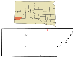
Custer is a city in Custer County, South Dakota, United States. The population was 1,919 at the 2020 census. It is the county seat of Custer County.

<span class="mw-page-title-main">Fairburn, South Dakota</span> Town in South Dakota, United States

Fairburn is a town in Custer County, South Dakota, United States. The population was 60 at the 2020 census.

<span class="mw-page-title-main">Pringle, South Dakota</span> Town in South Dakota, United States

Pringle is a town in Custer County, South Dakota, United States. The population was 109 at the 2020 census.

<span class="mw-page-title-main">Onaka, South Dakota</span> Town in South Dakota, United States

Onaka is a town in Faulk County, South Dakota, United States. The population was 13 at the 2020 census.

<span class="mw-page-title-main">Revillo, South Dakota</span> Town in South Dakota, United States

Revillo is a town in southeastern Grant County, South Dakota, United States. The population was 99 at the 2020 census.

<span class="mw-page-title-main">Stockholm, South Dakota</span> Town in South Dakota, United States

Stockholm is a town in Grant County, South Dakota, United States. The population was 102 at the 2020 census.

<span class="mw-page-title-main">Camp Crook, South Dakota</span> Town in South Dakota, United States

Camp Crook is an incorporated small town in Harding County, South Dakota, United States, on the Little Missouri River. The population was 60 at the 2020 census.

<span class="mw-page-title-main">Lake City, South Dakota</span> Town in South Dakota, United States

Lake City is a town in Marshall County, South Dakota, United States. The population was 45 at the 2020 census. Fort Sisseton Historic State Park, whose fort is listed on the National Register of Historic Places, is located nearby.

<span class="mw-page-title-main">Wetonka, South Dakota</span> Town in South Dakota, United States

Wetonka is a town in McPherson County, South Dakota, United States. The population was 16 at the 2020 census.

<span class="mw-page-title-main">Crooks, South Dakota</span> City in South Dakota, United States

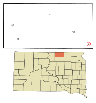
Crooks is a city in Minnehaha County, South Dakota, United States and is a suburb of Sioux Falls. The population was 1,362 at the 2020 census. Crooks was named New Hope until 1904. The town's present name honors W. A. Crooks, a local politician.

<span class="mw-page-title-main">Sherman, South Dakota</span> Town in South Dakota, United States

Sherman is a town in Minnehaha County, South Dakota, United States. The population was 81 at the 2020 census.

<span class="mw-page-title-main">Corona, South Dakota</span> Town in South Dakota, United States

Corona is a town in Roberts County, South Dakota, United States. The population was 69 at the 2020 census.

<span class="mw-page-title-main">Brentford, South Dakota</span> Town in South Dakota, United States

Brentford is a town in Spink County, South Dakota, United States. The population was 88 at the 2020 census.

References

  1. "SD Towns" (PDF). South Dakota State Historical Society. Archived from the original (PDF) on February 10, 2010. Retrieved February 13, 2010.
  2. "ArcGIS REST Services Directory". United States Census Bureau. Retrieved October 15, 2022.
  3. 1 2 U.S. Geological Survey Geographic Names Information System: Hermosa, South Dakota
  4. 1 2 "Census Population API". United States Census Bureau. Retrieved October 15, 2022.
  5. 1 2 "U.S. Census website". United States Census Bureau . Retrieved January 31, 2008.
  6. "U.S. Census Bureau: Hermosa town, South Dakota". www.census.gov. United States Census Bureau. Retrieved March 23, 2022.
  7. Chicago and North Western Railway Company (1908). A History of the Origin of the Place Names Connected with the Chicago & North Western and Chicago, St. Paul, Minneapolis & Omaha Railways. p. 83.
  8. 1 2 3 4 5 6 7 8 9 Paul Higbee (2021) [January–February 2020]. "The Beauty That is Hermosa". South Dakota magazine. Retrieved April 18, 2024.
  9. "Custer County". Jim Forte Postal History. Retrieved March 20, 2015.
  10. "US Gazetteer files 2010". United States Census Bureau. Archived from the original on January 25, 2012. Retrieved June 21, 2012.
  11. "Census of Population and Housing". Census.gov. Retrieved June 4, 2015.
  12. "U.S. Census website". United States Census Bureau . Retrieved June 21, 2012.