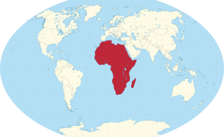
Africa is a continent comprising 63 political territories, representing the largest of the great southward projections from the main mass of Earth's surface. Within its regular outline, it comprises an area of 30,368,609 km2 (11,725,385 sq mi), excluding adjacent islands. Its highest mountain is Kilimanjaro; its largest lake is Lake Victoria.

South Africa occupies the southern tip of Africa, its coastline stretching more than 2,850 kilometres from the desert border with Namibia on the Atlantic (western) coast southwards around the tip of Africa and then northeast to the border with Mozambique on the Indian (eastern) coast. The low-lying coastal zone is narrow for much of that distance, soon giving way to a mountainous escarpment that separates the coast from the high inland plateau. In some places, notably the province of KwaZulu-Natal in the east, a greater distance separates the coast from the escarpment. Although much of the country is classified as semi-arid, it has considerable variation in climate as well as topography. The total land area is 1,220,813 km2 (471,359 sq mi). It has the 23rd largest Exclusive Economic Zone of 1,535,538 km2 (592,875 sq mi).

Table Mountain is a flat-topped mountain forming a prominent landmark overlooking the city of Cape Town in South Africa. It is a significant tourist attraction, with many visitors using the cableway or hiking to the top. Table Mountain National Park is the most visited national park in South Africa, attracting 4.2 million people every year for various activities. The mountain has 8,200 plant species, of which around 80% are fynbos, meaning fine bush. It forms part of the Table Mountain National Park, and part of the lands formerly ranged by Khoe-speaking clans, such as the !Uriǁʼaes. It is home to a large array of mostly endemic fauna and flora. Its top elevates about 1,000 m above the surrounding city, making the popular hike upwards on a large variety of different, often steep and rocky pathways a serious mountain tour which requires fitness, preparation and hiking equipment.

At all geography and geology, a cliff or rock face is an area of rock which has a general angle defined by the vertical, or nearly vertical. Cliffs are formed by the processes of weathering and erosion, with the effect of gravity. Cliffs are common on coasts, in mountainous areas, escarpments and along rivers. Cliffs are usually composed of rock that is resistant to weathering and erosion. The sedimentary rocks that are most likely to form cliffs include sandstone, limestone, chalk, and dolomite. Igneous rocks such as granite and basalt also often form cliffs.

The Drakensberg is the eastern portion of the Great Escarpment, which encloses the central Southern African plateau. The Great Escarpment reaches its greatest elevation – 2,000 to 3,482 metres within the border region of South Africa and Lesotho.

The Western Cape is a province of South Africa, situated on the south-western coast of the country. It is the fourth largest of the nine provinces with an area of 129,449 square kilometres (49,981 sq mi), and the third most populous, with an estimated 7 million inhabitants in 2020. About two-thirds of these inhabitants live in the metropolitan area of Cape Town, which is also the provincial capital. The Western Cape was created in 1994 from part of the former Cape Province. The two largest cities are Cape Town and George.
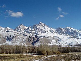
The Taurus Mountains are a mountain complex in southern Turkey, separating the Mediterranean coastal region from the central Anatolian Plateau. The system extends along a curve from Lake Eğirdir in the west to the upper reaches of the Euphrates and Tigris rivers in the east. It is a part of the Alpide belt in Eurasia.

The Cape Winelands District Municipality, formerly the Boland District Municipality, is a district municipality located in the Boland region of the Western Cape province of South Africa. As of 2011, it had a population of 787,490. The largest towns in the municipality are Paarl, Worcester, Stellenbosch and Wellington.

The Cape Peninsula of South Africa is a generally mountainous peninsula that juts out into the Atlantic Ocean at the south-western extremity of the African continent. At the southern end of the peninsula are Cape Point and the Cape of Good Hope. On the northern end is Table Mountain, overlooking Table Bay and the City Bowl of Cape Town, South Africa. The peninsula is 52 km long from Mouille point in the north to Cape Point in the south. The Peninsula has been an island on and off for the past 5 million years, as sea levels fell and rose with the ice age and interglacial global warming cycles of, particularly, the Pleistocene. The last time that the Peninsula was an island was about 1.5 million years ago. Soon afterwards it was joined to the mainland by the emergence from the sea of the sandy area now known as the Cape Flats. The towns and villages of the Cape Peninsula and Cape Flats, and the undeveloped land of the rest of the peninsula now form part of the City of Cape Town metropolitan municipality. The Cape Peninsula is bounded to the north by Table Bay, to the west by the open Atlantic Ocean, and to the east by False Bay in the south and the Cape Flats in the north.

Worcester is a town in the Western Cape, South Africa. It is the third-largest city in the Western Cape Province of South Africa. It is located 120 kilometres (75 mi) north-east of Cape Town on the N1 highway north to Johannesburg.

The Langeberg Range is a mountain range in the Western Cape province of South Africa. Its highest peak is Keeromsberg at 2,072 m that lies 15 km northeast of the town of Worcester. Some of the highest peaks of the range are located just to the north of Swellendam, in a subrange known as the Clock Peaks whose highest point is the 1,710 m high Misty Point. Local lore states one can tell the time by means of the shadows cast by the seven summits of the Clock Peaks.

The Cape Fold Belt is a fold and thrust belt of late Paleozoic age, which affected the sequence of sedimentary rock layers of the Cape Supergroup in the southwestern corner of South Africa. It was originally continuous with the Ventana Mountains near Bahía Blanca in Argentina, the Pensacola Mountains, the Ellsworth Mountains and the Hunter-Bowen orogeny in eastern Australia. The rocks involved are generally sandstones and shales, with the shales persisting in the valley floors while the erosion resistant sandstones form the parallel ranges, the Cape Fold Mountains, which reach a maximum height of 2325 m at Seweweekspoortpiek.

The Du Toitskloof Mountains are a range in the Cape Fold Belt in the Western Cape Province of South Africa. The highest point is Du Toits Peak (Dutoitspiek) which is the highest seaward facing peak in the Cape Fold Belt ranges, i.e. the highest peak in the Western Cape within direct sight of the ocean.

Table Mountain Sandstone (TMS) is a group of rock formations within the Cape Supergroup sequence of rocks. Although the term "Table Mountain Sandstone" is still widely used in common parlance, the term TMS is no longer formally recognized; the correct name is the "Peninsula Formation Sandstone", which is part of the Table Mountain Group. The designation "Table Mountain Sandstone" will, however, in deference to the title, continue to be used in the rest of this article. The name is derived from the famous landmark in Cape Town, Table Mountain.

The Drakenstein mountain is a mountain range in the Western Cape province of South Africa. It lies opposite Simonsberg Mountain and is part of the Cape Fold Belt. It is named after ex-soldier Hendrik Adriaan van Rheede tot Drakenstein, who was Colonial administrator of the Dutch East India Company.
Breede River Valley is a region of Western Cape Province, South Africa known for being the largest fruit and wine producing valley in the Western Cape, as well as South Africa's leading race-horse breeding area. It is part of the Boland bordering on becoming Little Karoo towards the east.

The four Hex River Tunnels consist of a twin tunnel of 500 m (0.31 mi) and three single tunnels of 1.1 km (0.68 mi), 1.2 km (0.75 mi) and 13.5 km (8.39 mi), on the Hexton railway route between De Doorns and Kleinstraat through the Hex River Mountains of the Western Cape Province, South Africa. The line, which connects De Doorns in the Hex River valley with Touws River in the Great Karoo, is part of the main rail route between Cape Town and Johannesburg. Of the 30 kilometres of track, 16.8 kilometres are underground. Construction of the line eliminated the bottleneck of the Hex River rail pass.

Touws River is a small railway town of 8,126 people in the Western Cape province of South Africa. It is located on the river of the same name, about 160 kilometres (100 mi) north-east of Cape Town. The Touwsrivier CPV Solar Project is located just outside of the town and supplies 50 MW to the national electrical grid.

The South African Railways Class 4E of 1952 was an electric locomotive.

Matroosberg is a peak in the South African Hex River Mountains, which belong to the Cape Fold Belt. With a height of 2,247 m (7,372 ft) above sea level, it is the highest mountain in the Cape Winelands District Municipality. The mountain is located in the Witzenberg Local Municipality in the Western Cape.


