
The Highlands is a historical region of Scotland. Culturally, the Highlands and the Lowlands diverged from the Late Middle Ages into the modern period, when Lowland Scots language replaced Scottish Gaelic throughout most of the Lowlands. The term is also used for the area north and west of the Highland Boundary Fault, although the exact boundaries are not clearly defined, particularly to the east. The Great Glen divides the Grampian Mountains to the southeast from the Northwest Highlands. The Scottish Gaelic name of A' Ghàidhealtachd literally means "the place of the Gaels" and traditionally, from a Gaelic-speaking point of view, includes both the Western Isles and the Highlands.

The Lower Colorado River Authority (LCRA) is a nonprofit public utility created in November 1934 by the Texas Legislature. LCRA's mission is to enhance the lives of the Texans it serves through water stewardship, energy and community service. LCRA provides public power, manages the lower Colorado River, builds and operates transmission lines, owns public parks, and offers community services.
Highland Springs is a census-designated place (CDP) located in Henrico County, Virginia, United States, 4.3 miles (7 km) east of Richmond. The population was 16,604 at the 2020 census.

Sandston is a census-designated place (CDP) in Henrico County, Virginia, United States, just outside the state capital of Richmond. The population as of the 2010 Census was 7,571. It was designated a Historic District by Henrico County in 2021.

The Northern Highland is a geographical region in the north central United States covering much of the northern territory of the state of Wisconsin.

The Great Atlanta Fire of 1917 began just after noon on 21 May 1917 in the Old Fourth Ward of Atlanta, Georgia. It is unclear just how the fire started, but it was fueled by hot temperatures and strong winds which propelled the fire. The fire, which burned for nearly 10 hours, destroyed 300 acres (120 ha) and 1,900 structures displacing over 10,000 people. Damages were estimated at $5 million,.
Highland Ridge Wilderness is a 68,627-acre (27,772 ha) wilderness area in the southern part of the Snake Range of White Pine County, just south of Great Basin National Park, in the U.S. state of Nevada. Located approximately 20 miles (32 km) south of the town of Baker, the Wilderness was designated in 2006 and is administered by the U.S. Bureau of Land Management.
Pine Mountain, 2,221 feet (677 m), is a prominent peak in the Taconic Mountains of western Massachusetts. The mountain is located in Pittsfield State Forest and is traversed by the Pine Mountain Trail, which connects to the 35 mi (56 km) Taconic Crest hiking trail and the 12.1 mi (19.5 km) multi-use Taconic Skyline Trail.

A clan badge, sometimes called a plant badge, is a badge or emblem, usually a sprig of a specific plant, that is used to identify a member of a particular Scottish clan. They are usually worn affixed to the bonnet behind the Scottish crest badge, or pinned at the shoulder of a lady's tartan sash. According to popular lore clan badges were used by Scottish clans as a means of identification in battle. An authentic example of plants being used in this way were the sprigs of oats used by troops under the command of Montrose during the sack of Aberdeen. Similar items are known to have been used by military forces in Scotland, like paper, or the "White Cockade" of the Jacobites.
Highland Pines near Prescott in Yavapai County, Arizona, United States
Florence Villa is a neighborhood within the city limits of Tampa, Florida. The ZIP Codes serving the neighborhood are 33605 and 33619. The neighborhood is part of the East Tampa region and is located within District Five of the Tampa City Council.
The Kiryas Joel-Poughkeepsie-Newburgh, NY Metropolitan Statistical Area, as defined by the United States Office of Management and Budget, is an area consisting of two counties in New York's Hudson Valley, with the municipalities of Kiryas Joel, Poughkeepsie, and Newburgh as its principal cities. As of the 2020 census, the MSA had a population of 679,221. The area was centered on the urban area of Poughkeepsie-Newburgh.
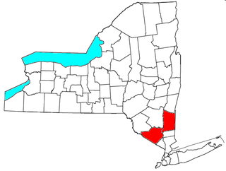
The Hudson Highlands Multiple Resource Area is a Multiple Property Submission study supporting multiple listings in 1982 to the United States National Register of Historic Places. It originally included 58 properties spread over the counties of Dutchess, Putnam, Westchester, Orange and Rockland.
This is the list of neighborhoods in Columbus, Georgia. Neighborhoods are generally considered to be housing subdivisions of a city. In some cases, other layers of intervening organization exist that may not exist in all places. In the city of Columbus, there exist an intermediate level of organization, called districts or zones.

The 1905 Mary W. Adams House, is a Frank Lloyd Wright designed Prairie School home that was constructed in Highland Park, Illinois. The Adams House is a two-story home with three bedrooms and two bathrooms with a light stucco exterior and wooden trim that emphasizes the horizontal.
Bend-La Pine Schools is a school district in the U.S. state of Oregon that serves the cities of Bend and La Pine in Central Oregon and the surrounding area, including Sunriver. The district has an enrollment of more than 18,000 students, and is the fifth largest in the state as of 2016.

Morningside Park is a recreational nature park located in Scarborough, Toronto, Ontario, Canada. It is Toronto's largest municipal park by area.

Rice Creek is a Wisconsin Department of Natural Resources-designated State Natural Area that features a large, high-quality wetland complex of conifer swamps, fens, and sedge meadows along a two-mile stretch of Rice Creek. The creek contains dense, lush beds of emergent and submergent aquatic vegetation, including wild rice. White cedar, balsam fir, black spruce, and tamarack are the dominant trees in the conifer swamp. Several stands of old-growth hemlock/hardwood forest can be found in the site, each with a supercanopy of large white pine. Two fens, fed by groundwater seepages and of exceptional floristic diversity, are found near the creek. Overall, the site supports a high concentration of rare plants and animals. At least seven species of orchid are found here: showy lady slipper, heart-leaf twayblade, swamp pink, striped coralroot, blunt-leaf orchid, northern bog orchid, and boreal bog orchid. Other notable plant species include: bog arrowgrass, naked miterwort, marsh cinquefoil, purple clematis, and downy willowherb. Notable animal species present include: barred owl, Canada jay, pine siskin, winter wren, and bog copper.

Highland Park, also known as Highland Pines, is a populated place situated near Prescott and within the Prescott National Forest, in Yavapai County, Arizona, United States. Highland Pines is the promotional name associated with the Highland Park areas several subdivisions. In the Arizona Territorial era up to 1912, and Statehood until around the late 1920s, this particular area of land acted as a cattle ranch with a mining history, lies within the Thumb Butte Mining District, which appears to be initially platted by the Arizona Corporation Highland Pine Properties Inc. beginning in the late 1950s.
