Hillsboro, Indiana

Last updated

Hillsboro
Hillsboro-US136-block-in.jpg
Main Street (US 136)
Fountain County Indiana Incorporated and Unincorporated areas Hillsboro Highlighted 1833862.svg
Location of Hillsboro in Fountain County, Indiana.
Location map of Fountain County, Indiana.svg
Red pog.svg
Hillsboro
Hillsboro's location in Fountain County
Coordinates: 40°06′32″N87°09′27″W / 40.10889°N 87.15750°W / 40.10889; -87.15750
Country United States
State Indiana
County Fountain
Township Cain
Area
[1]
  Total0.31 sq mi (0.81 km2)
  Land0.31 sq mi (0.81 km2)
  Water0.00 sq mi (0.00 km2)
Elevation
[2]
712 ft (217 m)
Population
 (2020)
  Total508
  Density1,623.00/sq mi (626.29/km2)
Time zone UTC-5 (EST)
  Summer (DST) UTC-5 (EST)
ZIP code
47949
Area code 765
FIPS code 18-33862 [3]
GNIS feature ID2396995 [2]
Website hillsboroindiana.com

Hillsboro is a town in Cain Township, Fountain County, Indiana, United States. Its population was 538 at the 2010 census.

Contents

History

The post office was established in 1829 as Hillsborough. [4] It was named from the terrain. [5]

In Cain township, at Hillsboro, the oldest church was the Methodist. The building was 30 by 36 feet, costing one thousand six hundred dollars. The society was formed there in 1870, with thirty-two members. The New Light doctrines were then being pressed on the minds of people in this section, and it was a long, hard struggle to maintain the new church, but finally it succeeded, and it had forty-two members in 1880, since which it has advanced. [6]

Geography

Hillsboro is located at the intersection of U.S. Route 136 and State Road 341, about a mile south of Interstate 74.

According to the 2010 census, Hillsboro has a total area of 0.31 square miles (0.80 km2), all land. [7]

Demographics

Historical population
CensusPop.Note
1880 266
1900 500
1910 5285.6%
1920 5371.7%
1930 448−16.6%
1940 51615.2%
1950 5261.9%
1960 517−1.7%
1970 505−2.3%
1980 56111.1%
1990 499−11.1%
2000 489−2.0%
2010 53810.0%
2020 508−5.6%
U.S. Decennial Census [8]

2010 census

As of the census [9] of 2010, there were 538 people, 207 households, and 150 families living in the town. The population density was 1,735.5 inhabitants per square mile (670.1/km2). There were 232 housing units at an average density of 748.4 per square mile (289.0/km2). The racial makeup of the town was 96.1% White, 0.2% African American, 0.7% Native American, 1.9% from other races, and 1.1% from two or more races. Hispanic or Latino of any race were 5.4% of the population.

There were 207 households, of which 37.7% had children under the age of 18 living with them, 51.7% were married couples living together, 17.4% had a female householder with no husband present, 3.4% had a male householder with no wife present, and 27.5% were non-families. 21.3% of all households were made up of individuals, and 8.7% had someone living alone who was 65 years of age or older. The average household size was 2.60 and the average family size was 3.01.

The median age in the town was 38.2 years. 27.5% of residents were under the age of 18; 8.1% were between the ages of 18 and 24; 25.1% were from 25 to 44; 26.2% were from 45 to 64; and 13% were 65 years of age or older. The gender makeup of the town was 48.7% male and 51.3% female.

2000 census

As of the census [3] of 2000, there were 489 people, 188 households, and 140 families living in the town. The population density was 1,527.5 inhabitants per square mile (589.8/km2). There were 211 housing units at an average density of 659.1 per square mile (254.5/km2). The racial makeup of the town was 99.39% White, 0.20% from other races, and 0.41% from two or more races. Hispanic or Latino of any race were 0.41% of the population.

There were 188 households, out of which 37.8% had children under the age of 18 living with them, 60.6% were married couples living together, 10.1% had a female householder with no husband present, and 25.5% were non-families. 22.9% of all households were made up of individuals, and 11.7% had someone living alone who was 65 years of age or older. The average household size was 2.60 and the average family size was 3.02.

In the town, the population was spread out, with 28.2% under the age of 18, 8.0% from 18 to 24, 30.1% from 25 to 44, 18.8% from 45 to 64, and 14.9% who were 65 years of age or older. The median age was 35 years. For every 100 females, there were 88.8 males. For every 100 females age 18 and over, there were 92.9 males.

The median income for a household in the town was $41,806, and the median income for a family was $46,458. Males had a median income of $30,547 versus $23,611 for females. The per capita income for the town was $16,630. About 8.5% of families and 9.5% of the population were below the poverty line, including 10.7% of those under age 18 and 7.0% of those age 65 or over.

Related Research Articles

<span class="mw-page-title-main">Monroe, Adams County, Indiana</span> Town in Indiana, United States

Monroe is a town in Washington and Monroe townships, Adams County, Indiana, United States. The population of the town was 945 residents at the 2019 census. Adams Central Community Schools is located in Monroe.

<span class="mw-page-title-main">Jonesville, Indiana</span> Town in Indiana, United States

Jonesville is a town in Wayne Township, Bartholomew County, in the U.S. state of Indiana. The population was 177 at the 2010 census. It is part of the Columbus, Indiana metropolitan statistical area.

<span class="mw-page-title-main">Flora, Indiana</span> Town in Indiana, United States

Flora is a town in Monroe Township, Carroll County, Indiana, United States. The population was 2,036 at the 2010 census. It is part of the Lafayette, Indiana Metropolitan Statistical Area.

<span class="mw-page-title-main">Michigantown, Indiana</span> Town in Indiana, United States

Michigantown is a town in Michigan Township, Clinton County, Indiana, United States. The population was 467 at the 2010 census. The town was named for the Michigan Road, an early thoroughfare through the area.

<span class="mw-page-title-main">Milltown, Indiana</span> Town in Indiana, United States

Milltown is a town in Whiskey Run Township in Crawford County, Indiana and in Blue River and Spencer townships in Harrison County. The population was 818 at the time of the 2010 census.

<span class="mw-page-title-main">Kingman, Indiana</span> Town in Indiana, United States

Kingman is a town in Millcreek Township, Fountain County, Indiana, United States. The population was 511 at the 2010 census.

<span class="mw-page-title-main">Mellott, Indiana</span> Town in Indiana, United States

Mellott is a town in Richland Township, Fountain County, Indiana, United States. The population was 197 at the 2010 census.

<span class="mw-page-title-main">Newtown, Indiana</span> Town in Indiana, United States

Newtown is a town in Richland Township, Fountain County, Indiana, United States. The population was 256 at the 2010 census.
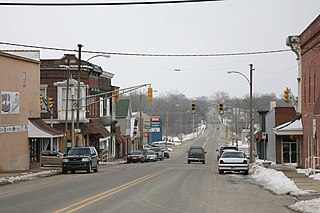
<span class="mw-page-title-main">Veedersburg, Indiana</span> Town in Indiana, United States

Veedersburg is a town in Van Buren Township, Fountain County, Indiana, United States. The population was 2,180 at the 2010 census.

<span class="mw-page-title-main">Shirley, Indiana</span> Town in Indiana, United States

Shirley is a town in Brown Township, Hancock County and Greensboro Township, Henry County, Indiana, United States. The population was 830 at the 2010 census.
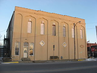
<span class="mw-page-title-main">Silver Lake, Indiana</span> Town in Indiana, United States

Silver Lake is a town in Lake Township, Kosciusko County, in the U.S. state of Indiana. The population was 915 at the 2010 census.

<span class="mw-page-title-main">Brook, Indiana</span> Town in Indiana, United States

Brook is a town in Iroquois Township, Newton County, in the U.S. state of Indiana. The population was 997 at the 2010 census.

<span class="mw-page-title-main">Roachdale, Indiana</span> Town in Indiana, United States

Roachdale is a town in Franklin and Jackson townships, Putnam County, in the U.S. state of Indiana. The population was 926 at the 2010 census.

<span class="mw-page-title-main">Saratoga, Indiana</span> Town in Indiana, United States

Saratoga is a town in Ward Township, Randolph County, in the U.S. state of Indiana. The population was 254 at the 2010 census.
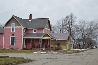
<span class="mw-page-title-main">La Fontaine, Indiana</span> Town in Indiana, United States

La Fontaine is a town in Liberty Township, Wabash County, in the U.S. state of Indiana. The population was 875 at the 2010 census. Its name means "The Fountain" in French.

<span class="mw-page-title-main">Fountain City, Indiana</span> Town in Indiana, United States

Fountain City, formerly Newport, is a town in New Garden Township, Wayne County, in the U.S. state of Indiana. The population was 796 at the 2010 census.

<span class="mw-page-title-main">Hillsboro, Ohio</span> City in Ohio, United States

Hillsboro is a city in and the county seat of Highland County, Ohio, United States, approximately 35 miles (56 km) west of Chillicothe and 50 miles (80 km) east of Cincinnati. The population was 6,481 at the 2020 census.

<span class="mw-page-title-main">Meridian Hills, Indiana</span> Town in Indiana, United States

Meridian Hills is a town in Washington Township, Marion County, Indiana, about 8 miles (13 km) north of downtown Indianapolis. It had a population of 1,774 at the 2020 census, up from 1,616 in 2010.

<span class="mw-page-title-main">Hillsboro (town), Wisconsin</span> Town in Wisconsin, United States

Hillsboro is a town in Vernon County, Wisconsin, United States. The population was 766 at the 2000 census. The City of Hillsboro is located within the town. The unincorporated community of Trippville is also located in the town.

<span class="mw-page-title-main">Hillsboro, Wisconsin</span> City in Wisconsin, United States

Hillsboro is a city in Vernon County, Wisconsin, United States. The population was 1,397 at the 2020 Census. The city is located within the Town of Hillsboro. Hillsboro is known as the Czech Capital of Wisconsin.

References

  1. "2020 U.S. Gazetteer Files". United States Census Bureau. Retrieved March 16, 2022.
  2. 1 2 U.S. Geological Survey Geographic Names Information System: Hillsboro, Indiana
  3. 1 2 "U.S. Census website". United States Census Bureau . Retrieved January 31, 2008.
  4. "Fountain County". Jim Forte Postal History. Retrieved September 6, 2014.
  5. Baker, Ronald L. (October 1995). From Needmore to Prosperity: Hoosier Place Names in Folklore and History . Indiana University Press. p.  164. ISBN   978-0-253-32866-3. ...named for its location.
  6. Clifton, Thomas A. (1913). Past and present of Fountain and Warren Counties, Indiana. Indianapolis: B.F. Bowen.PD-icon.svg This article incorporates text from this source, which is in the public domain .
  7. "G001 - Geographic Identifiers - 2010 Census Summary File 1". United States Census Bureau. Archived from the original on February 13, 2020. Retrieved July 17, 2015.
  8. "Census of Population and Housing". Census.gov. Retrieved June 4, 2015.
  9. "U.S. Census website". United States Census Bureau . Retrieved December 11, 2012.