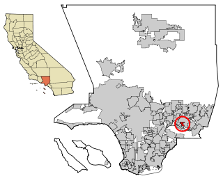
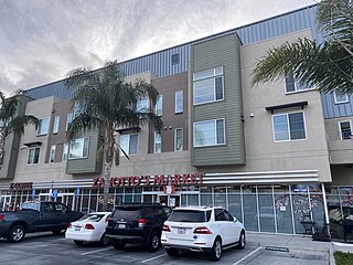
Valinda is a census-designated place (CDP) in the San Gabriel Valley, in Los Angeles County, California, in the United States. As of the 2010 census, the population was 22,822, up from 21,776 at the 2000 census.

Iron Horse is a census-designated place (CDP) in Plumas County, California, United States. The population was 297 at the 2010 census, down from 321 at the 2000 census.
Fruitdale is a district of San Jose, California, located in West San Jose, though some portions are still unincorporated as a census-designated place. The population of the CDP was 935 at the 2010 census.

Vamo is a census-designated place (CDP) in Sarasota County, Florida, United States. The population was 4,727 at the 2010 census. It is part of the Bradenton–Sarasota–Venice Metropolitan Statistical Area.

Brooklyn Park is a census-designated place (CDP) in Anne Arundel County, Maryland, United States. The population was 14,373 at the 2010 census.

Mayo is a census-designated place (CDP) in Anne Arundel County, Maryland, United States. The population was 8,298 at the 2010 census. The Mayo CDP of 2010 includes all of the area that used to be counted as the Selby-on-the-Bay CDP. The beach in Mayo used to be a popular weekend resort.

Parole, a suburb of Annapolis, is a census-designated place (CDP) in Anne Arundel County, Maryland, United States. The population was 15,922 at the 2010 census. It is where several major roads intersect at the western edge of the state capital, Annapolis, and contains the Annapolis Mall, and a number of other large shopping centers, and the Anne Arundel Medical Center. It is generally considered to be part of Annapolis rather than a separate town. The neighborhood was named because it was a parole camp, where Union and Confederate prisoners of war were brought for mutual exchange and eventual return to their respective homes.

Pumphrey is an unincorporated community and former census-designated place (CDP) in Anne Arundel County, Maryland, United States. At the 2000 census, the population was 5,317. It was split between the Linthicum and Brooklyn Park CDPs for the 2010 census.

Riva is a census-designated place (CDP) in Anne Arundel County, Maryland, United States. The population was 4,076 at the 2010 census. The area is scenic, especially where the two-lane Riva Road crosses the South River on a bridge. The area is growing with large new homes as the suburbs of Annapolis grow outward. Riva is bordered by Annapolis to the north, Edgewater to the east, and Davidsonville to the west.

Selby-on-the-Bay is a census-designated place (CDP) in Anne Arundel County, Maryland, United States, for the 2000 census, at which time its population was 3,674. It was added to the Mayo CDP for the 2010 census.

Shady Side is a census-designated place (CDP) in Anne Arundel County, Maryland, United States. The population was 5,803 at the 2010 census.

Chesapeake Ranch Estates-Drum Point was a census-designated place in Calvert County, Maryland, for the 2000 United States Census, when it had a population of 11,503. For the 2010 census the area was split into the CDPs of Chesapeake Ranch Estates and Drum Point. The communities are only a few minutes from the popular weekend resort town Solomons as well as the Calvert Cliffs Nuclear Power Plant, Calvert Cliffs State Park and fossil grounds, and the Dominion Cove Point liquefied natural gas terminal.

Algonquin is a census-designated place (CDP) in Dorchester County, Maryland, United States. The population was 1,241 at the 2010 census. The community was named for the Algonquin people, one of the Native American tribes in the East.

Kent Narrows is a census-designated place and town in Queen Anne's County, Maryland, United States. As of the 2000 census, the town had a population of 567.

Spring Ridge is a census-designated place (CDP) in Spring Township, Berks County, Pennsylvania. The population was 1,003 at the 2010 census.

Donaldson is a census-designated place (CDP) in Frailey Township, Schuylkill County, Pennsylvania, United States. The population was 325 at the 2000 census.
Shenandoah Heights is a census-designated place (CDP) in Schuylkill County, Pennsylvania, United States. The population was 1,298 at the 2000 census.

White Horse is a census-designated place (CDP) in Todd County, South Dakota, United States. The population was 234 at the 2020 census.
East Brainerd is an unincorporated community and former census-designated place (CDP) in Hamilton County, Tennessee, United States. The population was 14,132 at the 2000 census and was not recorded at the 2010 census. It is part of the Chattanooga, TN–GA Metropolitan Statistical Area.
Middle Valley is a census-designated place (CDP) in Hamilton County, Tennessee, United States. The population was 12,684 at the 2010 census. It is part of the Chattanooga, TN–GA Metropolitan Statistical Area.

